Modern agriculture is a complex dance between technology and nature. Farmers constantly seek innovative ways to optimize yields, conserve resources, and mitigate risks. A powerful synergy emerges when high-resolution aerial data from drones is combined with precise, localized weather information from on-farm weather stations. This integration transforms raw data into actionable insights, propelling precision agriculture to new heights.
Imagine knowing not just the overall health of your crops, but also how specific microclimates within your fields are affecting growth, water usage, and susceptibility to disease. This level of granular understanding is precisely what the integration of drone and weather station data offers, enabling farmers to make data-driven decisions that lead to healthier crops, increased yields, and a more sustainable future.
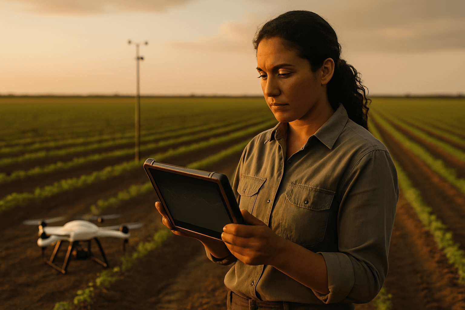
The Power Duo: Drones and Weather Stations in Precision Agriculture
Precision agriculture, also known as smart agriculture or Agriculture 4.0, leverages technologies like GPS, drones, sensors, and data analytics to manage crop production at a detailed level. Unlike traditional methods that treat entire fields uniformly, this approach allows for targeted application of inputs, reducing waste and improving outcomes. The combination of drone imagery and on-farm weather data is a cornerstone of this revolution.
What Drones Bring to the Field
Drones, or Unmanned Aerial Vehicles (UAVs), provide a bird’s-eye view of vast farmlands, collecting high-resolution imagery and data that is otherwise difficult or impossible to obtain. Equipped with various sensors, agricultural drones offer numerous benefits:
- High-Resolution Imagery: Drones capture extremely detailed images, allowing for the detection of subtle variations in plant health, pest infestations, or nutrient deficiencies.
- Multispectral and Thermal Imaging: Specialized sensors, such as multispectral and thermal cameras, can capture data beyond the visible spectrum. Multispectral imaging reveals plant health by measuring light reflectance, identifying stressed or unhealthy plants. Thermal cameras measure crop temperature, indicating water stress or disease.
- 3D Mapping and Terrain Analysis: Drones can create accurate 3D maps of agricultural lands, assisting in terrain analysis and water management planning.
- Flexibility and Timeliness: Drones can be deployed on demand, providing real-time data whenever needed, unlike satellites. This rapid data collection allows for quick decision-making and timely interventions.
- Precision Application: Some drones can be equipped with sprayers for targeted application of fertilizers or pesticides, reducing waste and environmental impact.
The Essential Role of On-Farm Weather Stations
While drones provide spatial data on crop health, on-farm weather stations offer critical, localized temporal data about environmental conditions. These stations are equipped with various sensors and tools to provide comprehensive meteorological data crucial for agricultural management.
Common components of a farm weather station include:
- Anemometer: Measures wind speed and direction, vital for pesticide application and understanding evapotranspiration rates.
- Rain Gauge: Measures rainfall, informing irrigation and planting schedules.
- Thermometer: Provides temperature data for predicting plant growth phases, frost warnings, and optimal planting/harvesting times.
- Hygrometer: Measures relative humidity, which impacts plant diseases and irrigation needs.
- Barometer: Measures atmospheric pressure, offering insights into weather patterns and helping predict changes like rain or drought.
- Soil Moisture Sensors: Crucial for precise irrigation management, preventing over or under-watering.
- Soil Temperature Sensors: Monitor soil temperature, influencing seed germination rates and root development.
- Leaf Wetness Sensors: Detect dew, water, or ice on leaf surfaces, critical for predicting disease outbreaks.
- Pyranometer: Measures solar radiation levels, used to calculate evapotranspiration.
Localized weather data from on-farm stations is far more accurate than regional forecasts, which can vary significantly even over short distances. This granular information helps farmers make better decisions for crop protection, scheduling, and yield predictions.
Seamless Integration: Methods and Technologies
The true power lies in combining these two distinct datasets. Integrating drone data with weather station information allows for a more holistic view of field conditions and provides deeper insights for optimized farm analysis.
Data Collection and Synchronization
The first step involves collecting data from both sources.
- Drone Data: Drones capture images and other sensor data during planned flights. Modern agricultural drones often come with integrated multispectral imaging systems and RTK (Real-Time Kinematic) for centimeter-level positioning accuracy.
- Weather Station Data: On-farm weather stations continuously log various meteorological parameters. Many modern stations are digital and can feed information instantly to computers or mobile devices.
Synchronization is key. Both datasets need to be timestamped and georeferenced to ensure they can be accurately correlated. This means knowing precisely when and where each piece of data was collected.
Data Processing and Analytics
Once collected, the raw data needs to be processed and analyzed.
Drone Data Processing:
- Stitching and Orthomosaics: Individual drone images are stitched together to create high-resolution orthomosaic maps of the entire field.
- Vegetation Indices: Multispectral data is used to generate vegetation index maps, such as NDVI (Normalized Difference Vegetation Index), which indicate crop health and vitality.
- Digital Surface Models (DSMs): Drone data can be used to create 3D terrain models, identifying drainage issues and elevation changes.
Integrating Weather Data:
- Contextualizing Drone Findings: Weather data provides crucial context for interpreting drone imagery. For instance, a drone might detect an area of stressed plants (low NDVI). By cross-referencing this with weather station data, a farmer can determine if the stress is due to recent drought, excessive rainfall, or temperature fluctuations.
- Predictive Analytics: Combined data can feed into machine learning algorithms to predict crop yields, disease outbreaks, and optimal planting or harvesting times. For example, soil moisture data from a weather station, combined with historical drone data on plant health, can predict irrigation needs.
- Real-time Decision Support: Software platforms can integrate live weather feeds and drone data to provide real-time recommendations for irrigation, fertilization, and pest management.
Software and Platforms for Integration
Specialized agricultural software and cloud-based platforms are essential for seamlessly integrating and analyzing diverse datasets. These platforms leverage AI, machine learning, and geospatial analytics to turn raw data into actionable insights. Examples include:
- Agronomic Analysis Software: Platforms that combine satellite-based imagery, ground sensor data, and meteorological forecasts to create a holistic view for optimized crop management.
- Drone Analytics Software: Tools like PIX4Dfields, Agremo, and DJI SmartFarm Web allow for rapid processing of drone imagery, creation of vegetation index maps, and generation of prescription maps for variable rate application. Many also offer cloud-based storage and processing.
- Farm Management Systems (FMS): These systems often integrate with drone and weather data platforms, allowing farmers to consolidate information and make smart management decisions.
Benefits of Integrated Analysis
The integration of drone data and weather station information offers a multitude of benefits for farm analysis, leading to enhanced efficiency, sustainability, and profitability.
Optimized Resource Management
- Precision Irrigation: By mapping soil moisture levels (from weather stations) and plant water stress (from thermal drones), farmers can implement targeted irrigation strategies, conserving water and maximizing crop productivity.
- Targeted Fertilization: Drone-generated nutrient maps combined with weather data on rainfall and humidity can guide precise fertilizer application, reducing waste, costs, and environmental impact.
- Efficient Pest and Disease Management: Early detection of crop stress via drone imagery, coupled with leaf wetness and humidity data from weather stations, allows for timely and targeted application of pesticides or fungicides, minimizing chemical use.
Enhanced Crop Monitoring and Yield Prediction
- Real-time Crop Health Assessment: Continuous monitoring with drones and weather stations provides real-time insights into crop health, allowing farmers to identify and address issues proactively before they escalate.
- Accurate Yield Estimation: Analyzing aerial imagery and data collected throughout the growing season, combined with historical weather trends, enables farmers to generate accurate yield estimates and forecast crop performance.
- Growth Stage Classification: Integrated data can help classify crop growth stages, which is crucial for fertilization and herbicide/fungicide application.
Risk Mitigation and Climate Change Adaptation
- Early Problem Detection: The combination of broad drone monitoring and detailed weather data allows for early detection of crop stress, disease outbreaks, or pest infestations, enabling prompt intervention.
- Extreme Weather Preparedness: Hyperlocal weather data helps farmers monitor weather patterns, anticipate changes, and take immediate action to mitigate damage from droughts, frosts, or storms.
- Climate Change Adaptation: Integrated data provides insights into long-term trends and short-term weather impacts on crops, helping farmers adapt to changing climate conditions.
Challenges and Future Outlook
Despite the significant advantages, challenges remain in the widespread adoption of this integrated approach. These include the initial cost of drones and weather stations, the need for technical know-how, and reliable internet connectivity in rural areas. Data security and privacy are also emerging concerns.
However, as drone technology becomes more affordable and user-friendly, and as AI-powered analytics become more sophisticated, the future of integrated drone and weather station data in agriculture looks promising. Future advancements will likely include even more refined sensor technologies, enhanced data analysis algorithms, and seamless integration with other IoT devices in the field, creating truly comprehensive monitoring systems. The goal is to make remote sensing practical, reliable, and accessible for every producer, regardless of operation size. By bridging the gap between aerial insights and ground-level environmental conditions, farmers can cultivate a more productive, efficient, and resilient agricultural future.


