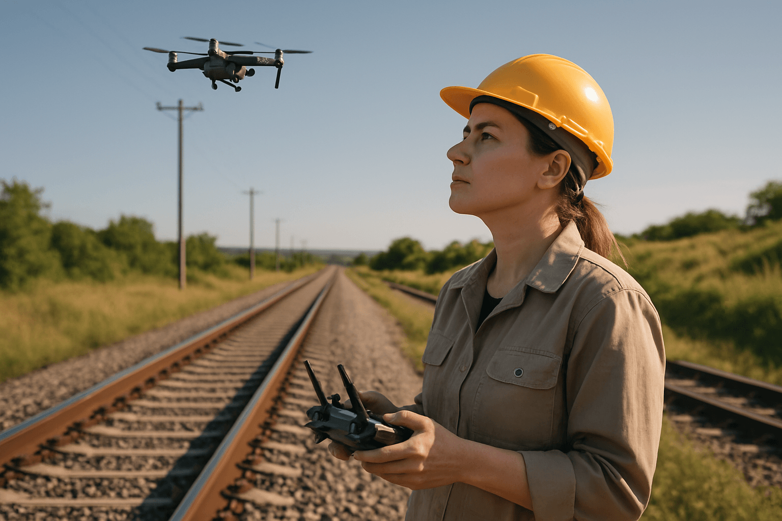
The railroad industry, a critical artery of global commerce and transportation, faces the continuous challenge of maintaining vast networks of tracks, bridges, and infrastructure. Traditional inspection methods are often time-consuming, costly, and pose significant safety risks to personnel. However, the advent of Unmanned Aerial Systems (UAS), commonly known as drones, is revolutionizing how these vital inspections are conducted, offering unparalleled efficiency, safety, and data accuracy.
Drones, equipped with advanced sensors and intelligent software, can swiftly cover extensive railway networks, detect subtle defects, and provide high-resolution data that informs timely maintenance and ensures operational safety. This guide delves into the systematic process of performing a drone survey for railroad track inspection, from initial planning to data analysis.
Why Drones are Essential for Railroad Track Inspection
The integration of drones into railway inspection protocols offers a multitude of benefits that address the inherent challenges of traditional methods:
Enhanced Safety
One of the most significant advantages of using drones is the drastic reduction in human exposure to hazardous environments. Inspectors no longer need to walk dangerous tracks or access hard-to-reach structures like bridges and tunnels, mitigating risks associated with active rail lines and difficult terrain. Drones operate above the tracks, ensuring worker safety and operational continuity.
Time and Cost Efficiency
Drones can inspect long sections of track much faster than manual methods, saving considerable time and resources. A task that might take a team days to complete manually can be accomplished in hours with a drone. This efficiency translates directly into reduced labor costs and minimized operational disruptions, as tracks often don’t need to be closed during inspection flights.
High-Resolution and Accurate Data
Equipped with sophisticated cameras and sensors, drones capture high-resolution imagery and detailed data that can detect even minute defects, such as cracks as small as 1/8 inch. This precision is critical for identifying issues before they escalate into major problems, leading to more effective predictive maintenance strategies.
Comprehensive Data Capture and Analysis
Drones can collect a diverse range of data, including visual, thermal, and 3D topographical information, allowing for a holistic assessment of railway infrastructure. This data can be processed using advanced software and AI to identify patterns, monitor changes over time, and provide actionable insights.
Key Stages of a Drone Survey for Railroad Track Inspection
Performing a successful drone survey for railroad track inspection involves several critical stages, each requiring careful planning and execution.
1. Pre-Flight Planning and Route Design
Thorough planning is the bedrock of any successful drone mission. This stage involves defining the inspection objectives, understanding the railway environment, and designing an optimal flight path.
Defining Objectives and Scope
Clearly establish what needs to be inspected (e.g., track geometry, ballast condition, rail fasteners, catenary systems, bridges, tunnels, vegetation encroachment) and the level of detail required. This will influence the choice of drone, sensors, and flight parameters.
Site Assessment and Risk Analysis
Evaluate the terrain, potential obstacles (overhead lines, buildings, trees), weather conditions, and airspace restrictions. Identify any “no-fly zones” or sensitive areas. A comprehensive risk assessment helps in mitigating potential hazards and ensuring a safe operation.
Regulatory Compliance and Permissions
Obtain all necessary permits and adhere to aviation regulations, such as FAA Part 107 in the United States, which includes maintaining visual line of sight (VLOS) with the drone, flying below 400 feet, and operating under good weather conditions. For Beyond Visual Line of Sight (BVLOS) operations, specific authorizations are required, which some railroads like BNSF have pioneered. Coordinate with railway authorities to avoid disrupting train schedules and ensure safety.
Flight Path Design
Utilize specialized drone planning software to create automated flight paths. These paths typically involve a grid pattern for photogrammetry surveys to ensure sufficient overlap for 3D model reconstruction. For linear infrastructure like railway tracks, a flight path directly over the track, potentially using track centerline following, is ideal. Consider altitude (e.g., 35m for 1mm resolution, 40m, or 100 feet for CSX) and speed to achieve the desired ground sample distance (GSD) and image quality.
2. Equipment Selection
The right drone and sensor payload are crucial for effective data acquisition.
Drone Platform
Professional-grade drones, often multi-rotor systems like the DJI Matrice series or DJI Phantom 4 Pro, are commonly used for their stability, endurance, and payload capacity. Some specialized drones, like the Staaker BG-300, can even operate on rails and fly off when trains approach, offering unique flexibility.
Sensor Payloads
- High-Resolution RGB Cameras: Essential for visual inspection, capturing detailed images and videos to identify cracks, corrosion, and general wear and tear. 4K cameras are standard, with some even reaching 48MP.
- Thermal/Infrared (IR) Cameras: Detect heat anomalies and temperature variations, crucial for identifying overheating electrical components, insulation failures, or structural issues not visible to the naked eye.
- LiDAR (Light Detection and Ranging) Sensors: Emit laser pulses to create highly accurate 3D point clouds, enabling precise measurements of track alignment, rail gauges, and detection of deviations, even through vegetation. This is invaluable for generating detailed 3D models and digital twins.
- Ultrasonic Sensors: Useful for detecting surface and subsurface anomalies like cracks, voids, or metal fatigue in tracks or welds through non-destructive testing.
- Multispectral and Hyperspectral Sensors: Capture data across various spectral bands, useful for assessing vegetation health around the railway and land use.
- RTK/PPK GPS: Real-Time Kinematic (RTK) or Post-Processed Kinematic (PPK) GPS systems enhance positional accuracy, providing centimeter-level precision for georeferencing data.
Ground Control Points (GCPs)
For highly accurate mapping and 3D modeling, especially in photogrammetry, strategically placed and accurately surveyed ground control points (GCPs) are often used to improve the overall accuracy of the spatial data.
3. Drone Flight Execution
Once planning is complete and equipment is ready, the flight can be executed.
Pre-Flight Checks
Perform thorough pre-flight checks, including battery levels, payload mounting, GPS signal acquisition, and calibration of sensors. Ensure the flight area is clear of people and obstacles.
Automated Flight
Most drone surveys for railroads utilize automated flight modes based on pre-programmed missions. The drone follows the planned trajectory, autonomously capturing images and sensor data at specified intervals and overlaps. Advanced systems can even adapt flight paths in dynamic environments, such as avoiding moving cranes in container terminals.
Real-time Monitoring
During the flight, the drone pilot and visual observer (if required for VLOS) continuously monitor the drone’s position, altitude, and sensor feedback. Some systems offer real-time data transmission to control centers, allowing for immediate alerts on detected anomalies.
Reactive Maneuvers
In case of unforeseen obstacles or approaching trains, some advanced drone systems (like the Staaker BG-300) can autonomously take evasive action, such as flying off the tracks to avoid collision. Manual override capabilities are always available for the pilot.
4. Data Processing and Analysis
After data acquisition, the raw data must be processed and analyzed to derive actionable insights.
Data Pre-Processing
This involves transferring data from the drone, organizing it, correcting distortions, and refining image quality. Software like Pix4D, 3DF Zephyr, and RealityCapture are commonly used for these tasks. Converting images to HSV (Hue, Saturation, Value) color models can enhance visibility and reduce the impact of adverse weather conditions.
Photogrammetry and 3D Reconstruction
For visual data, photogrammetry software stitches together hundreds or thousands of overlapping images to create orthomosaic maps, 3D models, and point clouds of the railway infrastructure. These 3D models allow for detailed measurements and visualization of the track and surrounding environment.
LiDAR Data Processing
LiDAR data is processed to generate highly accurate 3D point clouds, which can be used to create digital terrain models (DTMs) and digital surface models (DSMs). This data is vital for assessing track geometry, identifying ballast issues, and monitoring ground settlement.
Defect Detection and Change Analysis
This is where advanced analytics come into play:
- Machine Learning and AI: AI algorithms are trained on datasets of common railway defects (cracks, corrosion, loose fasteners, misaligned rails) to automatically identify and classify anomalies with high accuracy.
- Change Detection: By comparing current survey data with historical data, changes in track conditions, vegetation encroachment, or structural wear can be precisely identified and quantified over time.
- Gauge Measurement: Specialized software can accurately measure track gauge, a critical parameter for ensuring track stability.
Reporting and Integration
The processed data and analysis results are compiled into comprehensive reports, often including visual evidence (images, videos), 3D models, and GIS-compatible maps. These deliverables can be integrated into existing railway management systems (e.g., ESRI, AutoCAD Civil 3D, BIM platforms) to streamline maintenance planning and decision-making.
Future Outlook for Drone Railway Inspection
The use of drones in railway inspection is continuously evolving. Advances in AI, automation, and sensor technology promise even more sophisticated and autonomous solutions. The development of drones capable of fully autonomous, Beyond Visual Line of Sight (BVLOS) operations over long distances, potentially using railway tracks for navigation even in GPS-denied environments, represents the next frontier. This will further enhance safety, efficiency, and the ability to conduct frequent, high-quality inspections, ensuring the ongoing integrity and safety of railway networks worldwide.


