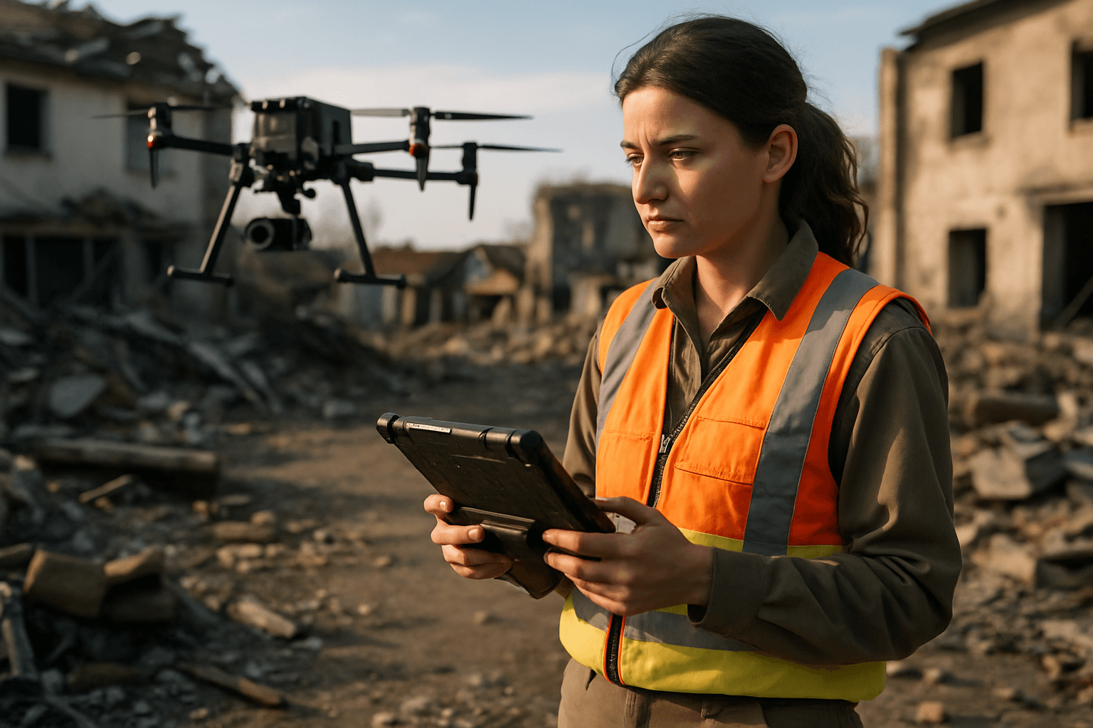
When disaster strikes, the immediate aftermath often presents a chaotic and perilous landscape. Traditional methods of damage assessment and search and rescue can be slow, costly, and inherently dangerous for human responders. This is where Unmanned Aerial Vehicles (UAVs), commonly known as drones, have emerged as transformative tools. By rapidly deploying into disaster zones, drones offer an unparalleled ability to survey vast areas, gather critical data, and enhance situational awareness, ultimately saving lives and accelerating recovery efforts.
The Indispensable Role of Drones in Disaster Response
Drones have revolutionized disaster management across all four stages: prevention, preparation, response, and recovery. Their agility, speed, and ability to operate in hazardous environments make them invaluable.
Enhanced Safety and Accessibility
Disaster zones are often characterized by unstable structures, hazardous materials, and inaccessible terrain, posing significant risks to human responders. Drones can be deployed into areas too dangerous for people, such as those affected by nuclear radiation contamination or wildfires, protecting relief workers from harm. They provide a safe means to conduct reconnaissance and structural analysis of damaged infrastructure, offering vital intelligence without risking lives.
Rapid Data Collection and Situational Awareness
In the critical hours following a disaster, every second counts. Drones can be deployed quickly, often within minutes, to provide real-time aerial video feeds and high-resolution images of affected areas. This rapid data collection helps emergency teams understand the big picture, assess the extent and severity of damage, locate survivors, and plan efficient rescue routes. This real-time situational awareness is crucial for prioritizing aid and directing resources effectively.
Cost-Effectiveness and Efficiency
Compared to human-crewed aircraft like helicopters, drones are less expensive and more flexible to deploy for surveying disaster areas. They can cover large distances and assess situations even when traditional transportation routes are destroyed or inaccessible. Drones enable faster damage assessment, which in turn reduces overall costs and expedites recovery.
Types of Drones and Essential Equipment
The effectiveness of a drone survey in a disaster zone largely depends on choosing the right platform and equipping it with appropriate payloads.
Fixed-Wing vs. Multi-Rotor Drones
Two primary types of drones are utilized for aerial surveying:
- Multi-rotor Drones: These include quadcopters, hexacopters, and octocopters. They excel in precision mapping and maneuverability, allowing them to hover and navigate tight, complex spaces like collapsed buildings or debris-filled streets. Multi-rotors are ideal for capturing high-resolution images and videos over smaller, more intricate areas. Examples include the DJI Phantom 4 RTK, Parrot Anafi USA, and DJI Matrice 300 RTK.
- Fixed-Wing Drones: Similar to small airplanes, fixed-wing drones are designed for endurance and large-scale mapping, making them suitable for surveying vast disaster-affected areas such as floodplains or hurricane-stricken regions. They can fly for hours, covering significantly larger areas in a single flight compared to multi-rotors, often mapping hundreds of acres per hour. The SenseFly eBee X is a notable fixed-wing drone used for long-range mapping. Hybrid drones, combining features of both, offer vertical takeoff and landing with greater flight endurance.
Payloads: Cameras, Thermal Sensors, and LiDAR
The “payload” refers to the specialized equipment a drone carries beyond its basic flight components. These payloads are critical for data acquisition in disaster zones:
- High-Resolution RGB Cameras: These are standard for capturing detailed visual images used in creating 2D orthomosaic maps and 3D models through photogrammetry. Mechanical shutters are preferred to reduce image distortion caused by drone movement.
- Thermal Imaging Cameras (FLIR sensors): Essential for search and rescue operations, thermal cameras detect heat signatures, allowing responders to locate stranded or trapped victims in low-visibility conditions, such as collapsed buildings, dense smoke, or at night.
- LiDAR (Light Detection and Ranging) Sensors: LiDAR uses laser pulses to measure distances and create highly precise 3D point clouds of the terrain. This technology is particularly valuable for mapping areas with dense vegetation or complex topography, as it can penetrate tree canopies to create ground-level models and detect small changes in elevation caused by floods, landslides, or earthquakes.
- Other Payloads: Drones can also carry multi-spectral and hyperspectral cameras to identify chemical spills or structural weaknesses, communication devices to restore networks, spotlights, and even drop kits for delivering essential supplies like medical aid, food, or water to hard-to-reach areas.
Ground Control Systems and Communication
Effective drone operations require robust ground control systems and reliable communication. This includes remote controllers, ground stations for mission planning and real-time monitoring, and secure data links to transmit imagery and sensor data back to response teams. Integrating with 5G networks and IoT devices is expected to further enhance real-time data transmission and drone coordination in the future.
Operational Procedures for Disaster Zone Surveying
Successful drone deployment in disaster zones requires meticulous planning and adherence to regulations.
Pre-Flight Planning and Risk Assessment
Before deployment, a comprehensive pre-flight plan is crucial. This involves assessing the disaster area’s specific challenges, identifying safe takeoff and landing zones, and determining the most effective flight paths for data acquisition. Risk assessment includes evaluating potential hazards such as power lines, trees, radio antennas, and other air traffic. Creating “before” snapshots of areas through prior mapping can also be instrumental for post-disaster comparison and damage detection.
Regulatory Compliance and Airspace Management
Operating drones in disaster zones often involves navigating complex airspace regulations. National Aviation Authorities (NAAs), such as the FAA in the United States, impose rules regarding drone registration, pilot certification, altitude restrictions, and no-fly zones. In emergency situations, Temporary Flight Restrictions (TFRs) may be issued, and unauthorized drones can disrupt vital response efforts, potentially grounding all aircraft. Expedited approval processes, like the Special Governmental Interest (SGI) process by the FAA, allow certified drone pilots to operate in controlled airspace, at night, or beyond visual line of sight in urgent situations. Operators must always maintain clear communication with response teams and air traffic controllers.
Flight Execution and Data Acquisition
During flight, operators must continuously monitor weather conditions, terminating operations if they become unsuitable for safe flight (e.g., strong winds, heavy rain). Drones can operate in manual, autonomous, or semi-autonomous modes. Autonomous flight planning allows drones to follow predetermined routes, ensuring comprehensive coverage and consistent data collection. Real-time video feeds provide immediate visual intelligence to ground teams.
Processing and Analyzing Drone-Collected Data
Raw data collected by drones must be processed and analyzed to generate actionable insights for disaster response and recovery.
Photogrammetry and Orthomosaic Generation
Photogrammetry is the process of stitching together multiple overlapping aerial images to create accurate 2D orthomosaic maps and 3D models. This technique provides a detailed understanding of the affected area, allowing for precise damage assessment and hazard identification. Orthomosaic maps, which are geometrically corrected and scaled, enable emergency teams to determine safe navigation routes and allocate resources effectively.
3D Modeling and Digital Elevation Models (DEMs)
Drone-captured data, especially from LiDAR sensors, can generate highly accurate 3D models and digital elevation models (DEMs) of disaster-stricken regions. These 3D models offer unparalleled precision for measuring distances, volumes of debris, and structural integrity of damaged buildings. They allow civil engineers and urban planners to assess damage, prioritize repairs, and plan reconstruction efforts.
Data Analysis for Damage Assessment and Resource Allocation
Integrating drone data with Geographic Information Systems (GIS) allows recovery teams to layer various data sources, such as weather forecasts, population density, and infrastructure maps, onto the drone imagery. This holistic view supports informed decision-making for both short-term relief and long-term rebuilding. Drone data can identify areas with trapped victims, pinpoint structural collapses, and assess the impact on essential services like power lines and bridges. This detailed analysis helps authorities decide where to send help first and plan for the delivery of humanitarian aid.
Challenges and Considerations
Despite their numerous benefits, using drones for disaster surveying comes with several challenges.
Battery Life and Endurance
Many smaller, battery-powered drones have limited flight times, typically between 20 minutes and 2 hours, which can restrict their efficiency during critical, extended missions over large areas. This necessitates having spare batteries and planning for frequent battery changes. While fixed-wing and gas/diesel-powered drones offer longer endurance, continuous development in battery technology is crucial for maximizing drone impact in post-disaster scenarios.
Adverse Weather Conditions
Drones can be susceptible to adverse weather, such as strong winds, heavy rain, or extreme temperatures, which can limit their flight capabilities and the quality of data collected. Operators must continuously monitor weather conditions and adhere to manufacturer specifications and regulatory guidelines for safe operation.
Data Security and Privacy Concerns
The high-resolution cameras and sensors on drones collect vast amounts of visual and location data, raising concerns about data security and privacy. In disaster zones, sensitive information about individuals’ identities, locations, or private property might be inadvertently captured. Proper data management protocols are essential to prevent misuse or external threats, and clear guidelines regarding data collection, storage, and sharing are needed.
The Future of Drone Technology in Disaster Management
The role of drones in disaster management is continuously evolving, with exciting advancements on the horizon.
AI-Powered Analysis and Automation
Artificial Intelligence (AI) and machine learning are set to enhance drone capabilities significantly. AI algorithms can process vast amounts of data from drone sensors, including satellite imagery and weather data, to provide early warnings for natural disasters. Future drones, powered by AI, will be able to operate autonomously, make real-time decisions, and conduct complex tasks such as search and rescue missions or infrastructure assessments without direct human intervention.
Swarm Robotics and Collaborative Missions
The concept of “swarm intelligence” involves multiple drones communicating and coordinating to complete tasks faster and more efficiently. Swarm robotics will enable collaborative missions, allowing a fleet of drones to cover larger areas simultaneously for comprehensive and rapid surveying of disaster zones.
Advancements in Sensor Technology
Future disaster drones will feature even more advanced sensors, including enhanced hyperspectral imaging to identify chemical spills or structural weaknesses, and further refinements in LiDAR technology for unprecedented detail in mapping. The integration of drones with the Internet of Things (IoT) and 5G networks will further improve real-time situational awareness and data transmission, ensuring responders have the most granular details possible.


