Drone technology has revolutionized surveying, agriculture, construction, and environmental monitoring, offering unparalleled efficiency and detail in spatial data collection. However, the true power of Unmanned Aerial Systems (UAS) in these applications hinges on the reliability and accuracy of their mapping sensors. When these sophisticated instruments encounter issues, the integrity of the entire mapping project can be compromised, leading to costly errors and unreliable deliverables. Understanding how to diagnose and resolve common sensor malfunctions is crucial for every drone operator aiming to produce high-quality, actionable data.
This guide delves into the most frequent problems encountered with drone mapping sensors—including GPS/GNSS, camera systems (photogrammetry and multispectral), and LiDAR—and provides practical troubleshooting steps to ensure your missions are successful from planning to final data output.
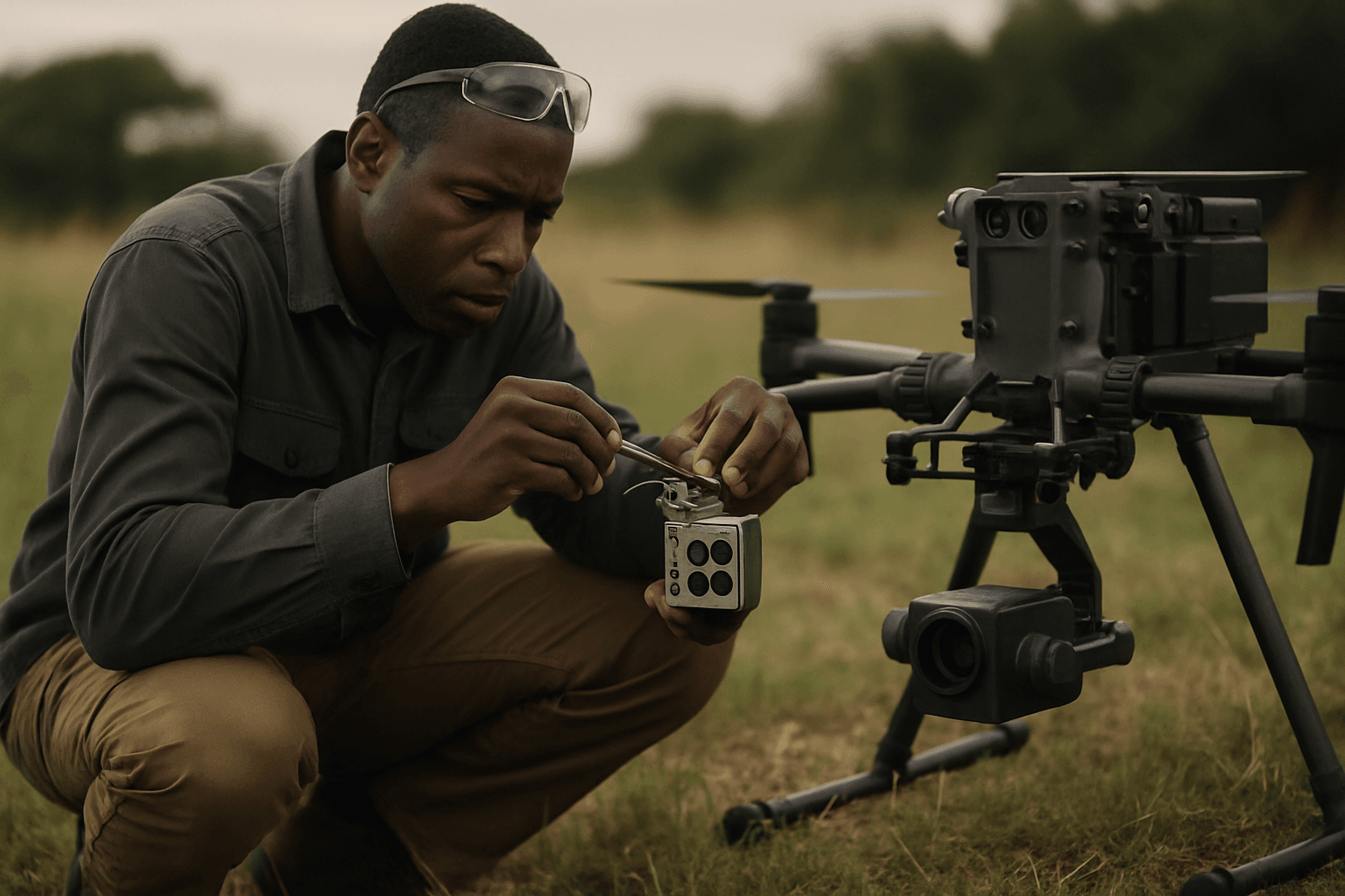
Understanding Drone Mapping Sensors and Their Importance
Drone mapping relies on a variety of sensors to capture diverse forms of data. GPS/GNSS sensors provide precise location information, critical for georeferencing images and point clouds. Camera sensors, whether RGB for photogrammetry or multispectral for agricultural analysis, capture visual data that is stitched together to create detailed maps and 3D models. LiDAR sensors, on the other hand, use laser pulses to measure distances, generating highly accurate 3D point clouds, especially useful in vegetated areas or for precise topographic mapping. The seamless operation and accurate calibration of these sensors are foundational to generating reliable geospatial intelligence.
Common GPS/GNSS Positioning Challenges
Accurate Global Positioning System (GPS) or Global Navigation Satellite System (GNSS) data is the backbone of precise drone mapping. Without it, images cannot be accurately aligned, and measurements become unreliable. Several factors can lead to GPS/GNSS signal issues:
Symptoms of GPS/GNSS Problems
- Erratic drone movement or difficulty maintaining a stable hover.
- “GPS signal lost” warnings during flight.
- Inaccurate georeferencing of collected data, leading to misaligned maps.
- Long acquisition times for GPS lock before takeoff.
Causes of GPS/GNSS Errors
- Environmental Obstructions: Buildings, dense tree canopies, mountains, or even deep valleys can block or weaken GPS signals, increasing the risk of signal interference.
- Atmospheric Conditions: Ionospheric and tropospheric delays can distort GPS signals.
- Satellite Geometry: Poor positioning of satellites relative to the drone receiver can reduce accuracy.
- Magnetic Interference: Proximity to metal objects or strong magnetic fields can interfere with the drone’s compass, which works in conjunction with GPS for accurate positioning.
- Multi-path Effects: Reflected signals from surfaces like buildings or water can cause inaccuracies.
- Outdated Firmware: Incompatible or outdated drone firmware can lead to GPS signal loss or errors.
Troubleshooting GPS/GNSS Issues
- Pre-Flight Location Check: Always ensure you are in an open area with a clear view of the sky, away from obstructions.
- Allow Warm-Up Time: Give the drone sufficient time to acquire a stable GPS lock before takeoff.
- Calibrate the Compass and IMU: Perform compass and Inertial Measurement Unit (IMU) calibration as recommended by the manufacturer, especially before the first flight of the day or if relocating to a new area.
- Update Firmware: Keep your drone’s firmware and associated app/software up to date to address potential bugs and improve performance.
- RTK/PPK Systems: For high-accuracy mapping, consider drones equipped with Real-Time Kinematic (RTK) or Post-Processed Kinematic (PPK) GPS systems. These systems use correction data to achieve centimeter-level accuracy, significantly mitigating standard GPS errors.
- Check for Physical Obstructions: Ensure no stickers or objects are blocking the drone’s GPS module.
Camera and Imaging Sensor Malfunctions (Photogrammetry & Multispectral)
Camera and imaging sensors are fundamental for photogrammetric and multispectral mapping. Issues with these can result in poor image quality, affecting the accuracy and completeness of the final maps.
Symptoms of Camera/Imaging Sensor Problems
- Blurry, unfocused, or distorted images.
- Inconsistent exposure or lighting across images.
- Gaps in data or uncalibrated images after processing.
- Chromatic aberration (color fringes on high-contrast edges).
- Sensor mismatch problem, where a high-resolution sensor is paired with a mediocre lens, leading to poor clarity.
Causes of Camera/Imaging Sensor Problems
- Dirty or Damaged Lens: Dust, smudges, or scratches on the lens can obscure the sensor and lead to blurry or hazy images.
- Improper Focus: Incorrect focus settings, especially in manual mode, can result in unfocused imagery.
- Gimbal Malfunction: A faulty gimbal can lead to unstable images, power failure to the camera, or misaligned shots.
- Camera Calibration Errors: Even high-quality cameras need regular calibration to correct for lens distortions and determine intrinsic parameters like focal length and principal point. Temperature changes, vibrations, and even drone impacts can affect calibration.
- Incorrect Exposure Settings: Too high or too low shutter speed, aperture, or ISO can lead to overexposed, underexposed, or blurry images, particularly in windy conditions.
- Insufficient Image Overlap: Poor flight planning resulting in too little overlap between images makes it difficult for photogrammetry software to stitch them accurately, leading to gaps or reconstruction issues.
- Non-Nadir Imagery: Including images that capture the sky/horizon rather than facing the ground can reduce map quality.
Troubleshooting Camera/Imaging Sensor Problems
- Clean the Lens: Regularly clean the gimbal lens and all sensors with a microfiber cloth.
- Check Gimbal Functionality: Ensure the gimbal moves freely and the camera is securely mounted with all cables intact. Test gimbal calibration if needed.
- Perform Camera Calibration: Follow manufacturer guidelines for routine camera calibration. This may involve dedicated calibration flights or using ground control points (GCPs). For multispectral sensors, pre-flight calibration using a calibration panel is often required to ensure accurate data comparison.
- Optimize Camera Settings: Adjust shutter speed, aperture (f-number), and ISO appropriate for lighting conditions to avoid blur and ensure consistent exposure. For beginners, “Auto” mode with “Average Metering” and “AE unlock” might be a good starting point for multispectral drones.
- Review Flight Planning: Ensure adequate image overlap (e.g., 70-75% frontlap and 60% sidelap for photogrammetry) and appropriate flight altitude for your desired Ground Sampling Distance (GSD). Consider adding a margin to your capture areas beyond the area of interest to ensure comprehensive data.
- Avoid Adverse Conditions: Refrain from flying in low light, strong winds, heavy rain, or extreme temperatures, as these can severely impact image quality.
- Consider Lens Quality: Be aware that compact drone lenses can sometimes compromise optical quality, leading to issues like edge softness or chromatic aberration even with high-resolution sensors.
LiDAR Sensor Specific Issues
LiDAR (Light Detection and Ranging) sensors provide highly accurate 3D point cloud data but can also encounter specific problems that affect data quality.
Symptoms of LiDAR Sensor Malfunctions
- Low-density point clouds.
- Missing data, especially in varying terrain or dense vegetation.
- Data distortion or “spray” in point clouds, particularly during aggressive maneuvers.
- Sensor misalignment.
Causes of LiDAR Sensor Malfunctions
- Flight Maneuvers: Aggressive cornering, rapid ascending, or descending can cause data distortion and affect GPS resolution of vertical position, leading to poor LiDAR data quality.
- Vegetation Obstruction: While LiDAR can “see through” some vegetation, dense foliage can still block the sensor from accurately capturing the ground surface, leading to gaps in data.
- Sensor Misalignment: The LiDAR sensor may become misaligned, impacting data accuracy.
- Dust/Debris on Sensor: Dust or grime on the internal or external components of the LiDAR sensor can obstruct the laser, causing errors.
- Poor Mission Planning: Incorrect flight plans (e.g., not flying long, straight lines in a corridor survey) can lead to data quality issues.
Troubleshooting LiDAR Sensor Malfunctions
- Smooth Flight Path: Plan missions with smooth, long, straight flight lines, avoiding aggressive turns or rapid changes in altitude.
- Regular Calibration: Perform routine calibration of the LiDAR sensor according to manufacturer guidelines to maintain accuracy and performance.
- Clean Sensor Components: Gently clean any visible dust or debris from the LiDAR sensor. If an internal D-TOF (Direct Time-of-Flight) sensor is malfunctioning due to dust, it may require careful disassembly and cleaning following specific instructions for your model.
- Terrain Awareness Flight Planning: For varying terrain, ensure your flight planning software accounts for terrain following rather than maintaining a constant altitude above takeoff, to prevent missing data.
- Check for Physical Damage/Loose Connections: Inspect the sensor for any physical damage or loose cables, which can cause signal loss. In complex cases, professional repair may be necessary.
Data Collection and Processing Errors
Even with perfectly functioning sensors, issues can arise during data acquisition and post-processing, impacting the final map product.
Symptoms of Data Collection & Processing Faults
- Gaps or inconsistencies in the final map or 3D model.
- Misaligned data or distorted 3D models/orthophotos.
- Uncalibrated images in processing software.
- Poor vertical alignment of output products with elevation surfaces.
- Processing failures.
Causes of Data Collection & Processing Faults
- Insufficient Data Collection: Not enough photos, low resolution, or density for accurate mapping.
- Poor Overlap: As mentioned, insufficient image overlap is a major cause of stitching issues.
- Inaccurate Ground Control Points (GCPs): Improperly placed or measured GCPs can lead to georeferencing errors.
- Homogenous Subject Matter: Mapping areas with very uniform features (e.g., dense vegetation, water bodies) can make it difficult for photogrammetry software to find tie points, leading to uncalibrated images or artifacts.
- Outdated Software or Improper Settings: Errors in data processing can stem from using older software versions or incorrect processing parameters.
Resolving Data Acquisition & Processing Faults
- Detailed Flight Planning: Implement meticulous flight planning to ensure sufficient image overlap (both frontlap and sidelap), appropriate Ground Sampling Distance (GSD), and comprehensive coverage. Utilize flight planning software to map optimal paths.
- Proper GCP Placement: When using GCPs, ensure they are accurately placed and measured with high-precision equipment. Increase the density and distribute them evenly across the survey area to improve georeferencing accuracy.
- Review Image Quality Pre-Processing: Before processing, scroll through images to check for blur, underexposure, overexposure, or inclusion of non-nadir shots (e.g., sky/horizon). Discard problematic images if necessary.
- Update Software and Settings: Use the latest versions of photogrammetry and GIS software. Familiarize yourself with optimal settings for your specific project type; there are no “one-size-fits-all” settings.
- Adjust Image Scale for Tie Point Generation: If images are uncalibrated, increasing the image scale or the size of the image neighborhood in processing software can help generate more tie points and improve matches.
- Waterbody Masks: For areas with significant water bodies, drawing a waterbody mask in processing software can help mitigate artifacts.
Proactive Maintenance and Best Practices for Sensor Health
Consistent maintenance and adherence to best practices are key to preventing many common sensor issues and extending the lifespan of your drone mapping equipment.
Pre-Flight Checks
- Visual Inspection: Before each flight, thoroughly inspect the drone and all sensor components for any physical damage, loose wires, or obstructions. Ensure propellers are secure and undamaged.
- Battery Check: Verify that drone, controller, and any display tablet batteries are fully charged.
- SD Card Status: Ensure the SD card is formatted and has sufficient storage space.
- Firmware Verification: A quick check for the latest stable firmware versions for both drone and controller can prevent connectivity or performance issues.
- Sensor Alignment & Calibration: Confirm that sensors are aligned and, if necessary, perform quick calibrations (e.g., compass, IMU, gimbal) before flight.
- Payload Security: Double-check that all sensors are securely mounted and cables are properly fastened to prevent disconnections or interference.
Ongoing Maintenance
- Regular Cleaning: Keep the drone’s exterior and all sensor surfaces free of dust, dirt, and debris.
- Routine Calibration: Implement a schedule for regular sensor calibration based on manufacturer recommendations or after any significant event (e.g., crash, firmware update, relocation).
- Firmware Updates: Regularly update drone and sensor firmware to benefit from performance enhancements and bug fixes.
- Proper Storage: Store your drone and sensors in a clean, dry environment, protected from temperature extremes, humidity, and dust, which can affect performance and durability.
- Professional Servicing: For complex issues or routine deep maintenance, consider professional servicing to ensure expert diagnosis and repair.
Conclusion
Drone mapping sensors are sophisticated instruments that, with proper care and troubleshooting, can deliver incredibly accurate and valuable geospatial data. By systematically addressing common issues related to GPS/GNSS accuracy, camera malfunctions, LiDAR performance, and data processing, operators can minimize errors and maximize the efficiency and reliability of their drone surveying projects. Adopting a proactive approach to maintenance, meticulous pre-flight checks, and continuous learning about your equipment are the cornerstones of successful drone mapping, ensuring that every flight contributes to precise and actionable intelligence.


