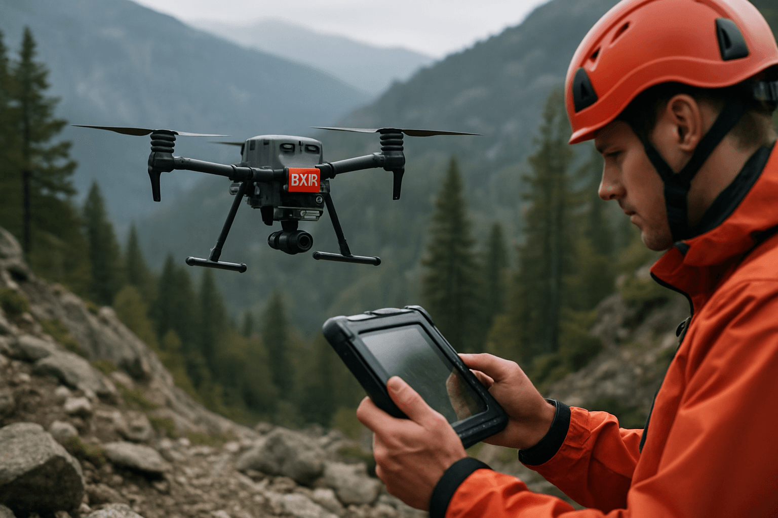
Unmanned Aerial Systems (UAS), commonly known as drones, have revolutionized search and rescue (SAR) operations by extending the reach and enhancing the efficiency of rescue teams, particularly in challenging and complex terrains. From dense forests and rugged mountains to collapsed urban environments and disaster zones, these demanding landscapes pose significant navigational challenges for traditional methods. The ability of drones to traverse areas inaccessible or hazardous to human rescuers, coupled with their capacity for rapid aerial assessment and data collection, makes them indispensable tools in modern SAR. However, effective operation in such environments necessitates sophisticated navigation techniques that go beyond basic GPS reliance.
Fundamental Navigation Principles for Drones
At their core, drones utilize fundamental navigation principles to maintain flight stability and determine their position.
Global Positioning Systems (GPS) and its Limitations in Complex Terrain
The Global Positioning System (GPS), a satellite-based navigation system, is a cornerstone of modern drone navigation, providing crucial location data for autonomous flight and precise positioning. Most off-the-shelf consumer drones rely on GPS to orient themselves in three-dimensional space and maintain stability during flight. However, GPS signals are inherently weak and highly susceptible to disruption. In complex terrains such as deep valleys, dense forests, urban canyons with tall buildings, or subterranean environments like mines and collapsed structures, GPS signals can be obstructed, degraded, or even entirely unavailable. This signal loss leads to inaccurate positioning or erratic flight behavior, severely compromising mission success and safety in critical SAR scenarios.
Inertial Navigation Systems (INS)
To counteract the limitations of GPS, drones integrate Inertial Navigation Systems (INS). An INS is a self-contained mechanism that continuously calculates an object’s position, orientation, direction, and speed without external references. It achieves this by fusing data from onboard Inertial Measurement Units (IMUs), which typically consist of accelerometers, gyroscopes, and sometimes magnetometers.
- Accelerometers measure linear acceleration.
- Gyroscopes measure angular velocity, determining the drone’s pitch, roll, and yaw.
- Magnetometers provide heading information relative to the Earth’s magnetic field.
By continuously measuring rotation and acceleration, INS enables precise tracking of position, velocity, and orientation, even when GPS or other external signals are unavailable or unreliable. While INS provides a crucial dead-reckoning capability, it is prone to drift over time, leading to cumulative errors in position. Therefore, INS is often aided by GNSS (Global Navigation Satellite Systems) when available, and complemented by other sensors in GPS-denied environments.
Advanced Navigation Techniques for Complex Terrain
To overcome the inherent challenges of complex terrain, modern SAR drones employ a suite of advanced navigation techniques, often leveraging sensor fusion—the integration of data from multiple sensors to create a more robust and reliable understanding of the environment.
Terrain Following and Contour Flight
Terrain following allows a drone to maintain a consistent altitude above the ground, adapting its flight path to the varying topography of the landscape. This is particularly useful in hilly or mountainous regions, enabling the drone to capture consistent, high-resolution data and avoid collisions with elevated terrain.
- LiDAR (Light Detection and Ranging) Sensors: LiDAR sensors are critical for terrain following. They measure the drone’s height from the ground and the shape of the terrain by emitting laser pulses and measuring the time it takes for them to return. This creates a detailed 3D map of the surroundings, allowing the drone to adjust its altitude and position dynamically. LiDAR is especially effective for penetrating dense vegetation to map the ground beneath.
- Vision Sensors: Cameras and infrared sensors can provide images and video to help drones recognize and track changes in terrain.
- GPS (with Digital Elevation Models): While GPS alone is insufficient, it can be combined with pre-loaded Digital Elevation Models (DEMs) to inform terrain-following flight plans, especially in surveyed areas. The drone can then adjust its altitude above the DEM for accurate terrain avoidance.
Obstacle Avoidance Systems
SAR operations frequently occur in hazardous environments with abundant obstacles, such as dense forests, collapsed buildings, and mountainous terrain, where visibility can be low. Advanced obstacle avoidance systems are crucial for safe navigation, preventing collisions, mission delays, and equipment damage. These systems provide 360-degree coverage and typically utilize a combination of sensors:
- LiDAR: As mentioned, LiDAR creates detailed 3D maps, enabling drones to navigate with high precision and avoid obstacles.
- Stereo Vision and Computer Vision: Computer vision systems use onboard cameras and sophisticated algorithms to analyze the drone’s surroundings, detect and track objects, and identify obstacles like buildings and trees. This allows the drone to make real-time decisions and adjust its flight path to avoid collisions, even in GPS-denied environments.
- Ultrasonic Sensors: These sensors use sound waves to detect obstacles in the immediate vicinity and calculate their distance, particularly useful for close-range avoidance.
- Radar: Radar systems can also be used for collision detection, especially in challenging weather conditions or low visibility.
Simultaneous Localization and Mapping (SLAM)
Simultaneous Localization and Mapping (SLAM) is a transformative technology that enables a drone to map an unknown environment while simultaneously tracking its own position within that map, all without relying on GPS. This is critical for navigating GPS-denied environments like tunnels, dense forests, urban canyons, and disaster-stricken areas.
- How SLAM Works: SLAM algorithms use sensor data, often from cameras and LiDAR, to create real-time 3D maps of the surroundings. As the drone explores, it continuously refines its position estimation using visual cues, landmarks, and inertial data.
- Sensor Fusion in SLAM: SLAM drones integrate multi-sensor data fusion, combining inputs from LiDAR scanners, visual cameras, and IMU-assisted localization for high-accuracy environmental mapping and real-time positioning.
- Applications in SAR: SLAM technology helps UAVs locate and plan paths in complex environments, supporting indoor cruise and task execution, and enabling 3D modeling and scene reconstruction in real-time.
Visual Odometry (VO)
Visual Odometry (VO) is an AI-powered algorithm that estimates the drone’s position and orientation by analyzing the motion of features in successive camera images. It’s particularly useful in environments where GPS is weak or unavailable. While VO offers a solution for localization, it requires significant computational power and can be susceptible to errors in low-light or featureless conditions.
AI and Machine Learning in Navigation
Artificial intelligence (AI) and machine learning (ML) are significantly enhancing autonomous drone navigation.
- Autonomous Flight and Path Planning: AI algorithms enable drones to autonomously plan and execute optimized search patterns tailored to specific terrain and conditions. They can dynamically adjust flight paths in real-time, responding to changing conditions and new information, ensuring thorough and systematic searches while avoiding obstacles.
- Object Detection and Identification: AI-powered computer vision algorithms are trained to detect and identify objects of interest, such as humans or animals, even through dense foliage or in low visibility conditions (e.g., using thermal imaging). This capability streamlines the search process and reduces false positives.
- Reinforcement Learning (RL): RL algorithms allow drones to learn optimal search patterns and path planning strategies through trial and error, improving their decision-making capabilities over time.
- AI-Driven Sensor Fusion: Modern AI-driven sensor fusion technology helps drones navigate autonomously in GPS-compromised or denied environments by integrating data from various sensors (e.g., multi-vector aerial speed, airflow, aileron feedback, barometer, compass, gyroscope, and magnetometer) to ensure high positional accuracy and environmental awareness.
Navigation in GPS-Denied and Challenging Environments
Operating drones in GPS-denied locations, where satellite signals are obstructed, degraded, or jammed, is a significant milestone for UAS. These environments include urban canyons, indoor spaces, underground areas, and even battlefields where GPS jamming may occur.
To navigate these challenging scenarios, drones rely on a combination of the advanced techniques previously discussed:
- Vision-Based Navigation: This is a key alternative to GPS, using onboard cameras and computer vision algorithms to analyze surroundings and determine the drone’s position and orientation relative to its environment.
- SLAM and Visual Odometry (VO): These technologies are at the heart of GPS-denied navigation, allowing real-time mapping and localization.
- Inertial Navigation Systems (INS): While prone to drift, INS provides crucial self-contained positioning when external signals are absent. GPS-aided INS units further enhance accuracy when signals are intermittently available.
- Sensor Redundancy and Fusion: By integrating data from barometers, anemometers, accelerometers, gyroscopes, magnetometers, and visual navigation systems, drones can create redundancy in positioning information, ensuring accuracy and reliability even in the most restricted environments.
Integration of Techniques for Enhanced SAR Operations
The true power of drone navigation for complex terrain search lies in the integration and synergistic application of these diverse techniques. For a SAR mission in a mountainous forest, for instance:
- Pre-mission planning can utilize AI algorithms to analyze historical data, topography, and weather to determine priority search areas.
- The drone might initiate flight using GPS-aided INS for broad area coverage.
- As it enters dense tree cover, GPS signals degrade, and the drone seamlessly transitions to SLAM and visual odometry for precise localization and mapping of the environment, integrating data from LiDAR to penetrate foliage and create a detailed 3D terrain model.
- Terrain-following sensors (LiDAR, vision) ensure the drone maintains a consistent height above the uneven ground, avoiding collisions with trees and cliffs.
- AI-powered obstacle avoidance systems detect and navigate around unexpected branches, power lines, or other debris in real-time.
- Thermal cameras integrated with AI-enhanced object recognition algorithms scan for heat signatures of missing persons, even through dense foliage or in darkness.
- The drone’s AI-driven path planning dynamically adjusts its search pattern based on real-time data and detected objects, optimizing efficiency.
This multi-faceted approach allows drones to systematically search vast and challenging areas quickly and safely, providing critical real-time aerial intelligence and precise coordinates to ground teams.
Future Trends and Innovations
The field of drone navigation for complex terrain is continuously evolving. Future advancements will likely focus on:
- More robust AI and Machine Learning: Further development in deep reinforcement learning will allow drones to learn more optimal search patterns and adapt even more effectively to highly dynamic and unpredictable environments.
- Enhanced Sensor Fusion: Integrating even more diverse sensor types and developing sophisticated algorithms for their fusion will lead to greater navigational accuracy and resilience in extreme conditions.
- Swarm Robotics: Coordinated drone swarms, leveraging collective intelligence and shared environmental mapping, promise to cover vast areas more rapidly and thoroughly, especially in urban environments or disaster zones.
- Miniaturization and Energy Efficiency: Continued advancements in sensor and processing technology will lead to smaller, lighter, and more energy-efficient navigation systems, enabling longer flight times and larger payloads for SAR missions.
- Improved GPS-denied Solutions: Research into alternative navigation methods beyond current visual and inertial systems, such as advanced RF-based navigation, will further enhance drone capabilities in completely signal-denied or underground environments.
Conclusion
Drone navigation techniques for complex terrain search are critical to the success of modern search and rescue operations. By combining fundamental principles like GPS and INS with advanced capabilities such as terrain following, sophisticated obstacle avoidance, real-time SLAM, visual odometry, and the pervasive power of artificial intelligence, drones are able to overcome the most formidable environmental challenges. These integrated systems provide unparalleled situational awareness, enable rapid and precise victim localization, and ultimately save lives by extending the reach and enhancing the safety of SAR teams in environments that were once considered impassable. As technology continues to advance, the role of autonomous drones in navigating the unseen will only grow, opening new prospects for global emergency response.


