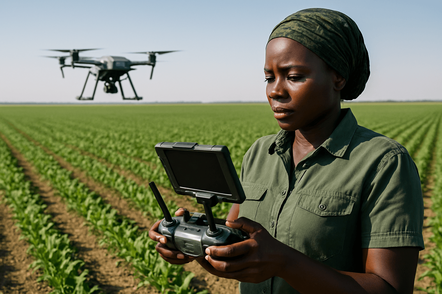
Weeds pose a persistent and significant challenge to global agriculture, competing with crops for essential resources like nutrients, water, and sunlight, ultimately leading to substantial yield losses and increased production costs. Traditional weed management often relies on labor-intensive manual methods or broad-spectrum herbicide applications, which can be inefficient, environmentally damaging, and contribute to herbicide resistance. However, the advent of drone technology, coupled with advanced sensing and artificial intelligence (AI), is transforming weed management by offering precise, efficient, and sustainable identification solutions.
Drone-based weed identification allows farmers to pinpoint weed infestations with remarkable accuracy, enabling targeted interventions that minimize chemical use, reduce operational costs, and promote healthier ecosystems. This innovative approach is becoming a game-changer in precision agriculture, helping to optimize resource utilization and enhance crop yields.
The Core Technologies Behind Drone-Based Weed Detection
The efficacy of drone-based weed identification systems hinges on the sophisticated integration of various hardware and software components. These systems typically involve:
Advanced Sensors for Data Acquisition
Drones can carry a range of sensors, each offering unique capabilities for capturing crucial information about vegetation:
- RGB Cameras: Standard Red-Green-Blue (RGB) cameras capture high-resolution visible light images, similar to what the human eye sees. These are often the most cost-effective option and, when combined with AI, can be highly effective for differentiating weeds from crops, especially in “green-on-brown” scenarios (weeds in bare soil) or when weed morphology is distinct. Modern RGB cameras on drones can achieve image resolutions as high as 1-2 cm per pixel, enabling the detection of small, early-stage weeds.
- Multispectral Cameras: These cameras capture images across several specific, narrow bands of the electromagnetic spectrum, including visible light (blue, green, red) and non-visible bands like red-edge and near-infrared (NIR). Multispectral imagery provides more detailed information about plant health, vigor, and chlorophyll content, as different plant species reflect and absorb light in unique ways, creating distinct “spectral signatures.” This is particularly valuable for “green-on-green” detection, where weeds are intermixed with crops and visual differences are subtle.
- Hyperspectral Cameras: Offering even greater spectral detail than multispectral sensors, hyperspectral cameras capture hundreds of narrow, contiguous spectral bands. This rich spectral information allows for very precise discrimination between plant species and can even help identify herbicide-resistant weeds or detect plant stress before visible symptoms appear. However, hyperspectral data generates large volumes of information, which requires significant computational resources for processing.
- Thermal Cameras: Thermal cameras detect temperature variations, which can sometimes indicate differences between healthy crops and weeds, as plants may have different thermal properties. This can be useful under specific environmental conditions.
- LiDAR (Light Detection and Ranging): LiDAR technology creates detailed 3D maps of the terrain and vegetation by emitting laser pulses and measuring the time it takes for them to return. This can help identify weeds based on their height and density relative to other vegetation, providing structural information that other sensors might miss.
Artificial Intelligence and Machine Learning
The raw imagery captured by drone sensors is transformed into actionable intelligence through sophisticated AI and machine learning (ML) algorithms.
- Computer Vision (CV): CV techniques enable AI systems to process visual inputs (drone images) and extract meaningful information like the shape, texture, and color of plants.
- Deep Learning (DL): A subset of ML, deep learning utilizes neural networks to analyze large datasets and identify patterns that differentiate weeds from crops. Models like Convolutional Neural Networks (CNNs), You Only Look Once (YOLO), and Vision Transformers are commonly employed for image classification and semantic segmentation (distinguishing pixels belonging to weeds from those belonging to crops or soil). AI models are trained on vast, annotated datasets, making them increasingly robust across diverse agricultural environments and adaptable to new weed types.
- Data Processing and Analysis: After image acquisition, individual images are stitched together to create seamless orthomosaic maps of the entire field. AI-powered software then analyzes these orthomosaics to detect, classify, and quantify weed populations. This data is compiled into “prescription maps” that indicate the exact location, density, and often even the species of weeds present.
Best Methods for Effective Drone-Based Weed Identification
Integrating the right sensor technology with powerful AI analytics forms the basis of the most effective drone-based weed identification methods:
1. RGB Imaging with Advanced AI/ML
For many applications, especially in “green-on-brown” scenarios (e.g., weeds in fallow fields or early-stage crops where soil is visible), high-resolution RGB imagery combined with AI/ML offers an efficient and cost-effective solution.
- How it works: Drones equipped with standard RGB cameras capture detailed visible light images. AI models, particularly deep learning networks, are trained to recognize specific weed characteristics (color, shape, texture) and distinguish them from soil or crops. Projects like WeedRemeed™ utilize advanced color picking and AI/ML to identify and georeference priority weed species at scale.
- Advantages: Lower initial cost for equipment, high spatial resolution allows for detection of small weeds, and relatively simpler data processing compared to multispectral or hyperspectral. Studies have shown accuracies of over 90% in identifying and mapping weeds using UAV imagery with AI.
- Limitations: Less effective in “green-on-green” scenarios where weeds and crops have similar visual appearances.
2. Multispectral Imaging for Enhanced Discrimination
Multispectral sensors are crucial for distinguishing weeds from crops when visual differences are minimal, such as when both are green.
- How it works: Multispectral cameras capture data in bands like green, red, red-edge, and near-infrared (NIR). Healthy plants reflect a large amount of NIR light and less red light, while stressed or different plant species (weeds) exhibit distinct reflectance patterns. Vegetation indices (e.g., Normalized Difference Vegetation Index – NDVI) are derived from these bands to provide insights into plant health and differentiate vegetation types. AI algorithms then analyze these spectral signatures to accurately map weed infestations.
- Advantages: Superior “green-on-green” detection capabilities, early detection of plant stress, and ability to differentiate a wider range of vegetation characteristics than RGB alone.
- Limitations: Higher cost than RGB cameras, and data processing is more complex.
3. Hyperspectral Imaging for Fine-Grained Identification
For the most challenging identification tasks, particularly distinguishing between very similar plant species or detecting specific physiological conditions like herbicide resistance, hyperspectral imaging provides unparalleled detail.
- How it works: Hyperspectral sensors collect data across numerous narrow spectral bands, creating a unique “fingerprint” for each plant species or condition. AI/ML models, including neural networks, are then trained on these detailed spectral profiles to classify weeds with high precision.
- Advantages: Highest accuracy in species-level identification, ability to detect subtle differences in plant biochemistry, and potential for identifying herbicide-resistant biotypes.
- Limitations: Very high cost of sensors and significant computational demands for data processing and analysis due to the large volume of data. Drone-based hyperspectral imaging can achieve classification accuracies ranging from 25% to 79% depending on plant age and lighting.
4. Integration of Multiple Sensor Types
Combining data from different sensor types (e.g., RGB, multispectral, and LiDAR) can provide a more comprehensive understanding of the agricultural landscape, leveraging the strengths of each technology to improve detection accuracy and robustness. This multi-sensor approach enhances the ability to discriminate between closely spaced or small weed infestations.
Data Processing and Decision Support
Regardless of the sensor type, the efficacy of drone-based weed identification culminates in the data processing and subsequent decision-making.
- Image Stitching and Georeferencing: Individual drone images are stitched into seamless orthomosaics, which are then georeferenced to precisely map weed locations.
- AI-Powered Analytics: Specialized software solutions, often integrated with AI/ML platforms, automatically detect, classify, and quantify weeds. These systems can generate detailed “prescription maps” that guide variable-rate herbicide application.
- GIS Integration: The collected data is integrated into Geographic Information System (GIS) software to create maps showing weed distribution, which is crucial for developing targeted weed control strategies.
- Real-time Processing and Edge AI: Advancements in “Edge AI,” where data processing occurs directly on the drone or on-site devices, are reducing latency and making real-time analysis more feasible, even in areas with limited connectivity.
Challenges and Future Outlook
Despite significant advancements, challenges remain in the widespread adoption of drone-based weed identification. These include the high initial cost of advanced sensors and computational resources, regulatory hurdles for UAV operations, limited battery life, weather dependency, and the need for skilled operators. Data quality, diversity, and bias in training AI models also present ongoing challenges.
However, the future of drone-based weed identification is promising. Continuous innovation in sensor technology, more efficient AI algorithms (including lightweight vision transformers), and improved data management solutions are expected to enhance accuracy, reduce costs, and simplify operations. The integration of drone-based weed mapping with automated guidance systems and robotic sprayers further enhances precision weed control. As these technologies evolve, drones will continue to play an increasingly vital role in achieving sustainable, efficient, and profitable agriculture.


