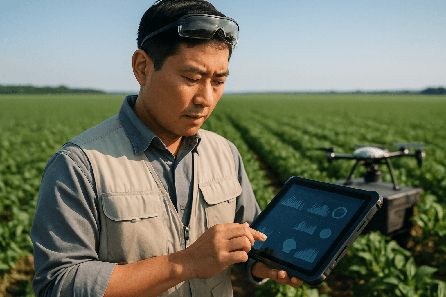
In an increasingly data-driven world, agriculture stands at the cusp of a technological revolution. Farmers are constantly seeking innovative ways to optimize yields, conserve resources, and enhance sustainability. Enter agricultural drones, sophisticated tools capable of capturing unparalleled aerial insights into field conditions. However, the true power of this technology isn’t just in data collection, but in its seamless integration with farm management software (FMS). This integration transforms raw drone data into actionable intelligence, empowering farmers to make precision decisions that can significantly impact their bottom line and environmental footprint.
The Foundation: Understanding Agricultural Drone Data
Before integration, it’s crucial to understand the diverse types of data drones collect and their specific applications in precision agriculture. Drones are equipped with various sensors that capture different aspects of crop and soil health, providing a comprehensive overview that ground-based scouting often misses.
Types of Drone Data for Precision Farming
- RGB Imagery (Visible Light): Standard high-resolution cameras capture images similar to what the human eye sees. These are valuable for basic visual inspections, monitoring crop growth progression, identifying field boundaries, and creating detailed orthomosaics.
- Multispectral Imagery: These advanced sensors capture data across specific light spectrums, including visible and near-infrared (NIR) light. This is critical for generating vegetation indices like NDVI (Normalized Difference Vegetation Index) and NDRE (Normalized Difference Red Edge). NDVI maps visualize plant health and stress, revealing issues like nutrient deficiencies, pest infestations, or diseases often before they are visible to the naked eye.
- Thermal Imagery: Thermal sensors detect temperature variations across a field, indicating issues such as water stress, uneven irrigation, or disease outbreaks by highlighting hot or cold spots. This allows for targeted irrigation adjustments and proactive problem-solving.
- LiDAR (Light Detection and Ranging): LiDAR systems mounted on drones use laser pulses to create highly accurate 3D point clouds of terrain and crop canopies. This data is invaluable for precise terrain mapping, drainage analysis, volumetric measurements, and even penetrating dense foliage to map bare earth.
- Hyperspectral Imagery: While less common than multispectral, hyperspectral sensors capture data in many narrow bands across the electromagnetic spectrum, offering even more detailed insights for specific agricultural research and advanced analysis.
The Integration Workflow: From Flight to Farm Management
Integrating drone data into farm management software involves a structured workflow, transforming raw aerial captures into digestible and actionable insights.
1. Drone Flight Planning and Data Capture
The initial step involves careful flight planning. Farmers or drone service providers define the area to be surveyed, desired altitude, and overlap for imagery, using specialized flight planning software. The choice of drone (multi-rotor for smaller fields and high maneuverability, fixed-wing for large areas and longer endurance, or VTOL hybrids) and sensor payload (RGB, multispectral, thermal, LiDAR) depends on the specific agricultural mission. Modern drones often come with RTK/PPK GPS systems for centimeter-level accuracy in positioning, ensuring precise georeferenced data.
2. Data Processing and Analysis
Once captured, the raw drone data requires significant processing:
- Geotagging and Stitching: Individual images are geotagged with precise location data and then “stitched” together to create large orthomosaic maps or 3D models of the entire field. This process often requires specialized drone mapping software.
- Generating Vegetation Indices: For multispectral data, software calculates indices like NDVI, creating color-coded maps that highlight variations in plant health across the field.
- AI and Machine Learning Analysis: Advanced platforms utilize AI and machine learning algorithms to automate crop health assessments, detect pests and diseases, predict yields, and even optimize flight paths. These tools can identify specific issues and quantify their severity, turning raw data into meaningful metrics.
3. Integrating with Farm Management Software (FMS)
This is the pivotal step where processed drone data becomes truly actionable. Integration methods vary depending on the FMS and drone software used:
- Direct Upload/Import: Many FMS solutions allow for the direct upload of processed drone maps (e.g., shapefiles, GeoTIFFs). This is a common method for integrating imagery, enabling farmers to overlay drone data onto existing field maps.
- API (Application Programming Interface) Integrations: More sophisticated systems offer API connections, allowing for a seamless, automated flow of data between drone processing platforms and FMS. This real-time or near-real-time data transfer is crucial for dynamic decision-making.
- Cloud-Based Platforms: Many drone data platforms and FMS are cloud-based, simplifying data storage, processing, and access from anywhere. Cloud solutions often facilitate seamless integration and collaboration.
- Compatibility with Existing Systems: Key FMS solutions like FarmWorks, AgLeader SMS, and the SST platform are designed to integrate with drone data, providing actionable insights for smarter management decisions. Platforms like Agremo also offer direct integration with drone imagery for actionable agronomy decisions and spray maps.
4. Data-Driven Decision Making and Action
With drone data integrated, farmers can:
- Create Variable Rate Application (VRA) Maps: Based on crop health maps (e.g., NDVI), FMS can generate prescription maps for precise application of fertilizers, pesticides, or irrigation. This ensures that each part of the field receives the optimal amount of resources, reducing waste and improving efficiency.
- Monitor Crop Performance Over Time: Integrated data allows farmers to track crop health trends across seasons, optimize field management practices, and refine strategies for future plantings.
- Early Problem Detection and Intervention: Real-time data helps in the early detection of issues, enabling timely interventions that can prevent significant crop losses.
- Yield Estimation and Risk Assessment: Analyzing aerial imagery throughout the growing season empowers farmers to generate accurate yield estimates and assess factors influencing productivity.
Benefits of Integrating Drone Data into Farm Management
The synergy between drone technology and farm management software offers a multitude of advantages:
- Enhanced Precision Agriculture: Drones provide highly accurate, real-time data, enabling precision in tasks from soil analysis to targeted spraying, leading to better resource allocation.
- Improved Crop Yields: By detecting issues early and applying inputs precisely, farmers can significantly improve crop health and, consequently, increase yields.
- Reduced Costs and Increased Efficiency: Drones reduce the need for manual scouting, optimize the use of water, fertilizers, and pesticides, and streamline various farming activities, leading to substantial cost savings.
- Sustainability and Environmental Benefits: Precise application of resources minimizes chemical runoff and water usage, promoting more sustainable and environmentally friendly farming practices.
- Data-Driven Decision Making: Integration transforms raw data into actionable insights, empowering farmers with accurate information to make informed decisions and improve long-term planning.
- Comprehensive Field Monitoring: Drones offer a bird’s-eye view, capturing detailed images that reveal patterns and issues not visible from the ground, across large areas quickly and efficiently.
Navigating Challenges in Drone Data Integration
Despite the immense benefits, integrating drone data into farm management systems comes with its own set of challenges:
- Data Volume and Management: Drones generate vast amounts of data, requiring robust cloud storage, fast processing systems, and effective data management strategies.
- Technical Expertise and Learning Curve: Operating drones, processing data, and interpreting insights require specialized skills and training, which can be a significant hurdle for some farmers.
- Compatibility Issues: Ensuring seamless compatibility between various drone systems, data processing software, and existing farm management platforms can be complex. Choosing drone systems compatible with popular agricultural management platforms is crucial.
- Initial Investment: The cost of acquiring high-end drones, sensors, and specialized software can be a substantial initial investment.
- Regulatory Hurdles: The evolving regulatory landscape for drone operations can be challenging to navigate, requiring farmers to stay updated on compliance.
- Connectivity in Remote Areas: Inconsistent network connectivity in rural agricultural areas can impact the seamless transmission of real-time data, hindering prompt decision-making.
The Future of Farm Management: AI, IoT, and Autonomous Drones
The future of drone data integration in agriculture is set to become even more sophisticated. The integration of Artificial Intelligence (AI) and Machine Learning (ML) will lead to more accurate predictive models, earlier disease detection, and autonomous decision-making. Combining drone data with other IoT (Internet of Things) devices like soil moisture sensors and weather stations will provide a truly 360-degree view of field conditions. Autonomous drone swarms could be deployed for simultaneous data collection and even tasks like precision spraying, further enhancing efficiency and productivity across large agricultural networks.
By strategically adopting compatible technologies and embracing the continuous evolution of digital agriculture, farmers can unlock the full potential of drone data, paving the way for more efficient, sustainable, and profitable farming operations.


