Vineyard management has historically relied on traditional methods, often requiring extensive manual labor and subjective assessments to gauge vine health. However, in the dynamic world of modern agriculture, technology is rapidly reshaping how winegrowers monitor their crops, care for their vines, and ensure optimal harvests. Unmanned Aerial Vehicles (UAVs), commonly known as drones, are emerging as a transformative force, offering unparalleled precision, efficiency, and real-time data to help vineyard managers make informed decisions for healthier, more productive vineyards.
The Revolution of Drones in Precision Viticulture
Precision viticulture is an approach to vineyard management that optimizes resource use and improves grape quality by addressing the inherent variability within a vineyard. Drones, equipped with advanced sensors and cameras, are central to this paradigm shift. They provide a “bird’s-eye view” of the vineyard, enabling the collection of high-resolution aerial imagery and data that is far more detailed than traditional methods like manual scouting or satellite imagery. This extensive data collection helps vineyard managers identify issues such as water stress, nutrient deficiencies, or pest infestations with remarkable accuracy and speed.
Essential Drone Technology for Vineyard Monitoring
The effectiveness of drone monitoring in vineyards hinges on the right combination of drone platforms and sophisticated sensor technology.
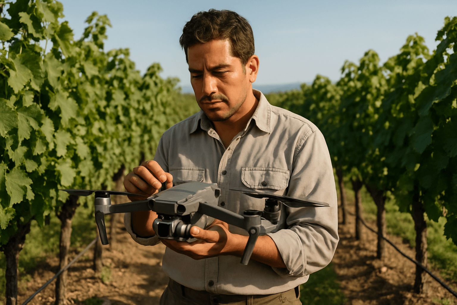
Types of Drones for Vineyards
Two primary categories of drones are suitable for agricultural applications, including viticulture:
- Multi-Rotor Drones: These drones, like quadcopters such as the DJI Phantom 4 RTK, are known for their ability to take off and land vertically and hover with precision, making them ideal for detailed inspections and smaller vineyard blocks. They are generally faster to set up in the field.
- Fixed-Wing Drones: Designed more like traditional airplanes, fixed-wing drones such as the eBee SQ by senseFly or the Delair DT18 AG can cover vast areas quickly, making them highly efficient for large-scale vineyard mapping and monitoring over hundreds of hectares in a single flight.
Key Sensors for Comprehensive Health Assessment
The sensors mounted on drones are crucial for gathering the diverse types of data necessary for thorough vineyard health analysis:
- RGB (Red, Green, Blue) Cameras: These are standard cameras found on most drones, capturing visible light images. While less expensive, they are primarily used for estimating canopy size, leaf density, and general visual assessment. They are not capable of detecting early signs of crop stressors or diseases that are not yet visible to the naked eye.
- Multispectral Sensors: These are among the most commonly used scanning systems in precision agriculture. Multispectral cameras capture specific ranges of the electromagnetic spectrum, typically 4 to 7 bands, including visible light and near-infrared. This allows for the calculation of various vegetation indices that are proxies for plant health and vigor.
- Normalized Difference Vegetation Index (NDVI): A widely used index that uses red and near-infrared reflectance to measure photosynthetic activity and overall plant vigor. High NDVI values often indicate healthy, vigorous vegetation, while lower values can signify stress or sparse growth.
- Normalized Difference Red Edge (NDRE): Similar to NDVI but utilizes the red-edge spectrum, which is particularly sensitive to changes in chlorophyll content and nitrogen levels in plants. It’s often more effective than NDVI for detecting issues in dense canopies or later growth stages.
- Thermal Sensors: These sensors detect and measure heat radiating from plants and soil, providing valuable insights into temperature variations within the vineyard. They are particularly useful for:
- Crop Water Stress Index (CWSI): Calculating CWSI from thermal data helps assess water stress in vines, enabling precise irrigation management.
- Soil Moisture Levels: Thermal imagery can indirectly indicate soil moisture levels, helping identify areas of water scarcity or excess.
- Hyperspectral Sensors: These advanced sensors collect and process a vast amount of information across many narrow bands of the electromagnetic spectrum. While more complex and expensive, they offer the potential for highly specific diagnostics, such as identifying particular viruses or nutrient deficiencies based on unique spectral patterns.
- Lidar Sensors: LiDAR (Light Detection and Ranging) technology creates 3D models of the vineyard canopy and terrain, offering insights into vine structure, canopy volume, and topographical features that can influence water flow and sunlight exposure.
How Drones Gather and Analyze Vineyard Health Data
The process of utilizing drones for vineyard monitoring involves systematic data collection and sophisticated analysis.
Data Collection Process
- Flight Planning: Using specialized software, operators define the area to be surveyed, outlining the vineyard blocks on a map. This allows the drone to follow pre-programmed GPS-guided routes, ensuring comprehensive coverage and consistency across multiple flights.
- Image Acquisition: Drones fly at relatively low altitudes (up to 122 meters or 400 feet), capturing high-resolution images with their integrated sensors. The ability to fly closer to the canopy provides a more detailed look at individual vineyard areas compared to satellites. Drones can be scheduled for frequent flights (e.g., 5-10 times a season) to monitor changes over time, offering greater flexibility than fixed-wing aircraft or satellites.
Advanced Data Processing and Interpretation
Once collected, the raw data undergoes intensive processing and analysis:
- Orthomosaics and 3D Models: Individual images are stitched together to create seamless, high-resolution orthomosaic maps of the entire vineyard. Some processes can also generate 3D models of the terrain and canopy. These maps highlight areas requiring attention, such as vines struggling due to pests, diseases, or nutrient deficiencies.
- Vegetation Indices Mapping: Software processes multispectral data to generate maps based on indices like NDVI and NDRE. These color-coded maps visually represent vine vigor and health, making it easy to spot variability. For example, healthy, vigorous vines will show high reflectance in the near-infrared spectrum and lower reflectance in the red, resulting in higher NDVI values.
- AI and Machine Learning: The integration of Artificial Intelligence (AI) and machine learning algorithms is an emerging area of research, enhancing the analysis of drone imagery. AI can automatically detect diseases, pest infestations, or identify individual vines with high accuracy, often with up to 90% accuracy for vine detection. This technology can also assist in yield estimation and irrigation management by analyzing crop health on the spot.
Key Applications and Benefits of Drone Monitoring
The insights gained from drone monitoring offer a multitude of practical applications and significant benefits for vineyard management.
Early Detection of Pests and Diseases
Drones equipped with multispectral and hyperspectral sensors can detect subtle changes in plant health that are invisible to the naked eye. This early detection of diseases like leaf roll or pest infestations allows for swift, targeted interventions, minimizing crop loss and preventing the spread of problems across the vineyard.
Precision Irrigation Management
Thermal and multispectral sensors provide accurate, real-time data on soil moisture levels and vine water stress. This enables vineyard managers to adjust irrigation schedules with precision, delivering the optimal amount of water to specific areas or even individual vines. This optimizes water use efficiency, reduces waste, and is crucial for grape quality, especially in regions facing droughts.
Nutrient Deficiency Identification
By analyzing vegetation indices, drones can pinpoint areas where vines are exhibiting nutrient deficiencies, such as nitrogen or potassium imbalances. This information allows for targeted fertilizer application, ensuring vines receive what they need without excessive chemical use, which benefits both the environment and cost efficiency.
Canopy Management and Vigor Mapping
Drones provide detailed maps of vine vigor and canopy cover, revealing variations in leaf density and growth patterns. This data helps in making informed decisions about pruning, thinning, and training to ensure balanced growth, optimal sunlight exposure, and ultimately, better grape ripening. It allows managers to identify weak spots or areas with excessive vigor, which can influence grape quality and harvest timing.
Yield Estimation and Harvest Planning
Drones equipped with various sensors can provide detailed data on grape size, color, and condition, helping to estimate ripeness and yield potential across the vineyard. This enhances harvest prediction accuracy, allowing for better planning of labor needs and optimizing the timing of harvest for the best possible product price.
Environmental and Cost Efficiency
Targeted interventions based on drone data significantly reduce the overuse of pesticides, fertilizers, and water. This leads to substantial cost savings in materials and labor, reduces environmental contamination from chemical runoff, and promotes more sustainable farming practices. Drones can also access difficult or dangerous terrain, eliminating the need for manual inspections in such areas.
Challenges and Considerations for Drone Integration
Despite the numerous advantages, integrating drones into vineyard management presents certain challenges:
Initial Investment and ROI
The initial cost of purchasing drones, advanced sensors, and specialized data processing software, along with staff training, can be a significant barrier for some vineyards, particularly smaller operations. However, the long-term cost savings through improved efficiency, reduced resource waste, and increased productivity often outweigh this initial investment.
Regulatory Landscape and Flight Restrictions
Regulations regarding drone operation vary by region and can be complex, including restrictions on flight altitude, proximity to airports, and “Beyond Visual Line Of Sight” (BVLOS) operations, which are essential for large vineyards. Adherence to these regulations is crucial for legal and safe operation.
Data Management and Expertise
The sheer volume of data collected by drones requires robust data management systems and personnel with the expertise to process, interpret, and translate this data into actionable insights. While AI is making this easier, human oversight and agronomic knowledge remain vital.
Sensor Limitations and Environmental Factors
Each sensor type has limitations. For example, RGB cameras cannot detect early stress. Environmental factors like cloud cover, shadows, or smoke from wildfires can also affect image quality and data accuracy, though drones offer more flexibility than satellite imagery in such conditions.
The Future of Drone Technology in Viticulture
The future of drone technology in viticulture is characterized by continuous advancements. The integration of Artificial Intelligence (AI) and the Internet of Things (IoT) will further enhance accuracy and efficiency, potentially leading to fully autonomous vineyard management systems capable of real-time analysis and even precision spraying. As technology becomes more accessible and affordable, drones are set to become an even more ubiquitous and indispensable tool for sustainable and high-quality wine production.
Conclusion
Drones are undeniably revolutionizing vineyard management, offering winegrowers an unprecedented level of detail and control over their crops. By providing high-resolution, multi-spectral insights into vine health, water stress, nutrient levels, and yield potential, drones enable highly targeted and efficient interventions. This not only optimizes resource utilization and reduces operational costs but also fosters greater environmental sustainability and ultimately leads to the production of higher quality grapes and wines. Embracing drone technology is no longer just an innovation but a strategic imperative for vineyards seeking to thrive in the modern agricultural landscape.


