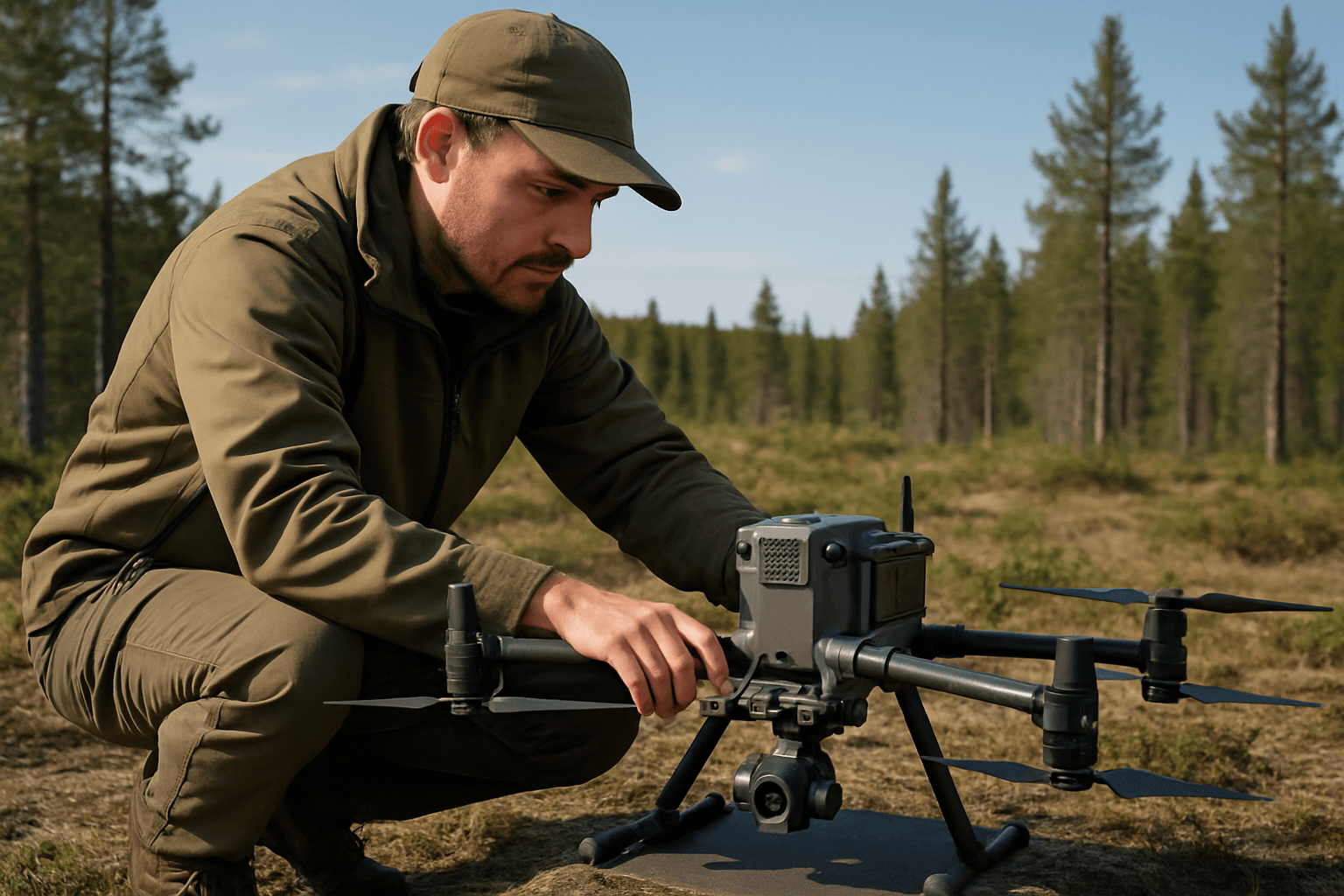
The escalating challenges of environmental degradation, climate change, and biodiversity loss demand increasingly sophisticated and efficient monitoring solutions. Traditional methods often prove costly, time-consuming, and limited in scope, particularly across vast or inaccessible terrains. In this context, Unmanned Aerial Vehicles (UAVs), commonly known as drones, have emerged as transformative tools, fundamentally reshaping the landscape of environmental monitoring and conservation. Providing unparalleled accessibility and data collection capabilities, drones are now indispensable for understanding, managing, and protecting our planet’s delicate ecosystems.
Bridging the Data Gap with Aerial Precision
One of the most significant advantages drones offer is their ability to bridge critical data gaps. Conventional environmental research frequently involves labor-intensive fieldwork in difficult terrains, or relies on less frequent, lower-resolution satellite imagery. Drones can access virtually any area with minimal environmental impact, from dense rainforests to remote wetlands, providing continuous monitoring where physical presence would be prohibitively expensive or dangerous.
Equipped with a diverse array of advanced sensors and cameras, drones gather high-resolution, real-time data that traditional methods simply cannot match. This rich data empowers environmental scientists and conservationists to make more informed decisions and implement timely interventions.
Key Applications Across Diverse Ecosystems
The versatility of drones in environmental monitoring is evident in their wide-ranging applications:
Wildlife Tracking and Conservation
Drones are revolutionizing wildlife conservation by providing a non-intrusive way to monitor animal populations and behavior. Unlike traditional methods that often require close physical proximity, potentially causing stress or behavioral changes, drones can observe from a distance, gathering more naturalistic data.
- Population Counting and Identification: Drones equipped with high-resolution cameras can efficiently count animal populations, assess species distribution, and even identify individuals by unique markings.
- Tracking and Behavioral Studies: Thermal imaging cameras allow drones to detect and track nocturnal, camouflaged, or hidden wildlife, even in dense foliage or darkness, providing crucial insights into their movements, habitat use, and behaviors. This has been used to monitor endangered species like elephants, rhinos, orangutans, tortoises, and even track the unique behaviors of marine animals like whales and narwhals.
- Anti-Poaching Efforts: Drones with thermal cameras and other sensors can aid in detecting illegal activities like poaching by identifying heat signatures or unusual movements, providing real-time data to authorities for swift action.
- Habitat Mapping: Drones create detailed maps of animal habitats, helping conservationists understand how species interact with their environments and identify areas where intervention is needed to improve habitat connectivity, such as wildlife corridors.
Forest Management and Deforestation Monitoring
Forests, vital for biodiversity and carbon sequestration, face immense pressure from climate change and human activities. Drones are indispensable for their monitoring and management.
- Health Assessment and Inventory: Drones with multispectral and hyperspectral imaging can assess forest health based on optical characteristics, detect subtle changes in vegetation, identify disease outbreaks or pest infestations, and collect accurate data for forest planning and management.
- Deforestation and Illegal Logging Detection: Drones provide an unparalleled vantage point to track deforestation rates, detect illegal logging activities, and monitor human encroachment into protected forest areas, even in remote regions. This data can be used to inform policy decisions and enforce regulations. Projects in the Peruvian Amazon have shown that drone and smartphone-based monitoring can significantly reduce illegal logging.
- Reforestation and Carbon Sequestration: Drones can map degraded areas for reforestation efforts and track the progress and success of these initiatives. LiDAR-equipped drones can create detailed 3D maps of forests, allowing researchers to estimate carbon storage with greater precision, crucial for climate change research.
Water Quality and Aquatic Ecosystems
Monitoring the health of lakes, rivers, wetlands, and marine environments is critical, and drones offer a swift and accurate means to do so.
- Pollution Detection: Drones equipped with specialized sensors can detect pollutants, measure pH levels, water temperature, electric conductivity, and dissolved oxygen, helping identify sources of contamination like illegal discharges or algal blooms.
- Thermal Anomaly Detection: Thermal imaging drones are particularly useful for monitoring water temperature distribution in streams and wetlands, identifying groundwater outburst points, cold-water fish habitats, or the spread of pollutants.
- Riverbank and Coastal Monitoring: Drones can map river heights, monitor bank erosion, and assess changes to riverbank vegetation. They are also used for monitoring coral reefs to collect information about water quality, temperature, and coral health.
Air Quality Monitoring
The ability of drones to navigate urban and industrial environments at various altitudes makes them effective for tracking air pollution.
- Pollutant Detection: Drones equipped with gas sensors can measure atmospheric conditions such as CO2, methane, temperature, and humidity, and track toxins like PM 2.5, helping identify pollution hotspots and inform public health concerns.
Disaster Response and Environmental Change Assessment
Drones play a crucial role in responding to natural disasters and assessing environmental shifts.
- Post-Disaster Assessment: After events like wildfires or floods, drones can survey damage, assess the extent of impact, and provide real-time data for coordinating relief efforts and locating stranded wildlife.
- Glacial Melt and Climate Impact: Drones with thermal imaging can monitor glacial melt rates in unprecedented detail, providing crucial data to understand the impacts of global warming on sea-level rise.
- Landslide and Erosion Monitoring: Drone-mounted LiDAR systems can detect very small changes in terrain, such as erosion lines or the shape and size of landslides, even under dense vegetation, crucial for risk assessment and conservation.
Advanced Technologies Enhancing Drone Capabilities
The effectiveness of drones in environmental monitoring is continually boosted by advancements in sensor technology and artificial intelligence.
- Multispectral and Hyperspectral Sensors: These sensors capture data across a wide range of wavelengths, allowing drones to detect subtle changes in vegetation health, water quality, and soil composition, providing more detailed and accurate data than standard RGB cameras.
- LiDAR (Light Detection and Ranging): LiDAR drones emit laser pulses to create highly detailed 3D models of the environment. This technology excels at penetrating vegetation, capturing multiple layers of a forest, and accurately mapping ground elevation, which is invaluable for biomass estimation, deforestation monitoring, and flood risk assessment.
- Thermal Imaging: Thermal cameras detect heat signatures, making them ideal for locating nocturnal or camouflaged animals, identifying heat loss from buildings (contributing to urban sustainability), and detecting fire hazards in landfills.
- AI and Machine Learning: The integration of Artificial Intelligence (AI) and Machine Learning (ML) is a game-changer. AI algorithms enable drones to process vast amounts of data in real-time, automate tasks like species identification and anomaly detection, and even predict future environmental trends. AI-powered drones can:
- Automate Data Analysis: Quickly identify patterns, classify ecological features, and detect anomalies, significantly reducing manual workload.
- Real-time Processing: Analyze incoming data instantly for rapid decision-making, crucial for obstacle avoidance and live monitoring.
- Autonomous Navigation: Plan optimal flight paths, adapt to changing conditions, and even identify safe landing zones, enhancing safety and efficiency.
Benefits Beyond Data Collection
The advantages of employing drones for environmental monitoring extend beyond just superior data collection.
- Cost-Effectiveness and Efficiency: Drones offer a significantly more cost-effective and efficient alternative to traditional methods like manned aircraft or extensive ground surveys. They can cover large areas quickly, reducing time, labor, and financial resources.
- Accessibility and Safety: Drones provide access to remote, dangerous, or otherwise inaccessible areas, reducing risks to human researchers.
- Non-Invasive Monitoring: For wildlife, drones offer a non-intrusive method of observation, minimizing disturbance to animals and their natural behaviors.
- Informed Decision-Making: The high-resolution, real-time data collected by drones provides critical insights for developing targeted conservation strategies, implementing timely interventions, and informing policy decisions.
Challenges and Future Outlook
Despite their immense potential, the widespread adoption of drones in environmental monitoring faces several challenges:
- Regulatory Frameworks: The rapid evolution of drone technology has often outpaced the development of clear regulations. Compliance with aviation authority rules, obtaining permits, and operating within designated airspace can pose logistical hurdles.
- Data Processing and Analysis: The sheer volume of high-resolution data collected by drones requires significant computational power, specialized software, and skilled analysts for efficient processing and interpretation.
- Battery Life and Endurance: Limited battery life and flight duration can restrict the ability of drones to cover vast areas or monitor for extended periods, though advancements in battery technology are addressing this.
- Environmental Impact: While less intrusive than manned aircraft, drones can cause noise pollution, disturbing wildlife. The production and disposal of lithium-polymer batteries also pose environmental challenges.
- Privacy and Data Security: The collection of highly sensitive data, especially concerning endangered species or illegal activities, raises concerns about data ownership, privacy, and security.
Looking ahead, the future of drones in environmental monitoring is bright. Key trends include:
- Enhanced Autonomy: Drones will become even more autonomous, capable of navigating complex environments and making real-time decisions without human intervention.
- Swarming Technology: The development of swarming technology, where multiple drones work together as a coordinated unit, will enable more rapid and efficient coverage of large areas, providing comprehensive ecosystem data.
- Improved Sensor Capabilities: Further advancements in sensor technology will allow drones to detect even more subtle environmental changes, offering hyper-detailed and accurate data.
- Integration with IoT and 5G: Seamless integration with Internet of Things (IoT) devices and 5G networks will enhance connectivity, enabling real-time data sharing and remote control for immediate habitat monitoring.
- AI for Predictive Analysis: AI-powered drones will not only identify current environmental changes but also predict future trends, allowing for proactive conservation and mitigation strategies.
In conclusion, drones have transitioned from novelties to indispensable tools in the fight for environmental preservation. Their capacity to access remote areas, collect high-quality, diverse data, and leverage advanced analytical capabilities through AI, offers an unprecedented understanding of our natural world. While challenges remain, continuous technological advancements and collaborative efforts among researchers, policymakers, and industry experts will ensure drones continue to play an increasingly vital role in protecting and preserving our planet for generations to come.


