Maintaining infrastructure while adhering to increasingly stringent environmental regulations presents a significant challenge for industries worldwide. From sprawling pipelines to towering wind turbines, the vastness and often hazardous nature of these assets make traditional inspection methods costly, time-consuming, and risky. Enter drone-based infrastructure inspection—a transformative technology that is redefining how organizations monitor their environmental footprint and ensure compliance. These unmanned aerial vehicles (UAVs) offer an unparalleled combination of safety, efficiency, and data precision, providing a crucial tool in the pursuit of sustainable operations and robust environmental stewardship.
What is Drone-Based Infrastructure Inspection for Environmental Compliance?
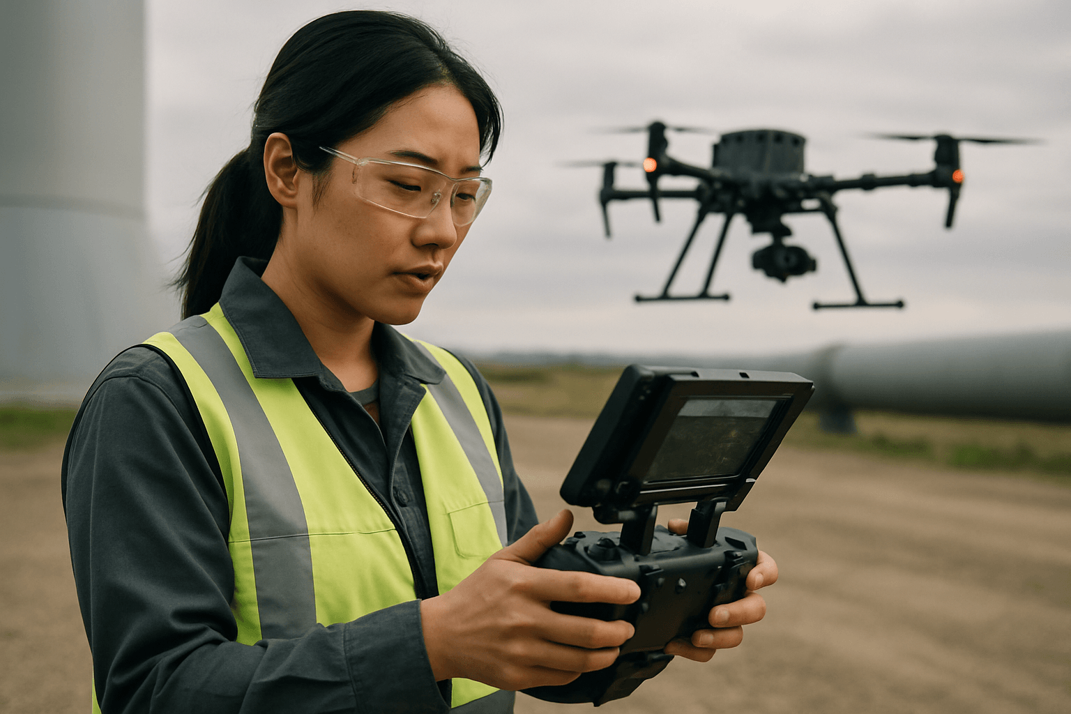
Drone-based infrastructure inspection for environmental compliance involves utilizing Unmanned Aerial Vehicles (UAVs) equipped with advanced sensors and cameras to monitor industrial and public infrastructure for potential environmental risks and regulatory adherence. This includes detecting issues such as leaks, erosion, habitat encroachment, and emissions that could violate environmental standards. By providing detailed, real-time data from hard-to-reach or hazardous locations, drones enable proactive identification and mitigation of environmental impacts associated with infrastructure.
Key Benefits of Integrating Drones into Environmental Monitoring
The adoption of drone technology for environmental compliance offers a multitude of advantages over conventional methods:
Enhanced Safety and Reduced Risk
Traditional inspections often require personnel to work at heights, in confined spaces, or near hazardous materials, posing significant safety risks. Drones eliminate or drastically reduce the need for human presence in these dangerous environments, thereby enhancing worker safety and minimizing accident rates. For example, inspecting a waterline in unsafe terrain, as faced by an energy company, can be done safely from the air using drones equipped with thermal imaging cameras, avoiding the need for personnel to enter dangerous areas.
Increased Efficiency and Speed
Drones can cover vast areas and collect data much faster than human teams or traditional methods, such as those requiring scaffolding or specialized equipment. This accelerated data collection translates into quicker identification of potential issues, faster assessment processes, and reduced downtime for critical infrastructure. One utility provider reported that drones enabled eight inspections per day compared to three via traditional methods.
Cost-Effectiveness
By reducing labor hours, eliminating the need for expensive equipment like cranes or scaffolding, and minimizing travel time, drones significantly lower operational costs associated with inspections. This cost-efficiency allows for more frequent monitoring, leading to early detection of problems before they escalate into costly environmental disasters or non-compliance penalties.
Superior Data Quality and Accuracy
Equipped with high-resolution cameras, thermal imaging, multispectral, hyperspectral, and LiDAR sensors, drones capture incredibly detailed and precise data. This rich dataset enables thorough analysis, the creation of accurate 3D models, and the identification of minute defects or environmental anomalies that might be missed by the naked eye. This data can then be integrated with GIS systems for comprehensive analysis and reporting.
Reduced Environmental Impact
Drones generally have a smaller carbon footprint than traditional inspection methods, as they do not require large vehicles or equipment that consume fuel and produce emissions. This makes them a more sustainable option for ongoing environmental monitoring.
Specific Applications in Environmental Compliance
Drone technology has diverse applications across various infrastructure types, directly contributing to environmental compliance:
Pipeline and Utility Line Monitoring
For oil, gas, and water pipelines, drones are invaluable for detecting leaks, erosion, and changes in the surrounding environment that could indicate a problem. Thermal imaging can pinpoint invisible leaks, while LiDAR can identify ground movement or erosion near pipelines. Drones can also monitor vegetation health along right-of-ways, which can indicate pipeline issues or encroachment.
Power Line and Wind Turbine Inspections
Drones inspect power lines for damage, vegetation encroachment, and thermal anomalies indicative of overheating components, which can prevent outages and potential wildfires. For wind turbines, drones can identify blade damage or structural issues, ensuring efficient operation and reducing the risk of material failure that could impact the environment.
Bridge and Dam Assessments
Drones can conduct detailed structural integrity checks of bridges and dams, identifying cracks, corrosion, or other damage. This is critical for preventing catastrophic failures that could lead to significant environmental contamination or habitat disruption.
Industrial Site and Facility Monitoring
Industrial operations, including oil & gas, petrochemicals, power generation, and mining, carry significant environmental footprints. Drones can monitor air quality for pollutants like particulate matter, SO₂, NOx, VOCs, and CO, and detect gas leaks (e.g., methane) from flare stacks, storage tanks, and other equipment. They can also monitor outflows into watercourses, illegal dumping, and changes in land use around industrial sites to ensure compliance with emission and waste disposal regulations.
Construction and Post-Construction Compliance
During construction projects, drones can monitor vegetation clearance, assess potential risks to sensitive ecosystems, and track habitat recovery, erosion, and landform changes post-construction. They also help in identifying environmental violations in real-time.
The Technology Behind Drone Environmental Inspection
Modern environmental monitoring drones are sophisticated systems integrating various technologies:
Advanced Drone Platforms
Both fixed-wing drones (for sweeping vast expanses) and multi-rotor drones (for fine-scale inspections over hotspots or sensitive areas) are utilized, chosen based on the mission’s requirements. These platforms are designed for stability, maneuverability, and often extended flight times.
Specialized Sensors and Payloads
Key sensors include:
- High-Resolution RGB Cameras: For detailed visual inspection, mapping, and 3D modeling.
- Thermal Imaging Cameras: To detect temperature anomalies, heat loss, leaks, and malfunctioning components.
- Multispectral and Hyperspectral Sensors: For assessing vegetation health, identifying plant stress, nutrient deficiencies, and mapping different land cover types, which can indicate environmental changes or pollution.
- LiDAR Scanners: For creating precise 3D terrain models, measuring volumes, detecting erosion, and analyzing structural integrity.
- Gas Detectors: Specialized sensors for identifying and quantifying various air pollutants and greenhouse gases like methane, SO₂, NOx, and VOCs.
Data Processing and Analytics
The massive amounts of data collected by drones are processed using specialized software, GIS technology, and AI-driven analytics. This allows for the creation of maps, 3D models, change detection analysis, and detailed reports that highlight environmental issues and compliance status. Cloud-based software solutions provide immediate access to detailed reports and images.
Regulations and Challenges
While the benefits are clear, the widespread adoption of drones for environmental compliance faces certain hurdles:
Regulatory Landscape
Drone operations are subject to evolving regulations governing airspace management, flight altitude, visual line of sight, and licensing requirements. Bodies like the FAA in the United States and EASA in the European Union are continually developing frameworks to ensure safe integration into national airspace. Compliance with environmental review processes, such as NEPA in the U.S., is also critical, especially for complex operations or those with potential environmental impacts.
Data Privacy and Security
The ability of drones to collect vast amounts of high-resolution data raises concerns about data privacy, especially in populated areas. Companies must ensure transparent data handling, minimize data collection to what is necessary, and comply with privacy laws like GDPR.
Technical Limitations
Challenges such as limited battery life, payload capacity, and susceptibility to adverse weather conditions can impact drone operations, particularly for extensive or long-duration missions. Signal interference in confined spaces or remote areas also poses a challenge.
The Future Outlook
Despite these challenges, the trajectory for drone-based infrastructure inspection for environmental compliance is one of rapid growth and innovation. Continuous advancements in battery technology, sensor miniaturization, AI, and autonomous flight capabilities are addressing current limitations. The integration of drone data with corporate ESG (Environmental, Social, and Governance) dashboards will further streamline reporting and support net-zero compliance goals. As regulatory frameworks mature and technologies become more robust, drones will increasingly serve as indispensable tools for environmental protection, offering a proactive, precise, and sustainable approach to managing the environmental impacts of our vital infrastructure.


