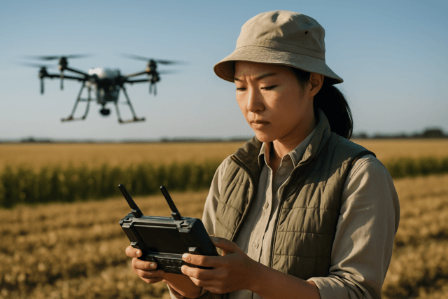
The quarrying industry, with its constantly evolving landscapes and critical need for precise data, is rapidly embracing drone technology. Unmanned Aerial Systems (UAS), or drones, offer a transformative approach to quarry mapping and volume calculation, providing enhanced safety, efficiency, and accuracy compared to traditional methods. By leveraging high-resolution aerial imagery and advanced photogrammetry, drones deliver detailed 2D and 3D models of quarry sites, empowering operators with actionable insights to optimize resource management, track extraction progress, and ensure environmental compliance.
This guide will walk you through the essential steps of conducting a drone survey for quarry mapping and volume calculation, from equipment selection and flight planning to data processing and analysis.
The Transformative Benefits of Drone Surveys in Quarries
Traditional surveying in quarries often involves sending personnel into hazardous areas with steep slopes, unstable stockpiles, and heavy machinery, posing significant safety risks. Drones mitigate these dangers by capturing data remotely, minimizing human exposure to unsafe environments.
Beyond safety, drone surveys offer a multitude of operational advantages:
- Enhanced Safety: Drones eliminate the need for personnel to physically enter dangerous zones, reducing risks from unstable ground, high cliffs, and heavy equipment. They can also identify potential hazards in real time, such as cracks in rock formations or unstable slopes.
- Improved Efficiency and Speed: Drones can survey vast areas quickly, significantly reducing the time and resources required compared to manual methods or manned aircraft. A survey that once took days can now be completed in hours.
- High Accuracy and Repeatability: Equipped with advanced sensors and GPS correction technologies like RTK (Real-Time Kinematic) and PPK (Post-Processed Kinematic), drones can achieve centimeter-level accuracy in data collection, providing highly precise 3D models and volumetric calculations. This consistency allows for accurate tracking of changes over time.
- Cost Savings: By reducing manpower, equipment rental, and project timelines, drone surveys can lead to substantial cost reductions—sometimes up to 60% compared to conventional methods.
- Comprehensive Data Collection: Drones capture high-resolution aerial imagery, enabling the creation of detailed orthomosaic maps, 3D point clouds, and Digital Surface Models (DSMs) for in-depth analysis.
- Better Resource Management: Precise volume and stockpile calculations facilitate accurate inventory tracking, progress monitoring, and optimal use of resources, leading to better financial outcomes.
- Environmental Monitoring and Compliance: Drones assist in monitoring environmental impact, tracking land use, assessing rehabilitation zones, and ensuring adherence to extraction limits and environmental regulations.
- Enhanced Planning: Up-to-date aerial imagery and topographic data support informed decision-making for exploration, haul road optimization, and overall site planning.
Essential Equipment for Quarry Drone Surveys
A successful drone survey relies on the right combination of hardware and software.
Drone Platforms
The choice of drone depends on the size of the quarry and specific survey goals.
- Multirotor Drones: These are agile and precise, making them excellent for smaller to medium-sized quarries and detailed inspections. The DJI Phantom 4 Pro, for instance, is often cited as ideal for many quarry applications.
- Fixed-Wing Drones: Capable of longer flight times and covering vast territories quickly, fixed-wing drones are suitable for larger mining or quarry sites. Some models can take off and land vertically (VTOL), offering flexibility in confined spaces.
- VTOL Drones: These drones combine the long endurance of fixed-wing aircraft with the vertical takeoff and landing capabilities of multi-rotors, making them versatile for varying terrain and launch conditions in quarries.
Sensors and Cameras
- RGB Cameras: High-resolution RGB (Red, Green, Blue) cameras are standard for visual inspections and generating orthomosaic maps.
- LiDAR Sensors: For precise 3D modeling and capturing elevation data, especially in areas with vegetation or complex geological features, LiDAR (Light Detection and Ranging) sensors are highly effective. They use laser pulses to create detailed 3D models, crucial for topographical mapping and terrain analysis.
GPS Correction Technology: RTK and PPK
Achieving centimeter-level accuracy requires advanced GPS correction systems:
- RTK (Real-Time Kinematic): RTK drones receive real-time GPS corrections from a base station on the ground during flight, providing instant, highly accurate positioning data for each image. This requires a stable internet connection for communication.
- PPK (Post-Processed Kinematic): PPK systems record raw satellite data onboard the drone and from a separate base station simultaneously. Corrections are applied after the flight during post-processing. This method is advantageous in areas with unreliable internet connectivity and often delivers higher absolute accuracy. Many modern systems can utilize both, allowing for a robust and precise workflow.
Ground Control Points (GCPs) and Checkpoints
- Ground Control Points (GCPs): These are precisely surveyed reference points placed on the ground within the survey area. GCPs act as “anchors” with known geographic coordinates, enabling mapping software to accurately align drone imagery with real-world locations and significantly reduce positional errors (from meters to centimeters).
- Checkpoints: Similar to GCPs, checkpoints are surveyed reference points but are not used in the georeferencing process. Instead, they are used to independently verify the accuracy of the drone map.
- GCP Materials: High-contrast markers (e.g., white squares with black crosses) are typically used for GCPs to ensure easy identification in drone photos.
Survey-Grade GPS (GNSS) Receiver
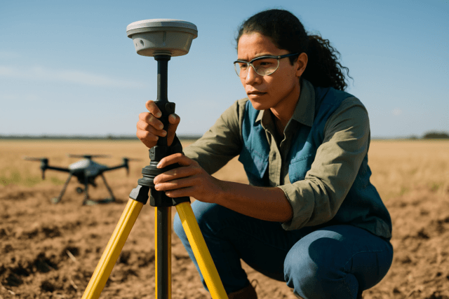
A survey-grade GPS (Global Navigation Satellite System) or a total station is essential for precisely measuring the coordinates of your GCPs.
Planning the Drone Flight for Quarry Mapping
Meticulous planning is the foundation of an accurate and safe drone survey.
Define the Survey Area and Objectives
Clearly define the boundaries of the quarry to be surveyed and specify what data you need to collect (e.g., volumetric calculations of specific stockpiles, overall topographic mapping, change detection).
Flight Planning Software
Specialized flight planning software automates the drone’s mission, ensuring comprehensive coverage and consistent data capture. Popular options include:
- DroneDeploy: A cloud-based solution with automated flight planning and 3D modeling capabilities.
- Pix4Dcapture (or Pix4Dmapper): Offers precise grid missions for photogrammetry and comprehensive data processing.
- DJI GS Pro / DJI Pilot 2: Dedicated planning software for DJI drones, offering professional planning tools within the DJI ecosystem.
- UgCS: A professional tool for complex environments, offering advanced linear and corridor planning, and specialized LiDAR toolsets.
- ArcGIS Flight: A mobile app that enhances drone flight planning and performance for reality mapping and inspection, integrating with Esri’s broader geospatial ecosystem.
- Litchi: A user-friendly option for DJI drones that allows for waypoint missions where the drone can pause for each photo.
- Map Pilot Pro: Known for its terrain-following capabilities and offline map support, suitable for remote areas.
Flight Parameters
- Flight Altitude: Lower altitudes generally result in higher resolution imagery (smaller Ground Sampling Distance – GSD).
- Overlap: Crucial for photogrammetry, ensuring sufficient overlap between images for successful stitching and 3D reconstruction. Typically, 60-70% side overlap and 70-80% front overlap are recommended.
- Ground Sampling Distance (GSD): This defines the real-world distance represented by each pixel in the image. For detailed quarry mapping and volume calculations, a fine GSD (e.g., less than 5 cm per pixel) is often desired.
- Terrain Following: If the quarry has significant elevation changes, use terrain-following mode to maintain a consistent altitude above the ground, ensuring uniform GSD and image quality. Software like UgCS excels in this.
Safety and Regulations
- Airspace Regulations: Be aware of local aviation regulations and obtain necessary licenses or permits for commercial drone operations.
- Site-Specific Hazards: Identify and account for any quarry-specific hazards, such as active blasting zones, heavy machinery operations, or unstable ground. Plan launch and landing zones in safe areas.
- Weather Conditions: Conduct flights in clear weather, avoiding strong winds, rain, and extreme temperatures, which can affect drone performance and data quality. Maintain consistent illumination, ideally in the middle of the day to minimize shadows.
Executing the Drone Survey
Setting Up Ground Control Points (GCPs)
- Placement Strategy: Distribute GCPs evenly across the entire survey area, including the corners and center. For uneven or rugged terrain, place GCPs at both the lowest and highest elevations. Avoid clustering GCPs too closely, as this can reduce overall accuracy.
- Number of GCPs: While a minimum of 3-4 GCPs can orientate a model, 5-10 GCPs are generally recommended for small regions, and more for larger areas (e.g., 8 GCPs for up to 50 acres, adding a checkpoint for every additional 10 acres beyond that without RTK/PPK). RTK/PPK drones can reduce the number of GCPs needed, but they are still valuable for quality control.
- Measurement: Use a survey-grade GPS (GNSS) receiver or total station to precisely measure the coordinates (latitude, longitude, and elevation) of each GCP.
Conducting the Flight
- Pre-Flight Checks: Perform all necessary pre-flight checks on the drone, batteries, and sensors.
- Automated Flight: Launch the drone and allow the flight planning software to execute the pre-programmed mission. The drone will autonomously navigate the flight path, capturing thousands of high-resolution images or LiDAR point clouds with geotags.
- Monitor Flight: Continuously monitor the drone’s flight, battery levels, and data acquisition to ensure no issues arise.
- Data Acquisition Best Practices: Ensure consistent lighting and minimal terrain variations during image capture. If using RTK, maintain a stable connection to the base station. If using PPK, ensure both the drone and the base station are recording raw GNSS data.
Data Processing and Analysis
Once the flight is complete, the raw data must be processed to generate actionable insights.
Photogrammetry Software
Specialized photogrammetry software stitches the overlapping drone images together to create detailed 2D and 3D models. Popular software options include:
- Pix4Dmapper: Widely used for stockpile measurement and 3D modeling, offering various base surface-defining options for volume calculations.
- DroneDeploy: Offers cloud-based processing and intuitive dashboards for mapping and analysis.
- Agisoft Metashape (formerly PhotoScan): Known for high-precision 3D modeling and GIS integration.
- Propeller Aero: Designed specifically for the mining and construction sectors, with robust volume calculation capabilities.
- Virtual Surveyor: Bridges the gap between photogrammetric processing and engineering design packages, facilitating volume calculations and report generation.
- ArcGIS Drone2Map / ArcGIS Reality for ArcGIS Pro: Esri tools that process drone imagery into orthomosaics and 3D products, integrating with the ArcGIS ecosystem.
Key Drone Imagery Products
- Orthomosaic Maps: These are large, geometrically corrected, and distortion-free maps created by stitching hundreds or thousands of individual drone photos. They are georeferenced, allowing for accurate distance and area measurements. Processing involves orthorectification to remove distortions from camera tilt, lens curvature, and terrain elevation.
- Digital Surface Models (DSM): A DSM represents the elevation of the Earth’s surface, including all natural and artificial features on it (e.g., buildings, trees, stockpiles). They are crucial for volumetric calculations.
- 3D Point Clouds: A dense collection of data points, each with X, Y, and Z coordinates, representing the 3D structure of the quarry site. These are the foundation for creating DSMs and 3D models.
- Digital Terrain Models (DTM): Similar to a DSM, but with vegetation and man-made structures digitally removed, providing a “bare earth” representation of the terrain. This is essential for accurate cut and fill analysis and geological mapping.
Volume Calculation Techniques
Accurate volume calculation is a primary application of drone surveys in quarries.
Stockpile Volume Calculation
- 3D Model Generation: The processed drone data (point clouds, DSMs) is used to create a precise 3D model of the stockpiles.
- Base Surface Definition: The software allows you to define a reference base for the stockpile, typically either the ground level before the pile was formed or a predetermined boundary.
- Volume Computation: By comparing the stockpile surface with this reference base, the software calculates the precise volume of material. Many platforms, like Propeller Aero and Virtual Surveyor, offer dedicated tools for this, even allowing the removal of equipment from the scene for cleaner calculations.
- Tonnage and Value: Some software can integrate material density to calculate tonnage and even estimate material value, aiding in inventory management and financial forecasting.
Cut and Fill Analysis
- Comparing Surfaces: Cut and fill calculations involve comparing two different terrain surfaces – typically an existing ground model (or a DTM) with a proposed design surface or a previous survey’s surface.
- Software Tools: Dedicated software, often integrated within the photogrammetry or surveying platforms, simplifies complex cut-and-fill calculations, showing areas of excavation (cut) and deposition (fill). This data is invaluable for tracking excavation progress and optimizing earthwork operations.
Best Practices and Tips for Accurate Results
- Consistent GSD: Aim for a consistent GSD across your survey area to ensure uniform accuracy.
- High Overlap: Maintain recommended front and side overlap settings (70-80% front, 60-70% side) to provide sufficient data for robust 3D reconstruction.
- Strategic GCP Placement: Ensure GCPs are evenly distributed, visible from the air, and located at varying elevations to capture the full topography.
- Use RTK/PPK: Whenever possible, use RTK or PPK drones to minimize the reliance on a large number of GCPs and enhance absolute accuracy.
- Regular Surveys: Conduct frequent drone surveys to track changes over time, monitor extraction progress, and keep stockpile inventories up-to-date.
- Quality Software: Invest in professional-grade photogrammetry and mapping software for processing and analysis to ensure accurate and reliable outputs.
- Trained Personnel: While drones automate much of the data collection, skilled land surveyors with knowledge of drone technology are crucial for delivering precise spatial data and ensuring quality control.
Conclusion
Drone surveying has revolutionized quarry management by providing a safer, faster, and more accurate method for mapping and volume calculation. From enhancing safety and boosting operational efficiency to optimizing resource management and ensuring environmental compliance, the benefits are clear. By understanding the equipment, planning the flight meticulously, and utilizing advanced data processing techniques, quarry operators can unlock the full potential of this technology, transforming raw drone data into invaluable insights for informed decision-making and a more productive future.

