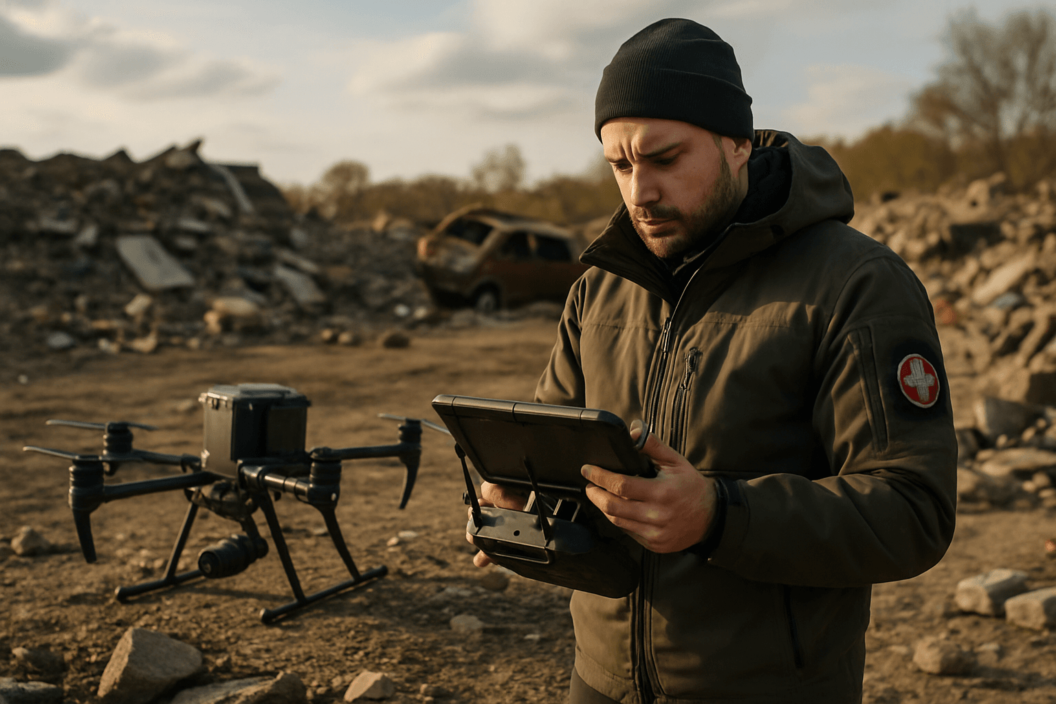
In the chaotic aftermath of disasters, traditional methods of assessing damage and mapping affected areas often prove slow, dangerous, and insufficient. The urgent need for rapid, accurate, and safe intelligence to guide search and rescue (SAR) operations has found a powerful solution in Unmanned Aerial Systems (UAS), commonly known as drones. These versatile aerial platforms are transforming disaster management strategies, providing unprecedented capabilities that significantly enhance the efficiency and safety of emergency response and recovery efforts.
The Evolving Role of Drones in Emergency Response
Historically, assessing the scale and nature of damage after a disaster—be it an earthquake, hurricane, flood, or wildfire—has been a labor-intensive and risky undertaking. First responders and assessment teams faced challenges such as inaccessible terrain, compromised structures, and evolving hazards. Manned aircraft, while offering an aerial perspective, are often costly and limited in their ability to capture detailed, close-up data.
Drones have emerged as a game-changer, addressing these shortcomings by offering rapid deployment, real-time data collection, and access to hazardous or otherwise unreachable areas. They provide a crucial “eyes in the sky” perspective, enabling emergency managers to make informed decisions quickly.
Precision Mapping: A Game-Changer for Damage Assessment
The ability of drones to collect highly detailed geospatial data is central to their effectiveness in post-incident mapping and damage assessment.
Data Acquisition and Sensor Technologies
Drones can be equipped with a variety of advanced sensors to capture comprehensive data:
- High-Resolution Visual Cameras: These capture detailed images and videos, providing crucial visual intelligence on the extent of damage to roads, bridges, power lines, buildings, and debris fields.
- Thermal Cameras: Essential for search and rescue, thermal sensors detect heat signatures, enabling teams to locate survivors even through dense foliage, smoke, or in low visibility conditions, including at night. They can also identify residual heat and hotspots in wildfire scenarios, critical for preventing reignition.
- LiDAR (Light Detection and Ranging): LiDAR drones use laser pulses to create highly accurate 3D point clouds, which are invaluable for mapping complex structures, measuring structural dimensions, and assessing terrain changes, even in environments with heavy vegetation or poor lighting.
- Photogrammetry: This technique involves stitching together multiple overlapping 2D images captured from various angles to create detailed 3D models, orthomosaic maps, and visual records. Photogrammetry is excellent for capturing visual texture and color.
Creating Accurate 2D Maps and 3D Models
The raw data collected by drone sensors is processed to generate critical mapping products:
- Orthomosaic Imagery: Large-scale, geometrically corrected 2D maps formed by stitching together hundreds or thousands of drone images, providing a comprehensive bird’s-eye view of the affected area.
- 3D Point Clouds and Models: Using photogrammetry or LiDAR, drones can generate precise 3D models of structures and terrain. These models are crucial for understanding the topography, assessing structural stability, identifying deformations, and planning reconstruction efforts. Digital twins, which are detailed 3D virtual representations, can be created to monitor structural integrity and track changes over time, improving defect detection by 30% and speeding up inspections by 75% compared to traditional methods.
Rapid Assessment and Situational Awareness
The speed and detail offered by drone-based mapping are unparalleled. What might take weeks using traditional surveying methods can be accomplished in hours or days with drones. This rapid assessment provides real-time situational awareness, allowing emergency managers to quickly grasp the impact of the disaster, find survivors, identify trouble spots, and evaluate the extent of damage.
Streamlined Workflow: From Deployment to Decision-Making
The integration of drones into post-incident response follows a systematic workflow to maximize efficiency and data utility.
Pre-flight Planning and Regulatory Considerations
Before deployment, careful planning is essential. This includes identifying the area of interest, defining flight paths to ensure adequate coverage and overlap for mapping, and managing battery life. Adherence to regulatory frameworks, such as FAA rules regarding altitude limits and airspace, is critical. Establishing pre-approved disaster management protocols and obtaining emergency-specific certifications or waivers can expedite drone deployment in critical situations.
On-site Operations and Data Collection
Drones can be rapidly deployed to survey large areas, especially those that are restricted or unsafe for ground personnel. Autonomous flight patterns can be programmed, or manual missions can be conducted depending on the needs. Real-time streaming capabilities link directly to emergency operations centers, synchronizing recorded data and providing live video feeds for immediate analysis.
Post-processing and Data Analysis
Once data is collected, it undergoes processing to generate actionable intelligence. This involves stitching images for orthomosaics, reconstructing 3D models, and analyzing sensor data. Software tools and GIS (Geographic Information System) integration play a vital role in creating comprehensive reports. Artificial intelligence (AI) and machine learning algorithms are increasingly used to automate data analysis, identify patterns, detect specific types of damage (e.g., cracks, deformations), and prioritize areas for intervention.
Key Benefits for Search and Rescue Operations
Drones offer multifaceted advantages that significantly enhance search and rescue efforts following an incident.
Enhanced Safety for Responders
By providing remote hazard assessment and detailed aerial views, drones reduce the need for human presence in dangerous or unstable environments. This minimizes risks for rescue teams who would otherwise be exposed to collapsed structures, active fires, or hazardous materials.
Accelerated Search Efforts
Equipped with thermal cameras, drones can systematically scan vast areas much faster than ground teams, identifying heat signatures of humans or animals through debris, dense foliage, or in low visibility. This capability allows SAR teams to locate missing persons accurately and swiftly, increasing the chances of successful rescues. Drone swarms, with their ability to cover large areas collaboratively, can significantly reduce the time to gather critical intelligence.
Resource Allocation and Strategic Planning
Detailed maps and 3D models generated by drones provide critical information for prioritizing response efforts. This includes identifying safe evacuation routes, determining the extent of infrastructure damage, assessing damage severity according to criteria like FEMA standards, and optimizing the movement and distribution of relief supplies.
Documentation for Recovery and Future Preparedness
Drone-collected data offers geo-tagged, timestamped photographic and spatial evidence invaluable for insurance claims, auditing, funding agencies, and legal records. This comprehensive documentation also aids in long-term recovery planning, infrastructure monitoring, environmental impact assessment, and helps communities plan for future disaster preparations, response, and mitigation.
Challenges and Limitations
Despite their immense potential, the widespread application of drones in disaster management still faces several challenges.
Regulatory Hurdles and Airspace Management
Varying laws and restrictions on drone usage, including flying over certain areas, altitude limits, and licensing, can delay deployment during emergencies. Airspace coordination, especially in complex urban environments, also poses a significant challenge.
Technical Expertise and Training
Operating drones effectively for post-incident mapping and damage assessment requires specialized technical expertise in drone piloting, sensor operation, data collection methodologies, and post-processing software. A lack of trained personnel can hinder deployment and data utilization.
Environmental Factors
Adverse weather conditions such as strong winds, heavy rain, or fog can limit drone operations. Low visibility due to smoke or dust in disaster zones can also complicate image acquisition and computer vision tasks for AI analysis.
Data Volume and Processing Demands
Drones generate massive amounts of high-resolution images, videos, and sensor readings. Managing and analyzing this data in real-time can be overwhelming, requiring robust computing power and efficient cloud-based platforms for processing and sharing.
The Future of Drone Technology in Incident Response
The capabilities of drones in post-incident mapping and damage assessment are continuously evolving, driven by advancements in technology.
AI and Automation
The integration of artificial intelligence and machine learning is making drones more autonomous, enabling them to make real-time decisions, identify objects of interest, and analyze vast amounts of data more efficiently. AI algorithms can automatically detect damage, classify it, and even predict the evolution of disasters like wildfires.
Swarm Technology
Future developments include swarm intelligence, where multiple drones communicate and coordinate to cover larger areas faster and execute complex tasks simultaneously. This collaborative approach enhances efficiency in search, rescue, and comprehensive mapping, potentially operating without human intervention.
Improved Endurance and Payload
Advancements in battery technology, solar-powered drones, and self-charging systems are extending flight times and operational durations. Improved payloads will see more sophisticated and multi-spectral sensors, including hyperspectral imaging for identifying chemical spills or structural weaknesses, enhancing data quality and utility.
Integration with Wider Emergency Management Systems
Drones will increasingly integrate with broader emergency management systems, providing real-time data feeds for smart cities and facilitating coordinated response efforts across various agencies. The use of digital twins will become more prevalent for continuous monitoring and predictive capabilities.
The utilization of drones for post-incident mapping and damage assessment represents a paradigm shift in search and rescue and disaster management. By combining speed, safety, and unprecedented data fidelity, drones empower emergency responders with the critical intelligence needed to save lives, mitigate further damage, and accelerate recovery efforts in a world facing increasingly complex challenges.


