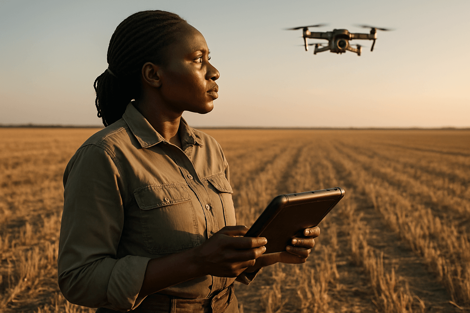
In an era where global food security and sustainable resource management are paramount, precision agriculture has emerged as a transformative approach, and at its heart lies the rapidly evolving utility of drone technology. Unmanned Aerial Vehicles (UAVs), commonly known as drones, are no longer futuristic gadgets but essential tools that provide farmers with unprecedented insights, efficiency, and data-driven decision-making capabilities throughout the entire crop cycle – from early-season field scouting to crucial post-harvest analysis.
The Rise of Drone Technology in Precision Agriculture
Precision agriculture utilizes technology, data analysis, and specialized equipment to optimize various aspects of farming. This approach enables tailored interventions such as irrigation, fertilization, and pest control, which in turn helps farmers make informed decisions, reduce resource use, and maximize yields while minimizing environmental impact. Drones are central to this revolution, equipped with sophisticated sensors and imaging systems that collect high-resolution data about crops and farmland. This data, when processed and analyzed, provides actionable insights that were previously difficult or costly to obtain.
Drones in Field Scouting: Early Season to Mid-Growth Monitoring
Field scouting, traditionally a labor-intensive and time-consuming task, involves walking or driving through fields to look for signs of stress, pests, or disease. Drones have fundamentally changed this, offering a faster, more thorough, and data-driven approach to monitoring crop health and field conditions.
Rapid and Comprehensive Field Coverage
Drones can cover vast agricultural areas quickly, scanning hundreds to thousands of acres in a fraction of the time it would take for manual inspections, often in minutes. This efficiency ensures no part of the field is overlooked, providing a bird’s-eye view that allows for near real-time monitoring of an entire operation.
Early Detection of Crop Stress and Disease
One of the most significant advantages of drone-based scouting is the early detection of crop issues. Drones equipped with multispectral and thermal imaging sensors can reveal subtle signs of nutrient deficiencies, water stress, pest infestations, and diseases four to seven days before they become visible to the naked eye. This early warning system allows for quick, targeted interventions, protecting yields and reducing crop loss.
Assessing Crop Establishment and Stand Counts
During the early stages, drones can evaluate crop establishment, identify rows or areas with winter damage or subpar growth, and conduct early-stage plant counts. Accurate stand counts across the entire field are crucial for revealing potential issues with crop establishment and providing an early indicator of yield potential, which can inform replanting decisions.
Soil and Water Management Insights
Drones play a critical role in providing detailed information on soil and crop conditions. They can collect data on pH levels, soil types, and chemical content. Equipped with advanced sensors, drones assess soil moisture levels and identify dry spots or irrigation issues, helping farmers optimize water usage and make precise adjustments to irrigation systems. High-resolution maps generated by drones can also highlight areas of varying soil composition or drainage patterns, enabling targeted soil treatments and efficient water management.
Enhancing Post-Harvest Analysis with Drone Data
Beyond in-season monitoring, drones extend their utility to post-harvest analysis, providing valuable data that informs future planting strategies, marketing decisions, and overall farm management.
Accurate Yield Estimation
Drones contribute significantly to accurate yield prediction. By analyzing crop density and health from aerial data, farmers can estimate harvest size, allowing for better planning of storage and transportation, negotiation of prices with buyers, and reduction of post-harvest losses.
Identifying Field Variations for Future Planning
Post-harvest drone mapping can reveal persistent issues or variations in field performance that might be due to soil anomalies, compaction, or other environmental factors. Identifying these underperforming or overperforming areas helps farmers investigate root causes and make informed management decisions for subsequent seasons, such as implementing variable-rate seeding or targeted soil amendments. This high-resolution mapping capability can help farmers create 3D models of their land, useful for topographic mapping and soil analysis.
Damage Assessment for Insurance and Improvement
In cases of crop damage from environmental factors or wildlife, drone imagery provides a valuable tool for assessing the extent of the damage. This detailed, objective information can be crucial for insurance claims and for understanding the impact of specific events on field performance, aiding in preventative measures for the future.
Key Drone Technologies and Sensors for Agricultural Applications
The effectiveness of drones in agriculture hinges on the specialized sensors they carry:
RGB Cameras
Standard Red, Green, Blue (RGB) cameras capture visible light images, similar to what the human eye sees. These cameras are useful for visual assessments such as counting plants, detecting weeds, identifying visible symptoms of damage or discoloration, and estimating vegetation cover.
Multispectral Sensors
Multispectral sensors capture data across multiple light bands, including those beyond the visible spectrum, such as near-infrared (NIR). This allows for the calculation of vegetation indices like NDVI (Normalized Difference Vegetation Index), which provides crucial insights into plant vitality, chlorophyll levels, and overall health status long before visual symptoms appear. These sensors are vital for early detection of nutrient deficiencies and stress.
Thermal Sensors
Thermal sensors detect temperature differences in plants and soil. These differences can indicate water stress, irrigation issues, and temperature anomalies caused by disease or pests, enabling optimized water management and early problem identification.
LiDAR (Light Detection and Ranging)
LiDAR technology uses laser mapping to build highly accurate 3D models of the land. This is particularly useful for mapping soil elevation, drainage patterns, and creating precise topographic maps, which can guide decisions on field grading and irrigation infrastructure.
The Broader Impact and Benefits for Farmers
The integration of drones into agricultural practices offers a multitude of benefits, empowering farmers to operate more efficiently, sustainably, and profitably.
Time and Labor Savings
Drones significantly reduce the time and effort required for traditional field inspections and scouting, allowing farmers to monitor large areas quickly and efficiently. This frees up labor for other critical tasks, enhancing overall operational efficiency.
Reduced Input Costs and Environmental Impact
By enabling precision resource application, drones help farmers apply water, fertilizers, and pesticides only where needed. This targeted approach minimizes waste, reduces input costs, and lessens the environmental impact associated with blanket applications, promoting more sustainable farming practices.
Data-Driven Decision Making
The high-resolution, real-time data collected by drones provides farmers with valuable insights into their crops and fields. This data-driven approach enhances decision-making regarding planting schedules, irrigation strategies, fertilization, pest control, and harvest timing, leading to improved overall farm management.
Improved Crop Yields and Profitability
Ultimately, the precision and efficiency offered by drones translate into improved crop yields and increased profitability. By allowing for timely interventions, optimized resource use, and informed decision-making, drones contribute to healthier crops and a more robust harvest.
Conclusion
Drones are fundamentally transforming modern agriculture by providing indispensable support in both field scouting and post-harvest analysis. Through their ability to rapidly cover vast areas, detect subtle indicators of crop stress, manage resources precisely, and offer accurate yield estimations, these unmanned aerial vehicles empower farmers with the insights needed to navigate the complexities of contemporary farming. As drone technology continues to advance, integrating AI and machine learning for even more sophisticated data analysis, their role in cultivating sustainable, productive, and resilient agricultural systems will only continue to expand.


