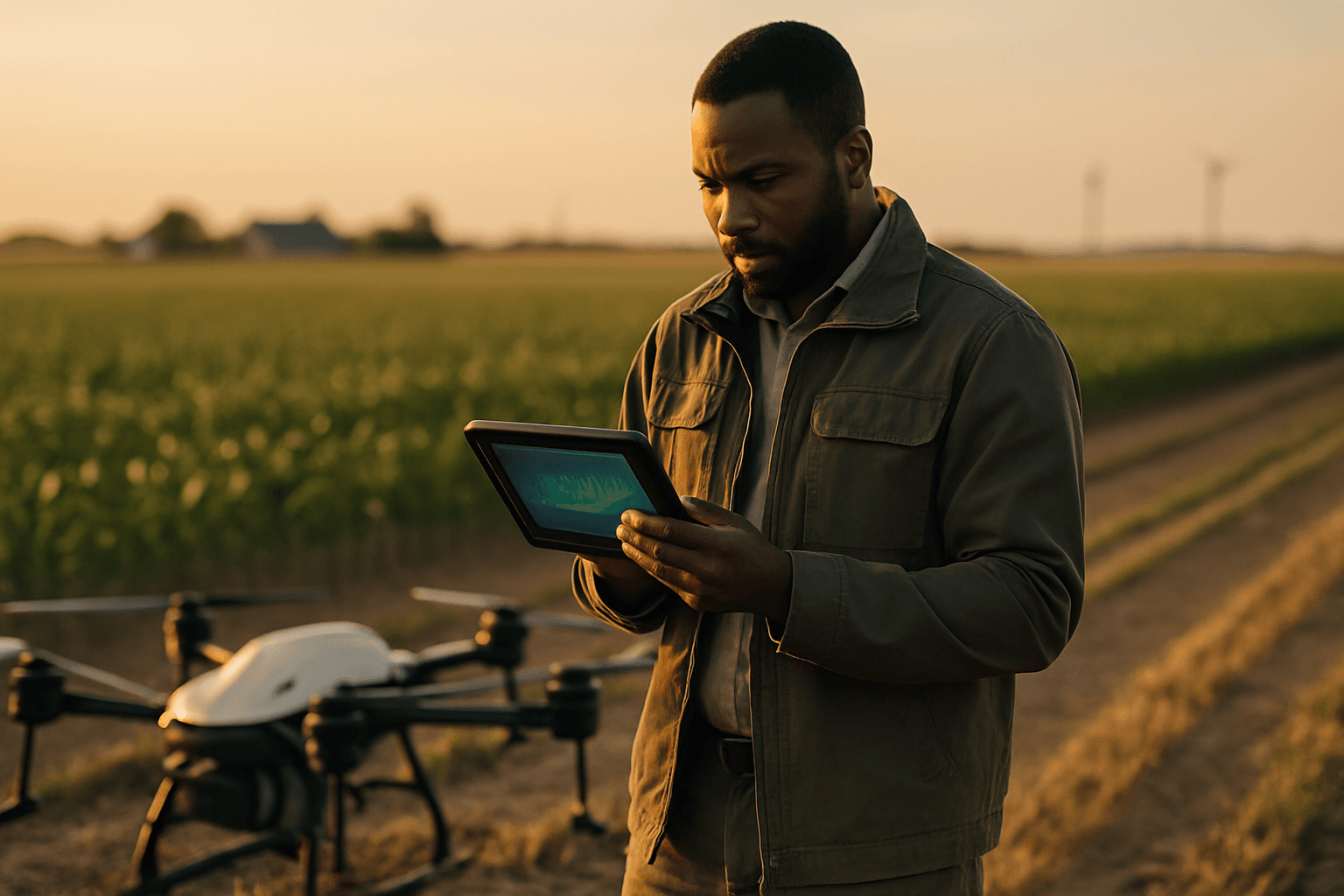
Traditional methods of monitoring crop health, often reliant on manual inspection, are labor-intensive, time-consuming, and frequently fail to detect issues until visible symptoms appear, by which point significant damage may have already occurred. This reactive approach can lead to substantial yield losses and inefficient resource allocation. Enter the age of precision agriculture, where AI-powered drones are transforming crop health assessment from a reactive chore into a proactive, data-driven science.
Unmanned Aerial Vehicles (UAVs), commonly known as drones, equipped with advanced sensors and artificial intelligence, are now providing farmers with unprecedented real-time insights into the well-being of their crops. This technology allows for early detection of potential stressors like pests, diseases, and nutrient deficiencies, enabling timely and targeted interventions that boost yields, reduce waste, and promote sustainable farming practices. This article delves into the comprehensive process of creating AI-powered crop health assessment reports from drone data, outlining the key steps from data acquisition to actionable insights.
The Foundation: Drone Data Acquisition for Crop Health
The first crucial step in generating AI-powered crop health reports is the systematic acquisition of high-quality data using drones. This involves careful planning and the right equipment to capture the necessary information.
Choosing the Right Drone and Sensors
Not all drones are created equal for agricultural purposes. Key considerations include flight time, payload capacity, and the ability to maintain consistent altitude. However, the most critical component for crop health assessment is the sensor payload.
- Multispectral Sensors: These are indispensable for crop health monitoring. They capture data across specific bands of the electromagnetic spectrum, including visible light (red, green, blue) and non-visible light (near-infrared, red-edge). Different plants reflect light differently depending on their health, allowing these sensors to detect subtle changes before they are visible to the human eye.
- Hyperspectral Imagers: Offering even finer spectral resolution than multispectral sensors, hyperspectral imagers capture data across a greater number of narrower bands. This provides more detailed information about plant chemistry and physiology, enabling earlier and more precise disease detection.
- Thermal Cameras: These sensors measure the temperature of the crop canopy, which can indicate water stress or other physiological issues.
- RGB Cameras: Standard high-resolution cameras provide visual imagery useful for general crop monitoring, plant counting, and identifying visible damage.
Flight Planning and Data Collection
Effective data acquisition requires meticulous flight planning to ensure comprehensive and consistent coverage of the agricultural field.
- Automated Flight Planning Software: Tools like DroneDeploy and Pix4D are commonly used to define flight paths, set altitude, and ensure adequate image overlap for comprehensive coverage. Consistent altitude is crucial for uniform image quality.
- Optimal Flight Conditions: Clear skies and consistent lighting are ideal for data collection. Cloud cover and poor light can affect image quality and the accuracy of spectral data.
- High-Resolution Image Capture: Drones capture numerous high-resolution images, ensuring that every part of the field is documented. Overlapping images are essential for later stitching into a single, seamless orthomosaic map.
From Raw Data to Actionable Insights: The AI Processing Pipeline
Once the drone data is collected, it moves into a sophisticated processing pipeline where artificial intelligence transforms raw images into meaningful crop health reports.
Image Stitching and Georeferencing
The individual images captured by the drone must first be combined to create a complete, high-resolution map of the field.
- Orthomosaic Generation: Specialized photogrammetry software stitches the overlapping drone images together to create a single, geometrically corrected orthomosaic map. This map is free of distortions and accurately represents the field’s scale.
- Georeferencing: The orthomosaic is then georeferenced, meaning it’s precisely aligned with real-world coordinates. This allows farmers to pinpoint specific problem areas on a map and navigate to them in the field.
Preprocessing and Vegetation Index Calculation
Before AI models can analyze the data, further preprocessing is often required to enhance image quality and extract relevant spectral information.
- Image Enhancement: Techniques like resizing, normalization, and contrast enhancement improve the quality of data fed into machine learning models.
- Vegetation Indices (VIs): These mathematical formulas, derived from multispectral data, quantify plant health and vigor.
- Normalized Difference Vegetation Index (NDVI): One of the most common VIs, NDVI measures the difference between near-infrared (NIR) and red light reflectance. Healthy, photosynthetically active plants reflect a lot of NIR and absorb red light, resulting in a high NDVI value. Stressed or unhealthy plants have lower NDVI values.
- Normalized Difference Red Edge (NDRE): NDRE is particularly useful for assessing nitrogen levels and crop health in later growth stages when the canopy is dense. It uses red-edge and NIR bands.
- Other Indices: Many other VIs exist, such as the Green Normalized Difference Vegetation Index (GNDVI) for chlorophyll content and the Normalized Difference Water Index (NDWI) for water stress.
AI-Powered Analysis: Machine Learning and Deep Learning
This is where the “AI-powered” aspect truly comes into play. Machine learning (ML) and deep learning (DL) algorithms analyze the processed drone imagery and vegetation indices to identify patterns indicative of crop health issues.
- Disease and Pest Detection: AI models, especially Convolutional Neural Networks (CNNs), are trained on vast datasets of healthy and diseased plant images to automatically extract features like leaf texture, color, and shape. This allows them to identify early signs of fungal infections, bacterial blight, pest infestations, and other stressors often before they are visible to the human eye. Models like ResNet-50 and MobileNet-V2 have proven effective in disease detection.
- Nutrient Deficiency Analysis: AI can identify subtle discolorations or growth patterns linked to nutrient deficiencies, such as nitrogen or potassium shortages. By combining spectral data with soil information, AI programs can even recommend precise fertilizer application rates.
- Water Stress Detection: By analyzing thermal and multispectral imagery, AI models can detect areas of water stress, helping to optimize irrigation schedules and conserve water.
- Weed Identification and Mapping: AI algorithms can differentiate between crops and weeds, enabling targeted herbicide application and reducing chemical use.
- Yield Prediction and Biomass Estimation: AI can analyze plant count, size, growth rates, and overall vigor to predict potential yields and estimate biomass.
Generating and Interpreting Crop Health Reports
The culmination of this process is the generation of comprehensive, easy-to-understand crop health assessment reports. These reports transform complex data into actionable insights for farmers and agronomists.
Visualizing Health Data: Maps and Zones
The most effective reports include visual representations of crop health across the field.
- Crop Health Maps: These maps use color-coding (e.g., green for healthy, yellow for stressed, red for severely unhealthy) to visually represent the distribution of vegetation indices or identified issues across the field. Geospatial disease heatmaps can be integrated into web and mobile applications for farmers’ alerts.
- Management Zones: AI can delineate specific “management zones” within a field that require different interventions. For example, a zone with low NDVI might be flagged for a targeted nitrogen application, while a zone with high canopy temperature could indicate a need for more water.
- 3D Canopy Height Models: From overlapping drone frames, 3D models can be generated to assess plant height and volume, providing insights into growth and biomass.
Detailed Reports and Recommendations
Beyond visual maps, the reports should provide detailed analysis and specific recommendations.
- Identification of Issues: Clearly state detected problems, such as “early-stage fungal infection,” “nitrogen deficiency,” or “moderate water stress.”
- Location Pinpointing: Provide precise GPS coordinates or highlight affected areas on the map, allowing for highly targeted interventions.
- Actionable Recommendations: Offer prescriptive advice, such as “apply X amount of nitrogen in zone A,” “inspect plants in quadrant B for pest activity,” or “increase irrigation in section C”. This moves from merely identifying problems to suggesting solutions.
- Trend Analysis: Over time, AI can track changes in crop health, identifying trends and assessing the effectiveness of past interventions.
- Integration with Farm Management Systems: Reports can be integrated into broader farm management software, allowing for seamless incorporation into existing workflows.
The Future of AI-Powered Crop Health Monitoring
The integration of AI and drone technology in agriculture is continuously evolving. Future advancements promise even greater efficiency and predictive power. This includes:
- Multi-Source Data Fusion: Combining drone imagery with satellite data, ground-based sensors (IoT), soil probes, and weather models to create a holistic AI layer for more accurate predictions and simulations.
- Energy-Efficient AI Models and Drones: Addressing current limitations such as drone battery life and computational power for large datasets.
- Real-time Edge Computing: Processing data directly on the drone or at the field edge to provide immediate insights and enable autonomous, real-time interventions.
- Ethical Considerations and Accessibility: Ensuring these advanced technologies are accessible to a wider range of farmers and addressing privacy concerns related to data collection.
By harnessing the power of AI to analyze drone-collected data, farmers are empowered to make informed, precise decisions that optimize crop health, maximize yields, and foster a more sustainable and efficient agricultural future.


