Water is the lifeblood of agriculture, and precise soil moisture management is paramount for sustainable farming and environmental health. Traditional methods of assessing soil moisture are often labor-intensive, time-consuming, and provide limited spatial coverage, making it challenging to respond effectively to varying conditions across vast landscapes. This is where the integration of drone technology emerges as a game-changer, offering unparalleled precision, efficiency, and real-time insights into a critical environmental parameter: soil moisture.
The Critical Role of Soil Moisture in Agriculture and Beyond
Accurate soil moisture data is a cornerstone of effective land management, influencing everything from crop health to disaster prevention. For farmers, it directly impacts irrigation scheduling, nutrient uptake, and ultimately, crop yields. Over-watering can lead to root diseases, nutrient runoff, and wasted resources, while under-watering causes plant stress and reduced productivity.
Beyond agriculture, soil moisture is a key hydrological variable crucial for forecasting weather and climate variability, predicting and monitoring drought conditions, managing water resources, and even preventing natural disasters such as wildfires, landslides, and floods. Monitoring its dynamics with high resolution is essential for adapting to a changing climate and ensuring ecological resilience.
How Drones Revolutionize Soil Moisture Analysis
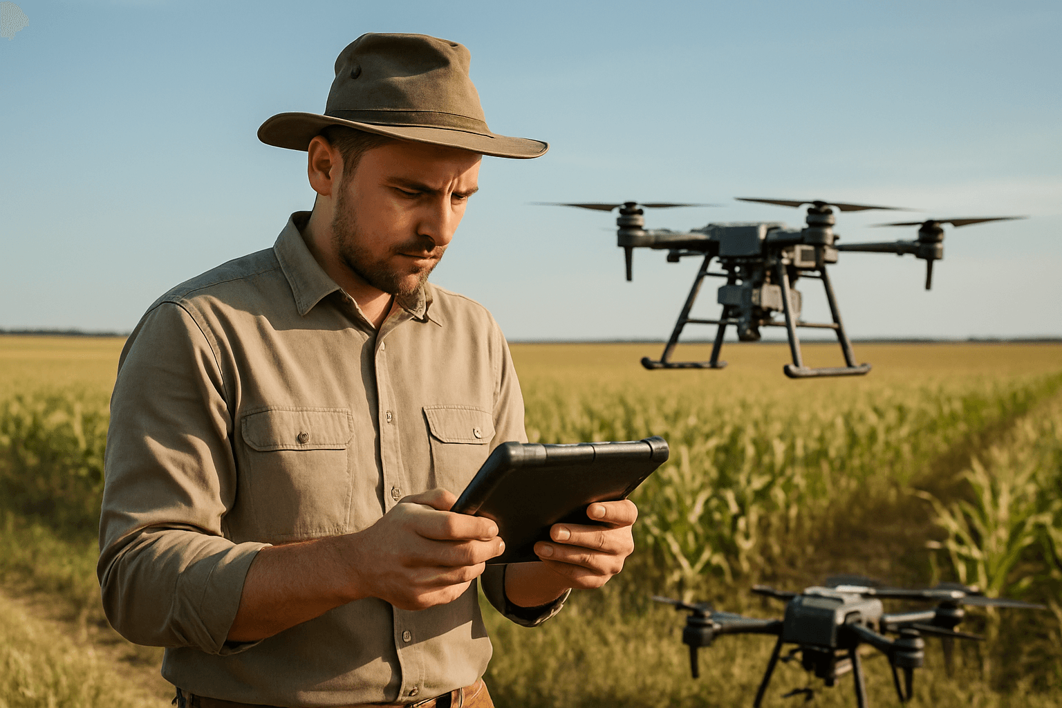
Drone-based soil moisture monitoring leverages unmanned aerial vehicles (UAVs) equipped with specialized sensors to collect data on soil moisture levels across large areas quickly and efficiently. This cutting-edge technique provides a non-invasive way to assess various soil properties, offering detailed maps that reveal subtle variations in moisture content not visible to the naked eye.
The process typically involves:
- Drone Deployment: Drones follow pre-planned flight paths over agricultural fields or natural landscapes.
- Data Collection: Onboard sensors capture data related to soil moisture content, temperature, and other environmental factors.
- Data Analysis: Collected data is processed using advanced algorithms and software, often integrated with machine learning, to generate detailed maps and reports.
- Decision-Making: Farmers and environmental managers use this analyzed data to make informed decisions, such as optimizing irrigation schedules or identifying areas prone to water stress.
Sensors at the Forefront of Drone Technology
The accuracy and utility of drone-based soil moisture analysis heavily depend on the sophistication of the sensors employed:
Multispectral and Hyperspectral Cameras
Multispectral sensors capture data across several specific wavelength bands, providing insights into plant health and soil characteristics. Hyperspectral sensors offer a significant advantage by capturing continuous spectral data across hundreds of narrow bands, providing finer spectral resolution to detect subtle features correlated with soil moisture content, especially beneath vegetative canopies. These sensors can help identify specific wavelengths related to moisture levels, enhancing estimation accuracy.
Thermal Cameras
Thermal sensors measure soil temperature, which serves as a reliable indicator of soil moisture content. Drier soil tends to heat up more quickly and exhibit higher temperatures, while cooler areas suggest higher moisture content. By analyzing thermal images, farmers can pinpoint areas that are too dry or too wet.
RGB Sensors
Surprisingly, studies have shown that standard Red, Green, and Blue (RGB) cameras can also be highly effective for estimating soil moisture. Research has indicated that the green value in RGB images, in particular, can have a strong correlation with measured soil moisture levels, sometimes outperforming multispectral and thermal sensors in specific agricultural contexts. This suggests a potentially more accessible and cost-effective entry point for some users.
Radar-Equipped Drones
For a deeper understanding of subsurface moisture, radar-equipped drones are emerging as a powerful tool. Synthetic Aperture Radar (SAR) systems mounted on UAVs can provide continuous, cost-effective measurements of soil moisture up to 40 centimeters deep, a critical depth for plant growth and yield. This technology helps overcome the limitations of optical sensors that primarily capture surface characteristics.
From Data Collection to Actionable Insights
Once the drone completes its flight and collects raw sensor data, the real work of transformation begins. This data is fed into sophisticated software platforms that employ advanced algorithms, including machine learning and Principal Component Analysis (PCA). These tools process the raw spectral and thermal imagery, correlating it with ground-truth data (physical soil samples) to build predictive models for soil moisture content.
The output is typically a high-resolution map of the field, color-coded to represent varying moisture levels. These detailed maps allow for precise identification of dry spots, waterlogged areas, and overall soil variability. Farmers can then use this actionable intelligence to implement “precision irrigation,” tailoring water application to specific zones rather than uniformly across an entire field. This targeted approach conserves water, optimizes resource use, and prevents localized crop stress.
Key Benefits of Drone-Based Monitoring
The adoption of drones for soil moisture analysis brings a multitude of advantages:
- Enhanced Efficiency and Speed: Drones can cover large areas rapidly, providing real-time or near real-time data significantly faster than traditional manual methods. This allows for quick responses to changing field conditions.
- High Precision and Accuracy: The high-resolution data from advanced sensors enables precise mapping of soil moisture variations, leading to more accurate decision-making and targeted interventions.
- Cost-Effectiveness: Automating data collection reduces the need for labor-intensive fieldwork, potentially lowering operational costs compared to traditional ground-based monitoring.
- Optimized Resource Management: Precision irrigation based on drone data minimizes water wastage and optimizes the use of fertilizers, leading to more sustainable farming practices and reduced environmental impact.
- Improved Crop Health and Yields: By ensuring crops receive the optimal amount of water, drones contribute to healthier growth and increased productivity.
- Proactive Problem Solving: Timely access to data allows farmers to identify and address issues like nutrient deficiencies or moisture stress proactively, minimizing potential yield losses.
- Scalability: Drone technology is suitable for monitoring vast agricultural areas, providing a comprehensive overview of soil conditions across entire farms or multiple properties.
Overcoming Challenges in Drone Soil Moisture Mapping
Despite the numerous benefits, the widespread implementation of drone-based soil moisture analysis faces several challenges:
- Regulatory Issues: Navigating airspace regulations and obtaining necessary permits for drone operation can be complex.
- Data Accuracy and Resolution: Ensuring consistent data accuracy and resolution across diverse landscapes and under varying environmental conditions requires sophisticated calibration and validation.
- Specialized Expertise: Operating drones, processing complex sensor data, and interpreting the resulting maps often require specialized skills and training.
- Sensor Limitations: There is a lack of commercially available drones equipped with certain radar sensors or miniaturized multispectral cameras with short-wave infrared reflectance (SWIR) bands, which are highly sensitive to soil water content.
- Vegetation Interference: Above-ground vegetation can impact the accuracy of moisture data collected by some sensors, necessitating further research into robust models that account for plant cover.
- Data Integration: Integrating drone-collected data with existing farm management systems and other data sources (e.g., weather stations, satellite imagery) can be complex.
Ongoing research is focused on developing more robust models, improving sensor capabilities, and simplifying data interpretation to make this technology more accessible and reliable.
The Future of Drone Technology in Environmental Monitoring
The future of drones in environmental monitoring, particularly for soil moisture analysis, is bright. The agricultural drone market is projected to reach over £5 billion by 2026, indicating rapid growth and adoption. Key trends include:
- Increased Automation: Expect to see fully autonomous drone fleets capable of managing entire farms with minimal human intervention, making operations more efficient and less labor-intensive.
- Advanced AI and Machine Learning Integration: Drones will become even smarter, with AI capabilities predicting problems like disease outbreaks or water stress based on historical data and real-time inputs. This will lead to enhanced decision-making and predictive analytics.
- Improved Data Analytics: Drones will excel at collecting and analyzing data, providing farmers and environmentalists with real-time, in-depth insights into every aspect of their operations.
- Affordability and Accessibility: As technology advances, drone prices are expected to drop, making them more accessible to smaller farms and a wider range of environmental monitoring applications.
- Multi-sensor Fusion: The integration of diverse sensor types (e.g., optical, thermal, radar) and their data fusion will provide a more comprehensive and accurate understanding of soil conditions at various depths and across different scales.
- IoT Integration: Connecting drones to a broader network of IoT sensors across the farm will enable real-time data transmission on various conditions, pivotal for remote monitoring and management.
Conclusion
Drones are fundamentally transforming how we understand and manage soil moisture. By providing unprecedented levels of detail, efficiency, and timeliness, they empower precision agriculture and enhance broader environmental monitoring efforts. While challenges remain, continuous innovation in sensor technology, data processing, and artificial intelligence promises to make drones an indispensable tool for optimizing water usage, boosting agricultural productivity, and fostering a more sustainable future in the face of growing environmental pressures.


