In the rapidly evolving world of surveying and mapping, drones have become indispensable tools, offering unparalleled efficiency and detail. However, the true power of Unmanned Aerial Systems (UAS) in these applications hinges on one critical factor: camera calibration. Without proper calibration, even the most advanced drone can produce inaccurate data, leading to costly errors and unreliable 3D models. This guide delves into the essential aspects of calibrating your drone’s camera to ensure survey-grade accuracy, transforming raw aerial imagery into precise, actionable intelligence.
Why is Drone Camera Calibration Crucial for Surveying?
Accurate camera calibration is the bedrock of reliable photogrammetry. Drones often use non-metric, consumer-grade cameras that are not inherently designed for precise measurements. These cameras can exhibit significant lens distortions and unstable calibration characteristics, which, if uncorrected, directly impact the geometric accuracy of the resulting 3D models and maps.
Here’s why it matters:
- Geometric Accuracy: Calibration corrects for lens distortions (like barrel or fisheye distortion) and determines intrinsic camera parameters such as focal length, principal point, and sensor size. These parameters are vital for accurately transforming 2D image points into 3D real-world coordinates. Poor calibration can cause distortions, measurement errors, and unreliable models, especially in industrial applications.
- Systematic Error Reduction: Uncalibrated cameras introduce systematic errors into the photogrammetric process. Correcting these errors through calibration ensures that every pixel in your image corresponds accurately to real-world coordinates, leading to precise reconstructions and improved digital twin reliability.
- Data Quality and Reliability: For commercial photography or mapping tasks, uncorrected distortion can lead to inaccurate data, affecting the quality of deliverables and increasing post-processing workload. Proper calibration ensures consistency and reliability in drone surveys, which is fundamental for making informed decisions.
Understanding Camera Parameters
To effectively calibrate a drone camera, it’s important to understand the parameters involved:
- Intrinsic (Interior) Orientation Parameters: These describe the camera’s internal geometry. They include the focal length (f), principal point (the intersection of the optical axis with the image plane), and lens distortion coefficients (e.g., radial and tangential distortion).
- Extrinsic (Exterior) Orientation Parameters: These define the camera’s position and orientation in a 3D coordinate system at the time of image capture. They include the X, Y, Z coordinates of the camera’s projection center and the camera’s rotation angles (Roll, Pitch, Yaw, or Omega, Phi, Kappa). While Yaw, Pitch, and Roll define the drone’s rotation, Omega, Phi, and Kappa define the rotation between the image coordinate system and a projected coordinate system, commonly used in photogrammetry software.
When to Calibrate Your Drone Camera
Regular calibration is recommended for optimal performance. You should specifically recalibrate your camera if:
- The camera or lens has been changed.
- The drone has suffered any impact or crash.
- Environmental conditions have significantly changed (e.g., extreme temperatures).
- You relocate to a different area, especially if magnetic interference might be different.
- After firmware updates, as these can sometimes disrupt calibration settings.
- Every four to six months, even if the drone has been operating normally, to maintain optimum performance.
Calibration Methods for Drone Cameras
There are several approaches to camera calibration, each with its advantages and suitable scenarios:
1. Pre-Flight On-Board Drone Calibrations
Before any mission, several essential calibrations ensure the drone’s flight stability and initial data accuracy. These are typically performed using the drone’s dedicated app or software.
- IMU (Inertial Measurement Unit) Calibration: The IMU measures the drone’s angular rate and acceleration, crucial for stable flight and precise movements. Calibration ensures the IMU provides accurate data to the flight controller, preventing unwanted drift and oscillations. This often involves placing the drone on a level surface in specific orientations and allowing it to reach room temperature.
- Compass Calibration: Essential for accurate positioning and navigation. This usually involves rotating the drone 360 degrees horizontally and then vertically in specific patterns as guided by the drone’s app. It’s crucial to perform this in an open area free from electronic interference.
- Gimbal Calibration: Ensures smooth and stable camera footage by calibrating the gimbal’s motors and sensors, eliminating vibrations and unwanted movements. This often involves placing the drone on a flat, level surface and initiating an auto-calibration process through the drone app.
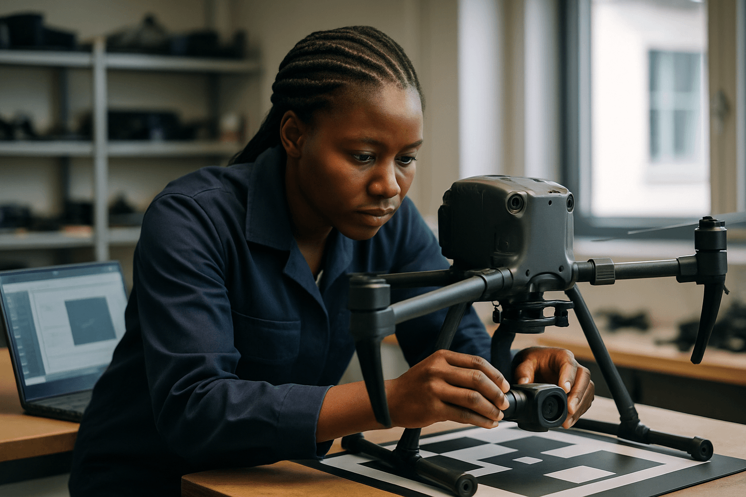
2. Laboratory Camera Calibration
This method involves calibrating the camera in a controlled indoor environment using specialized targets.
- Checkerboard or Pattern-Based Calibration: This common method involves capturing multiple images of a known calibration pattern (like a checkerboard) from various angles and distances. The images are then uploaded to calibration software (e.g., Agisoft Metashape, Pix4D, MATLAB, OpenCV) which analyzes the pattern to determine and correct intrinsic camera parameters and lens distortions.
- Out-of-focus Calibration: A newer approach involves positioning the UAV camera several meters away from a low-cost target to ensure focus. The intrinsic camera parameters are then calibrated using an out-of-focus small calibration target, and these parameters are fixed before flight. This method has shown promise in improving reliability and accuracy for UAV surveying applications.
- 3D Targeted Objects/Arrays: Similar to checkerboards, but using a three-dimensional object with known reference points to capture a wider range of perspectives for calibration.
3. On-the-Job (Self-Calibration) During Flight Missions
This is a widely adopted method in photogrammetry where camera parameters are estimated concurrently with the 3D model reconstruction.
- Structure-from-Motion (SfM) and Bundle Adjustment: Modern photogrammetry software uses SfM and Feature-Based Matching (FBM) techniques to automatically reconstruct 3D models from overlapping images. During this process, a self-calibrating bundle adjustment can simultaneously refine both the camera’s intrinsic and extrinsic parameters.
- Utilizing Ground Control Points (GCPs): Even with RTK/PPK-enabled drones, GCPs are highly beneficial for accuracy verification and can aid in camera self-calibration. By providing known real-world coordinates, GCPs help tie the drone data to the real-world coordinate system accurately and can improve vertical accuracy, especially when combined with oblique imagery. If accurate GCPs are used, pre-calibration might not always be necessary, as the software can perform self-calibration during processing.
- Oblique Imagery: Incorporating oblique (angled) images alongside nadir (straight down) imagery during self-calibration can significantly improve vertical accuracy and reduce errors in Digital Elevation Models (DEMs). This diverse network geometry is more conducive to robust self-calibration, as nadir imagery alone often presents the least suitable geometry for this process.
- Double Grid Flights: Flying in a double grid pattern (e.g., crisscrossing flight lines) with the camera set to an oblique angle rather than just a single grid flight with the camera facing perpendicular to the surface can help mitigate the “bowl effect” (accumulation of distortions causing surfaces to curve).
Practical Tips for Successful Camera Calibration and Accurate Surveying
- High-Quality Equipment: Invest in a drone with a high-resolution camera and, ideally, RTK (Real-Time Kinematic) or PPK (Post-Processing Kinematic) GPS systems for precise positioning data.
- Consistent Lighting: Ensure consistent lighting conditions when capturing calibration images to improve detection accuracy.
- Varying Angles and Distances: Capture images from different angles and distances during calibration to provide comprehensive data for the software.
- RAW Format Shooting: Shooting in RAW format provides more flexibility for post-adjustment of lens distortion, as RAW files retain original distortion data.
- Lens Correction Software: Utilize photogrammetry software (like Adobe Lightroom, Pix4D, Agisoft Metashape) that offers lens correction tools. Many programs have built-in profiles for common drone cameras to automatically correct distortion.
- Regular Maintenance: Keep the camera lens clean and perform regular maintenance checks on your drone to avoid image distortion and ensure optimal performance.
- Firmware Updates: Always keep your drone’s firmware updated, as this can affect calibration and overall performance.
- Environmental Considerations: Perform calibration in an area free from electromagnetic interference, away from metal structures and electronic devices. Ensure the drone is at its optimal operating temperature for sensor reliability.
By understanding the importance of camera calibration and implementing these methods and best practices, drone operators can significantly enhance the accuracy and reliability of their surveying and mapping data, delivering professional-grade results for a multitude of applications.


