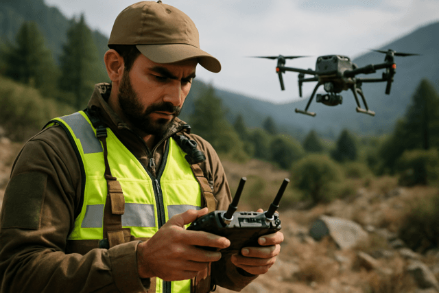
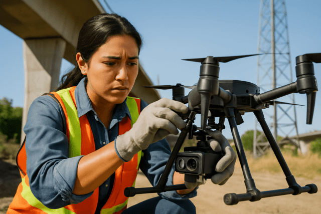
For millennia, understanding the Earth’s topography has been a cornerstone of human endeavor, from ancient agricultural planning to modern urban development. Early surveyors painstakingly measured every contour by hand, a process as laborious as it was slow. The advent of aerial photography and, later, manned LiDAR brought unprecedented speed, yet still demanded significant cost and logistical complexity. But what if the next leap in topographical intelligence wasn’t about larger aircraft or more expensive sensors, but about democratizing high-precision data capture, putting mapping capabilities into the hands of professionals with unparalleled agility and efficiency? This is precisely the revolution ushered in by survey drones, transforming how we perceive and plan for the very ground beneath our feet.
Unmanned Aerial Systems (UAS), commonly known as drones, have become indispensable tools in modern surveying and mapping, offering a dynamic and cost-effective alternative to traditional methods. Their ability to acquire high-resolution spatial data rapidly makes them ideal for generating detailed elevation models, which are critical for a myriad of applications, from civil engineering to environmental monitoring.
Demystifying Elevation Models: DEM, DTM, and DSM
Before delving into the “how-to,” it’s crucial to understand the types of elevation models that survey drones help create:
- Digital Elevation Model (DEM): Often used as a general term, a DEM is a 3D representation of terrain elevation data. It is essentially a raster dataset, a grid where each cell holds an elevation value (Z) for its corresponding horizontal coordinates (X, Y). DEMs typically represent the bare-earth surface, with natural and built features largely removed, especially at coarser resolutions.
- Digital Surface Model (DSM): A DSM captures the elevation of everything on the Earth’s surface, including natural features like vegetation and trees, and man-made structures such as buildings, bridges, and power lines. It represents the “first surface” the sensor hits. DSMs are crucial for applications where above-ground elements are relevant, like urban planning or assessing tree canopy heights.
- Digital Terrain Model (DTM): A DTM is a refined version of a DEM, focusing exclusively on the bare-earth ground surface with all above-ground features (like buildings and trees) meticulously filtered out. It often includes additional vector features of the natural terrain, such as breaklines (ridges, stream lines) that define changes in slope, providing a more accurate representation of the true ground shape. DTMs are fundamental for analyses requiring a clear depiction of ground relief, such as hydrological modeling or earthwork calculations.
The choice between these models depends entirely on the project’s specific requirements.
Core Technologies: Photogrammetry vs. LiDAR
Survey drones primarily utilize two advanced technologies to acquire the data necessary for elevation models: photogrammetry and LiDAR (Light Detection and Ranging).
Drone Photogrammetry: The Art of 3D from 2D
Photogrammetry involves capturing a series of overlapping 2D aerial images and then processing them using specialized software to reconstruct a 3D model of the terrain and its features. This technique, often based on Structure-from-Motion (SfM) algorithms, identifies common points across multiple images taken from different vantage points. By calculating the parallax shift of these points, the software can determine their 3D coordinates, building a dense point cloud.
- Workflow: The drone flies a pre-programmed grid pattern, ensuring high image overlap (typically 75% front overlap and 60% side overlap are good starting points, though higher overlap can improve accuracy). The images are then imported into photogrammetry software which performs aerotriangulation, generates a dense point cloud, and from that, can create orthomosaic maps, DSMs, and DTMs (after ground classification).
- Advantages: Photogrammetry is generally more cost-effective as it utilizes standard RGB cameras, which are less expensive than LiDAR sensors. It also produces visually rich models with photographic context.
- Limitations: Photogrammetry struggles in areas with dense vegetation because the camera cannot “see” through foliage to the bare ground, leading to inaccurate ground elevation data. It also requires consistent lighting conditions and may face challenges over homogeneous surfaces (like water or sand) that lack distinct features for image matching.
Drone LiDAR: Precision Through Light
LiDAR technology, an active remote sensing method, emits millions of laser pulses toward the Earth’s surface and measures the time it takes for these pulses to return to the sensor. Combined with highly accurate Global Navigation Satellite System (GNSS) data and Inertial Measurement Unit (IMU) readings that provide sensor orientation, these measurements generate an incredibly dense and precise 3D point cloud.
- Workflow: A LiDAR sensor-equipped drone flies over the area, collecting millions of XYZ points per second. The raw point cloud data is then processed to classify points (e.g., ground, vegetation, buildings) and generate bare-earth DTMs, DSMs, and other derivatives.
- Advantages: LiDAR excels in vegetated areas because the laser pulses can penetrate gaps in the canopy to reach the actual ground, allowing for accurate DTM generation even in dense forests. It is less affected by lighting conditions and can be used day or night. LiDAR typically offers superior vertical accuracy and is ideal for projects requiring extreme precision.
- Limitations: LiDAR systems are significantly more expensive and heavier than photogrammetry payloads, which can limit drone flight times and increase overall project costs. The data processing can also be more complex, often requiring specialized expertise.
Enhancing Accuracy: Ground Control Points (GCPs), RTK, and PPK
Achieving survey-grade accuracy with drone-based elevation models necessitates precise georeferencing. While drones are equipped with GPS/GNSS, their onboard systems alone may not provide the centimeter-level accuracy often required for professional surveying. This is where Ground Control Points (GCPs) and advanced GPS correction technologies come into play.
Ground Control Points (GCPs)
GCPs are physical markers strategically placed on the ground within the survey area, whose precise geographic coordinates (latitude, longitude, and elevation) are known and measured using high-precision GNSS receivers (like RTK or PPK units) or total stations.
- How they work: During data processing, the known coordinates of the GCPs are matched with their visual locations in the drone imagery. The mapping software then uses these anchor points to correct any positional errors or distortions in the drone’s collected data, ensuring the maps and models accurately align with real-world coordinates.
- Placement: GCPs should be distributed evenly throughout the survey area, including at the corners and center. While the optimal number varies, 5 to 10 GCPs are often sufficient, with diminishing returns beyond 10-15 points. They should be highly visible from the air (e.g., checkerboard patterns, brightly painted X-shapes) and have a clearly defined center.
- Importance: GCPs are critical for achieving high absolute accuracy in drone maps, meaning how well the map aligns with its true position on Earth. Even with RTK/PPK drones, GCPs are recommended for quality control and error verification, though fewer may be needed.
Real-Time Kinematic (RTK) and Post-Processed Kinematic (PPK) Drones
RTK and PPK are advanced GNSS correction techniques that significantly enhance the positional accuracy of drone data, often achieving centimeter-level precision without, or with minimal, GCPs.
- RTK (Real-Time Kinematic): An RTK drone receives real-time kinematic corrections from a stationary base station (or a Continuously Operating Reference Station – CORS network) during the flight. This requires a constant telemetry link between the drone and the base station, allowing the drone to correct its GPS data in real-time.
- Pros: Provides instant, high-accuracy results; ideal for time-sensitive projects with good connectivity.
- Cons: Requires a continuous, uninterrupted connection, which can be challenging in areas with signal obstructions (e.g., urban environments, dense foliage) or over long distances, potentially leading to data loss.
- PPK (Post-Processed Kinematic): In a PPK workflow, the drone records raw GNSS data during the flight, and a stationary base station also independently records raw GNSS data. After the flight, these two datasets are combined and processed in specialized software to apply corrections, eliminating the need for a real-time link during the mission.
- Pros: More reliable in challenging environments (e.g., remote areas, complex terrain, or where signal interruptions are likely) because corrections are applied post-flight, making it less susceptible to real-time signal issues.
- Cons: Requires an additional post-processing step, adding to the project timeline.
Both RTK and PPK systems can deliver comparable levels of accuracy. The choice largely depends on the project’s site conditions, operational flexibility, and specific accuracy requirements.
The Workflow: From Flight to Model
Creating elevation models with survey drones involves a systematic multi-step process:
Step 1: Project Planning and Preparation
- Define Objectives: Clearly identify the type of elevation model needed (DSM, DTM, or DEM) and the required accuracy. This dictates the choice of drone, sensor (photogrammetry or LiDAR), and flight parameters.
- Site Assessment: Evaluate the terrain, vegetation density, and presence of tall structures. This helps determine the appropriate technology (LiDAR for dense vegetation), flight altitude, and necessary overlap.
- Equipment Selection: Choose a suitable survey-grade drone (e.g., DJI Matrice series, WingtraOne) equipped with a high-resolution RGB camera for photogrammetry (like Zenmuse P1) or a LiDAR sensor (like Zenmuse L2).
- Ground Control Strategy: Plan the placement and measurement of GCPs (if needed) or set up the base station for RTK/PPK corrections. Ensure GCPs are visible, evenly distributed, and measured with survey-grade GNSS equipment.
- Flight Planning: Use dedicated flight planning software (e.g., DJI Pilot 2, Pix4Dcapture, UgCS) to define the mission area, flight altitude, speed, image overlap (for photogrammetry), and flight paths. Consider weather conditions and airspace regulations.
Step 2: Data Acquisition (Drone Flight)
- Pre-Flight Checks: Calibrate the drone’s sensors and ensure all equipment is functioning correctly.
- Execute Mission: Launch the drone and execute the pre-programmed flight plan. Maintain visual line of sight (VLOS) or Beyond Visual Line of Sight (BVLOS) with proper approvals. Monitor flight progress and ensure data capture is successful.
- GCP Capture: If using GCPs, ensure they are visible in the captured imagery.
Step 3: Data Processing
This is where the magic happens, transforming raw images or point clouds into actionable elevation models.
- Import Data: Transfer all collected images or LiDAR point cloud data from the drone’s memory card into specialized processing software.
- Georeferencing & Bundle Adjustment (Photogrammetry): The software analyzes the overlapping images, identifies common features, and uses complex algorithms (like SfM) to reconstruct the 3D scene. If GCPs are used, they are precisely identified in the images to georeference the entire dataset, correcting any inherent distortions and improving absolute accuracy.
- Point Cloud Generation: Both photogrammetry and LiDAR processing generate a dense 3D point cloud, a collection of millions of discrete points, each with X, Y, and Z coordinates.
- Point Cloud Classification (for DTM): To create a DTM (bare-earth model), the software classifies and filters out non-ground points such as buildings, trees, and other objects from the point cloud. This often involves automated algorithms that can be manually refined for higher accuracy.
- DEM/DSM/DTM Generation: From the classified point cloud, the software interpolates the elevation data into a gridded raster format, producing the desired Digital Surface Model (DSM) or Digital Terrain Model (DTM). A DEM, as a general term, can encompass either.
- Software Examples: Popular software platforms include Pix4Dmapper/Pix4Dmatic, Agisoft Metashape (formerly PhotoScan), DJI Terra, and open-source options like OpenDroneMap (WebODM).
Step 4: Validation and Quality Control
- Checkpoints: If independent checkpoints (surveyed points not used in the processing) were measured, compare their known coordinates with the elevations derived from the drone model. This provides an objective assessment of the model’s absolute accuracy.
- Visual Inspection: Visually inspect the generated models for anomalies, gaps, or distortions.
- Accuracy Standards: Evaluate the model against industry accuracy standards, such as those set by the American Society for Photogrammetry and Remote Sensing (ASPRS).
Step 5: Deliverables and Applications
Once validated, the elevation models can be exported in various formats (e.g., GeoTIFF for rasters, LAS for point clouds, DXF/SHP for contours) for use in GIS (Geographic Information Systems), CAD (Computer-Aided Design), and other specialized software.
- Civil Engineering & Construction: Site planning, cut-and-fill analysis, volume calculations for stockpiles, progress monitoring, and grading.
- Land Management & Urban Planning: Terrain analysis, watershed delineation, flood risk assessment, land-use mapping, and urban development.
- Mining & Quarrying: Volumetric calculations, pit analysis, and monitoring changes in excavation.
- Environmental Monitoring: Landslide susceptibility assessments, erosion tracking, and ecological studies.
- Precision Agriculture: Terrain suitability, drainage analysis, and water flow studies.
The Future of Topographical Intelligence
The integration of survey drones into the realm of elevation modeling has not only streamlined traditional workflows but also unlocked new possibilities for data collection and analysis. The continuous advancements in drone technology, sensor capabilities, and processing software promise even greater precision, efficiency, and accessibility. Whether through the visual richness of photogrammetry or the penetrating power of LiDAR, survey drones are undeniably charting the course for a more detailed, dynamic, and digitally informed understanding of our world’s topography.


