Understanding Earth’s past climate is crucial for predicting future environmental changes, yet traditional methods of paleoclimate research often face significant logistical and accessibility challenges. Enter drones: these unmanned aerial vehicles (UAVs) are rapidly transforming the field of paleoclimatology by offering an unprecedented ability to conduct high-resolution aerial surveys, gather precise data from remote or hazardous areas, and create detailed 3D models of ancient landscapes. Their integration into scientific research is providing a “bird’s-eye view” that helps unlock secrets of Earth’s climatic history, making data collection more efficient, cost-effective, and comprehensive.
Understanding Paleoclimatology and Traditional Research Challenges
Paleoclimatology is the study of past climates on Earth, utilizing evidence found in natural sources such as ice cores, tree rings, ocean sediments, coral reefs, and layers of sedimentary rocks. By analyzing these “proxy data,” scientists can reconstruct ancient climate patterns, temperature fluctuations, atmospheric composition, and environmental conditions over thousands to millions of years. This historical perspective is vital for understanding natural climate variability and distinguishing it from human-induced climate change. For instance, paleoclimate evidence reveals that current warming is occurring at a rate roughly 10 times faster than the average warming rate after an ice age.
Traditional methods often involve extensive groundwork, drilling operations, or manned aircraft surveys, which can be expensive, time-consuming, and limited by difficult terrain or adverse conditions. Accessing remote polar regions, dense forests, or rugged mountain ranges to collect samples or conduct observations poses considerable logistical hurdles and safety risks. These limitations can restrict the spatial resolution and temporal frequency of data collection, impacting the completeness and accuracy of paleoclimate reconstructions.
Drones: A Game-Changer for Paleoclimate Research
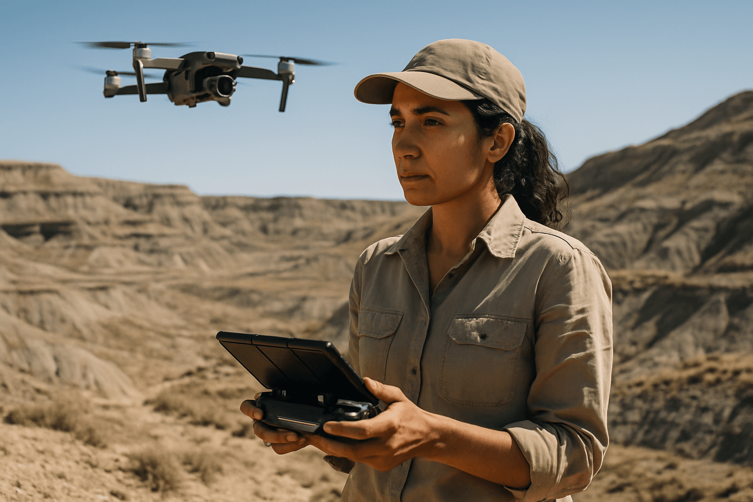
Drones, also known as Unmanned Aircraft Systems (UAS), are emerging as a powerful tool to overcome many of these traditional challenges in geological and Earth science applications. Their ability to fly at low altitudes, access hard-to-reach areas, and collect high-resolution, real-time data makes them ideal for targeted environmental monitoring.
Key Advantages of Drone-Based Aerial Surveys:
- Accessibility to Remote and Hazardous Areas: Drones can survey terrain that is difficult or dangerous for humans to access on foot or by traditional manned aircraft, such as rapidly eroding cliffs, dense jungles, rugged mountains, or remote polar regions. This expanded reach allows for the collection of crucial data from previously unexplored or under-sampled sites.
- High-Resolution Data Collection: Unlike satellites, which often provide lower-resolution imagery, drones can capture centimeter-scale resolution data, offering fine-grained detail that is invaluable for studying small-scale changes and features.
- Cost-Effectiveness and Efficiency: Deploying drones for aerial surveys is often significantly less expensive and more time-efficient than using helicopters, chartered planes, or extensive ground expeditions. Researchers can go from launching a drone to having workable data in hours, compared to days with traditional aircraft.
- Repeatable Surveys for Monitoring Change: Drones can conduct repeat surveys over the same area, allowing scientists to track rapid physical changes over time, such as glacier retreat, coastal erosion rates, or changes in vegetation distribution. This temporal dimension is critical for understanding dynamic environmental processes.
- Non-Invasive Data Acquisition: For sensitive paleoclimate sites, drones offer a non-invasive method of data collection, preserving the integrity of the environment while still gathering critical information.
Aerial Survey Techniques and Data Acquisition
The versatility of drones in paleoclimatology stems from the array of advanced sensors they can carry. These “eyes, ears, and reflexes” of the drone transform them into data-gathering powerhouses.
Specialized Drone Sensors for Paleoclimate Studies:
- RGB (Red, Green, Blue) Cameras: Standard high-resolution cameras capture visible light images, which can be stitched together using photogrammetry software to create orthomosaics, detailed 2D maps, and 3D models of landscapes. These are essential for visual documentation and mapping surface features.
- LiDAR (Light Detection and Ranging) Sensors: LiDAR uses laser pulses to measure distances to the Earth’s surface, creating highly accurate 3D point clouds and digital elevation models (DEMs). This technology can penetrate vegetation canopies, revealing ancient landforms, subtle changes in elevation, or buried structures that might indicate past environmental conditions. LiDAR is particularly useful for measuring ice thickness and tracking glacier retreat.
- Thermal Infrared Cameras: These sensors measure surface temperatures and detect heat variations, which can be crucial for identifying buried structures with different thermal properties than surrounding soil, or for monitoring meltwater flow on glaciers.
- Multispectral and Hyperspectral Sensors: These advanced cameras capture data across multiple narrow bands of the electromagnetic spectrum, including visible, near-infrared, and sometimes ultraviolet light. They are invaluable for analyzing vegetation health, land cover changes, and surface reflectivity (albedo). For paleoclimatology, changes in ancient vegetation patterns or soil composition can offer clues about past climates.
- Atmospheric Sensors: Drones can be equipped with sensors to measure air temperature, humidity, wind speed and direction, and even air quality (e.g., pollutants and greenhouse gases). While more relevant to current climate monitoring, these capabilities hint at future potential for reconstructing past atmospheric conditions from specific microclimates.
The data collected from these sensors can be processed into interactive 3D models, digital terrain models (DTMs), and highly detailed maps, allowing researchers to analyze complex geological occurrences and reconstruct past environments.
Key Applications of Drones in Paleoclimatology
Drones are being deployed in various critical areas of paleoclimate research:
Glaciology and Ice Sheet Dynamics
Drones are vital for monitoring glaciers and polar ice melt, providing detailed 3D mapping of ice sheets and real-time visual data on melting patterns. Researchers use drones equipped with LiDAR and thermal sensors to track glacier retreat, measure surface temperature, monitor meltwater flow, and assess changes in ice thickness. This high-resolution data complements satellite imagery and ground measurements, improving the accuracy of climate models and predictions.
Studying Ancient Landscapes and Geological Features
UAV imagery and 3D modeling are becoming part of geological research, helping to understand and interpret geological occurrences. Drones can create models of paleosols (ancient soils) and geological faults, providing insights into past environmental conditions and tectonic activity. By mapping ancient lake beds or river channels, drones can help reconstruct hydrological regimes of the past, inferring precipitation and temperature patterns.
Paleovegetation and Ecosystem Reconstruction
Multispectral sensors on drones are excellent for mapping vegetation cover and health. By analyzing fossil plant remains or ancient pollen data in conjunction with drone-derived topographic and environmental data, scientists can reconstruct past vegetation distributions, offering insights into ancient ecosystems and climate zones. Changes in vegetation, such as lichen biomass in tundra ecosystems, can be correlated with land surface temperature, aiding in understanding past thermal regimes.
Coastal and Marine Paleoclimate Studies
Drones can monitor coastal erosion, shoreline changes, and even ancient coastal settlements, providing evidence of past sea levels and storm events. While challenging, future advancements may allow drones to contribute more to shallow marine paleoclimate studies by monitoring indicators like coral reef health, which are sensitive to ocean conditions over time.
Advantages Over Traditional Methods
Drones offer several significant advantages over traditional methods of aerial data collection and field-based studies:
- Improved Spatial Resolution and Detail: Drones capture data with much higher resolution than satellites, allowing for the detection of small-scale features and changes that are crucial for detailed paleoclimate reconstructions.
- Flexibility and Rapid Deployment: Drones can be deployed quickly and repeatedly as needed, enabling scientists to capture transient events or monitor rapid changes, which is often impossible with scheduled satellite passes or expensive manned flights.
- Access to Inaccessible Terrain: They can reach areas that are hazardous, remote, or difficult for humans or larger aircraft, expanding the scope of research significantly.
- Cost-Effectiveness: The operational costs of drones are considerably lower than traditional aerial survey methods, making high-quality data collection more accessible to a wider range of research projects.
- 3D Modeling and Visualization: The ability to create detailed 3D models and maps from drone imagery provides researchers with comprehensive visual tools to analyze and interact with reconstructed ancient landscapes.
Challenges and Future Directions in Drone Paleoclimatology
Despite the immense potential, the use of drones in paleoclimatology also presents challenges. These include limitations in payload capacity and battery life, which can restrict flight duration and the types or number of sensors carried. Regulatory constraints on drone operations, data processing complexities, and the need for specialized expertise in drone piloting and data analysis are also factors to consider. The representativity of single-date or single-time data acquisition flights can also be limited, especially given the sensitivity of surface temperature to various factors.
However, ongoing advancements in drone technology are continuously addressing these issues. Improved battery efficiency, increased payload capacities, enhanced sensor miniaturization, and more sophisticated autonomous flight capabilities are on the horizon. The integration of artificial intelligence (AI) and machine learning will further enhance data processing and analysis, allowing for automated feature recognition and more accurate climate modeling. As drone technology evolves, its role in unraveling Earth’s ancient climate mysteries will only continue to grow, providing an indispensable tool for understanding our planet’s past and preparing for its future.


