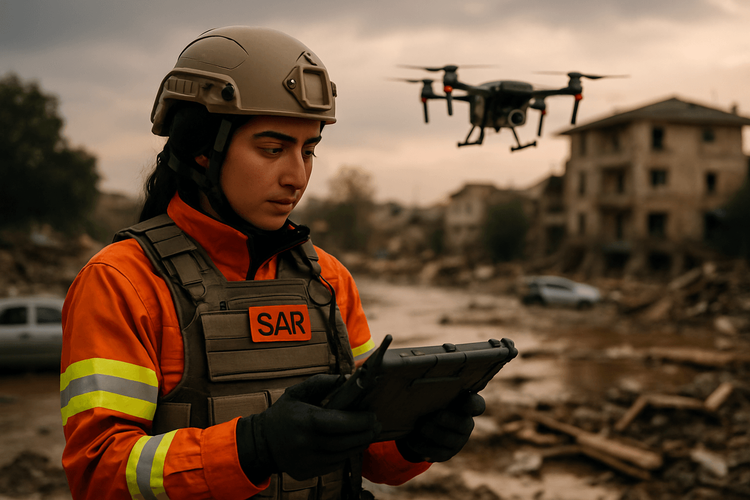
Environmental events, from devastating wildfires to catastrophic floods and earthquakes, pose immense challenges for search and rescue (SAR) operations. The sheer scale of destruction, hazardous conditions, and compromised infrastructure often impede traditional rescue efforts, making every second critical for saving lives. In this dynamic and often perilous landscape, drones, or Unmanned Aerial Vehicles (UAVs), have emerged as indispensable tools, profoundly transforming how emergency services respond to and mitigate the impact of natural disasters.
The Immediate Challenges of Environmental Disasters for SAR
When an environmental event strikes, the immediate aftermath is typically chaotic and dangerous. Damaged roads, widespread debris, and unstable structures can make large areas inaccessible to ground teams and traditional manned aircraft like helicopters. Furthermore, poor visibility due to smoke, dust, or heavy rain, coupled with the vastness of affected regions, significantly hampers the ability to quickly locate missing persons or assess damage. The clock is always ticking in SAR missions, and these obstacles directly impact response times and the safety of rescue personnel.
How Drones are Deployed in Environmental Search and Rescue
Drones offer a versatile and efficient solution to many of these challenges, providing a critical aerial perspective and a range of capabilities that enhance the effectiveness of SAR operations.
Aerial Reconnaissance and Situational Awareness
One of the primary applications of drones in disaster response is providing rapid aerial reconnaissance and enhancing situational awareness for first responders. Equipped with high-resolution cameras, drones can quickly survey vast areas, capture detailed images and videos, and transmit real-time data to command centers. This bird’s-eye view allows rescue teams to quickly assess the extent of damage, identify critically affected areas, and make informed decisions about resource allocation and safe routes for ground personnel. In the aftermath of hurricanes, for instance, drones have been used to survey flooded neighborhoods and monitor levees.
Thermal Imaging for Victim Location
A key feature making drones invaluable for SAR is their ability to carry advanced sensors, particularly thermal imaging cameras. Human skin emits heat that is invisible to the naked eye, but thermal drones can detect these heat signatures, even in conditions of low visibility such as smoke, fog, dense vegetation, or darkness. This capability is crucial for finding missing persons in wilderness areas, under rubble, or during night operations, significantly speeding up victim location efforts. For example, after hurricanes in Texas, Florida, and Puerto Rico, drones used thermal imaging to pinpoint survivors. Similarly, in wildfire management, thermal cameras help detect hotspots and track fire progression, guiding firefighting efforts and identifying trapped individuals.
3D Mapping and Damage Assessment
Beyond immediate victim location, drones are instrumental in post-disaster damage assessment and recovery planning. They can swiftly create 2D maps and 3D models of disaster sites, providing crucial data on damage to infrastructure like bridges, roads, and buildings. This data helps experts evaluate structural damage, assess the integrity of critical infrastructure, and plan reconstruction processes. During the 2024 Noto Peninsula earthquake in Japan, drones relayed 3D-generated data from photos to rescue teams, aiding in damage examination and identifying suitable temporary housing locations.
Delivering Emergency Supplies and Communication
In scenarios where ground access is cut off, drones can act as vital lifelines. They can be equipped with payload capabilities to carry and deliver essential supplies such as medical kits, flotation devices, food, water, and two-way radios to stranded individuals. This functionality ensures aid reaches those in need faster and more effectively, especially in remote or isolated locations. Drones can also serve as temporary communication relays in areas where traditional infrastructure has been damaged.
Environmental Events Where Drones are Crucial
Drones demonstrate their utility across a spectrum of environmental events:
- Wildfires: Drones monitor fire perimeters, identify hotspots, track progression, and assist in containment strategies, often equipped with thermal cameras to peer through smoke.
- Floods: UAVs survey flooded areas, monitor rising water levels, identify at-risk locations, and guide rescue operations, including the delivery of life vests and food to isolated communities.
- Earthquakes: Drones provide critical aerial views of affected areas, help locate survivors trapped under wreckage, and assess structural damage in collapsed buildings.
- Hurricanes and Tropical Storms: They aid in surveying damage, monitoring levees, assessing infrastructure, and providing real-time data for resource deployment.
- Avalanches: Drones with thermal capabilities are used to search for missing people buried under snow, reducing the time human rescuers spend in dangerous zones.
- Landslides: Drones map affected regions and continuously update maps, as seen in a Norway landslide where drones flew for 270 hours over 40 days to create a dynamic disaster area map.
Benefits of Drone Integration in SAR
The integration of drones into search and rescue operations during environmental events offers several significant advantages:
- Speed of Response: Drones can be deployed rapidly, often within minutes, reaching disaster zones much faster than ground-based vehicles or manned aircraft, which is critical when every second counts.
- Increased Safety for Rescuers: By providing preliminary information and operating in hazardous or inaccessible environments, drones minimize the risk to human rescue teams, allowing them to avoid dangerous conditions like unstable terrain, extreme temperatures, or toxic environments.
- Enhanced Coverage and Access: Drones can cover large geographic areas quickly and access remote or difficult-to-reach locations such as cliffs, dense forests, mountainous terrain, or areas with debris, which would be impossible or unsafe for human teams.
- Cost-Effectiveness: Compared to deploying helicopters or large ground teams, drones offer a more affordable solution for extensive search and assessment missions.
- Real-time Data and Informed Decision-Making: Drones provide live video feeds and data, enabling emergency personnel to have a better understanding of the situation and make faster, more informed decisions.
The Future of Drones in Emergency Response
The role of drones in search and rescue operations during environmental events is continuously evolving. Future innovations are expected to include further advancements in sensor technology (e.g., LiDAR for precise 3D mapping and object detection), extended flight endurance, improved communication systems, and greater integration with artificial intelligence and machine learning algorithms. AI-powered navigation and data analysis will enable drones to autonomously search larger areas, detect patterns, and provide even more accurate predictions, revolutionizing emergency services. The development of “Drone as First Responders” (DFR) programs aims to deploy drones to emergency scenes even before human responders, delivering immediate assistance and critical information.
By increasing situational awareness, reducing response times, and preserving human resources, UAV technology offers greater efficiency and effectiveness in disaster management. While drones are unlikely to completely replace traditional humanitarian operations, they will continue to play an essential and increasingly significant role in improving disaster responses and mitigating the impact of environmental events, ultimately saving more lives.


