Beneath our feet lies a hidden world of intricate water networks – aquifers, underground rivers, and saturated soil layers – critical for everything from drinking water to agricultural irrigation. Accurately mapping these subterranean water systems has historically been a monumental challenge, often proving costly, time-consuming, and limited in scope. However, advancements in drone technology are rapidly transforming this field, offering unprecedented capabilities for precise, efficient, and safer hydrogeological surveys.
The Persistent Challenges of Traditional Subterranean Water Mapping
Traditional methods for understanding what lies beneath the Earth’s surface are fraught with limitations. Groundwater detection has typically involved labor-intensive geophysical surveys, manual drilling, and often, unsuccessful outcomes. Techniques such as drilling boreholes provide precise, but localized, information, often failing to give a comprehensive picture of the surrounding geology or aquifer extent. The vastness and inaccessibility of many regions, coupled with the invisible nature of underground water, make comprehensive mapping difficult and expensive. Moreover, ground-based surveys can be slow and require easy access to study areas, limiting their application in challenging terrains.
How Drones are Revolutionizing Subterranean Water Mapping
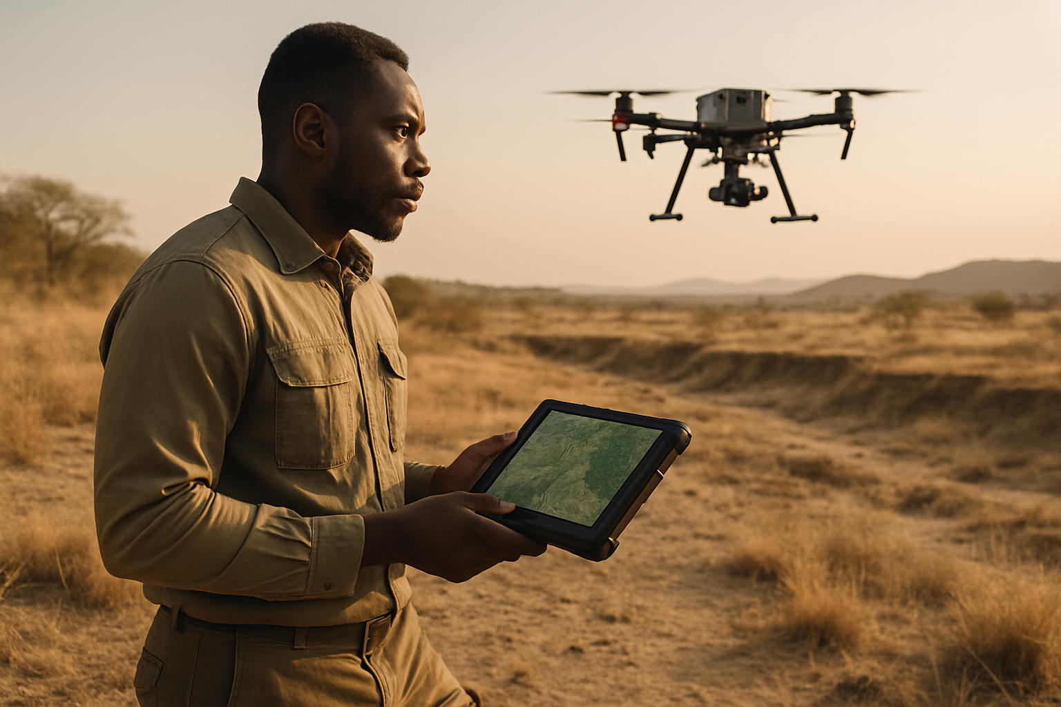
Unmanned Aerial Systems (UAS), commonly known as drones, have emerged as a game-changer in environmental monitoring and management, bridging the data gap between satellite observations and ground-based measurements. Their ability to collect high-resolution data quickly and safely in difficult-to-access locations makes them ideal for hydrogeological research.
Specialized Drone Technology for Underground Exploration
Modern drones designed for subterranean mapping are equipped with advanced navigation systems that allow them to operate effectively even in GPS-denied environments, which are common underground. Technologies like Simultaneous Localization and Mapping (SLAM) combined with LiDAR enable these drones to construct highly accurate 3D maps in real-time as they navigate complex underground spaces like mines and cave systems. Some drones are designed as heavy-lift multi-rotors to carry specialized geophysical instruments.
Advanced Sensor Systems for Subsurface Detection
The true power of drones in mapping subterranean water lies in the sophisticated sensors they can carry:
- Ground-Penetrating Radar (GPR): Drone-mounted GPR systems are at the forefront of this technology. GPR works by emitting high-frequency electromagnetic signals into the ground and detecting the reflections when these signals encounter different materials, such as water-saturated layers or geological boundaries. This non-destructive method provides detailed information about subsurface features, soil layers, and even water table levels. It’s particularly effective in dry sandy soils, snow, and ice, and can penetrate several meters to map riverbeds, lakebeds, and the sediments beneath them. While signal penetration can be a challenge in heavy, wet soils, GPR is crucial for identifying plastic water pipes and other non-metallic utilities that traditional methods might miss.
- LiDAR (Light Detection and Ranging): While primarily used for surface topography, LiDAR also plays a significant role in creating precise 3D models of underground environments, especially in mines and cave systems, which can indirectly inform hydrogeological studies by revealing geological structures that may host water. When combined with SLAM, LiDAR-equipped drones can generate millions of data points, creating highly detailed 3D models of underground areas and assisting in navigation without GPS.
- Electromagnetic (EM) Sensors: Drones equipped with electromagnetic instruments can measure and map changes in the Earth’s magnetic field, which can indicate subsurface conditions, including the presence of water.
- Thermal Infrared (TIR) Cameras: Infrared technology can detect changes in temperature on the surface that indicate the presence of cooler groundwater evaporating from below. This is particularly useful for detecting leaks in underground pipes, quantifying groundwater fluxes to surface water bodies, and studying groundwater discharge in coastal zones.
- Other Sensors: Drones can also carry optical sensors, multispectral, and hyperspectral sensors to monitor surface indicators that relate to groundwater, such as vegetation health and soil moisture, which can provide insights into water availability and quality. Gas sensors can also be integrated to monitor conditions in subterranean environments.
Data Acquisition and Analysis
Drones can rapidly cover vast areas, gathering continuous geospatial data and high-resolution images that are geotagged with exact coordinates. This data is then processed into detailed 2D maps, 3D models, and subsurface profiles, allowing hydrogeologists to visualize aquifer structures, estimate borehole yield, and detect contamination risks. The integration of AI and advanced analytics further enhances the interpretation of this large volume of data, providing actionable insights for water resource managers.
Key Benefits of Drone-Based Hydrogeological Surveys
The adoption of drone technology brings a multitude of advantages to the field of subterranean water mapping:
Enhanced Safety
One of the most significant benefits is the drastic improvement in safety. Drones can access hazardous and hard-to-reach areas, such as unstable slopes, glaciers with crevices, contaminated soils, or deep underground tunnels, without exposing human workers to risk. This reduces the danger associated with traditional in-water work, manual inspections, or manned expeditions, particularly during high-flow conditions or in confined spaces.
Increased Efficiency and Speed
Drones can cover expansive areas in a single flight, collecting data much faster than traditional ground-based methods. What might take months or even a year with conventional surveys can be accomplished in days or hours. This rapid data collection and turnaround time enable quick decision-making for water management and reduce project timelines and costs.
Unprecedented Accuracy and Resolution
Equipped with advanced sensors, drones capture high-resolution images and precise spatial data, leading to more accurate and detailed maps of subsurface terrain and water content. This provides a comprehensive view of aquifer structures and subsurface layers, far surpassing the localized information from boreholes alone. The high spatial and temporal resolution capabilities of drones fill a critical gap between satellite and ground-based data.
Environmental Advantages
Drone surveys offer a non-intrusive approach, minimizing the environmental impact often associated with invasive ground operations like extensive drilling. This helps preserve natural habitats and can lead to more sustainable water management practices by optimizing site selection and reducing trial-and-error drilling.
Applications of Drone Technology in Water Resource Management
The capabilities of drones extend across various critical areas within water resource management:
Aquifer Mapping and Groundwater Assessment
Drones provide hydrogeologists and water resource managers with the ability to visualize aquifer structures, estimate borehole yield, detect contamination risks, and identify optimal drilling sites. They help assess groundwater resources by mapping subsurface layers and water table levels, aiding in sustainable water management and well siting decisions. This is crucial for securing sustainable water supplies, especially in arid regions.
Leak Detection in Infrastructure
Infrared cameras on drones can detect “invisible” leaks in underground water distribution pipes by identifying temperature changes on the surface caused by evaporating water. This non-destructive technology provides a cost-effective way to monitor major pipelines, reduce water loss, and prevent contamination.
Snow Hydrology and Meltwater Monitoring
Drone-based GPR, coupled with photogrammetry, is proving highly promising for assessing the spatiotemporal evolution of snowpack characteristics, including snow depth, density, snow water equivalent, and bulk liquid water content. This data is vital for predicting the hydrological consequences of winter melting episodes, managing flood risks, and understanding water flow into groundwater systems.
Wetland and Coastal Erosion Studies
GPR drones can help map wetland boundaries, determine soil moisture content, and study subsurface hydrology, contributing to conservation and restoration efforts. They also assist in monitoring coastal erosion by studying subsurface sediment layers and tracking changes in beach profiles, supporting coastal management initiatives. Drones with radiometric cameras can even track groundwater inputs to coastal zones by measuring temperature differences at the water’s surface.
Challenges and Future Outlook
Despite their significant advantages, drone applications in hydrogeophysics still face challenges. Payload limitations on small UAS can restrict the use of multifrequency or multichannel GPR imaging. The decoupling of the GPR antenna from the ground surface can limit signal penetration, and heavy, wet soils can reduce GPR performance. Furthermore, processing the large volumes of data collected requires specialized software skills.
However, the future of drones in mapping subterranean water systems is bright. Ongoing advancements in sensor technology, artificial intelligence, and autonomous navigation are expected to overcome current limitations. The integration of drone data with machine learning and Geographic Information Systems (GIS) will enhance the accuracy and utility of groundwater modeling. Drones are set to become an indispensable tool for water resource management, providing the fine-scale, responsive data needed to address global water scarcity and manage hydrological systems more effectively and sustainably.
Conclusion
The ability to accurately map subterranean water systems is more critical than ever, given increasing global water demand and climate change impacts. Drones, with their specialized sensors like GPR, LiDAR, and thermal cameras, are profoundly transforming this complex field. By offering enhanced safety, unparalleled efficiency, and highly accurate data, these unmanned aerial vehicles are not just tools, but catalysts for a more informed and sustainable approach to managing our most precious resource: water.


