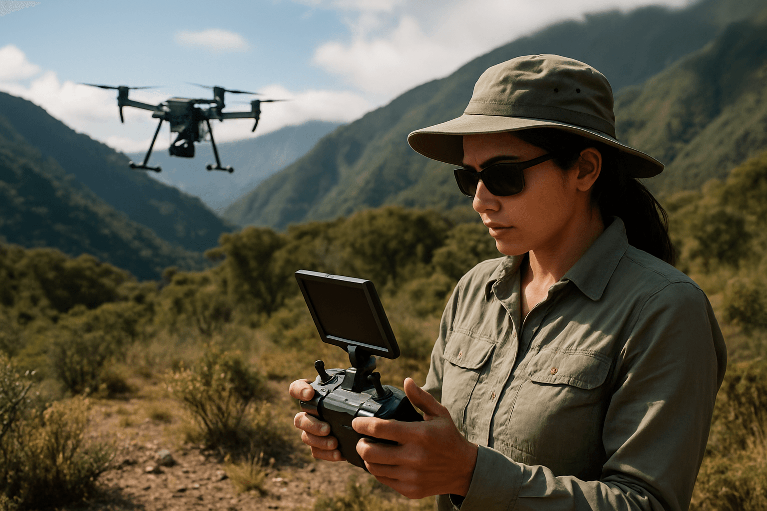
The silent hum of a drone cutting through the air is no longer just a sign of technological advancement; it’s becoming a symphony of hope for biodiversity conservation. In an era where species extinction rates are accelerating and pristine ecosystems face unprecedented threats, the ability to effectively monitor and protect Earth’s most vulnerable biodiversity hotspots is paramount. These critical areas, often remote, rugged, and dangerous for human access, have long posed significant challenges for conservationists. However, unmanned aerial vehicles (UAVs), commonly known as drones, are rapidly emerging as indispensable tools, offering an unprecedented “eye in the sky” to gather vital data, enhance understanding, and drive more effective conservation strategies.
The Imperative of Monitoring Remote Biodiversity Hotspots
Biodiversity hotspots, characterized by their exceptional species richness and high rates of habitat loss, are crucial for global ecological health. Yet, their very remoteness, combined with challenging terrains like dense forests, mountainous regions, or vast wetlands, makes traditional monitoring methods — such as ground surveys, manned aircraft, or satellite imagery alone — often impractical, expensive, or insufficient. Traditional techniques can be costly, inefficient, and struggle to detect cryptic or nocturnal species, or to access difficult landscapes.
This creates significant data gaps, hindering conservation efforts to track ecosystem changes, assess species populations, identify threats like poaching or illegal logging, and evaluate the impact of management interventions. The need for cost-effective, versatile, and precise monitoring solutions is more urgent than ever.
Diverse Applications of Drones in Conservation
Drones offer a versatile platform for data collection and resource management, bridging critical gaps in how we understand and manage our natural environment. Equipped with advanced sensors, they provide a unique perspective, literally and figuratively, by offering a bird’s-eye view of vast and often inaccessible natural areas.
Wildlife Monitoring and Management
Drones are proving to be an indispensable tool for studying and protecting animal populations with minimal disturbance.
- Population Counting and Identification: High-resolution cameras, often integrated with AI software, can conduct semi-automated counts of animal populations, identify species types, and track movement patterns more accurately and efficiently than manual methods. For instance, UAVs have been used to count pelican colonies and survey large herds. Thermal cameras are particularly effective for detecting elusive or nocturnal species by sensing temperature differences between the animal’s body and the environment.
- Tracking and Behavioral Analysis: Drones can track radio-tagged animals simultaneously across vast and challenging landscapes, providing real-time location data. This allows conservationists to monitor animal behavior, understand predatory dynamics, and detect disease transmission without human encroachment.
- Anti-Poaching and Security: Drones equipped with live-streaming visible and thermal camera systems can detect and track suspicious activity, providing crucial support for law enforcement and anti-poaching efforts in protected areas.
- Human-Wildlife Conflict Mitigation: Drones can be used to shepherd wild animals away from farmlands or dangerous situations, reducing conflicts without risking humans or animals.
Habitat Mapping and Ecosystem Assessment
Understanding the health and changes within ecosystems is fundamental to biodiversity conservation. Drones excel at collecting detailed data for habitat analysis.
- Vegetation Mapping and Health: Drones capture high-resolution imagery, multispectral, and hyperspectral data, allowing for detailed mapping of vegetation cover, monitoring changes in climate and vegetation, and identifying areas suffering from degradation. LiDAR sensors mounted on drones can penetrate dense canopies to generate detailed 3D models of forest structure, revealing crucial information about species distribution and habitat suitability.
- Ecosystem Restoration: By precisely mapping degraded areas, drones facilitate reforestation efforts and can track the progress and success of restoration initiatives.
- Water Quality Monitoring: UAVs equipped with advanced remote sensors can gather comprehensive data from water bodies, providing insights into parameters like turbidity, pH levels, and temperature, which are invaluable for detecting pollutants and determining water quality in remote aquatic ecosystems.
Key Technologies Powering Drone Conservation
The effectiveness of drones in biodiversity monitoring is largely due to the sophisticated technologies they integrate.
Advanced Sensor Payloads
Modern drones can carry a variety of sensors tailored to specific monitoring needs:
- RGB (Visible Light) Cameras: For high-resolution visual imagery and traditional mapping.
- Thermal Cameras: Essential for detecting animals at night or in dense cover by sensing body heat, as well as for assessing habitat conditions by detecting temperature variations.
- Multispectral and Hyperspectral Sensors: These capture data across different light spectrums, revealing insights into plant health, species identification, and water quality that are invisible to the naked eye.
- LiDAR (Light Detection and Ranging): Generates precise 3D elevation models, capable of penetrating vegetation canopies to map ground-level features and forest structure.
- Acoustic Sensors: Used to record and identify species like songbirds, contributing to bioacoustic monitoring of biodiversity.
Artificial Intelligence and Machine Learning
AI and machine learning are revolutionizing drone data processing, allowing for automation and deeper insights.
- Automated Species Detection and Identification: AI algorithms can autonomously identify various species from drone-captured images and videos, providing wildlife managers with in-depth insights previously challenging to obtain.
- Real-time Data Processing: Advancements in AI and machine learning enable drones to process environmental data on the fly, making real-time environmental monitoring a reality.
- Predictive Modeling: Multimodal AI systems, capable of analyzing images, audio, video, and environmental sensor data simultaneously, can provide comprehensive predictions of biodiversity loss and improve human-wildlife conflict mitigation strategies.
GPS and Radio-Telemetry Integration
For tracking specific animals, drones can integrate with existing radio-telemetry systems, significantly improving data collection efficiency. Drone-based radio-telemetry systems can track up to 40 VHF tags simultaneously, collecting real-time location data and even detecting mortality signals.
Advantages of Drones in Remote Environments
The benefits of deploying drones in remote biodiversity hotspots are numerous and transformative:
- Accessibility and Safety: Drones can access remote or difficult terrains, such as rugged mountains or dense forests, that are dangerous or impossible for humans to reach, enhancing safety for personnel and minimizing human disturbance to sensitive habitats.
- Cost-Effectiveness: Drones can significantly reduce the costs associated with wildlife tracking and habitat monitoring compared to traditional methods like manned aircraft.
- High-Resolution and Precision Data: UAVs capture highly detailed, high-resolution imagery and data, allowing for unprecedented accuracy in environmental monitoring and the detection of micro-scale changes.
- Efficiency and Real-Time Insights: Drones offer faster and more accurate surveying, collecting large volumes of data from wide areas. With real-time data collection capabilities, conservationists can make timely decisions and implement preventative measures.
- Minimally Invasive: Drones offer a less noticeable observation method compared to ground-based surveys or manned aircraft, reducing disturbance to wildlife.
- Repeatability: Drone surveys are highly repeatable, providing consistent results and comparable data over time, which is crucial for long-term monitoring of ecosystem changes and management effectiveness.
Overcoming Challenges and Future Outlook
Despite their immense potential, the use of drones in remote biodiversity monitoring faces several challenges:
- Technological Limitations: Issues like limited flight time and endurance, especially for modest drones covering large areas, and the need for robust navigation systems in challenging environments (e.g., weak GPS near magnetic poles, extreme cold, high winds) are ongoing hurdles. Advancements in solar-powered drones are anticipated to increase flight duration.
- Data Processing and Analysis: The sheer volume of high-resolution data collected by drones requires significant computational resources and expertise for processing and analysis, especially when balancing wide-area coverage with detailed target detection. Lightweight AI models optimized for edge deployment are being developed to address onboard computing constraints.
- Ethical and Social Concerns: The militaristic origins of drone technology raise concerns about “green securitization” and potential privacy rights issues. It’s crucial to ensure that drone use is proportional to conservation needs and considers potential social implications.
- Wildlife Disturbance: While generally less invasive than traditional methods, the acoustic disturbance from drone engines can still affect some species, necessitating careful planning of flight altitudes to minimize impact.
The future of drone technology in biodiversity monitoring is promising, with continuous development, collaborative approaches, and innovative uses of AI. Innovations are expected to enhance UAV endurance, allowing for longer flights and greater coverage. Improvements in AI and machine learning will enable drones to process environmental data on the fly, making real-time environmental monitoring a widespread reality. Autonomous drones and robotics are expected to perform complex tasks like animal tracking and environmental monitoring with minimal human intervention. Multimodal AI systems capable of analyzing various data types simultaneously will provide more comprehensive predictions of biodiversity loss. Furthermore, specialized AI startups and increased demand for advanced sensors like acoustic sensors and edge AI devices will continue to drive innovation in this field.
By addressing the current challenges and harnessing the ongoing technological advancements, drones will undoubtedly continue to revolutionize how we monitor, understand, and ultimately protect the invaluable biodiversity of our planet’s most remote and vulnerable hotspots.


