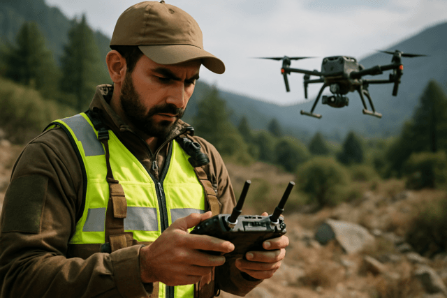
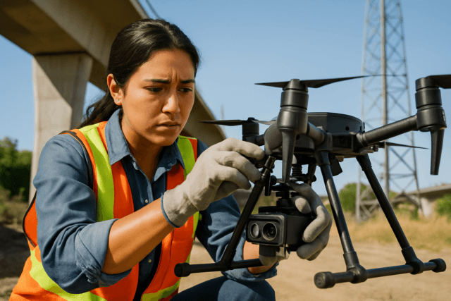
Soil erosion poses a pervasive threat to agricultural productivity, environmental health, and global food security. It strips away the fertile topsoil, diminishes arable land, and contributes to increased sedimentation in water bodies. Traditionally, assessing and monitoring soil erosion has been a laborious and often imprecise task, relying on extensive field surveys or satellite imagery with limited resolution. However, the advent of drone technology is rapidly transforming this landscape, offering unprecedented capabilities for detailed, real-time assessment of soil erosion and the effectiveness of conservation efforts within precision agriculture.
The Critical Problem of Soil Erosion
Soil erosion occurs when the top layer of soil, rich in organic matter and nutrients, is displaced by natural forces like wind and water, or by human activities. This degradation leads to decreased agricultural productivity, loss of fertile land, and increased sedimentation in rivers and lakes, impacting water quality and ecosystems. It is a global challenge, demanding efficient and accurate monitoring to implement effective mitigation strategies.
How Drones Assess Soil Erosion: Data Collection and Sensor Technologies
Drones, or Unmanned Aerial Vehicles (UAVs), provide a flexible and highly effective platform for collecting detailed data crucial for soil erosion assessment. Equipped with a range of advanced sensors, they can generate high-resolution imagery and 3D models of terrain, far surpassing the detail offered by traditional methods or satellite imagery.
Advanced Sensors for Detailed Soil Analysis
The effectiveness of UAVs in soil erosion monitoring largely depends on the sophisticated sensors they carry:
- RGB Cameras: Standard Red, Green, Blue cameras capture visual data that helps in creating high-resolution orthophotos and 3D terrain models, allowing for the identification of changes like rill formation and soil loss.
- Multispectral (MS) Cameras: These cameras capture images across multiple wavelengths of the electromagnetic spectrum, providing data on vegetation health, soil moisture, and nutrient composition. This is crucial as healthy vegetation cover is a key factor in preventing erosion.
- Hyperspectral Cameras: Offering even more detailed information, hyperspectral cameras capture data across hundreds of narrow spectral bands, enabling more precise analysis of soil composition and moisture content, especially beneath vegetative canopies.
- Lidar (Light Detection and Ranging) Sensors: Lidar drones are particularly valuable for soil erosion studies. They use laser pulses to measure distances and create highly detailed 3D models of the Earth’s surface, capturing topography and morphology with exceptional accuracy. This allows researchers to identify subtle changes in elevation, slope, and features like gullies, stream channels, and drainage patterns that contribute to erosion.
- Thermal Cameras: These sensors detect temperature variations, which can indicate soil moisture content and other properties related to soil health and water stress.
Specific Applications in Soil Erosion and Conservation
The high-resolution data collected by drones facilitates a variety of applications critical for understanding and combating soil erosion.
Mapping and Monitoring Erosion-Prone Areas
Drones excel at creating precise maps and 3D models that identify areas at high risk of erosion. By flying over land repeatedly, they can compare data over time to track changes in topography, detect new erosion features like rills and gullies, and quantify soil loss. This continuous monitoring is vital for assessing the effectiveness of implemented conservation measures and making necessary adjustments. For instance, drone-based photogrammetry has been used to create high-resolution elevation models and multispectral imagery to identify flood-risk zones and areas with poor surface drainage on agricultural fields.
Assessing Soil Properties and Health
Beyond topography, drones provide insights into crucial soil properties. Multispectral and hyperspectral sensors can map organic matter content, moisture levels, nutrient composition, and even indirectly assess pH levels by analyzing vegetation response. Understanding these variations helps farmers apply resources like water, fertilizers, and pesticides precisely where needed, reducing waste and preserving soil quality. Healthy soil, less compacted and rich in nutrients, is more resistant to erosion.
Evaluating Conservation Efforts
Drones are instrumental in evaluating the impact of conservation practices. By tracking changes in vegetation cover, soil structure, and topographical features after the implementation of measures like contour farming, terracing, or reforestation, land managers can quantify their effectiveness. This data-driven approach helps refine conservation strategies for better outcomes.
Precision Application of Erosion Control Measures
In some advanced applications, drones can even deliver erosion control measures directly. By carrying and dispersing seeds, mulch, or erosion control blankets, drones can reseed damaged or inaccessible areas, stabilizing the soil and promoting vegetation regrowth with precision.
Advantages of Drone Technology in Soil Conservation
The integration of drones into soil erosion assessment and conservation offers significant benefits over traditional methods:
- High Resolution and Accuracy: Drones provide highly detailed aerial views and precise 3D models (down to a few centimeters with RTK GPS) that reveal subtle changes in terrain and soil characteristics, which are often missed by satellite imagery or manual surveys.
- Efficiency and Speed: Drones can cover expansive areas in a fraction of the time compared to traditional ground-based methods, allowing for swift and effective data collection. This automation reduces labor costs and allows resources to be reallocated to data analysis and interpretation.
- Real-time and On-Demand Monitoring: The flexibility of UAVs allows for frequent, on-demand data collection, offering better temporal resolution than satellites. This real-time feedback enables rapid assessment and decision-making for managing soil erosion.
- Access to Challenging Terrain: Drones can access and survey areas that are difficult or dangerous for humans, such as steep slopes, remote locations, or post-disaster sites, significantly enhancing safety and data collection capabilities.
- Cost-Effectiveness: While initial investment exists, drones offer significant cost savings compared to traditional methods for long-term studies or large areas, making them beneficial for sustainable land management.
- Environmental Benefits: By enabling precision agriculture, drones help reduce the overuse of water, fertilizers, and pesticides, minimizing chemical runoff and preserving surrounding ecosystems and biodiversity. They also reduce the need for heavy machinery, preventing soil compaction.
Challenges and Limitations
Despite the many advantages, the widespread adoption of drones for soil erosion assessment faces several challenges:
- Data Accuracy and Integration: Ensuring the reliability of collected data can be affected by spatial resolution variability and sensor quality. Integrating data from diverse sources, including UAVs, satellites, and ground sensors, remains a challenge.
- Cost and Expertise: The initial investment in drones, advanced sensors, processing software, and operator training can be substantial for smaller farms or organizations. Specialized knowledge is required for effective drone operation and data analysis.
- Weather Dependence: Drones are susceptible to adverse weather conditions such as heavy rain, strong winds, snow, or fog, which can limit their operational capacity and impact data accuracy.
- Regulatory Frameworks: Evolving and variable regulations across different regions regarding airspace restrictions and drone operation can create hurdles for deployment.
- Battery Life: Limited flight duration and payload capacity can restrict the coverage area and the types of sensors that can be carried in a single flight.
The Future of Drone Applications in Soil Conservation
The future of drone technology in soil erosion assessment and conservation is promising. Ongoing advancements in drone capabilities, sensor technology, and data processing — particularly with AI and machine learning — are continuously improving accuracy, efficiency, and accessibility. These developments are expected to overcome current challenges, making drones an indispensable tool for sustainable agriculture and environmental stewardship. The integration of drone data with IoT sensors and AI platforms promises real-time, automated responses to soil health issues, paving the way for a more resilient and sustainable agricultural future.
Conclusion
Drones are revolutionizing how we approach soil erosion and conservation efforts, particularly within precision agriculture. By providing highly detailed, accurate, and timely data on topography, soil properties, and vegetation health, UAVs empower farmers and land managers to make informed decisions, implement targeted interventions, and effectively monitor the impact of conservation strategies. While challenges related to cost, regulation, and data integration persist, the continuous evolution of drone technology points towards a future where these aerial workhorses play an even more critical role in protecting our planet’s most vital resource: its soil.


