Ancient trees stand as living monuments, silent witnesses to centuries of history and vital anchors of our ecosystems. These arboreal giants, however, face increasing threats from climate change, pests, diseases, and urban development. Monitoring their health has traditionally been a labor-intensive and often challenging endeavor, but a new era of arboriculture is emerging, driven by the remarkable capabilities of drone technology. Unmanned Aerial Vehicles (UAVs), equipped with sophisticated sensors, are transforming how we assess, protect, and preserve these invaluable natural treasures, offering unprecedented levels of detail and efficiency.
Why Ancient Trees Need Special Monitoring
Ancient trees possess immense ecological, cultural, and historical value. Ecologically, they are often keystone species, supporting diverse communities of flora and fauna, and acting as critical carbon sinks. Culturally, they are often linked to local heritage, providing aesthetic beauty and a sense of continuity. Their longevity, however, also makes them vulnerable. Many ancient trees are living at the extremes of their physiological limits, making them particularly susceptible to environmental stressors such as prolonged droughts, novel pathogens, and invasive species. Their size and intricate canopies also make physical inspection difficult and dangerous.
The Limitations of Traditional Monitoring Methods
Historically, assessing tree health relied heavily on ground-based visual inspections, climbing arborists, and costly aerial surveys using helicopters or planes. These methods are often:
- Labor-intensive and time-consuming: Manual inspections of large or numerous trees require significant human effort.
- Costly: Helicopter rentals and specialized personnel incur high expenses.
- Limited in scope and accessibility: Dense canopies, steep terrain, or hazardous environments can make it impossible for humans to reach certain parts of a tree or an entire stand.
- Potentially damaging: Climbing can sometimes cause stress or minor damage to ancient or fragile trees.
- Reactive: Traditional methods often detect problems only after they are visibly advanced, making intervention more challenging.
Drone Technology: A Game Changer for Arboriculture
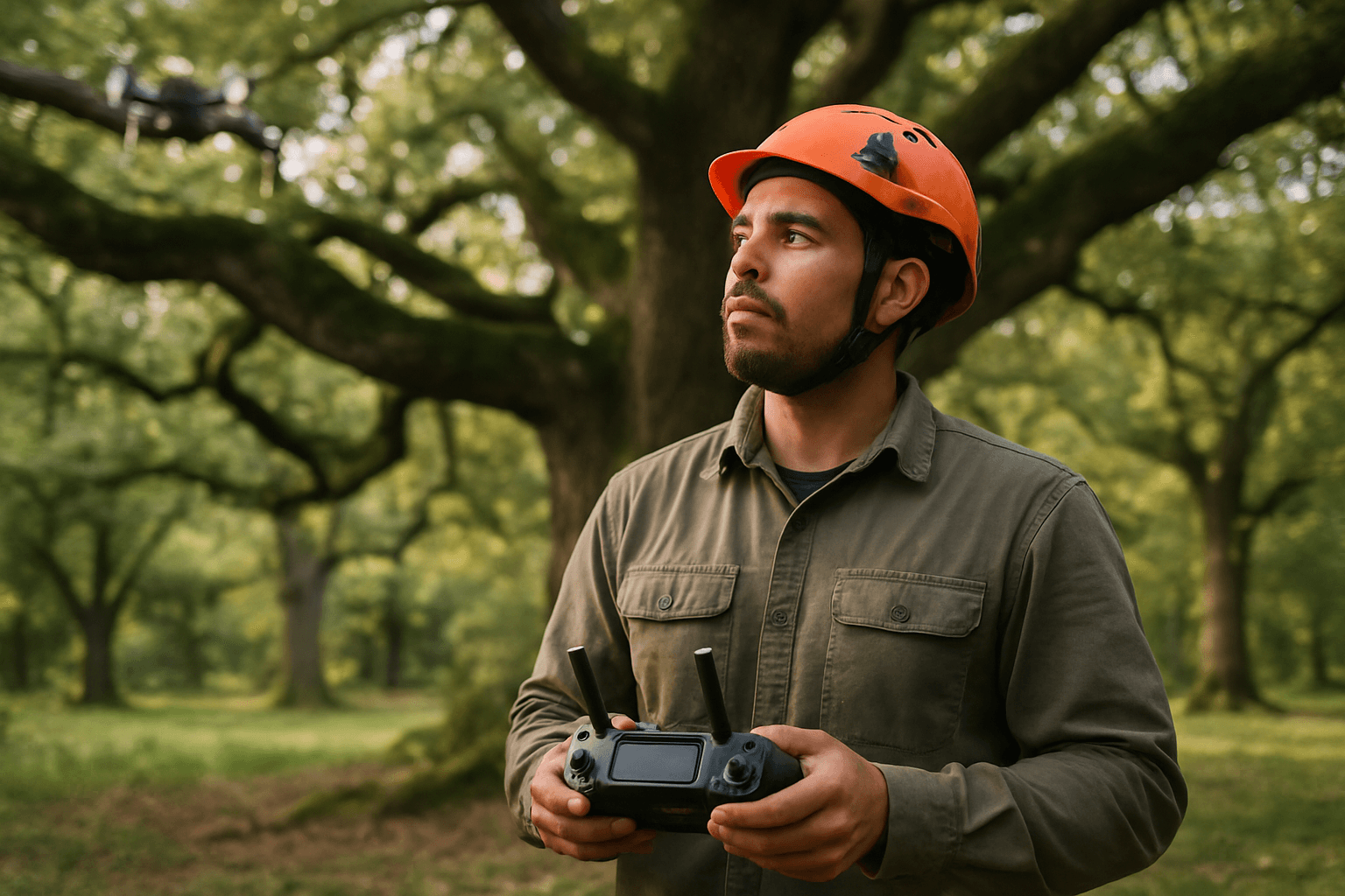
Drones have emerged as a powerful tool in forestry and arboriculture, offering a safer, faster, and more precise way to monitor tree conditions. Equipped with high-resolution cameras and advanced sensors, UAVs can gather detailed data on a tree’s condition from above, providing a comprehensive perspective that is difficult to achieve through traditional means. This non-invasive approach is especially valuable for trees that are rare, old, or have cultural significance, as it avoids unnecessary stress or damage during assessment.
Key Drone Applications in Ancient Tree Health Monitoring
The versatility of drone technology, coupled with specialized payloads, enables a wide range of applications for monitoring ancient tree health:
High-Resolution Aerial Imagery and Photogrammetry
Drones can capture high-resolution photographs and video footage of an entire tree canopy, providing a “bird’s-eye view” that allows arborists to quickly spot visible signs of stress, damage, disease, or pest infestation. This includes detecting dead or dying branches, unhealthy leaf coloration or patterns, distorted foliage, or overcrowded canopy areas. Photogrammetry allows for the creation of detailed 3D models, enabling precise measurements of tree height, crown width, and even prediction of diameter at breast height (DBH) and tree age, which is crucial for ancient tree surveys. Researchers have successfully used UAV photogrammetry to monitor ancient tree communities and detect early signs of pest infestation and canopy damage.
Multispectral and Hyperspectral Imaging
For even more detailed and early-stage assessments, drones can be equipped with multispectral or hyperspectral sensors. These sensors capture light beyond the visible spectrum, providing valuable information about how trees interact with different wavelengths of light.
- Multispectral imaging can identify issues like chlorophyll levels in leaves, which can indicate nutrient deficiencies, water stress, or diseases before visible symptoms appear. These cameras often capture data in specific bands like red, green, blue, red-edge, and near-infrared (NIR).
- Hyperspectral imaging offers an even more detailed analysis, detecting subtle changes in a tree’s condition that might go unnoticed by the human eye. This allows for the early detection of physiological changes related to stress. In one study, UAV-based multispectral imagery was used to classify the health status of old trees into healthy, declining, and severe declining categories with high accuracy, especially when incorporating additional variables like aspect and canopy area.
Thermal Imaging for Stress Detection
Thermal imaging technology allows drones to detect temperature variations in tree canopies using infrared sensors. Trees under stress from drought, disease, or pest damage often exhibit different temperatures compared to healthy trees. For instance, dehydrated trees may show increased heat due to insufficient water flow, while infected areas might have different thermal properties. This early detection can be crucial for preventing further damage and improving tree care strategies. Research has shown that thermal imaging can detect sub-degree temperature differences induced by disease onset in trees. Scientists are using thermal imaging from drones to measure the health, growth, and recovery of forest systems, as stressed trees often have a higher temperature.
LiDAR for Structural Analysis and Growth Monitoring
LiDAR (Light Detection and Ranging) technology uses laser pulses to create highly precise 3D models of trees and their surrounding environment. This capability is invaluable for:
- Measuring tree height and canopy density: LiDAR can penetrate dense foliage to map forest structure, providing detailed information on tree height, canopy density, and even understory vegetation.
- Detecting structural weaknesses: By creating detailed point clouds, LiDAR can help identify structural issues, assess biomass, and analyze canopy structures.
- Monitoring changes over time: Repeat LiDAR flights can track forest growth and changes in structure without the need for manual measurements.
- Precision mapping: LiDAR drones provide high-resolution, real-time data for forest management, enabling the accurate mapping of terrain features and individual tree identification, even in densely vegetated areas. This has been particularly useful in identifying ancient trees for preservation in potential development sites.
Pest and Disease Surveillance
Drones facilitate the early identification and monitoring of pest outbreaks and disease spread. By capturing detailed imagery and spectral data, drones can pinpoint affected areas, allowing for targeted intervention and preventing widespread damage. For example, thermal imaging has been used to detect defoliation caused by LDD moths, offering a tool to uncover the presence of invasive species.
Benefits of Drone-Based Tree Health Monitoring
The adoption of drones in monitoring the health of ancient trees offers numerous advantages:
- Efficiency and Speed: Drones can survey large areas quickly and collect detailed data in a fraction of the time compared to traditional methods.
- Enhanced Safety: They eliminate the need for human personnel to climb tall trees or access hazardous terrain, significantly reducing risks.
- Improved Data Accuracy and Quality: Advanced sensors provide high-resolution and precise data, allowing for early detection of subtle changes in tree health that might be missed by the human eye.
- Cost-Effectiveness: While initial investment in drone technology exists, it can lead to significant long-term savings by reducing labor, time, and the need for costly conventional aerial surveys.
- Non-Invasiveness: Drones can assess tree health without physically disturbing the tree, which is crucial for fragile ancient specimens.
- Accessibility: Drones can reach remote or difficult-to-access areas, such as dense forests, steep slopes, or areas with heavy vegetation, providing comprehensive coverage.
- Proactive Management: Early detection of stress and disease enables proactive interventions, potentially saving trees that might otherwise be lost.
Challenges and Future Directions
Despite their immense potential, challenges remain in the widespread application of drones for ancient tree monitoring. These include the massive amounts of data generated by advanced sensors, which require robust processing and analysis capabilities, often involving artificial intelligence and machine learning. Regulatory hurdles, the cost of high-end sensors, and the need for skilled operators also need to be addressed.
The future of drone applications in arboriculture is promising. Integration of AI for automated data analysis, improvements in sensor technology (e.g., combining LiDAR and multispectral data for enhanced classification and health tracking), and the development of more autonomous flight capabilities, even under dense canopies, will further enhance their utility. Projects like the data-driven drone system in Stuttgart, Germany, which oversees and protects ancient trees from climate impacts by collecting thermal and optical data for precise water requirements, showcase a model for future green-tech initiatives.
Conclusion: Safeguarding Arboreal Giants with Advanced Technology
Drones are no longer just a novelty; they are indispensable tools in the fight to preserve our planet’s ancient trees. By providing unprecedented insights into their health, structural integrity, and environmental stressors, drone technology empowers arborists, conservationists, and researchers to make informed decisions and implement targeted interventions. As these technologies continue to evolve, they will play an increasingly critical role in ensuring that these magnificent arboreal giants can continue to stand as silent sentinels for generations to come.


