The world’s protected areas, vital bastions of biodiversity and natural heritage, face relentless pressures ranging from climate change and habitat degradation to poaching and illegal activities. Traditional monitoring methods, often labor-intensive, costly, and limited in scope, struggle to keep pace with these escalating threats. However, a new eye in the sky has emerged: drone technology. Unmanned Aerial Vehicles (UAVs), commonly known as drones, are rapidly revolutionizing conservation efforts, offering a scalable, efficient, and often less intrusive way to safeguard these invaluable ecosystems.
A New Era of Environmental Surveillance: The Rise of Drone Technology
Drones have transitioned from military applications to become indispensable tools across various civil and environmental sectors, heralded as a new era of remote sensing for studying the environment. Their ability to provide a “bird’s-eye view” is proving critical for monitoring vast and often inaccessible natural areas, reshaping how conservation efforts are conducted.
What Are Conservation Drones?
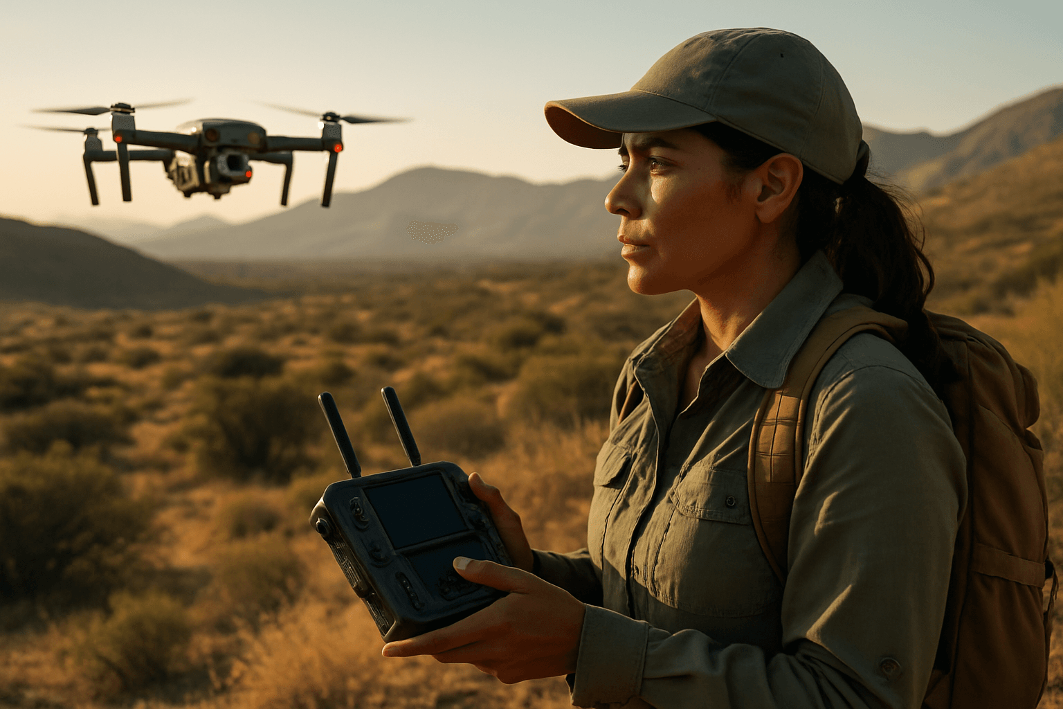
Conservation drones are unmanned aerial vehicles designed specifically for environmental monitoring and protection. These remotely controlled or autonomously operated aircraft are equipped with a diverse suite of advanced sensors and cameras, allowing them to gather crucial data from unique vantage points. Common payloads include:
- High-resolution visual cameras: For detailed imagery and video.
- Thermal infrared sensors: To detect heat signatures, enabling wildlife tracking and poacher detection at night or through dense foliage.
- Multispectral and hyperspectral sensors: To analyze vegetation health, soil moisture, and land use patterns by capturing data across different wavelengths.
- LiDAR (Light Detection and Ranging) systems: For creating precise 3D topographic models and mapping ground features, even beneath dense vegetation.
- Acoustic sensors: Primarily used underwater but also on land for specific monitoring tasks.
- Physical and chemical sensors: For detecting parameters like temperature, pressure, humidity, and even gases.
Bridging Gaps in Traditional Monitoring
Traditional methods for habitat monitoring, such as ground surveys, manned aircraft, and satellite imagery, often present significant limitations. Ground surveys are labor-intensive, costly, risk causing damage to sensitive areas, and provide limited detail over expansive regions. Manned aircraft are expensive and logistically challenging, especially in remote or politically sensitive areas, and their noise can disturb wildlife. While satellites offer broad coverage, their geographical availability, rapid access to products, and resolution for species-level tracking can be limited.
Drones bridge these gaps by offering a risk-free, low-cost manner to rapidly and systematically observe natural phenomena at high spatio-temporal resolution. They can access areas that are dangerous or prohibitively expensive for human researchers, reducing both time and labor costs.
Multifaceted Applications of Drones in Protected Areas
The versatility of drones, coupled with their varied sensor capabilities, allows for a wide array of applications in monitoring and managing protected areas.
Vigilant Eyes on Wildlife: Monitoring and Anti-Poaching Efforts
One of the most impactful applications of drones is in wildlife monitoring and anti-poaching operations. Drones enable researchers to observe animals without causing significant disturbance, collecting more naturalistic data about species in their habitats. This includes:
- Population tracking: Counting animals, observing movement patterns, and monitoring breeding and feeding behaviors. For example, drones are used to track species like the Arabian oryx, elephants, seals, and orangutans, providing more accurate data than traditional methods.
- Endangered species protection: Drones can track endangered species with precision, aiding in the implementation of effective conservation strategies.
- Anti-poaching surveillance: Equipped with high-resolution and thermal cameras, drones can monitor vast areas, detect suspicious activities, and identify poachers, especially at night when most illegal activities occur. Live footage can be transmitted to control centers, allowing for immediate identification and response. In Kruger National Park, drone implementation improved poacher detection significantly, leading to a decrease in poaching activity. Organizations like Air Shepherd have successfully used drones and AI to conduct thousands of missions to stop rhino and elephant poachers.
Mapping Habitats and Assessing Ecosystem Health
Drones play a critical role in biodiversity and habitat conservation by enabling the detailed mapping and assessment of ecosystems.
- Habitat mapping: UAVs provide detailed maps of forest cover, vegetation density, soil moisture, and land use, which are crucial for understanding habitat dynamics and the impacts of human activity. This is vital for creating effective conservation plans and identifying areas in need of intervention.
- Ecosystem health assessment: Multispectral sensors can detect variations in vegetation health and identify specific areas suffering from degradation. Drones are used to map coral reefs and assess their health, track bleaching events, and monitor recovery. They also help in monitoring wetlands and coastal areas.
- Reforestation and restoration: Drones assist reforestation efforts by mapping degraded land and can even be used for seed dispersal in hard-to-reach areas, accelerating restoration and increasing success rates.
Combating Invasive Species and Environmental Degradation
Drones offer a valuable tool for managing threats posed by invasive species and other forms of environmental degradation.
- Invasive species detection: UAVs equipped with specialized sensors can detect differences in plant species reflectance, aiding in the early identification and monitoring of invasive species. They have been used to detect nests of invasive hornets, such as Vespa velutina, for eradication.
- Monitoring degradation: Drones can track the progress of degradation in various ecosystems and help identify sources of pollution, like illegal discharges or algal blooms, enabling timely intervention.
Law Enforcement and Human Impact Monitoring
Monitoring human activities within protected areas is crucial for effective management. Drones provide an efficient way to oversee compliance and assess impacts.
- Illegal activities: Drones can document illegal logging, mining, and other unauthorized intrusions.
- Tourism impact: They can monitor tourism impacts such as trail condition (width and depth), informal trail proliferation, trampling, and trash along trails, providing high-resolution time-series data to measure changes. This is particularly useful in popular national parks where increased visitation can adversely affect conservation values.
Rapid Response for Environmental Hazards
In emergencies, drones offer rapid deployment and critical information gathering capabilities.
- Disaster assessment: They can be quickly deployed to assess damage during natural disasters like floods or wildfires, identifying affected areas and supporting management efforts.
- Pollution assessment: Drones can map the spread of oil spills, monitor their movement, and guide containment and recovery efforts. They can also detect water quality issues and help in search and rescue operations.
Key Advantages of Drone-Based Monitoring
The effectiveness of drones in protected areas stems from several distinct advantages over traditional monitoring methods.
Enhanced Efficiency and Cost-Effectiveness
Drones offer a more efficient and cost-effective approach to environmental monitoring. They can cover massive areas within a fraction of the time required by traditional methods, significantly reducing labor costs and the need for expensive manned aircraft. More efficient monitoring tools that reduce management costs have the potential to make significant contributions to nature protection, especially in remote and extreme environments where costs are particularly high.
Unparalleled Data Accuracy and Resolution
Equipped with advanced sensors, drones capture high-resolution imagery and sensor data from precise vantage points, leading to enhanced data accuracy and reduced inconsistencies. This allows for the detection of micro-scale changes and provides detailed baseline data for future monitoring, which is crucial for understanding ecosystem change. The integration of photogrammetry software allows for the creation of highly detailed 3D models.
Minimizing Disturbance and Maximizing Reach
Drones offer a relatively risk-free way to observe natural phenomena and can access virtually any area with minimal impact. Their ability to fly quietly reduces disturbance to wildlife compared to manned aircraft or human ground patrols. This non-intrusive monitoring is essential for studying shy or endangered species without altering their natural behaviors. They can reach remote, dangerous, or time-consuming areas to explore, greatly expanding the scope of conservation efforts.
Real-time Insights and Adaptive Management
Many drones can transmit live footage and data back to control centers, providing real-time insights that allow conservationists to respond promptly to threats or changes. This capability supports adaptive management strategies, enabling quicker decision-making and more effective interventions in dynamic environmental situations.
Navigating the Challenges and Limitations
Despite their immense potential, the integration of drones into protected area management is not without its challenges.
Regulatory Hurdles and Public Perception
A significant hurdle is the evolving regulatory landscape surrounding drone use, particularly in national parks. In many countries, like the U.S., national parks have imposed bans on recreational drone flights due to concerns about safety, noise pollution, and disturbance to wildlife and visitors’ peaceful experiences. Early incidents of uncontrolled drone flights frightening animals or disrupting quiet spaces led to a blanket ban by the National Park Service in 2014. While special use permits for research, search and rescue, or fire safety may be available, they are often difficult to obtain in practice. This highlights a tension between recreational use and conservation objectives.
Technical Constraints and Operational Demands
While drone technology is rapidly advancing, some technical limitations persist. These include:
- Endurance and range: While improving, battery life and flight range can still limit the coverage of vast protected areas. Fixed-wing drones offer longer range, while multi-rotors provide greater maneuverability.
- Payload capacity: The weight and size of sensors can be a constraint for smaller drones.
- Autonomy: While AI is advancing autonomous operations, fully autonomous, complex missions still require development.
- Data processing: High-resolution data collected by drones can be massive, requiring expensive hardware and specialized software for processing and analysis.
- Environmental conditions: Drones must be robust enough to operate in harsh and varied environmental conditions, such as extreme temperatures, strong winds, or dense foliage.
Ethical Considerations: Privacy and Wildlife Disturbance
The use of drones raises ethical concerns regarding privacy and potential disturbance to wildlife.
- Privacy: The surveillance capabilities of drones can lead to concerns about data ownership and privacy violations, particularly when operating near human settlements or tourist areas.
- Wildlife disturbance: While generally less intrusive than manned aircraft, drones can still cause stress, anxiety, and behavioral changes in some animals due to their noise and visual presence. Responsible and ethical use, adherence to regulations, and careful flight planning are crucial to minimize such impacts.
The Future Flight: Advancements and Prospects for Drone Conservation
The future of drone technology in conservation is exceptionally promising, with ongoing innovations poised to further enhance their effectiveness.
AI Integration and Autonomous Operations
The integration of Artificial Intelligence (AI) and machine learning is a game-changer for drone-based monitoring. AI can analyze massive datasets collected by drones, enabling more precise species identification, behavioral analysis, and habitat monitoring.
- Predictive conservation: AI can model population dynamics and habitat suitability to forecast the long-term survival prospects of endangered species, allowing for proactive interventions.
- Autonomous patrolling: Drones equipped with AI can patrol habitats on predefined routes, autonomously detecting illegal activity or environmental changes, significantly reducing manpower requirements and improving efficiency.
- Real-time analysis: Improvements in AI and machine learning will enable drones to process environmental data on the fly, making real-time environmental monitoring a reality.
Extended Endurance and Advanced Sensor Systems
Innovations are expected to enhance UAV endurance, allowing for longer flights and greater coverage areas. Advancements in sensor technology will continue to provide more detailed and diverse data, including specialized sensors for air and water quality, and even environmental DNA (eDNA) sampling. The development of hybrid Vertical Take-Off and Landing (VTOL) drones combines the flexibility of multi-rotors with the efficiency of fixed-wing aircraft, offering extended range for challenging terrains.
Collaborative Conservation and Community Engagement
As drones become more accessible and user-friendly, there are opportunities for greater collaboration between governments, research institutions, private sectors, and local communities. Training programs can empower community members in drone piloting and data interpretation, combining local knowledge with technological innovation for more sustainable and culturally appropriate conservation efforts.
Conclusion
Drones are undeniably transforming the landscape of protected area monitoring, offering an unprecedented level of efficiency, accuracy, and accessibility for conservation efforts. From deterring poachers and tracking endangered species to meticulously mapping habitats and responding to environmental disasters, UAVs provide a powerful “new eye in the sky” for environmental stewards. While challenges related to regulation, technical limitations, and ethical considerations remain, ongoing technological advancements, particularly in AI and sensor integration, promise to further amplify the capabilities of these versatile machines. By embracing responsible development and deployment, drones will continue to be critical tools in the urgent global mission to preserve our planet’s invaluable natural heritage for generations to come.


