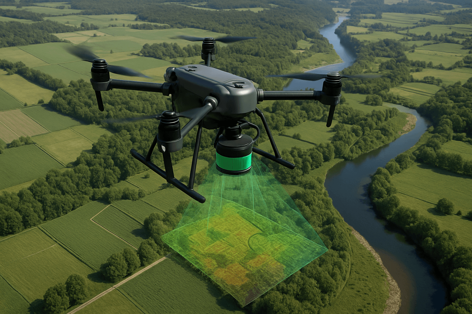
Drone LiDAR (Light Detection and Ranging) is transforming industries that rely on accurate 3D mapping and surveying. By mounting a LiDAR sensor on a drone, it’s possible to capture precise measurements of distances and elevations using laser pulses. This technology is used to create detailed 3D models of the environment, offering numerous advantages over traditional methods. This article explores the capabilities, benefits, and applications of drone LiDAR, as well as UK regulations.
What is Drone LiDAR?
Drone LiDAR involves using a drone equipped with a LiDAR sensor to collect detailed 3D data of the environment. LiDAR technology uses laser pulses to measure distances to the Earth’s surface. The sensor emits rapid light pulses, and by measuring the time it takes for these pulses to return after hitting objects, it generates highly accurate 3D point clouds of the terrain and any features on it.
Sometimes LiDAR is considered an acronym of Light Detection And Ranging, and sometimes Light Imaging, Detection, And Ranging, but it was originally a blend of the words light and radar.
How Does Drone LiDAR Work?
- Laser Pulses: The LiDAR sensor emits laser beams towards a target.
- Reflection Analysis: The reflected signal is analyzed as it returns to the LiDAR sensor.
- Distance Measurement: The time taken for the light pulses to travel to the target and back is measured, enabling precise distance calculations.
- Point Cloud Generation: Each pulse generates a data point representing a precise distance measurement. Collectively, these points form a “point cloud.”
- Data Processing: The point cloud is processed to create detailed 3D models.
- Integration with GPS: LiDAR systems often integrate with GPS to provide accurate geolocation data for each point, enhancing the spatial accuracy of the 3D models.
Components of a LiDAR System
- Laser Scanner: Emits the laser pulses.
- GPS Receiver: Tracks the precise location of the LiDAR sensor.
- Inertial Measurement Unit (IMU): Measures the orientation and motion of the sensor, compensating for any movements during data collection.
Solid-State vs. Mechanical LiDAR
- Solid-State LiDAR Systems: Known for their reliability and cost-effectiveness, these systems use coherent detection to steer laser beams electronically, utilizing infrared light to penetrate environments with high accuracy. They are compact and ideal for remote sensing on drones. An example is the DJI Zenmuse L2.
- Mechanical LiDAR Systems: Employ rotating mirrors or oscillating laser emitters to scan a full 360-degree field of view. These systems are favored for creating detailed point clouds, crucial for applications like urban planning and environmental monitoring.
Benefits of Using Drone LiDAR
Drone LiDAR offers several advantages over traditional LiDAR systems and other surveying methods:
- Flexibility and Accessibility: Reaches areas that are difficult or dangerous for ground-based surveys.
- Reduced Data Collection Time and Costs: Automates the process and covers larger areas in a shorter span. It can gather a million data points per second, making it one of the fastest surveying methods available.
- High Accuracy and Precision: Provides exceptional accuracy and precision in data capture. The ability of drones to fly at lower altitudes and capture data with high spatial resolution results in denser point clouds.
- Versatility: Captures data from different angles and altitudes, enhancing the quality and detail of the output.
- Penetration of Vegetation: Can penetrate dense vegetation, such as forests, to capture ground data and create accurate surface models.
- Cost-Effectiveness: Reduces costs and the time associated with traditional surveying techniques.
- Minimal Disruption: An increasingly important tool for collecting large amounts of data quickly, cost-effectively and with minimal disruption.
- Sustainable Technology: Enables surveys to be conducted in environmentally sensitive areas without the negative impacts associated with traditional methods, ultimately reducing a project’s carbon footprint.
Applications of Drone LiDAR
Drone LiDAR technology has found applications across a wide range of industries:
1. Surveying and Mapping
LiDAR drones can quickly and accurately capture data for large areas, including terrain, buildings, and infrastructure. This data is used to create detailed maps, identify potential hazards, and plan construction projects with a high degree of precision.
- Geological Mapping: Used in geology, land surveying, and infrastructure development.
- Land Surveying: Supports accurate land-use planning.
- Infrastructure Development: Ideal for flood risk assessment.
2. Agriculture and Forestry
LiDAR drones provide precise data on crop health, field elevation, and soil properties. This enables farmers to monitor large areas quickly, identifying issues such as disease, pest infestations, and irrigation problems. In forestry, LiDAR is used to measure tree height and location within dense forests.
- Crop Health Monitoring: Helps in early detection of crop issues, including pest infestations and diseases.
- Soil Analysis: Optimizes planting patterns.
- Irrigation Management: Helps optimize irrigation plans by mapping terrain and soil characteristics.
- Terrain Mapping: Supports precision agriculture, enhancing crop yields and resource efficiency.
- Forestry: Measure everything from the height of a canopy to the area of a single leaf, and this data is being used to classify land, manage forest fires, understand ecosystems, and take inventory of commercial forests.
3. Construction
LiDAR drones are increasingly used to create accurate 3D models of construction sites. By using LiDAR drones, construction companies can quickly and accurately assess the site, identify potential issues, and create more accurate cost estimates. This leads to more efficient construction projects and reduced costs.
- Site Inspection and Topography Analysis: Capture highly detailed 3D models of construction sites.
- Geological Surveying: Provides detailed topographic data for assessing the earth’s surface and subsurface.
- Digital Elevation Models (DEMs): Processed LiDAR data can achieve centimeter-level precision.
4. Mining
Drones offer unique perspectives for mining operations, including access to otherwise difficult-to-obtain vantage points. LiDAR drones are used to inspect mines after planned detonations to ensure the area is safe before sending in human workers. They are also used to measure ore volumes and ore extraction spaces.
- Mineral Spread Measurement: Helps to measure the mineral spread.
- Ore Volume Measurement: Used to measure ore volumes and ore extraction spaces.
5. Infrastructure Inspections
LiDAR drones are used to inspect and perform maintenance on rails, pipelines, turbines, and more. They can measure the amount of vegetation growing around a power line, greatly reducing both the time and cost of a manual survey or inspection.
- Power Line Inspections: Measuring the amount of vegetation growing around a power line.
6. Disaster Management
LiDAR drones can create an accurate and exhaustive report of any emergency situation before first responders even arrive, providing accurate information and a sweeping knowledge of visual details that otherwise may have been missed.
- Triage Assistance: Provides accurate information and a sweeping knowledge of visual details.
7. Archaeology
LiDAR drones are used to map and study ancient sites, helping archaeologists better understand the layout and architecture of ancient structures.
8. Environmental Monitoring
LiDAR drones are essential for monitoring environmental changes, such as coastal erosion, riverbank stability, and habitat mapping. They provide accurate topographic data, enabling scientists to track changes in ecosystems over time and assess the impact of climate change and human activities.
9. Urban Planning
LiDAR drones create high-resolution topographic maps, capturing detailed information about the Earth’s surface. This supports accurate land-use planning and flood risk assessment.
10. Search and Rescue
LiDAR-equipped drones can be deployed in search and rescue operations, especially in challenging terrains, to quickly map the area and identify potential hazards.
LiDAR Data Processing
LiDAR data processing translates raw point cloud data into accurate and usable information. The key steps include:
- Data Filtering and Cleaning: Performed to remove noise, outliers, and artifacts from the raw data.
- Point Cloud Classification: Involves identifying and categorizing objects such as buildings, vegetation, and roads.
- Feature Extraction: Includes feature extraction using automated classification algorithms to identify and categorize objects.
- 3D Modeling: To generate accurate 3D models.
- Data Registration: Involves merging multiple LiDAR scans into a single, cohesive dataset.
- Elevation Analysis: Involves generating Digital Elevation Models (DEMs) and contour maps from the LiDAR point cloud data.
- Data Interpretation and Visualization: Involves detecting anomalies through statistical analysis and change detection to identify issues.
- Data Fusion: Integrates LiDAR data with orthophotos, aerial imagery, or other geospatial datasets for comprehensive visualization and analysis.
Common LiDAR Data Processing Outputs
- Digital Elevation Models (DEMs)
- Contour Maps
- 3D Surface Models
- Vegetation and Terrain Classification
- Accurate Volume Calculations
UK Drone Laws and Regulations
Operating drones in the UK is governed by the Civil Aviation Authority (CAA). Regulations are designed to ensure safety, protect privacy, and maintain compliance with national regulations. Key rules include:
Registration and Identification
- Drone Registration: Anyone flying a drone weighing 250g or more needs to pass a free online test and get a flyer ID from the CAA.
- Operator ID: Drones and model aircraft must be labelled with the operator ID, visible from the outside or within an easily accessible compartment.
Operational Restrictions
- Maximum Altitude: Drones must not be flown higher than 120 meters (400 feet) above ground level, unless specific authorization from the CAA has been obtained.
- Visual Line of Sight (VLOS): Operators must keep their drone within visual line of sight at all times, without the use of visual aids like binoculars or telescopes.
- Distance from People and Property:
- Drones weighing 250 grams or more must be operated at least 150 meters away from parks, industrial areas, residential zones, and other built-up locations.
- Maintaining a minimum distance of 50 metres from persons, vehicles or buildings not under your control is mandatory unless your drone weighs less than 250 grams.
- Restricted Airspace:
- Drones must not be flown within the designated flight restriction zones around airports and airfields unless specific permission is granted.
Airspace Restrictions
- No-Fly Zones: Drones should not be flown over large gatherings of people, such as festivals, sporting events, or parades, without specific authorization.
- Temporary Restrictions: Temporary airspace restrictions are frequently put in place across the UK; operators must check for these as part of their pre-flight planning.
Penalties for Non-Compliance
Penalties for violating drone laws in the UK can include:
- Fines: Ranging from £1,000 to £7,500 depending on the severity of the violation.
- Confiscation of Drones: In cases of serious violations, the drone may be confiscated.
- Imprisonment: In extreme cases, imprisonment may be a possible penalty.
Best Practices for Compliance
- Pre-Flight Planning: Always check for airspace restrictions and temporary restrictions before each flight.
- Altitude Limits: Set altitude limits in the drone settings to avoid exceeding the maximum legal altitude.
- Visual Contact: Maintain visual contact with the drone at all times.
- Distance Monitoring: Accurately measure distances from people and built-up areas to comply with minimum distance requirements.
- Stay Informed: Regularly check for updates to drone laws and regulations from the CAA.
Drone LiDAR technology offers unparalleled precision and efficiency in data capture, making it an invaluable tool across various industries. As the technology continues to evolve, its applications will likely expand even further, driving innovation and progress in numerous sectors. By understanding the technology, its benefits, and the regulatory landscape, professionals can harness the full potential of drone LiDAR to revolutionize their work processes and make informed decisions.


