Biodiversity, the intricate web of life on Earth, faces unprecedented threats from climate change, habitat loss, and human activities. Effective conservation hinges on accurate and timely data about species distribution, population dynamics, and ecosystem health. Traditionally, gathering such ecological data has been labor-intensive, time-consuming, and often limited in scope. However, the advent of drone technology is revolutionizing biodiversity mapping, offering a powerful and versatile solution for environmental monitoring and conservation efforts.
The Imperative of Biodiversity Mapping
Biodiversity mapping serves as the foundation for informed conservation strategies, allowing scientists and policymakers to understand the current state of ecosystems, identify areas of high ecological value, and monitor changes over time. This data is crucial for creating effective conservation plans, managing natural resources, and assessing the impact of human activities on wildlife corridors.
Traditional Methods: Limitations and Labor
Conventional biodiversity assessment methods often involve extensive ground-based surveys, manned aircraft flights, or satellite imagery. These approaches, while valuable, come with significant limitations. Ground surveys can be resource-intensive, inaccurate, and may disturb wildlife, especially in remote or difficult-to-access terrains like dense forests or steep hills. Manned aircraft are costly and offer less flexibility, while satellite imagery, though broad in scale, often lacks the high resolution needed for detailed, fine-scale analysis of specific areas or individual organisms. Monitoring cryptic or nocturnal species with traditional means can also be particularly challenging and inefficient.
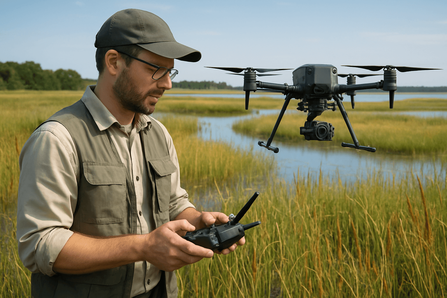
Drones: A Paradigm Shift in Ecological Monitoring
Unmanned Aerial Vehicles (UAVs), commonly known as drones, have fundamentally transformed environmental monitoring and conservation by providing an efficient, cost-effective, and less intrusive method for collecting ecological data. Their ability to access remote and challenging locations, coupled with high-resolution data capture capabilities, makes them indispensable tools for environmental scientists and conservationists.
Key Advantages of Drone Technology
The benefits of using drones in biodiversity mapping are numerous and impactful:
- Access to Inaccessible Areas: Drones can survey vast and remote regions, including dense canopies, mountainous terrain, or hazardous environments, without putting human researchers at risk.
- High-Resolution Data: Drones capture high-resolution imagery and sensor data, providing detailed information about the environment, far exceeding the resolution of satellite imagery. This allows for refined analysis of vegetation types, canopy density, and even individual plant species.
- Efficiency and Cost-Effectiveness: Drone surveys are rapid and can cover large areas more quickly and efficiently than ground-based methods, reducing both time and labor costs. Compared to manned aircraft, drones offer significant cost savings.
- Minimally Invasive Monitoring: Drones allow for the observation of animals without causing significant disturbance, enabling the collection of more naturalistic data about species in their habitats.
- Repeatability and Consistency: Drones equipped with advanced software and GPS can collect data with a high level of accuracy and replicate flight parameters, leading to better standardization of practices and precise comparisons of landscape changes over time.
Sensor Technologies for Comprehensive Data Capture
Modern lightweight UAVs can be equipped with a variety of advanced sensors, each designed to capture specific types of ecological data, thereby enhancing the richness of environmental studies.
- RGB Cameras: Standard Red, Green, Blue (RGB) cameras capture visible light, producing images similar to what the human eye sees. These are effective for mapping missions, generating orthomosaics, point clouds, and digital elevation models, which are crucial for detailed habitat mapping and land-use assessment.
- Multispectral and Hyperspectral Sensors: These sensors capture data across different wavelengths beyond the visible spectrum, providing detailed information on vegetation health, water bodies, and soil conditions. Multispectral sensors measure up to 15 wavebands, while hyperspectral sensors measure over 100 continuous bands, enabling the detection of minute differences in spectral signatures, which can indicate plant stress or species type.
- LiDAR (Light Detection and Ranging): LiDAR sensors emit laser pulses to create detailed 3D models of terrain and vegetation structure. They can penetrate dense canopies to map the ground beneath and collect data on vegetation height, canopy extents, and even individual trees, crucial for woodland management and biomass estimation.
- Thermal Sensors: Thermal imaging cameras detect heat signatures, allowing for the monitoring of nocturnal animals or those hidden by dense vegetation. They can also identify stressed or diseased vegetation, as unhealthy plants may exhibit altered thermal outputs.
Methodologies and Applications in Biodiversity Mapping
Drone surveys are being applied across a wide range of biodiversity mapping and environmental monitoring initiatives.
Vegetation Health and Species Identification
By combining high-resolution RGB imagery with multispectral and hyperspectral data, drones can accurately map vegetation cover, assess plant health, and even distinguish between different plant species. This is particularly valuable for tracking changes in forest health, identifying areas affected by disease (e.g., ash dieback), or monitoring reforestation efforts.
Wildlife Monitoring and Population Estimation
Drones provide a non-intrusive way to monitor animal populations, track movements, and study behaviors without disturbing wildlife. Equipped with thermal cameras, they can locate animals day or night. This technology has been successfully used to track endangered species like rhinoceros, elephants, sea turtles, and orangutans, aiding anti-poaching efforts and monitoring nesting sites. Drones can also provide data on animal movements, migration routes, and territory habits, reducing the need for physical tagging.
Habitat Mapping and Assessment
UAV technology plays a critical role in biodiversity conservation by enabling the detailed mapping of habitats and the species that inhabit them. Drones help identify patterns of habitat use, assess the impacts of human activity on wildlife corridors, and map forest canopy gaps. They can also be used to map coral reefs and assess their health, track bleaching events, and monitor recovery over time, which is vital for marine biodiversity.
Invasive Species Detection
Drones can efficiently cover large areas to detect the presence and spread of invasive species, allowing for timely intervention and management. Their high-resolution imagery can pinpoint new outbreaks that might be missed by ground surveys.
Challenges and Considerations
Despite their immense potential, the widespread adoption of drone surveys for biodiversity mapping faces several challenges.
Technical Limitations and Data Processing
While rapidly advancing, drone technology still has limitations. Battery capacity can restrict flight duration and coverage area, necessitating multiple flights and careful planning. Weather conditions such as high winds, rain, or extreme temperatures can impact flight operations and data quality. Furthermore, the sheer volume of high-resolution data generated by drone surveys requires significant computational resources and specialized software for processing and analysis, often involving advanced AI and machine learning algorithms. Ensuring accuracy and consistency in data interpretation remains an area of ongoing development.
Regulatory and Ethical Frameworks
The increasing use of drones, particularly in sensitive natural environments and near human communities, raises concerns about data ownership, privacy, and potential disturbance to wildlife. Strict regulations govern drone use in many protected areas, emphasizing the need for guidelines that balance technological innovation with ethical wildlife conservation practices. Studies show that drone altitude, speed, and noise levels can influence wildlife responses, highlighting the importance of responsible drone operation to minimize stress on animals.
Cost and Accessibility
While often more cost-effective than traditional methods in the long run, the initial investment in professional-grade drones and specialized sensors can be substantial. This can limit accessibility for smaller conservation groups or researchers with limited budgets. However, the decreasing cost of high-quality drones is enabling wider adoption.
Case Studies and Real-World Impact
Numerous success stories demonstrate the transformative impact of drone surveys in biodiversity mapping:
- Rhinoceros Protection: Drones equipped with night-vision cameras patrol African game reserves, providing live feeds to anti-poaching units, significantly reducing poaching incidents.
- Koala Monitoring: Studies have shown that drone-captured imagery combined with machine learning can provide unbiased detection data for species like koalas, overcoming biases present in traditional ground surveys.
- Orangutan Monitoring: Pioneers in conservation drone technology have successfully used UAVs to monitor orangutan populations in Southeast Asia.
- Gorilla Habitat Protection: AI-powered drones and satellite imagery are used to create comprehensive maps of gorilla habitats, identifying threats and guiding conservation strategies.
- Coral Reef Health: Drones provide high-resolution imagery to detect changes in reef structures and track bleaching events, vital for marine biodiversity conservation.
The Future of Drone-Enabled Biodiversity Conservation
The future of drone technology in environmental science is bright, with continuous advancements promising to enhance their capabilities further. Integration with artificial intelligence (AI) and machine learning is a key trend, enabling drones to automatically identify and track species, detect environmental changes, and predict future trends, thereby significantly reducing data analysis time. Swarming technology, where multiple drones work cooperatively, has the potential to cover vast areas more quickly and efficiently, providing comprehensive ecosystem data.
Furthermore, the development of new and more specialized sensors, coupled with increased accessibility and ongoing refinement of data processing techniques, will solidify drones as indispensable tools for protecting the planet and ensuring the sustainability of natural resources. As drone technology continues to evolve, it will play an increasingly vital role in informing policy, supporting decision-making, and driving effective biodiversity conservation efforts worldwide.


