The rapid advancement of Unmanned Aerial Systems (UAS), commonly known as drones, has revolutionized surveying and mapping, offering unprecedented opportunities for data collection. These aerial platforms can capture high-resolution imagery and spatial information with remarkable speed and efficiency, transforming traditional labor-intensive methods. However, the true power of drone-collected data is unlocked through meticulous post-processing and seamless integration into Geographic Information Systems (GIS). This crucial step transforms raw aerial captures into actionable intelligence, enabling professionals across diverse industries to make informed decisions and develop detailed spatial analyses.
Understanding Drone Survey Data Acquisition
Drone surveys involve deploying UAVs equipped with various sensors, such as RGB cameras, multispectral cameras, thermal cameras, and LiDAR systems, to collect aerial data over a designated area. The most common method for creating maps and 3D models from drone imagery is photogrammetry. Photogrammetry is the science of making measurements from photographs, combining multiple overlapping 2D images to reconstruct a 3D representation of terrain or objects. As drones follow pre-programmed flight paths, they capture thousands of photographs, with each image tagged with coordinates.
These high-resolution aerial images, when combined with accurate GPS data often from ground control points (GCPs), form the foundation for creating precise 3D maps and models. Unlike traditional methods that might provide only discrete data points, a single drone flight can yield thousands of measurements, offering a rich dataset for analysis. This data is invaluable for applications in civil construction, mining, agriculture, waste management, environmental monitoring, and urban planning.
The Critical Role of Post-Processing
Raw drone data, while abundant, is not immediately ready for sophisticated spatial analysis or direct use in GIS. Post-processing is the essential intermediate step that transforms this raw data into accurate, georeferenced, and usable outputs. It involves a series of computational tasks to stitch images, correct distortions, and generate various spatial products like orthomosaics, point clouds, and elevation models. Without proper post-processing, the full potential of drone-collected data for GIS integration remains untapped, leading to inaccuracies and limiting analytical capabilities.
Key Steps in Post-Processing Drone Data
The post-processing workflow for drone survey data typically involves several critical stages to ensure accuracy and readiness for GIS.
Data Import and Initial Assessment
The first step involves importing the raw images and associated metadata (e.g., GPS coordinates, camera parameters) into specialized photogrammetry software. An initial assessment includes checking image quality, consistency, and sufficient overlap between images, which is crucial for reliable 3D point cloud generation. Insufficient overlap can lead to “NoData” holes in the final products.
Georeferencing and Ground Control Points (GCPs)
Accurate georeferencing is paramount to ensure that the drone data precisely aligns with real-world coordinates. This is often achieved through the use of Ground Control Points (GCPs). GCPs are clearly identifiable targets placed on the ground within the survey area, whose precise real-world coordinates are measured using traditional survey methods (e.g., RTK GPS). These points serve as critical reference points, allowing the photogrammetry software to correctly position and scale the entire dataset. Drones equipped with RTK (Real-Time Kinematic) or PPK (Post-Processed Kinematic) positioning systems can significantly enhance geospatial data accuracy, achieving survey-grade standards and often reducing the need for numerous GCPs.
Image Alignment and Bundle Adjustment
Specialized software uses photogrammetry algorithms to identify common “tie points” across overlapping images. By analyzing the slight differences in the position of these tie points from various perspectives, the software can accurately align all images in a process known as bundle adjustment. This step corrects for lens distortions, camera tilt, and drone movement, creating a seamless and geometrically correct representation of the surveyed area.
Point Cloud Generation
Once images are aligned, the software generates a dense point cloud. A point cloud is a collection of millions or even billions of 3D points, each with X, Y, and Z coordinates, representing the exact location and elevation of features on the ground. This dense dataset is a fundamental output, providing a highly detailed 3D model of the surveyed area.
Orthomosaic Generation
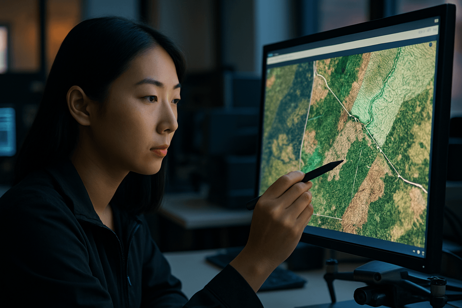
An orthomosaic is a high-resolution, georeferenced image created by stitching together hundreds or thousands of individual drone photographs. Unlike standard aerial photographs, an orthomosaic has been geometrically corrected (orthorectified) to remove distortions caused by camera angle, terrain variations, and lens imperfections, making it a true-to-scale representation of the Earth’s surface. This allows for accurate distance and area measurements directly from the map.
Digital Elevation Model (DEM) and Digital Surface Model (DSM) Creation
From the point cloud, two essential elevation models can be derived:
- Digital Surface Model (DSM): Represents the Earth’s surface, including all features on it, such as buildings, vegetation, and other structures.
- Digital Elevation Model (DEM): Represents the bare-earth terrain, with all surface objects (like buildings and trees) digitally removed. This is particularly useful for hydrological modeling, terrain analysis, and civil engineering projects.
Data Classification
(Optional but highly beneficial) Point cloud classification involves categorizing individual points within the point cloud based on what they represent (e.g., ground, vegetation, buildings, power lines). This classification allows users to extract specific features or remove unwanted elements, such as vegetation, to generate a bare-earth DEM from an original DSM.
Common Drone Data Outputs for GIS
Processed drone data yields several versatile products crucial for GIS applications:
- Orthomosaics: High-resolution, georeferenced 2D maps that are geometrically corrected for accurate measurements. They provide a visual context that point clouds alone cannot.
- Point Clouds: Dense 3D datasets containing millions of points, each with precise X, Y, and Z coordinates, representing the three-dimensional structure of the surveyed area.
- Digital Surface Models (DSMs) and Digital Terrain Models (DTMs): Raster datasets that provide elevation information, with DSMs including surface features and DTMs representing the bare earth.
- Contour Lines: Lines connecting points of equal elevation, generated from DEMs or DTMs, essential for topographic mapping and site planning.
- 3D Meshes: Textured 3D models that offer a visually rich and detailed representation of structures and landscapes.
- Specialized Maps: Products like Normalized Difference Vegetation Index (NDVI) maps, derived from multispectral drone data, are vital for agriculture and environmental monitoring to assess vegetation health.
Integrating Processed Drone Data into GIS
Integrating processed drone data into GIS platforms is where its analytical power truly shines. This involves importing the generated outputs and layering them with existing geospatial datasets for comprehensive analysis and visualization.
Compatible Data Formats
For seamless integration, drone data must be exported in formats compatible with GIS software. Common formats include:
- GeoTIFF: For orthomosaics, DSMs, DTMs, and other raster data, as it embeds precise geospatial information directly into the image file.
- LAS/LAZ: For point cloud data, providing efficient storage and display of dense 3D points.
- SHP (Shapefile): For vector data, such as extracted features, contour lines, or linework deliverables.
- DXF/DWG: Commonly used for CAD integration, especially for linework and design projects.
Workflow and GIS Platforms
Once processed, these data products can be imported into leading GIS software such as ArcGIS Pro, QGIS, Esri Site Scan for ArcGIS, Pix4D, DroneDeploy, Agisoft Metashape, and Propeller. Within these platforms, users can:
- Visualize and Layer Data: Combine orthomosaics with cadastral maps, utility networks, or environmental datasets.
- Perform Spatial Analysis: Conduct volumetric calculations (e.g., stockpile volumes), analyze slopes and aspects, perform line-of-sight analysis, and detect changes over time.
- Create Advanced Maps and Models: Generate detailed topographic maps, 3D building models, and custom thematic maps for various applications.
- Share and Collaborate: Disseminate maps and analytical results through web GIS platforms and dashboards for collaborative decision-making.
Challenges and Best Practices
While highly beneficial, integrating drone data into GIS comes with its own set of challenges and demands adherence to best practices.
Challenges in Drone Data Integration
- Large Data Volumes: Drone surveys generate massive datasets, requiring significant computational power, storage, and robust processing capabilities.
- Computational Intensity: Processing raw images into high-quality 2D and 3D products is computationally demanding and time-consuming.
- Accuracy Considerations: Achieving survey-grade accuracy requires careful planning, proper use of GCPs, and appropriate hardware (RTK/PPK drones).
- Regulatory Compliance: Navigating the evolving regulations for commercial drone operation can pose challenges.
- Data Management and Collaboration: Sharing and managing large, complex spatial datasets among multiple stakeholders can be difficult without cloud-based solutions and standardized workflows.
Best Practices for Optimal Results
- Thorough Flight Planning: Design flight paths with adequate forward and side overlap (often 70-80% forward and 60-70% side overlap) to ensure data redundancy and minimize occlusions. Maintain a consistent Ground Sample Distance (GSD) and altitude relative to the terrain.
- Strategic GCP Placement: Use a sufficient number of well-distributed GCPs (typically at least five: one in each corner and one in the center for projects) to ensure uniform accuracy across the project area, especially when high absolute accuracy is required.
- Quality Imagery Capture: Ensure images are sharp, well-exposed, and free from motion blur. Optimal weather conditions (minimal wind, consistent lighting) are crucial for data quality.
- Utilize Advanced Software: Invest in professional photogrammetry and GIS software solutions (e.g., Pix4D, DroneDeploy, ArcGIS, Agisoft Metashape) designed to handle drone data efficiently and accurately.
- Metadata Management: Maintain comprehensive metadata for all drone datasets, including flight parameters, sensor details, processing settings, and accuracy reports, to ensure data traceability and usability.
- Data Validation: Implement GIS-driven validation tools to check for spatial inconsistencies and continuously assess data quality. Using checkpoints to quantify accuracy is recommended.
The Future of Drone Data in GIS
The integration of drones and GIS is a rapidly evolving field, poised for even greater impact. Continued advancements in drone hardware, sensor technology (e.g., improved LiDAR, hyperspectral cameras), and artificial intelligence (AI) will further streamline data collection and processing. AI and machine learning are increasingly being leveraged for automated feature extraction, object recognition, and change detection, reducing manual effort and enhancing the insights derived from drone data.
The shift towards cloud-based processing and real-time data streaming will enable faster turnaround times and more accessible collaboration across teams and organizations. As regulations mature and technology becomes even more user-friendly, drone survey data will become an even more indispensable component of GIS workflows, supporting smarter decision-making in precision agriculture, urban development, disaster management, infrastructure inspection, and countless other applications globally.

