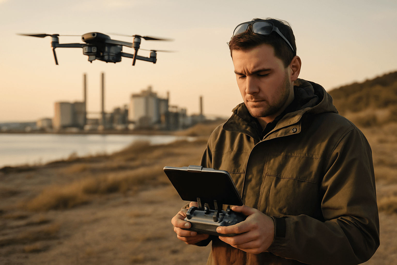
The insidious spread of pollution, whether in our air, water, or soil, poses a monumental threat to environmental health and human well-being. Identifying and precisely mapping these pollution sources has traditionally been a labor-intensive, costly, and often hazardous undertaking. However, a silent revolution is underway in environmental monitoring: the deployment of drones. These unmanned aerial vehicles (UAVs) are rapidly transforming our ability to detect, quantify, and visualize pollution, offering unprecedented efficiency, accuracy, and safety in the fight against environmental degradation.
The Growing Need for Advanced Pollution Mapping
Traditional methods for monitoring pollution often involve ground-based sampling, which can be limited by accessibility, terrain, and the sheer scale of the areas needing assessment. Satellite imagery offers broad coverage but may lack the high-resolution detail necessary for pinpointing specific contamination hotpots or tracking subtle changes over time. The manual collection of samples can also expose personnel to dangerous substances, making real-time, comprehensive monitoring a significant challenge. These limitations underscore the urgent demand for innovative solutions that can provide a clearer, more dynamic picture of environmental pollution.
How Drones Revolutionize Pollution Source Identification
Drones have emerged as versatile and powerful tools for environmental monitoring due to their ability to access difficult-to-reach locations and collect high-resolution data rapidly and safely. Equipped with an array of sophisticated sensors, drones can systematically survey vast areas, gathering critical information that was previously unattainable. This aerial perspective allows for the creation of detailed maps and 3D models, offering a comprehensive understanding of pollution distribution and potential sources.
Sensor Technologies for Environmental Monitoring
The effectiveness of drones in pollution mapping hinges on the advanced sensor technologies they carry. These miniaturized instruments are capable of detecting a wide range of pollutants and environmental parameters:
- Imaging Sensors:
- Visible-light (RGB) cameras: Provide high-resolution imagery for visual assessment, tracking land-use changes, illegal dumping, and identifying visible plumes or spills.
- Multispectral and Hyperspectral cameras: Capture images across numerous wavelengths, including those invisible to the human eye. Different chemicals and minerals reflect light uniquely, creating a “spectral fingerprint” that allows software to identify specific pollutants and assess vegetation health, which can be an indicator of underlying soil or water contamination. These are particularly useful for forest and vegetation monitoring and assessing their health based on optical characteristics.
- Thermal-infrared sensors: Detect temperature anomalies, which can indicate heat plumes from industrial sources, underground fires in landfills, or even the presence of certain chemical reactions. They are also used to monitor methane emissions, which are colorless and odorless.
- Gas Detection Sensors: Lightweight, miniaturized instruments designed specifically for UAV platforms can detect a variety of airborne pollutants, including:
- Particulate Matter (PM2.5, PM10)
- Carbon Monoxide (CO)
- Carbon Dioxide (CO2)
- Nitrogen Dioxide (NO2) and Nitrogen Oxides (NOx)
- Sulfur Dioxide (SO2)
- Volatile Organic Compounds (VOCs)
- Methane (CH4). These sensors enable drones to generate 3D air quality maps and analyze pollutants in real time.
- LiDAR (Light Detection and Ranging) technology: Creates detailed 3D models and topographic maps, which can be invaluable for understanding terrain, tracking land-use changes, and assessing the physical impact of pollution.
- Gamma-ray spectrometers: These sensors, now small enough to be drone-mounted, measure natural and man-made radionuclides to map soil texture and contamination, even in inaccessible areas.
Data Collection and Analysis Workflow
The process of using drones for pollution mapping typically involves several key steps:
- Mission Planning: Defining the survey area, desired data types, and flight paths. Drones can be programmed for autonomous flight along pre-planned routes.
- Data Acquisition: Drones equipped with appropriate sensors fly over the target area, collecting high-resolution images, spectral data, and air/water quality readings. For water pollution, drones can even collect physical water samples.
- Data Processing: Raw data is processed using specialized software to create detailed maps, 3D models, and visualizations of pollution levels and distribution. Cloud-based systems are often used for scalability and accessibility.
- Analysis and Interpretation: Environmental professionals analyze the generated maps and data to identify pollution hotspots, pinpoint sources, track plume movements, and assess the extent of contamination. Machine learning algorithms can be employed for advanced analysis and prediction of contamination levels.
- Reporting and Remediation: The insights gained inform public health decisions, regulatory policies, and the development of targeted remediation strategies.
Key Applications of Drones in Pollution Mapping
Drones offer a wide range of applications across various environmental sectors:
Air Quality Monitoring
Drones are revolutionizing air quality monitoring by providing highly mobile, real-time, and high-resolution data collection, especially in challenging urban or industrial environments. They can map pollutants like particulate matter (PM2.5, PM10), carbon monoxide, nitrogen dioxide, and volatile organic compounds across cities, industrial zones, and natural landscapes. This capability allows for:
- Source Detection: Drones can fly directly into plumes from factories, airports, highways, or even wildfires to pinpoint emission sources and track their dispersal patterns.
- 3D Mapping: Creating detailed 2D and 3D maps of air quality, showing concentration levels at different elevations.
- Hotspot Identification: Quickly identifying areas with elevated pollutant concentrations to inform public health warnings and regulatory actions.
Water Pollution Detection
Maintaining water quality is a critical concern, and drones are proving invaluable for monitoring water bodies. Drones equipped with sensors can identify pollution sources, track changes in water temperature, and measure pollutant levels such as pH, dissolved oxygen, and various chemical contaminants.
- Oil Spills and Chemical Discharges: Drones can rapidly survey large water bodies to detect and map spills, assess their spread, and guide remediation efforts without endangering human personnel.
- Agricultural Runoff and Algal Blooms: Monitoring nutrient levels and identifying harmful algal blooms, which can severely impact aquatic ecosystems and human health.
- Illegal Dumping: Surveilling remote waterways for illegal dumping of waste that can leach pollutants into the water.
- Water Sampling: Some drones are designed to collect physical water samples from various depths for detailed laboratory analysis, particularly useful in hazardous or hard-to-reach areas.
Soil and Land Contamination Assessment
Mapping soil contamination is essential for land management and remediation. Drones can assess soil properties and detect contaminants with unprecedented spatial resolution.
- Heavy Metal and Chemical Contamination: Hyperspectral cameras and gamma-ray spectrometers can detect how soil interacts with different types of energy, revealing the presence and distribution of heavy metals, chemicals, and radioactive elements, especially near mining or industrial sites.
- Land Degradation: Tracking land-use changes, deforestation, and habitat degradation to identify areas prone to erosion or contamination.
- Waste Sites: Assessing contamination around landfills and industrial waste sites.
Waste Management and Illegal Dumping Surveillance
Drones are transforming waste management by providing efficient and safe solutions for monitoring landfills and detecting illegal dumping.
- Landfill Monitoring: Drones can conduct volumetric surveys to monitor landfill capacity, identify potential fire hazards through thermal imaging, and detect methane emissions from a safe distance.
- Illegal Dumping Enforcement: Their ability to cover large areas quickly and capture high-resolution imagery makes them ideal for identifying illegal dumpsites, especially in remote or difficult-to-access zones.
Advantages of Drone-Based Pollution Mapping
The adoption of drones for pollution mapping offers numerous benefits over traditional methods:
- Efficiency and Speed: Drones can cover vast areas in a fraction of the time required for ground-based surveys, providing rapid data collection for timely intervention and response.
- Enhanced Accuracy and Resolution: Flying at lower altitudes than satellites allows drones to capture high-resolution imagery and sensor data, reducing errors and providing more precise localization of pollution sources.
- Safety: Drones can access hazardous or difficult-to-reach environments (e.g., toxic spills, dense industrial areas, remote terrains) without risking human life.
- Cost-Effectiveness: While initial equipment costs exist, drones often offer a more affordable alternative to traditional methods like helicopters or extensive manual labor, reducing personnel hours and overall operational expenses.
- Real-time Data: Many drone systems can provide real-time data transmission, allowing for immediate insights and quicker decision-making in environmental emergencies.
- Minimized Environmental Impact: Drones operate with a smaller carbon footprint compared to larger manned aircraft or vehicles used for surveys.
Challenges and Future Outlook
Despite their immense potential, drone-based environmental monitoring faces certain challenges:
- Regulatory Hurdles: Strict regulations regarding flight altitude, no-fly zones, and licensing can limit drone operations in many countries.
- Technical Limitations: Factors like limited battery life, payload capacity, and susceptibility to adverse weather conditions (rain, fog, wind) can hinder operations and sensor accuracy.
- Data Management and Processing: The sheer volume of high-resolution data collected by drones requires robust storage, processing, and analytical solutions, often demanding expensive hardware and specialized expertise.
- Sensor Calibration and Interpretation: Accurate calibration of sensors and skilled interpretation of complex data are crucial to ensure reliable pollution assessment.
Looking ahead, advancements in drone technology, including longer endurance, increased autonomy, and improved payload capacities, will further enhance their capabilities. The integration of artificial intelligence (AI) and machine learning will streamline data analysis, enabling more sophisticated pattern recognition and predictive modeling of pollution spread. Furthermore, developing lighter, more sensitive, and multi-functional sensors will expand the range of detectable pollutants and environmental parameters. The concept of drone swarms, working cooperatively, could provide even more comprehensive coverage and real-time monitoring over vast areas.
Conclusion: A Clearer Picture for a Healthier Planet
Drones are unequivocally redefining the landscape of environmental monitoring and pollution mapping. By offering unparalleled perspectives, precision, and efficiency, they empower scientists, policymakers, and conservationists with the tools needed to understand and combat pollution more effectively. As technology continues to evolve, drones will play an increasingly vital role in safeguarding our planet, enabling us to see the unseen, address environmental threats proactively, and work towards a healthier, more sustainable future for all.


