In an era where precision is paramount for sustainable agriculture, drone photogrammetry has emerged as a transformative technology, offering farmers and agronomists unprecedented insights into their fields. Moving beyond traditional, time-consuming scouting methods, Unmanned Aerial Vehicles (UAVs) equipped with advanced sensors provide high-resolution aerial imagery and data across entire fields in a fraction of the time. This article delves into the meticulous process of creating detailed field maps using drone photogrammetry, empowering agricultural professionals with evidence-driven practices for optimizing crop health, managing resources, and boosting yields.
What is Drone Photogrammetry?
Drone photogrammetry involves using drones equipped with cameras to capture overlapping aerial photographs of a surveyed area. These images are then processed using specialized software to create detailed 2D maps (orthomosaics) and 3D models of the terrain. The technique works by taking multiple pictures from different angles, allowing software to stitch them together and reconstruct a three-dimensional representation of the ground, capturing intricate details.
The Power of Drones in Precision Agriculture
Integrating drone mapping into agriculture delivers significant value, enhancing operational efficiency, boosting yields, minimizing costs, and promoting environmental stewardship.
Key Benefits of Drone Field Mapping:
- Improved Crop Monitoring: Drones provide high-resolution images that enable farmers to monitor crop health, detect stress, and identify anomalies like disease, pest damage, or irrigation problems early with unparalleled accuracy. This leads to timely intervention and optimized resource allocation.
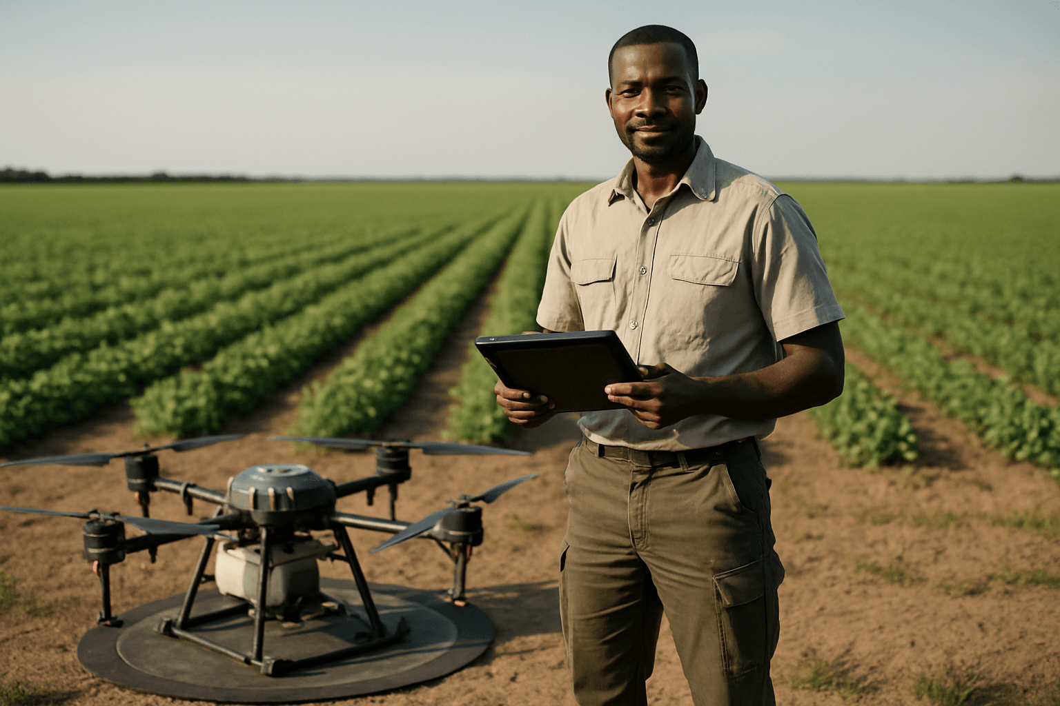
- Precision Agriculture Made Easy: Drones collect real-time data on soil conditions, moisture levels, and plant density, making precision agriculture more accessible. This allows for targeted application of fertilizers, pesticides, and water exactly where needed, optimizing resource use and boosting productivity.
- Enhanced Soil and Field Analysis: Drones can capture detailed 3D maps that offer valuable insights into soil composition, moisture levels, and topography. This helps identify areas prone to erosion or waterlogging, guiding informed decisions on planting and irrigation.
- Better Land Management and Planning: Detailed field maps aid in land management, allowing farmers to delineate boundaries, track changes in land use, and plan infrastructure development.
- Yield Prediction and Optimization: By monitoring crop development stages and analyzing data, drones can help predict yields with a high degree of accuracy, assisting farmers in planning harvests, logistics, and sales.
- Environmental Stewardship: Drones minimize the environmental impact often associated with traditional surveys, operating quietly, having a low carbon footprint, and enabling targeted applications that reduce chemical use.
Essential Equipment for Detailed Drone Field Mapping
Achieving high-quality, accurate field maps requires a combination of robust hardware and powerful software.
1. Mapping Drone:
- High-Resolution Camera: Look for drones with cameras offering high megapixel counts (e.g., 20MP or greater) and a mechanical shutter. A mechanical shutter is preferred over an electronic one to prevent motion blur and ensure crisp, distortion-free images, crucial for accurate photogrammetry.
- Stability and Flight Time: Stable flight ensures quality image capture, while longer flight times allow for extensive area coverage, especially for large agricultural fields.
- GPS Accuracy (RTK/PPK): Drones equipped with Real-Time Kinematic (RTK) or Post-Processed Kinematic (PPK) technology provide centimeter-level accuracy by correcting GPS data. While RTK offers real-time corrections, PPK processes data after the flight. These systems significantly reduce the need for numerous ground control points.
- Sensor Type:
- RGB Cameras: Suitable for creating orthomosaic maps for visual inspection, identifying areas with unhatched seeds, or assessing general damage.
- Multispectral Sensors: Essential for assessing crop health, detecting plant stress, and identifying nutrient deficiencies. These sensors capture images at specific wavelengths (e.g., green, red, red edge, near-infrared) to generate vegetation indices like NDVI (Normalized Difference Vegetation Index).
- Thermal Sensors: Used to detect irrigation issues or areas receiving too much or too little moisture.
- LiDAR Sensors: While more expensive, LiDAR uses laser pulses to create highly accurate 3D point clouds, capable of penetrating dense foliage to map the bare earth beneath, valuable for precise terrain mapping and drainage analysis.
2. Ground Control Points (GCPs) and RTK/PPK Base Stations:
- GCPs: These are identifiable markers placed on the ground with precisely known coordinates, measured using high-precision GPS equipment. GCPs act as “anchors” to tie your drone’s aerial imagery to the real world, significantly enhancing the geospatial accuracy of the maps, reducing errors from meters to centimeters.
- RTK/PPK Base Station: A ground base station works with RTK/PPK drones to correct GPS signals, providing highly accurate positional data for images. Even with RTK drones, GCPs can provide an independent check and further calibrate data, especially for absolute accuracy.
3. Flight Planning Software:
- These applications allow pilots to set flight parameters such as altitude, image overlap, and flight paths, often automating the mission.
4. Photogrammetry Processing Software:
- This specialized software is the “engine” that processes drone-captured images into 2D maps and 3D models. Popular options include Pix4D (e.g., Pix4Dfields, Pix4Dmapper) and DroneDeploy, which offer solutions for agricultural mapping, generating orthomosaics, vegetation index maps, and digital surface models (DSMs).
5. Geographic Information System (GIS) Software:
- Platforms like ArcGIS and QGIS are crucial for the analysis and interpretation of processed drone data. They allow farmers to discover spatial patterns, establish management zones, and prioritize actions based on spatial variability by overlaying drone imagery over pre-existing GIS layers.
The Workflow: Step-by-Step Guide to Detailed Field Mapping
Creating accurate and detailed field maps involves a systematic process:
1. Mission Planning
- Define Area of Interest: Clearly outline the boundaries of the field to be mapped. It’s often recommended to include a margin beyond the direct area of interest to ensure complete and accurate reconstruction.
- Determine Flight Parameters:
- Altitude: Lower altitudes generally yield higher Ground Sample Distance (GSD), meaning more detail per pixel, but require more photos and longer flight times. Higher altitudes cover more area but result in lower resolution.
- Image Overlap: Essential for photogrammetry, ensure at least 75% front overlap (between consecutive images) and 60% side overlap (between flight lines) to ensure seamless stitching and prevent gaps.
- Flight Speed: Adjust speed to ensure images are captured without motion blur, especially with electronic shutters, though mechanical shutters mitigate this.
- Regulatory Compliance: Be aware of local aviation regulations and obtain necessary permits for drone operations.
2. Data Acquisition (Flight Execution)
- Set Up Ground Control Points (GCPs): If not using an RTK/PPK drone exclusively for relative accuracy, strategically place GCPs across the field. They should be visible from the air, typically 0.5m x 0.5m, in highly contrasting colors, with an easily identifiable center point. A minimum of five GCPs (four corners and one center) is often recommended for smaller areas, with more for larger, irregular fields.
- Execute Automated Flight: Use flight planning software to execute the pre-programmed mission. The drone will automatically capture georeferenced images along its path.
3. Data Processing (Photogrammetry Software)
- Import and Organize Images: Upload all captured images into your chosen photogrammetry software.
- Image Stitching and Georeferencing: The software uses algorithms to identify common features across overlapping images and stitches them together. If GCPs were used, their precise coordinates are input into the software to align and scale the stitched images to real-world coordinates, enhancing absolute accuracy.
- Generate Outputs: The software will generate various outputs, including:
- Orthomosaic Maps: High-resolution, georeferenced 2D maps where all features are at a uniform scale, free of distortions.
- Digital Surface Models (DSMs): Represent the elevation of the terrain, including objects like crops, buildings, and trees.
- Digital Terrain Models (DTMs): Filter out objects to show the bare earth elevation, useful for drainage analysis.
- Point Clouds: A collection of 3D data points representing the surveyed area.
- Vegetation Index Maps: Using multispectral data, these maps (e.g., NDVI, NDRE) visualize plant health and vigor.
4. Output Analysis and Interpretation (GIS Software)
- Import Data into GIS: Transfer the processed orthomosaics, DSMs, and index maps into GIS software.
- Perform Spatial Analysis: Use GIS tools to analyze the data. This can include:
- Crop Health Analysis: Identify stressed areas, nutrient deficiencies, or pest infestations using vegetation indices.
- Variability Mapping: Create zones based on soil type, moisture levels, or plant vigor for variable rate application of inputs.
- Drainage Analysis: Use DSMs/DTMs to understand water flow and identify areas prone to waterlogging or erosion.
- Yield Estimation: Combine drone data with machine learning algorithms for predictive yield models.
- Generate Prescription Maps: Based on analysis, create actionable prescription maps for precision sprayers, fertilizer applicators, or irrigation systems.
- Monitor Changes Over Time: Regularly mapping fields allows for comparisons across growth stages and seasons, providing season-long insights and enabling effective change detection.
Key Considerations for Accurate Maps
- Image Quality: High-resolution images from a quality camera are fundamental.
- Overlap: Sufficient image overlap is crucial for successful photogrammetric reconstruction.
- Ground Control Points (GCPs): When absolute accuracy is critical, GCPs are indispensable for tying maps to real-world coordinates and reducing error.
- RTK/PPK Drones: These systems significantly improve geotagging accuracy, potentially reducing the number of GCPs needed.
- Flight Altitude and GSD: Understand the relationship between flight height and ground sample distance to achieve the desired level of detail and accuracy.
- Software Selection: Choose photogrammetry and GIS software that aligns with your project’s needs, offering the necessary processing power and analytical tools.
Applications in Precision Agriculture
Detailed field maps derived from drone photogrammetry enable a myriad of precision agriculture applications:
- Variable Rate Application: Precisely apply fertilizers, pesticides, and herbicides only where needed, reducing waste and optimizing costs.
- Irrigation Management: Optimize irrigation schedules by identifying areas of water stress or over-watering.
- Disease and Pest Detection: Early identification of issues allows for targeted treatment, minimizing crop loss.
- Crop Scouting and Monitoring: Rapidly assess crop health across vast areas, saving time and labor compared to traditional methods.
- Stand Count and Plant Emergence: Accurately count plants and track emergence for replanting decisions and yield prediction.
- Damage Assessment: Quickly identify and quantify damage from weather events, pests, or disease for insurance claims or remedial action.
Future Trends
The integration of drones and GIS in agriculture is continuously evolving. Future developments include enhanced AI and machine learning for data analysis, improved sensor technology, longer flight times, and more seamless integration with other smart farming technologies (IoT). These advancements will further empower farmers with predictive models and automated decision-support systems, leading to an even more productive, robust, and sustainable agricultural industry.
By mastering the art of drone photogrammetry, agricultural professionals can unlock unparalleled insights, transforming raw data into actionable intelligence that drives efficiency, profitability, and environmental sustainability in modern farming.


