For centuries, the meticulous work of cadastral surveyors has formed the bedrock of land ownership, property rights, and taxation. Traditionally, this involved painstaking manual measurements across challenging terrains, a process often time-consuming, labor-intensive, and fraught with safety risks. Today, a new era is dawning, with Unmanned Aerial Systems (UAS), commonly known as drones, transforming how these essential surveys are conducted, offering unprecedented levels of efficiency, accuracy, and safety.
This article explores the burgeoning role of drones in cadastral surveying, detailing their capabilities, the benefits they bring, the challenges they present, and the future outlook for this critical application of modern technology.
What is Cadastral Surveying?
Cadastral surveying is a specialized branch of land surveying focused on defining, measuring, and re-establishing real property boundaries. It is fundamental to land administration and management, providing the legal and spatial framework for land ownership, property valuation, and dispute resolution. Cadastral surveys involve interpreting property laws, delineating physical boundaries, and recording dimensions, areas, and associated rights, whether on land or water, or defined by natural or artificial features. These surveys are crucial for creating official and legal records of land ownership, supporting processes like land subdivision, property transfer, and tax assessments.
Historically, cadastral surveyors relied on equipment like total stations, electronic distance meters, and GPS receivers to establish baselines and conduct measurements on the ground. The data collected would then be used to produce plans, maps, and other legal documentation.
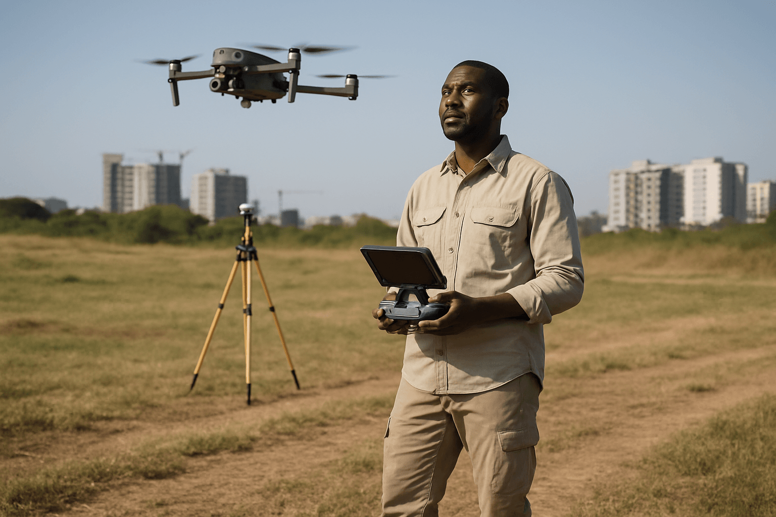
How Drones are Used in Cadastral Surveying
Drones equipped with advanced sensors and cameras have emerged as powerful tools in land surveying, capable of evaluating large plots of land rapidly and accurately. The process typically involves several key steps:
Flight Planning
Surveyors utilize specialized drone mapping software to design precise flight paths. This ensures comprehensive coverage of the survey area, factoring in altitude, speed, and terrain.
Data Acquisition
As the drone follows its pre-planned course, it captures georeferenced imagery and other sensor data. High-resolution cameras are standard, often augmented with advanced sensors like LiDAR (Light Detection and Ranging) or multispectral cameras for more specialized insights.
Data Processing
After the flight, the collected raw data is imported into specialized photogrammetry software (e.g., Pix4D, DroneDeploy, DJI Terra). This software processes the images and sensor data to generate various outputs, including:
- High-resolution orthomosaics: Geometrically corrected aerial photos that provide a true-to-scale representation of the ground.
- Detailed 3D models and point clouds: These recreate the terrain, buildings, and other features, offering comprehensive visual and spatial data.
- Digital Elevation Models (DEMs), Digital Surface Models (DSMs), and Digital Terrain Models (DTMs): These models provide precise elevation data crucial for contour lines and volumetric measurements.
- Contour maps: Representing elevation changes across the surveyed area.
The processed data can achieve centimeter-level accuracy, providing highly precise models and maps.
Key Benefits of Integrating Drones in Cadastral Surveying
The adoption of drones brings a multitude of advantages that significantly enhance traditional cadastral surveying practices:
Increased Efficiency and Speed
Drones can cover vast areas much faster than traditional ground-based methods, collecting extensive data in minutes or hours rather than days or weeks. This rapid data acquisition significantly shortens project timelines and allows for quicker delivery of results.
Cost-Effectiveness
By reducing the need for extensive manual labor and expensive equipment, drones lead to substantial cost savings. Fewer personnel are required in the field, and the operational costs of drones are often significantly lower than manned aircraft.
Enhanced Accuracy and Precision
Equipped with high-resolution cameras, LiDAR, and precision GPS (including RTK/PPK capabilities), drones can capture highly accurate and detailed data. This allows for the creation of precise 2D maps, 3D models, and volumetric measurements with centimeter-level accuracy. Unlike traditional methods that rely on selective points, drones capture comprehensive data across an entire site.
Improved Safety
Drones eliminate the need to send surveyors into hazardous or difficult-to-access areas, such as steep slopes, dense forests, active construction sites, or dangerous terrains. This significantly reduces risks and improves safety for surveying personnel.
Versatile Terrain Coverage
Whether it’s rocky hills, dense forests, or inaccessible environments, drones can effectively capture data, overcoming limitations faced by traditional measuring tools. They can operate without interrupting on-site operations and are less dependent on atmospheric conditions like cloud cover compared to satellite imagery.
Comprehensive Data Outputs
Beyond basic maps, drones can generate a rich array of data products, including digital surface models (DSMs), digital terrain models (DTMs), orthophotos, and 3D point clouds, which are invaluable for various land management and planning purposes.
Challenges and Considerations
Despite the numerous benefits, integrating drones into cadastral surveying also comes with certain challenges:
Regulatory Compliance
Drone operations are subject to strict regulations by aviation authorities, such as the Federal Aviation Administration (FAA) in the United States or the Civil Aviation Authority (CAA) in the UK. Commercial drone operators must obtain necessary permits and licenses, often including a Remote Pilot Certificate, and adhere to rules regarding flight altitude, visual line-of-sight (VLOS), and airspace restrictions. Additionally, state-specific licensing requirements for land surveyors must be considered.
Weather Dependency
Adverse weather conditions like heavy rain, strong winds, or extreme temperatures can significantly affect drone flights and data quality. This can limit operational windows and impact project schedules.
Limited Flight Time and Battery Life
Drones have finite battery life, which can restrict their flight duration and the size of the area they can cover in a single mission, especially for large-scale surveys. This necessitates careful flight planning and potentially multiple flights or battery changes.
Technical Expertise and Equipment Maintenance
Operating commercial drones and interpreting the complex data they produce requires specialized technical expertise. Surveyors need training in drone operation, flight planning software, and data processing techniques. Like any electronic equipment, drones also require routine maintenance, which adds to operational costs.
Data Processing and Storage
The sheer volume of high-resolution data collected by drones requires significant computing power and specialized software for processing, as well as robust storage solutions.
Drone Technology and Sensors for Cadastral Work
The effectiveness of drones in cadastral surveying largely depends on the advanced sensor technology they carry:
Photogrammetric Cameras
High-resolution RGB cameras are fundamental for capturing overlapping aerial images. These images are then processed using photogrammetry software to create 2D orthomosaics, 3D models, and point clouds.
LiDAR (Light Detection and Ranging) Sensors
LiDAR systems emit laser pulses to measure distances, generating dense 3D point clouds that accurately represent the terrain, even penetrating vegetation to map the ground underneath. This is particularly valuable for detailed elevation modeling and volumetric measurements.
RTK/PPK GPS Systems
Real-Time Kinematic (RTK) and Post-Processed Kinematic (PPK) GPS systems significantly enhance positional accuracy by correcting GPS data in real-time or post-processing, achieving centimeter-level precision without always relying on numerous ground control points (GCPs).
Drone Types
Both multirotor (quadcopters, hexacopters, etc.) and fixed-wing drones are utilized. Multirotors are adept at hovering and maneuvering in tight spaces, making them suitable for detailed inspections of smaller areas. Fixed-wing drones, with their longer flight times and ability to cover more ground, are ideal for large-scale surveys. Hybrid drones combine the vertical take-off and landing of multirotors with the efficient forward flight of fixed-wings.
The Future of Cadastral Surveying with Drones
The integration of drones into cadastral surveying marks a significant evolution in the field, moving towards more digital, efficient, and precise land management. As drone technology continues to advance, including longer battery life, improved sensor capabilities, and more sophisticated AI-powered data processing, their role is expected to expand further.
Drones are not replacing the expertise of licensed surveyors but rather augmenting their capabilities, allowing them to work more safely, efficiently, and with greater precision. The data provided by drones serves as a robust foundation for surveyors to interpret, analyze, and make informed recommendations, ensuring the continued integrity of cadastral records for legal, real estate, taxation, and land management purposes. The sky is indeed becoming a crucial vantage point for understanding and managing the ground beneath our feet.


