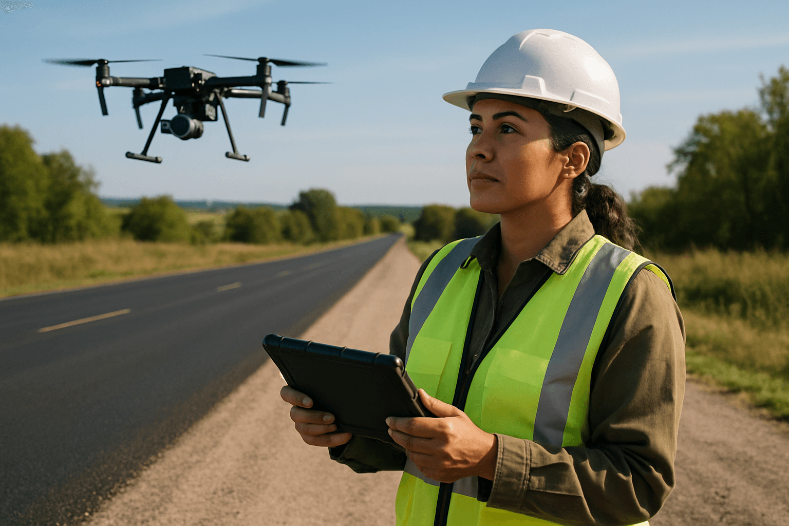
The integrity of asphalt surfaces is paramount to safe and efficient transportation networks. Traditional methods of inspection, often labor-intensive, time-consuming, and potentially hazardous, are rapidly being supplanted by innovative drone technology. Unmanned Aerial Systems (UAS), commonly known as drones, are transforming how we assess, monitor, and maintain our roads, highways, and other asphalt infrastructure, offering a safer, faster, and more cost-effective approach.
The Case for Drone-Based Asphalt Inspection
Integrating drones into pavement inspections offers a host of benefits compared to traditional methods like foot patrols or vehicle-mounted surveys.
Enhanced Safety and Accessibility
One of the most significant advantages of using drones is the improvement in safety for inspection teams. Traditional inspections often expose personnel to risks associated with working at heights, in confined spaces, or near heavy traffic. Drones eliminate the need for human presence in these dangerous environments, significantly reducing the likelihood of accidents and injuries. They can swiftly investigate inaccessible and perilous sections of roadways and bridges.
Unprecedented Efficiency and Speed
Drones can scan large areas quickly, drastically reducing data collection time. A runway that might require a two-hour closure for a manual walk-down can be imaged in 20-30 minutes by a drone, and highways that would take days of slow driving surveys can be flown in a fraction of the time. This increased efficiency allows for more frequent inspections, ensuring that potential issues are identified and addressed before they escalate into major problems. Studies have reported drone-based inspections to be up to 46% faster than traditional methods.
Superior Data Collection and Analysis
Drones equipped with high-precision cameras can detect pavement damage like cracking, crazing, and rutting. They provide superior resolution for inspections compared to ground-based methods. Modern inspection drones combine visual inspection with non-destructive testing, offering rich, real-time data. Top models include the latest visual sensors and optics for sharp images, even in challenging light conditions. The data collected is highly reliable, giving clear insight into asset performance to streamline decision-making.
Essential Equipment for Drone Asphalt Inspection
To conduct effective drone-based asphalt inspections, specific hardware and software are required.
Drone Platforms: What to Look For
The choice of drone platform depends on the scale and specific requirements of the inspection. Key factors include flight time, payload capacity, stability, and GPS accuracy.
- Multirotors (e.g., DJI Matrice 350 RTK, DJI Mavic 3 Enterprise series): These are stable for close-up inspections and are widely used due to their flight time (up to 55 minutes for Matrice 350 RTK, 30-40 minutes for Mavic 3 Enterprise) and ability to carry various payloads. The DJI Matrice 350 RTK is highlighted as a “gold standard” for inspections due to its versatility, durability, and professional-grade payload options. The DJI Mavic 3 Enterprise offers a 7x telephoto lens with 28x digital zoom, ideal for detailed visual inspections, and often includes RTK modules for centimeter-level precision.
- Fixed-wing drones (e.g., WingtraOne GEN II): These are better suited for longer endurance and surveying large areas quickly, such as highway corridors. They can achieve flight times of up to 90 minutes.
- RTK/PPK Positioning: Drones with Real-Time Kinematic (RTK) or Post-Processed Kinematic (PPK) technology ensure centimeter-level accuracy for geotagging images, which is crucial for precise defect mapping and analysis.
Camera Systems: Capturing the Detail
High-resolution cameras are paramount for detecting fine pavement distresses.
- RGB Cameras: True color RGB cameras with 20 MP or greater resolution are generally sufficient for standard surface distress surveys. They should be capable of capturing orthogonal (nadir) shots for accurate measurements, with imagery clear enough to distinguish fine cracks from pavement texture. A ground sample distance (GSD) of 1-3 mm/pixel is often required to reliably detect hairline cracks.
- Thermal Cameras: These are crucial for detecting issues not visible to the naked eye, such as moisture intrusion, delamination, and temperature segregation in Hot Mix Asphalt (HMA) during construction. Thermal cameras can provide valuable insights into underlying structural issues.
- LiDAR Sensors: For creating dense point clouds and highly accurate 3D models of infrastructure, LiDAR sensors are invaluable. They provide precise topographic mapping and exact distance measurements, aiding in the detection of structural deformations.
Flight Planning and Data Processing Software
Specialized software is essential for planning missions, processing raw data, and extracting actionable insights.
- Flight Planning Software: Programs allow users to define inspection goals, conduct site assessments, and create detailed flight plans that outline flight paths, altitude, and speed, while also considering obstacles and regulations.
- Data Processing Software: Tools like Pix4D (e.g., PIX4Dmapper, PIX4Dmatic, PIX4Dcloud), DroneDeploy, DJI Terra, Autel Mapper, Propeller, and SkyDeck convert drone-captured imagery into georeferenced orthomosaics, point clouds, 2D maps, and 3D models. These platforms are designed for precise analysis, inspections, and measurements.
- AI-Powered Analytics: Artificial Intelligence (AI) and machine learning algorithms are rapidly advancing, enabling automated detection, classification, and quantification of pavement distresses from drone imagery. AI models trained on thousands of road images can differentiate between minor cracks and those requiring urgent attention, achieving high accuracy in detecting pavement damage (over 95-98% in some studies). This significantly reduces manual effort in reviewing imagery and can even predict future road conditions.
A Step-by-Step Guide to Drone Asphalt Inspection
A well-planned and executed drone inspection ensures accurate and reliable results.
Pre-Flight Planning and Risk Assessment
Before any drone inspection, thorough preparation is critical.
- Define Inspection Goals: Clearly outline what you aim to achieve, such as identifying specific types of distresses or assessing overall pavement condition.
- Conduct a Site Assessment: Survey the inspection area to identify potential hazards, obstacles, and areas of interest. This also includes checking for local airspace restrictions and obtaining any necessary permits or permissions from authorities like the FAA.
- Create a Flight Plan: Develop a detailed flight path, altitude, and speed, taking into account site assessment findings and regulatory requirements. Automated flight planning software can program waypoint navigation.
- Choose the Right Equipment: Select a drone, camera, and sensor system appropriate for the inspection goals.
- Prepare Backup Equipment: Have spare batteries, propellers, and sensors ready to minimize downtime.
- Monitor Weather Conditions: Be aware of wind, rain, or extreme temperatures, which can affect drone performance and data quality. Flights are usually done in good daylight and clear weather for best results.
Executing the Flight Mission
During the flight, adherence to safety protocols and best practices is essential.
- Pre-Flight Checks: Thoroughly inspect the drone for any physical damage, loose components, or battery issues. Ensure batteries are fully charged.
- Maintain Visual Line of Sight (VLOS): The drone operator should always maintain unaided visual line of sight with the drone during the inspection, a fundamental safety rule in most jurisdictions.
- Execute Flight Plan: Fly the drone according to the pre-programmed path, adjusting as needed for obstacles or unexpected conditions. Fly at an altitude that captures necessary detail while avoiding obstacles, typically low enough for sufficient GSD (1-3mm/pixel). Use a gimbal to keep the camera steady and minimize movement.
- Capture High-Quality Data: Ensure clear, well-lit imagery. Orthogonal (nadir) shots are often preferred for accurate measurements.
Post-Flight Data Processing and Analysis
After data collection, the insights are extracted.
- Data Upload and Processing: Transfer the captured imagery and data to specialized drone software for processing. This typically involves stitching images into orthomosaics and creating 2D maps or 3D models.
- Automated Analysis (with AI/ML): Leverage AI algorithms to automatically detect and classify pavement distresses such as cracks, potholes, and rutting. Machine learning models can differentiate between various crack types (longitudinal, transverse, alligator) and measure their extent.
- Expert Verification and Interpretation: Subject matter experts should verify and describe the pavement condition, assign a Pavement Condition Index (PCI) score, and flag various distress types.
- Reporting and Decision-Making: Generate comprehensive reports detailing identified issues, their severity, and recommended maintenance plans. This data helps in budgeting, treatment planning, and deciding between repair, replacement, or reconstruction.
Identifying Asphalt Distresses with Drone Imagery
Drones can effectively detect a wide range of asphalt distresses that are critical for timely maintenance. A ground sample distance (GSD) of approximately 2 mm/pixel is often needed for reliable detection.
Cracking
Various types of cracks indicate different underlying issues.
- Fatigue Cracking (Alligator Cracking): A series of interconnected cracks forming small, irregular blocks resembling alligator skin, usually caused by repeated traffic loading.
- Longitudinal Cracking: Cracks parallel to the pavement’s centerline or laydown direction, often due to poor joints or pavement movement.
- Transverse Cracking: Cracks perpendicular to the pavement’s centerline, commonly caused by thermal contraction.
- Block Cracking: Interconnected cracks forming rectangular blocks, often due to aging asphalt and shrinkage.
Potholes and Patches
- Potholes: Bowl-shaped depressions in the pavement surface, typically caused by moisture penetration and freeze-thaw cycles, leading to localized disintegration. Drones can detect potholes with high accuracy.
- Patches: Areas of pavement that have been replaced or repaired, which can themselves indicate prior distress and may require inspection for proper compaction or integration.
Ruts and Shoving
- Ruts: Depressions in the wheel path caused by permanent deformation in the asphalt layer or underlying layers, often from heavy traffic.
- Shoving: A localized bulging or displacement of the pavement surface, often caused by instability in the asphalt mix.
Bleeding and Ravelling
- Bleeding (Flushing): The exuding of bituminous material to the pavement surface, creating a shiny, black film, which can reduce skid resistance.
- Ravelling: The dislodging of aggregate particles from the asphalt surface dueating to a loss of binder, creating a rough texture.
Best Practices and Future Outlook
To maximize the benefits of drone asphalt inspections, several best practices and emerging trends should be considered.
Adhering to Regulations and Safety Protocols
Compliance with local and federal regulations, such as FAA Part 107 in the United States, is mandatory. This includes ensuring operators are certified, maintaining VLOS, adhering to altitude limits (typically 400 feet AGL), and respecting no-fly zones. Detailed pre-flight inspections and continuous monitoring of weather conditions are crucial for safe operations.
Training and Expertise
While drones automate data capture, human expertise remains vital for planning, execution oversight, and, critically, for interpreting complex data and making informed maintenance decisions. Specialized training for drone operators and data analysts ensures high-quality data collection and accurate assessment.
The Future of AI and Automation in Drone Inspection
The integration of AI and machine learning is rapidly evolving, moving towards greater automation in identifying, classifying, and quantifying pavement distresses. Future developments include predictive maintenance capabilities, where AI analyzes historical data, weather patterns, and traffic conditions to forecast when and where road damage is likely to occur, enabling proactive interventions. The combination of drone-based image capture and AI analysis will accelerate the pavement inspection process and facilitate timely maintenance.
Conclusion
Drone-based visual inspection of asphalt surfaces represents a significant leap forward in infrastructure management. By offering enhanced safety, unparalleled efficiency, superior data quality, and increasingly sophisticated AI-powered analytics, drones provide a transformative solution to the perennial challenge of maintaining our vital road networks. As technology continues to advance, the role of drones in ensuring safer, more durable, and cost-effective asphalt infrastructure will only grow.


