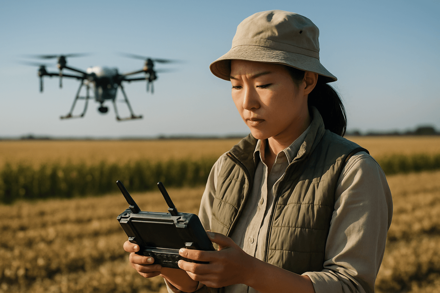
The agricultural landscape is undergoing a technological revolution, and at its forefront are unmanned aerial vehicles (UAVs), commonly known as drones. Once a novelty, agricultural drones are now indispensable tools for precision farming, offering farmers an unprecedented bird’s-eye view of their fields. By transforming raw aerial data into actionable insights, these advanced devices enable optimized crop management, reduced costs, and enhanced sustainability, making them a vital investment for modern agricultural operations.
Why Agricultural Drones are Essential for Modern Farming
Drones have redefined agricultural surveying, moving beyond traditional, time-consuming, and often labor-intensive methods. They provide farmers with a powerful platform to gather detailed, real-time data across various aspects of farm management.
Enhancing Precision Agriculture and Crop Monitoring
Precision agriculture heavily relies on accurate data to make informed decisions. Drones excel in this by capturing high-resolution imagery and data that reveal subtle variations in crop health, soil conditions, and irrigation efficiency that might be invisible to the naked eye. This allows for:
- Early Detection of Issues: Drones can identify pests, diseases, and nutrient deficiencies before they become widespread problems, enabling targeted interventions and preventing significant crop loss.
- Optimized Resource Management: With precise data, farmers can apply fertilizers, pesticides, and water exactly where needed, reducing waste, lowering input costs, and minimizing environmental impact from agricultural runoff and chemical drift.
- Yield Forecasting and Analysis: High-quality data sets, including multispectral and 3D mapping, help farmers predict yields and plan future planting patterns more effectively.
Improving Efficiency, Safety, and Sustainability
Beyond direct crop analysis, drones bring broad operational advantages:
- Increased Efficiency and Cost Savings: Drones can quickly cover vast areas, reducing the need for manual field walks or larger, more expensive equipment like tractors for initial scouting. This saves time and labor costs.
- Enhanced Environmental Stewardship: By enabling targeted applications, drones contribute to sustainable farming practices by reducing the overall use of water, fertilizers, and pesticides.
- Improved Safety: Automating tasks like pesticide spraying reduces farmers’ exposure to potentially toxic chemicals.
Key Features to Look for in Agricultural Surveying Drones
Choosing the right drone for agricultural surveying requires considering several critical features that directly impact data quality, operational efficiency, and overall utility.
Advanced Sensor Technology
The type of sensors a drone carries is paramount for agricultural surveying:
- Multispectral Cameras: These are crucial for assessing plant health. They capture data across specific wavelengths beyond the visible spectrum, including green, red, red-edge, and near-infrared bands. This information is used to generate vegetation indices like NDVI (Normalized Difference Vegetation Index), which indicates plant vigor and stress levels.
- RGB Cameras (High-Resolution): Standard visual cameras provide detailed images for general field inspection, crop emergence assessment, and monitoring physical infrastructure.
- Thermal Sensors: Useful for detecting water stress, identifying irrigation inconsistencies, and monitoring livestock by detecting temperature differences in plants, soil, or animals.
Precision Positioning Systems
Accuracy is vital for effective agricultural mapping and targeted interventions:
- RTK (Real-Time Kinematic) / PPK (Post-Processed Kinematic) GPS: These systems provide centimeter-level positioning accuracy, significantly reducing the need for ground control points (GCPs) and ensuring highly accurate geotagged images for precise mapping and analysis.
Flight Performance and Durability
Efficient surveying demands drones capable of covering large areas reliably:
- Long Flight Times: Extended battery life allows drones to map larger fields in a single mission, increasing operational efficiency.
- Wide Area Coverage: Drones optimized for agriculture can cover hundreds to thousands of acres per flight, depending on their design (e.g., fixed-wing drones typically cover more ground faster than multirotor drones).
- Robust Build Quality and Wind Resistance: Agricultural environments can be demanding, so drones need to be built to withstand various weather conditions.
- Omnidirectional Obstacle Avoidance: This feature enhances safety and protects the drone during complex flight paths, especially in areas with trees or other obstructions.
Software Compatibility and Data Processing
The value of drone data lies in its analysis:
- Automated Flight Paths: Drones with intelligent flight planning capabilities can be programmed to follow specific routes, ensuring consistent data collection and making operations repeatable.
- Real-Time Data Transmission: The ability to transmit data in real-time allows farmers to make immediate decisions.
- Integration with Agricultural Software: Compatibility with platforms like DJI Terra or other photogrammetry software (e.g., Pix4Dmapper) is essential for processing images into detailed orthomosaic maps, 3D models, and vegetation index maps.
Top Drones for Agricultural Surveying
Several drone models stand out for their capabilities in agricultural surveying, each offering a unique set of strengths tailored to different farming needs.
DJI Mavic 3 Multispectral (M3M)
The DJI Mavic 3 Multispectral (M3M) is a highly integrated and portable solution, combining an RGB camera with a multispectral camera system.
- Key Features: It includes a 20MP RGB camera and four 5MP multispectral cameras (green, red, red-edge, and near-infrared) for comprehensive crop growth monitoring and natural resource surveys. The built-in sunlight sensor captures solar irradiance, improving the accuracy and consistency of NDVI results over time. An RTK module provides centimeter-level positioning without ground control points.
- Performance: The M3M boasts a 43-minute flight time, capable of covering up to 200 hectares (494 acres) in a single flight. It features omnidirectional obstacle sensing and supports terrain-follow aerial surveying for operations in sloped landscapes.
- Applications: Ideal for high-precision aerial surveying, crop growth monitoring, and intelligent field scouting, with data seamlessly integrating into DJI Terra or DJI SmartFarm Platform.
senseFly eBee X
The senseFly eBee X is a leading fixed-wing drone, renowned for its extensive coverage capabilities and high accuracy, making it suitable for large-scale agricultural operations.
- Key Features: Its fixed-wing design allows for extended flight times, up to 90 minutes with an endurance extension, enabling mapping of up to 500 hectares (1,235 acres) in a single flight at 120 meters (400 ft) altitude. It offers on-demand RTK/PPK capabilities for absolute accuracy down to 1.5 cm (0.6 in) without GCPs. The eBee X is compatible with a wide range of interchangeable sensors, including multispectral (like Parrot Sequoia+ or MicaSense RedEdge-MX), thermal (senseFly Duet T), and high-resolution RGB cameras (senseFly S.O.D.A., senseFly Aeria X).
- Performance: Designed for rugged environments, it features steep landing technology for confined areas and is hand-launchable.
- Applications: Suited for comprehensive data collection for crop health analysis, detailed field mapping, soil analysis, and environmental monitoring across vast agricultural lands.
Autel Robotics EVO Series (e.g., EVO II Dual 640T RTK, EVO Max 4T/4N)
Autel Robotics drones, particularly models like the EVO II Dual 640T RTK and the newer EVO Max series, offer robust solutions for agricultural surveying with versatile imaging capabilities.
- Key Features: These drones are equipped with high-quality cameras and often include thermal imaging capabilities, which are beneficial for detecting irrigation stress or monitoring livestock. RTK modules are available on several models, providing high-precision positioning for mapping tasks. Autel drones are known for their robust build quality, long flight times, and advanced obstacle avoidance, ensuring reliable performance in diverse agricultural settings.
- Performance: Specific models like the EVO Lite Enterprise 640T are highlighted for their combination of high-resolution thermal and visual cameras, long flight times, and versatile capabilities for crop monitoring and irrigation inspection. They support autonomous mission planning and are compatible with third-party software for data analysis.
- Applications: Useful for aerial inspections, crop condition monitoring, identifying weed growth for precise pesticide application, farmland planning, and livestock tracking.
Conclusion
The evolution of drone technology has profoundly impacted agricultural surveying, providing farmers with powerful tools to optimize their practices. The best drones for agricultural surveying are those that combine advanced sensor technology—especially multispectral and RTK/PPK systems—with robust flight performance, long endurance, and seamless integration with data processing software. While multirotor drones like the DJI Mavic 3 Multispectral offer portability and detailed insights for smaller to medium-sized fields, fixed-wing options like the senseFly eBee X excel at covering vast areas efficiently. Autel Robotics offers versatile multirotor drones with strong imaging and thermal capabilities for diverse farm monitoring needs. Investing in the right agricultural drone empowers farmers to make data-driven decisions, leading to improved yields, reduced operational costs, and a more sustainable future for agriculture.


