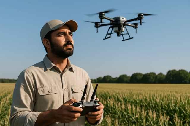
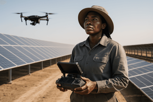
Solar energy is at the forefront of the global energy transition, with vast solar farms sprouting up worldwide to meet growing power demands. However, ensuring these sprawling installations operate at peak efficiency and identifying potential faults before they escalate into costly problems presents a significant challenge. Traditional manual inspection methods are slow, labor-intensive, and often dangerous. Enter drone-based thermal inspections, a revolutionary approach that is transforming how solar farms are monitored and maintained, offering unparalleled efficiency, safety, and accuracy.
Why Drone-Based Thermal Inspections are Essential for Solar Farms
Solar panels are constantly exposed to harsh environmental conditions, leading to wear and tear that can cause various defects over time. These issues, often invisible to the naked eye, can severely reduce energy output and impact revenue. Thermal imaging, powered by drones, provides a non-contact, non-invasive method to detect these hidden anomalies.
The Limitations of Traditional Inspection Methods
Manual inspections typically involve technicians walking through vast solar fields with handheld thermal cameras. This process is inherently:
- Slow and Inefficient: Covering large areas panel-by-panel can take weeks or even months for utility-scale solar farms.
- Dangerous: Technicians are exposed to fall risks, heat stress, electrical hazards, and challenging terrain.
- Inconsistent: Human error and varying environmental conditions during extended inspection periods can lead to inconsistent data.
- Costly: High labor costs and potential downtime contribute to significant operational expenses.
Key Advantages of Drone Thermal Inspections
Drones equipped with thermal cameras offer a powerful alternative, transforming solar farm maintenance from reactive to proactive.
- Enhanced Efficiency and Coverage: Drones can inspect 50-100 MW per day, drastically reducing inspection time by up to 70% compared to manual methods. This speed ensures comprehensive coverage of every panel and string.
- Improved Safety: By keeping personnel off rooftops and out of high-risk areas, drones eliminate safety hazards, reducing human exposure to dangerous tasks.
- Superior Accuracy: Thermal cameras on drones can detect temperature variations as small as 1-2°C, identifying issues like faulty cells, shading, dirt, or overheating long before they impact generation or become visually apparent.
- Predictive Maintenance: Early fault detection, enabled by thermal drones, can recover 2-5% of annual energy losses. For a 100 MW solar farm, this can translate into hundreds of thousands of dollars in recovered revenue annually.
- Cost-Effectiveness: Over time, drone inspections prove cheaper by cutting down labor, reducing downtime costs, and preventing major failures.
- Detailed Data & Reporting: Drones collect high-resolution thermal and visual (RGB) data, allowing for precise localization of faults and comprehensive reporting.
Understanding Thermal Imaging Technology
Thermal imaging technology detects infrared radiation emitted by objects, converting it into thermal images. Solar panels operating correctly typically emit heat uniformly. However, defects disrupt this heat distribution, creating “hotspots” or areas with abnormal temperatures. These anomalies are represented as color gradients in thermal images, highlighting potential issues.
Common issues detectable by thermal imaging include:
- Hotspots: Caused by micro-cracks, faulty cells, or partial shading, leading to reduced energy production and potential fire hazards.
- Faulty Diodes/Bypass Diodes: Can cause entire sections of a panel or string to overheat.
- Module Degradation: Due to environmental exposure or manufacturing defects.
- Loose or Damaged Electrical Connections: Leading to increased resistance and heat.
- Inverter and Junction Box Overheating: Critical for identifying system-level malfunctions.
- Soiling and Shading Issues: Accumulation of dirt or shadows can cause localized heating.
Key Equipment for Drone Thermal Inspections
A successful drone thermal inspection relies on a combination of specialized hardware and software.
Drones (UAVs)
The drone itself needs to be robust, capable of carrying appropriate payloads, and ideally offer stable flight characteristics for consistent data capture.
- Multi-rotor drones (e.g., quadcopters): Are commonly used due to their maneuverability and ability to hover, which is crucial for detailed inspections.
- Long Flight Time: To cover large solar farms efficiently, drones with extended battery life are preferred.
- RTK/PPK Capability: Real-Time Kinematic (RTK) or Post-Processed Kinematic (PPK) GPS systems provide centimeter-level accuracy for precise georeferencing of anomalies.
Thermal Cameras (Payloads)
This is the most critical component, directly impacting the quality and accuracy of the thermal data.
- Radiometric Thermal Sensors: These cameras capture temperature data for each pixel, allowing for quantitative analysis of temperature differences.
- High Resolution: A minimum resolution of 640×480 pixels is recommended for detailed inspections.
- Dual Sensor (Thermal + RGB): Drones equipped with both thermal and high-resolution RGB cameras are highly advantageous. RGB images provide visual context, helping to confirm anomalies detected by the thermal camera (e.g., cracks, soiling, vegetation overgrowth).
- Example: Drones like the DJI Matrice 350 RTK with a Zenmuse H30T thermal sensor are commonly used for solar inspections.
Flight Planning and Data Processing Software
Automated flight planning and sophisticated data analysis software are indispensable.
- Automated Flight Planning Software: Allows pilots to pre-program flight paths, ensuring consistent coverage, optimal overlap (e.g., 90% front and side overlap for thermal imagery), and repeatable missions.
- Post-Processing Software: Analyzes the raw thermal and RGB data to identify anomalies, generate orthomosaic maps, thermal maps, and detailed reports. Many solutions leverage AI for faster and more accurate defect detection.
- Georeferencing: Software should be able to geo-reference detected issues with high accuracy, making it easy for maintenance teams to locate and repair them.
How to Conduct a Thermal Inspection of a Solar Farm with Drones
Performing a thermal drone inspection of a solar farm involves several crucial steps, from meticulous planning to detailed post-analysis.
1. Pre-Inspection Planning and Preparation
Thorough planning is the foundation of a successful and safe inspection.
- Define Objectives: Clearly outline what you aim to achieve (e.g., general health check, fault detection, warranty claim documentation).
- Site Assessment: Understand the solar farm’s layout, dimensions, panel types (fixed vs. trackers), power capacity, and potential obstructions. Obtain as-built drawings if available.
- Regulatory Compliance: Obtain all necessary FAA (or local aviation authority) waivers and flight permissions. Drone pilots must have specialized training and certification, such as an FAA Part 107 license and sUAS thermography certification.
- Weather Assessment: Optimal conditions are crucial for accurate thermal data.
- Irradiance: Aim for irradiance levels of at least 600 watts per square meter, typically during midday when panels are under load. Track irradiance before, during, and after the inspection.
- Clear Skies: Avoid cloudy, rainy, or foggy conditions, as they can affect data quality.
- Low Wind: Minimize wind to ensure stable flight and prevent motion blur in images.
- Safety Protocols: Conduct a risk assessment, identify hazards, and ensure all personnel have appropriate Personal Protective Equipment (PPE).
- Flight Path Planning:
- Use automated flight planning software to create repeatable flight paths that ensure 100% coverage with high image overlap (e.g., 90% front and side).
- Consider panel orientation (fixed vs. tracker) as this impacts optimal flight angles and times.
- Plan for consistent altitude and speed to capture precise and reliable data.
- Equipment Check: Verify drone operational condition, battery levels, thermal camera calibration, and storage capacity. Have multiple charged batteries available.
2. Drone Flight Execution (Data Acquisition)
During the inspection, the focus is on precise data capture.
- Automated Missions: Launch pre-programmed flight missions to ensure consistent data capture.
- Consistent Flight Parameters: Maintain a steady altitude and speed throughout the inspection to ensure uniform image quality and overlap.
- Dual-Sensor Capture: Collect both thermal (infrared) and RGB (visual) imagery simultaneously for comprehensive analysis.
- Real-time Monitoring: Many advanced drone systems allow for real-time viewing of thermal feeds, enabling pilots to identify immediate issues or adjust flight paths if necessary.
3. Post-Inspection Data Processing and Analysis
Once data collection is complete, the crucial phase of analysis begins.
- Data Upload: Transfer all raw thermal and RGB imagery from the drone to a powerful processing platform.
- Image Stitching & Orthomosaic Generation: Photogrammetry software reconstructs RGB orthomosaics and thermal maps from the images.
- Anomaly Detection: Use specialized software, often leveraging AI, to automatically detect and flag hotspots, micro-cracks, soiling, shading, inverter issues, and other anomalies. This software is far more efficient than manually reviewing each image.
- Data Interpretation: Qualified thermographers interpret the thermal images. They can distinguish between different types of faults (e.g., a large temperature difference may indicate a broken module, while a smaller difference could be dirt).
- Reporting: Generate comprehensive reports that include annotated thermal and RGB images, precise GPS coordinates of faults, severity ratings, and recommended maintenance actions.
- Historical Data & Baselines: Establish a baseline inspection at the commissioning of the solar farm and use subsequent inspections to track changes and degradation patterns over time.
Challenges and Considerations
While highly beneficial, drone thermal inspections also come with challenges.
- Technical Training: Operating drones for thermography requires specialized skills and knowledge in thermography science, flight planning, drone safety, and camera settings.
- Equipment Cost: High-quality drones with radiometric thermal sensors can be a significant investment, often exceeding $30,000 for a professional setup.
- Environmental Factors: Unpredictable weather conditions (wind, rain, fog, thermal turbulence) can affect drone performance and data quality. Reflective surfaces of panels can also complicate data acquisition.
- Data Management: Thermal drones collect vast amounts of sensitive data, requiring robust storage, management, and security measures.
- Regulatory Landscape: Adhering to evolving local and national drone regulations (airspace, pilot certification) is crucial.
- Interpretation Complexity: Accurate interpretation of thermal data requires expertise to differentiate between critical faults and minor temperature variations.
The Future of Solar Farm Inspection
The integration of drones and advanced thermal imaging, often coupled with AI and machine learning for data analysis, is continuously evolving. This technology is becoming indispensable for maintaining the efficiency, reliability, and longevity of solar assets. By adopting these cutting-edge inspection methods, solar farm operators can ensure optimal energy output, reduce operational costs, and secure their investment in renewable energy for years to come.