The integration of Unmanned Aerial Vehicles (UAVs), commonly known as drones, into emergency response protocols has revolutionized how agencies address crises, particularly in surveillance and security. Drones offer unparalleled capabilities for rapid assessment, real-time data collection, and enhanced safety for first responders, making the development of comprehensive emergency drone response plans crucial.
The Pivotal Role of Drones in Emergency Response
Drones have emerged as indispensable tools across various emergency scenarios due to their versatility and efficiency.
Enhanced Situational Awareness and Rapid Deployment
One of the primary advantages of drones is their ability to provide immediate and comprehensive aerial views of a disaster zone. Unlike traditional manned aircraft, UAVs can be launched quickly from almost any location, even in areas where ground access is difficult or impossible. This rapid deployment allows emergency personnel to gain critical insights into the situation, assess damage, and identify hazards, enabling faster and more informed decision-making. High-resolution cameras and live video streaming capabilities on drones provide real-time visual data, which is essential for effective resource allocation and strategic planning during an incident.
Increased Safety for Responders
Drones significantly minimize the risks faced by human responders by allowing remote operation in hazardous environments. For instance, in situations involving collapsed buildings, wildfires, or areas with hazardous materials, drones equipped with specialized sensors can survey the scene, detect toxic gases, or locate individuals without endangering human life. This remote assessment capability protects emergency workers from potential injuries and accidents.
Diverse Applications in Crisis Management
The applications of drones in emergency response extend across various phases of disaster management, from pre-disaster monitoring to post-incident recovery.
- Search and Rescue (SAR): Drones equipped with thermal imaging cameras can efficiently scan large areas, detect heat signatures, and locate missing persons even in challenging conditions like dense forests or at night.
- Disaster Assessment: Following natural disasters such as hurricanes, floods, or earthquakes, drones provide aerial views for rapid damage assessment, helping officials understand the extent of the damage and plan reconstruction. They can also create 3D models and orthophoto maps to identify damaged areas and inspect critical infrastructure like bridges and power lines.
- Medical Supply Delivery: Drones can transport vital medical supplies, food, and other essentials to remote or inaccessible areas, which is particularly useful in post-disaster scenarios.
- Monitoring Hazardous Areas: Drones can be used to monitor construction sites, industrial facilities, or infrastructure for potential safety risks, alerting workers to take action before an incident occurs. They can also provide insights into fire spread and identify hotspots during wildfires.
- Situational Awareness: Drones offer a “bird’s-eye view” that enhances first responders’ understanding of the environment, aiding in identifying areas of concern like collapsed structures or blocked roads.
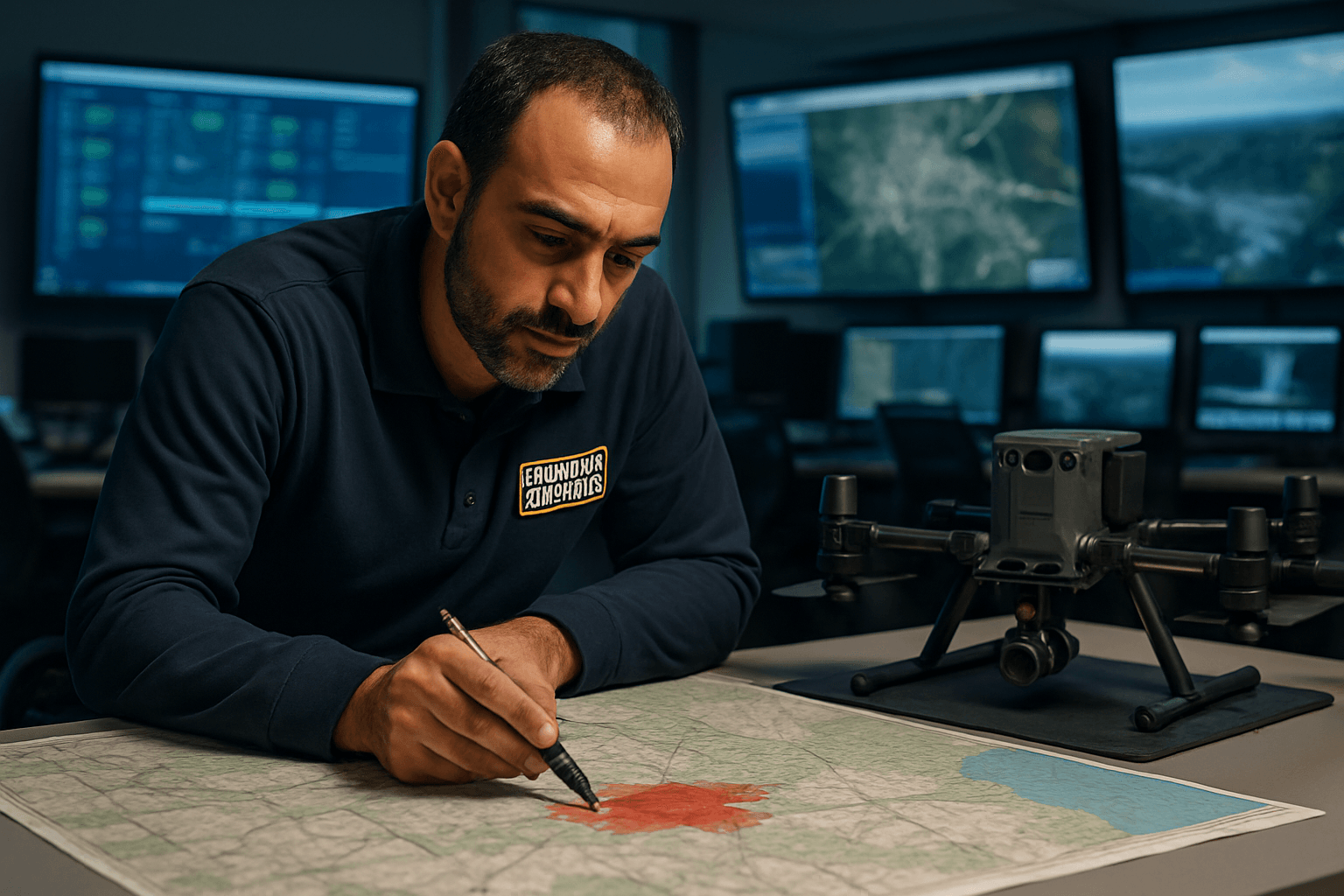
Key Components of an Emergency Drone Response Plan
Developing an effective emergency drone response plan (DERP) requires careful consideration of various operational, technical, and regulatory aspects.
Defining Purpose and Objectives
A successful drone program begins with clearly defined objectives tailored to the specific needs of the emergency response organization. This involves identifying the primary tasks drones will perform, such as search and rescue, wildfire management, damage assessment, or public safety surveillance.
Team Structure and Training
Establishing a dedicated drone response team is crucial. This team should include security personnel and operators trained in drone detection, communications leads, and liaison officers who can coordinate with law enforcement and the FAA. Regular simulations and drills are essential to build muscle memory and ensure readiness, involving both internal teams and external partners. Pilots must be certified (e.g., FAA Part 107 or COA for public safety) and receive ongoing training.
Equipment Selection and Readiness
Choosing the right drones for emergency operations is paramount. Key considerations include:
- Durability and Reliability: Drones must withstand harsh environmental conditions like high winds, rain, and extreme temperatures.
- Flight Time and Payload Capacity: Extended battery life (30-55 minutes or more) is critical for covering large areas and minimizing interruptions. Drones should also be capable of carrying necessary payloads like high-resolution cameras, thermal imaging sensors, LiDAR, or even medical supplies.
- Advanced Features: GPS navigation, obstacle avoidance, and reliable live video streaming are essential for effective operation in complex environments. Features like AI-powered heat detection and secure communication links enhance decision-making and data transmission.
- Redundancy and Spares: Having backup drones and critical spare parts (propellers, batteries) is vital to ensure continuous operations during high-stakes incidents.
Standard Operating Procedures (SOPs) and Protocols
Clear SOPs are necessary for every aspect of drone operation during an emergency. This includes:
- Deployment Protocols: Defining when and how drones will be requested and used within the emergency operations plan.
- Threat Assessment and Response Tiers: Procedures for verifying drone detection, escalating incidents based on threat level, and activating emergency procedures. The FAA’s DRONE mnemonic (Direct attention, Report, Observe, Notice features, Execute) can be a useful guide.
- Data Collection and Management: Guidelines for secure data storage, handling policies, and compliance with privacy regulations.
- Pre-flight Checklists: Ensuring equipment readiness, checking weather conditions, and assessing risks (terrain, air, human) before each flight.
Regulatory Compliance and Coordination
Navigating the complex regulatory landscape is a significant challenge for emergency drone operations. Agencies must understand and adhere to FAA regulations, including Part 107 for commercial operations and Certificates of Authorization (COAs) for public safety use, which offer more flexibility for emergency missions.
- Special Governmental Interest (SGI) Process: For urgent situations, the FAA offers an expedited SGI process for certified drone pilots to obtain waivers for operations not normally permitted, such as flying in controlled airspace, at night, or beyond visual line of sight (BVLOS).
- Airspace Deconfliction: Coordination with local law enforcement, air traffic control, and other emergency services is critical to prevent conflicts with manned aircraft and ensure safe airspace. Temporary Flight Restrictions (TFRs) often apply in disaster areas, requiring specific authorization.
- Inter-agency Coordination: Establishing clear communication pathways and joint protocols with supporting partners and agencies is vital for seamless operations and effective incident command system (ICS) integration.
Challenges and Future Outlook
Despite the immense potential, several challenges must be addressed for the widespread and effective implementation of emergency drone response plans.
Current Challenges
- Regulatory Hurdles: Varying and complex regulations, including restrictions on flight areas, altitude limits, and licensing requirements, can delay drone deployment.
- Technological Limitations: Limited flight time and battery life remain significant constraints, especially in large-scale disasters. Communication and connectivity issues can also arise in areas with damaged networks.
- Personnel and Training: A shortage of adequately skilled personnel to operate drones and manage the collected data can hinder program effectiveness.
- Ethical and Privacy Concerns: The use of drones in populated areas raises concerns about privacy and surveillance, requiring transparent communication and strict data privacy measures.
- Cost and Infrastructure: The initial investment in drones and supporting infrastructure can be substantial for many organizations.
The Future of Emergency Drone Response
The future of emergency drone response is rapidly evolving with advancements in technology.
- Increased Autonomy and AI: Future drones will feature enhanced autonomy, powered by Artificial Intelligence (AI) and machine learning, enabling them to operate without constant human intervention and make real-time decisions.
- Swarm Technology: Autonomous drone swarms will work collaboratively to cover larger areas and execute complex tasks simultaneously, improving efficiency in search and rescue and damage assessment.
- Advanced Sensors: Next-generation drones will integrate state-of-the-art sensors like hyperspectral imaging for identifying chemical spills or structural weaknesses, and LiDAR for detailed 3D mapping.
- Predictive Capabilities: Integrating predictive analytics with drone technology will enable emergency teams to foresee potential disasters and take preemptive measures, moving beyond reactive responses.
- Improved Connectivity: Solutions like satellite communication systems and mesh networks will ensure uninterrupted connectivity, even in compromised environments.
- Streamlined Regulations: Ongoing efforts by regulatory bodies like the FAA, including potential Part 108 regulations, aim to streamline and normalize advanced drone operations like BVLOS.
As drone technology continues to advance, the development and refinement of comprehensive emergency drone response plans will be paramount to leveraging their full potential in saving lives, minimizing damage, and enhancing global resilience in the face of emergencies.


