Soil compaction is a silent thief in agriculture, dramatically impacting crop yields and long-term soil health. This pervasive problem, often invisible to the naked eye, restricts root growth, impedes water and nutrient absorption, and ultimately diminishes the productivity and sustainability of farmland. Fortunately, advancements in aerospace engineering, particularly in drone technology, are offering farmers powerful new tools to detect, map, and even mitigate soil compaction with unprecedented precision.
Understanding the Menace of Soil Compaction
Soil compaction occurs when soil particles are pressed closely together, reducing pore space and increasing bulk density. This compression can be caused by heavy machinery, repeated fieldwork, and improper tillage practices. The consequences are severe and multifaceted:
- Reduced Water Infiltration and Aeration: Compacted soil has fewer and smaller pores, hindering water penetration and leading to increased runoff and waterlogging on the surface. It also reduces oxygen availability for roots and beneficial soil microbes.
- Impeded Root Growth: Roots struggle to penetrate dense, compacted layers, limiting their access to essential water and nutrients in deeper soil profiles. This results in stunted plant growth and reduced yields.
- Nutrient Lock-up and Erosion: Poor aeration affects nutrient cycling, and increased runoff leads to soil erosion and the loss of valuable topsoil and nutrients.
- Decreased Crop Yields: Studies have shown that soil compaction can cut crop yields by up to 50% in some cases.
Traditional Monitoring: A Ground-Level View with Limitations
Historically, assessing soil compaction has been a laborious and often imprecise task. Farmers typically rely on methods such as:
- Manual Soil Probes and Penetrometers: These tools measure the resistance of the soil to penetration, providing a direct but localized indication of compaction. However, manual measurements are time-consuming, labor-intensive, and can be inconsistent due to human factors.
- Visual Inspection and Educated Guesswork: Farmers observe crop growth patterns, water ponding, and soil structure by hand, which can indicate compaction, but lacks quantitative data and comprehensive field-wide coverage.
- Process Control: In construction or earthwork, this involves continuous observation of lift thickness and the number of passes by compacting machinery. While it ensures adequate compaction, it’s not directly applicable to agricultural fields for monitoring existing compaction and creates safety hazards with personnel near equipment.
- Soil Sampling: Involves collecting samples and sending them to labs for analysis, which is accurate for nutrient and chemical levels, but slow for real-time compaction assessment and often provides an incomplete picture of spatial variability.
These traditional methods offer limited spatial coverage, can be slow, costly, and often fail to provide the real-time, high-resolution data needed for effective precision agriculture.
The Aerial Advantage: Drones in Soil Compaction Monitoring
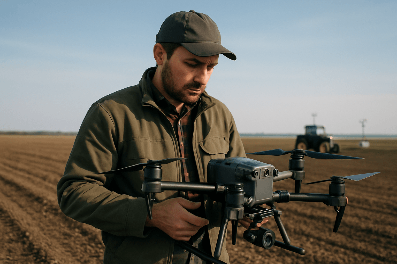
Unmanned Aerial Vehicles (UAVs), or drones, are transforming the way soil compaction is monitored by providing a non-invasive, scalable, and cost-effective solution for assessing soil health across vast agricultural landscapes. Drones can rapidly survey entire fields, collecting detailed data that reveals compaction patterns and severity, helping farmers make informed decisions about targeted interventions.
Unlike heavy ground-based equipment, drones have a minimal footprint, exerting negligible pressure on the soil surface. This inherently prevents further compaction during the monitoring process, which is a significant advantage over even ground robots designed for sampling that can contribute to compaction.
Sensors and Technologies for Detailed Detection
Drones are equipped with a variety of advanced sensors and imaging technologies that gather data indicative of soil compaction, often indirectly by observing its effects on plant health and soil properties. Key technologies include:
Multispectral Imaging
Multispectral cameras capture reflected light in several distinct spectral bands, including visible and near-infrared (NIR) ranges. Healthy plants reflect NIR light strongly, while stressed plants absorb more of it. Since soil compaction negatively impacts plant growth and health, multispectral data can reveal areas of plant stress, which can be an indicator of underlying compaction issues. Vegetation indices derived from multispectral images, such as the Normalized Difference Vegetation Index (NDVI), correlate with crop vigor and can highlight variations in growth caused by compaction.
Thermal Imaging
Thermal cameras detect temperature differences across the soil surface. Wet soil tends to be cooler than dry soil due to evaporative cooling. Compacted soil often has altered moisture retention and drainage properties, leading to variations in surface temperature that thermal sensors can identify. Hotter zones may signal dryness or compaction, while cooler patches can indicate higher moisture. This helps farmers optimize irrigation and manage soil consistency.
LiDAR (Light Detection and Ranging)
LiDAR sensors use laser pulses to create highly detailed 3D maps of terrain. These maps can reveal subtle elevation changes and drainage patterns that might be influenced by compaction, especially in relation to water accumulation or runoff. While LiDAR primarily maps topography, which can be affected by uneven soil settlement due to compaction, its direct application for detecting subsurface compaction layers is less direct compared to other methods.
Ground-Penetrating Radar (GPR)
GPR systems transmit radar pulses into the ground and measure the reflected signals. Changes in soil density, moisture content, and the presence of compacted layers alter the propagation of these waves, allowing GPR to detect structural changes associated with tillage practices and heavy machinery traffic. GPR offers a non-invasive way to visualize subsurface soil conditions and identify hardpan layers caused by compaction. While larger GPR units are often ground-based, miniaturized versions could be integrated into drones for more widespread, non-contact mapping.
RGB Cameras
While less sophisticated, high-resolution RGB (Red Green Blue) cameras can still offer initial insights. They provide general visual inspection and mapping, where differences in soil color (wet soil appearing darker, dry soil lighter) or obvious signs of crop stress (stunted growth, discoloration) might indicate compaction. Crop height models (CHM) derived from RGB drone images can also be used to assess crop growth and uncover compaction problems.
Beyond Detection: Drones for Compaction Prevention
Drones not only monitor but also indirectly help in minimizing soil compaction through their role in precision agriculture practices:
- Precision Application of Inputs: Drones equipped with spraying and seeding technology allow for precise and targeted application of fertilizers, pesticides, and seeds. This eliminates the need for unnecessary passes over the field with heavy ground machinery, significantly reducing soil disturbance and the risk of compaction.
- Controlled Traffic Systems (CTS): Drones can assist in implementing and maintaining CTS by mapping designated pathways for heavy machinery. By restricting vehicle movement to specific areas, compaction is confined, preserving the majority of the field’s soil structure.
- No-Till and Reduced Tillage Practices: Drones complement these sustainable farming methods by providing precise planting and seeding capabilities without disrupting the soil. This helps maintain soil structure, promotes organic matter accumulation, and enhances microbial activity, making the soil more resilient to compaction.
Benefits of Drone-Based Soil Compaction Monitoring
The integration of drones into soil compaction monitoring offers numerous advantages for modern agriculture:
- High Spatial Resolution and Coverage: Drones can scan entire fields quickly, identifying variations that manual testing might miss, providing a comprehensive, high-resolution view of soil conditions.
- Real-time Data and Rapid Insights: Unlike traditional methods that involve waiting for lab results, drones provide instant, accurate insights, allowing farmers to respond quickly to potential problems.
- Reduced Labor and Cost Efficiency: Drones automate much of the data collection process, reducing the need for extensive manual testing and associated labor costs.
- Non-Invasive and Environmentally Friendly: Drones prevent further soil compaction by avoiding heavy ground equipment. Their precision application capabilities also reduce chemical runoff and conserve water.
- Improved Decision-Making: With detailed compaction maps, farmers can make data-driven decisions on where and how deep to till, optimize irrigation, and tailor treatments to specific areas of the field, ultimately leading to increased yields and reduced waste.
Challenges and Future Directions in Drone-Enabled Soil Compaction Mapping
Despite the significant benefits, certain challenges remain. Integrating sophisticated sensors like GPR onto drones still faces payload limitations and power requirements, especially for direct soil sampling. Interpreting the large, technical datasets generated by modern drone systems can also be a barrier for many farmers, requiring specialized software and expertise. While multispectral data can indicate compaction through plant stress, directly measuring soil physical properties from the air remains an area of ongoing research.
The future of drone-enabled soil compaction monitoring is promising. Emerging trends include:
- AI-powered Drones: Artificial intelligence and machine learning algorithms are enhancing data analysis for faster decision-making and more accurate interpretation of sensor data.
- Swarm Technology: Multiple drones working together can cover larger areas more efficiently, increasing the speed and scale of monitoring.
- Improved Battery Life and Sensor Miniaturization: Ongoing innovations in drone hardware will enable longer flight times and the integration of even more advanced and diverse sensor payloads.
Conclusion
Drones are rapidly becoming indispensable tools in precision agriculture, offering a transformative approach to monitoring soil compaction. By providing high-resolution, real-time data through advanced sensor technologies, drones empower farmers to understand the intricate health of their soil like never before. This aerial perspective not only helps in identifying and mitigating existing compaction but also supports sustainable farming practices that prevent its occurrence, leading to healthier soils, resilient crops, and more bountiful harvests for a sustainable future.


