The integration of drones into agricultural practices is revolutionizing farming, offering unparalleled precision and efficiency in crop monitoring. These Unmanned Aerial Systems (UAS) provide farmers with a bird’s-eye view, enabling the collection of critical data for optimizing operations, enhancing productivity, and promoting sustainability. By adopting drone survey techniques, growers can move from reactive to proactive management, addressing issues before they become critical and maximizing yields.
This guide outlines the essential steps and considerations for performing an effective drone survey for agricultural crop monitoring.
The Power of Drones in Precision Agriculture
Precision agriculture, which aims to optimize resource application based on specific field conditions, heavily benefits from drone technology. Drones can cover large areas quickly, collecting detailed, high-resolution imagery that surpasses the capabilities of traditional scouting or even satellite data. This real-time, actionable data empowers farmers to make informed decisions that can lead to increased yields, reduced operational costs, and enhanced environmental sustainability.
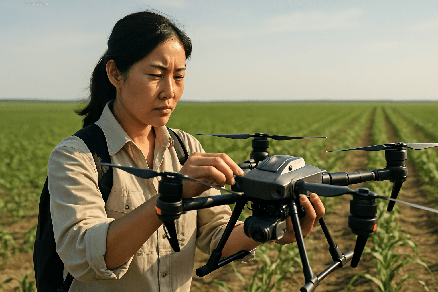
Essential Equipment for Agricultural Drone Surveys
Performing a successful drone survey requires specific hardware and software. The right tools depend on the scale of your operation and the specific insights you aim to gather.
Choosing the Right Drone Type
Agricultural drones are generally classified into two main categories:
- Rotary-Wing Drones (Multirotors): Such as quadcopters and hexacopters, these are highly maneuverable, can hover, change direction rapidly, and perform vertical takeoffs and landings. They are ideal for smaller fields, detailed close-up inspections, and areas with obstacles, though they typically have shorter flight times (10-20 minutes).
- Fixed-Wing Drones: Resembling airplanes, these drones rely on their wings for lift, allowing for longer flight times and greater efficiency over large areas. They are well-suited for extensive farmlands but require space for landing, similar to a runway.
- Hybrid (VTOL) Drones: Combining features of both, VTOL drones can take off and land vertically like multirotors and then transition to fixed-wing flight for efficient long-distance coverage. This versatility makes them suitable for varied topography and offers extended flight times.
Selecting Specialized Sensors and Cameras
Beyond basic visual (RGB) cameras, specialized sensors are crucial for advanced crop monitoring:
- Multispectral Cameras: These are the “workhorses of precision agriculture.” They capture data across multiple narrow bands of the electromagnetic spectrum, including visible (RGB) and non-visible light like near-infrared (NIR) and red edge. Multispectral imagery is vital for calculating vegetation indices such as NDVI, which indicate plant health, stress levels, and overall vegetation density. Drones equipped with these sensors can detect nutrient deficiencies, pests, disease outbreaks, and water stress before they are visible to the human eye.
- Thermal Cameras: Thermal imaging cameras detect heat emitted by objects, allowing farmers to identify subtle temperature variations across fields. This is particularly useful for detecting water stress (as stressed plants have reduced evapotranspiration and appear warmer), irrigation issues, and even pest infestations.
- LiDAR Sensors (Light Detection and Ranging): LiDAR uses laser beams to create detailed 3D maps of terrain, useful for terrain mapping, elevation analysis, and understanding drainage patterns.
- RGB Cameras: Standard RGB cameras are useful for general scouting, visual inspections, and identifying stand gaps or obvious problems.
The Drone Survey Workflow: Step-by-Step
A systematic approach ensures reliable data collection and actionable insights. The general workflow for a drone mapping project involves several consistent steps.
1. Mission Planning and Pre-Flight Checks
Thorough planning is the foundation of a successful drone survey.
- Define Objectives: What specific information do you need? (e.g., overall crop health, water stress, pest identification, yield estimation, soil mapping).
- Legality and Regulations: Research and comply with local drone regulations, including pilot certification, drone registration, and flight restrictions (e.g., altitude limits, no-fly zones).
- Field Assessment: Consider the size, shape, and topography of the field. Identify any obstacles like trees, power lines, or buildings.
- Flight Planning Software: Use specialized software (e.g., DroneDeploy, PIX4Dfields, Botlink, DJI Terra) to define the coverage area, flight altitude, flight speed, and flight pattern (often a serpentine pattern). This software helps create efficient routes and estimates flight time.
- Image Overlap: Sufficient overlap between successive images (often up to 75% in both forward and side-to-side directions) is critical for accurate stitching of images into a single map.
- Altitude and Ground Sample Distance (GSD): The flight altitude determines the ground sample distance (resolution). For detailed plant analysis (e.g., emergence rates, plant counts, sizing), lower altitudes (15-30m) providing ultra-high resolution (e.g., 30 pixels per plant) may be necessary. For general crop monitoring and health maps, higher altitudes (80-120m) capturing 3-10cm GSD are often sufficient.
- Weather Conditions: Fly in optimal conditions—low wind speed, clear blue skies, or fully overcast days are preferable to prevent shadows and ensure craft stability. Avoid flying during heavy rain, snow, or fog.
- Battery Management: Carry extra batteries, especially in extreme temperatures, as cold weather can reduce flight time.
2. Drone Flight and Data Acquisition
Once the mission is planned, execute the flight according to the programmed path. The drone will autonomously fly over the field, capturing images with its equipped sensors. Ensure the Downwelling Light Sensor (DLS), if used with multispectral cameras, is properly calibrated to account for varying light conditions.
3. Data Processing
After the flight, the raw image data needs to be processed to create usable maps and insights.
- Stitching Software: Use photogrammetry software (e.g., PIX4Dfields, DroneDeploy, Agisoft) to stitch the individual images together into georeferenced orthomosaic maps. Some software, like PIX4Dfields, offers rapid, offline processing directly in the field.
- Vegetation Indices Calculation: For multispectral data, calculate vegetation indices such as:
- NDVI (Normalized Difference Vegetation Index): The most common index, calculated from near-infrared (NIR) and red light reflectance. Healthy plants reflect more NIR and less red light, resulting in higher NDVI values (0.6 to 1.0 for very healthy vegetation). NDVI helps detect plant stress from water deficiency, pest infestation, or nutrient imbalance.
- NDRE (Normalized Difference Red Edge): More sensitive to changes in chlorophyll content, making it particularly useful for monitoring crops in later growth stages where NDVI can “saturate.”
- Thermal Maps: Process thermal images to create detailed heat maps of the field, highlighting temperature variations indicative of stress or moisture issues.
4. Data Analysis and Interpretation
The processed maps provide a wealth of information for informed decision-making.
- Crop Health Monitoring: Analyze NDVI and NDRE maps to identify areas of stressed or unhealthy plants, nutrient deficiencies, or disease outbreaks, often before visible symptoms appear.
- Irrigation Management: Thermal and multispectral maps can pinpoint areas of the field with too much or too little water, allowing for precise irrigation scheduling and water conservation.
- Soil Condition Mapping: Drones can provide insights into soil moisture, temperature, and structure, helping assess fertility, drainage patterns, and erosion.
- Pest and Disease Detection: Early detection of pest infestations or disease hotspots enables targeted application of pesticides, reducing overall chemical use.
- Yield Prediction and Plant Counting: Drones can count individual plants, estimate plant population, and monitor growth patterns to help predict yields and identify areas needing replanting.
- Prescription Maps: Generate variable rate application (VRA) maps for targeted application of fertilizers, pesticides, and water, optimizing resource use and reducing waste.
Benefits of Drone Surveys for Crop Monitoring
The adoption of drone technology in agriculture offers numerous advantages:
- Increased Efficiency and Speed: Drones can survey vast tracts of land much faster than traditional ground-based methods, saving significant time and labor.
- High-Resolution, Real-Time Data: Drones provide highly detailed imagery and data (down to the millimeter resolution), offering insights that satellite imagery often cannot. Real-time data allows for immediate decision-making.
- Early Problem Detection: Multispectral and thermal sensors can identify crop stress, disease, or pest activity days or even weeks before they are visible to the human eye, enabling timely intervention.
- Optimized Resource Allocation: Precision mapping allows for targeted application of water, fertilizers, and pesticides, reducing waste, lowering input costs, and minimizing environmental impact.
- Improved Crop Yields: By addressing issues promptly and optimizing management practices, farmers can significantly improve crop health and overall yields.
- Enhanced Sustainability: Reduced chemical usage, optimized irrigation, and informed resource management contribute to more sustainable farming practices.
Challenges and Considerations
Despite the significant benefits, there are challenges to consider when implementing drone surveys in agriculture:
- Initial Investment Costs: High-end drones with advanced sensors and accompanying software can be a substantial investment.
- Regulatory Hurdles: Navigating the complex and evolving regulations for drone operation can be time-consuming and confusing.
- Technical Expertise: Operating drones, especially advanced models, and processing complex spectral data requires specialized skills and training.
- Data Management and Analysis: Drones generate a large volume of data, requiring significant storage capacity and computational power for processing and analysis.
- Environmental and Operational Limitations: Drones are weather-dependent (wind, rain, extreme temperatures can limit operations) and have battery life constraints, which can affect coverage of large farms.
- Integration with Existing Systems: Integrating drone data with current farm management software and workflows can sometimes be challenging.
By understanding these comprehensive steps and considerations, agricultural professionals can effectively leverage drone technology to unlock greater precision, efficiency, and sustainability in crop monitoring and farm management.


