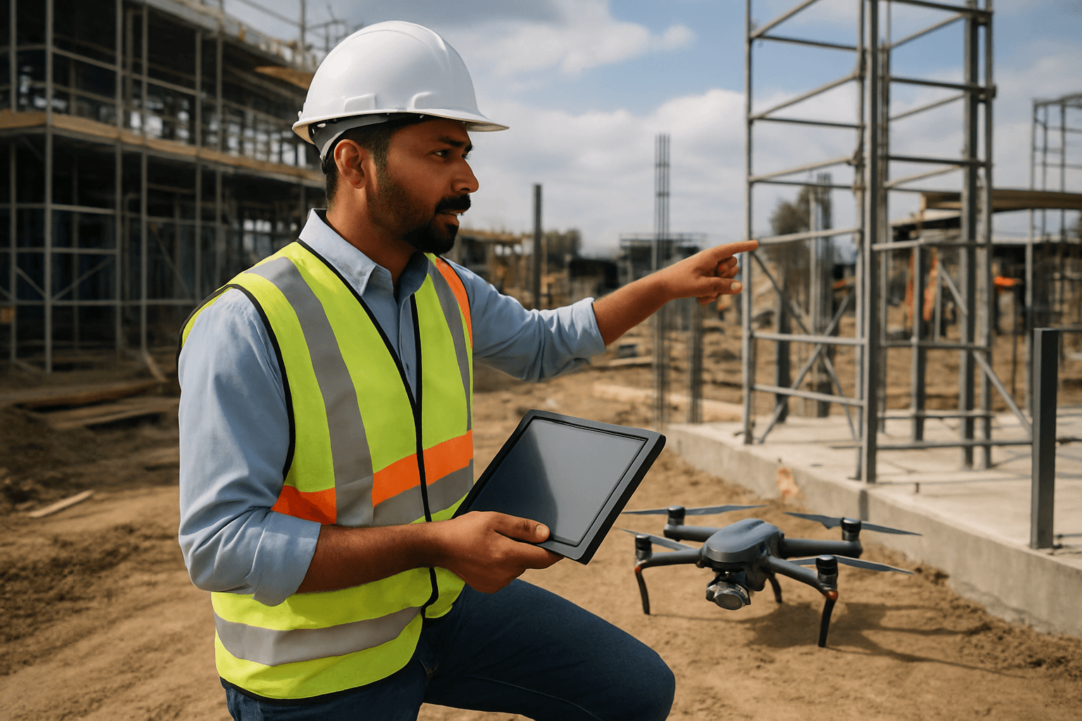
The construction industry, a realm traditionally characterized by manual processes and extensive fieldwork, is undergoing a profound transformation. At the forefront of this revolution are Unmanned Aerial Systems (UAS), commonly known as drones. These aerial platforms are fundamentally altering how construction projects are documented, particularly in the creation of highly accurate as-built models. No longer are project managers solely reliant on time-consuming, costly, and often hazardous traditional surveying methods; instead, drones offer a faster, safer, and more precise approach to capturing the true state of a completed build.
Understanding As-Built Models in Construction
As-built models are precise representations of a structure as it was actually built, incorporating all modifications and deviations from the original design plans that occurred during the construction process. These models, which can take the form of detailed 2D drawings or advanced 3D digital representations, are crucial for a multitude of reasons.
The Importance of Accurate As-Builts
Accurate as-built documentation serves as an invaluable reference throughout a building’s lifecycle. They are essential for:
- Legal Compliance and Quality Assurance: Ensuring the final structure meets all regulatory standards and approved specifications.
- Future Maintenance and Renovations: Providing facility managers and maintenance teams with an exact understanding of the building’s layout, systems (including mechanical, electrical, and plumbing), and components for repairs, upgrades, and planning future projects.
- Asset Management: Offering a comprehensive record for tracking and managing various assets within a facility.
- Resolving Disputes: Serving as an undeniable record in case of disagreements over what was built versus what was designed.
- Digital Twin Technology: Forming the foundational layer for creating digital twins—virtual replicas that continuously update with real-time data for predictive maintenance and optimization.
Limitations of Traditional As-Built Methods
Historically, creating as-built documentation involved manual measurements, extensive fieldwork, hand-drawn sketches, and field notes, often supplemented by photos. These methods were inherently:
- Time-Consuming: Requiring significant labor hours, especially for large or complex structures.
- Labor-Intensive: Demanding considerable manual effort from surveyors.
- Prone to Human Error: Susceptible to inaccuracies due to manual data collection and transcription.
- Costly: Incurring substantial expenses related to manpower and extended project timelines.
- Hazardous: Exposing workers to risks when surveying dangerous or difficult-to-access areas like tall structures or unstable environments.
Drones: The Game-Changer in As-Built Data Collection
Drones, or Unmanned Aerial Vehicles (UAVs), have emerged as a transformative solution to the challenges of traditional as-built data collection. Equipped with advanced sensors and cameras, drones can rapidly capture vast amounts of detailed aerial data, significantly improving speed, accuracy, and safety.
How Drones Capture As-Built Data
The process of using drones to create as-built models involves several key stages:
1. Mission Planning and Flight Execution
Before flight, a detailed mission plan is created, often using specialized software, to define flight paths, altitudes, and areas of interest. Drones can then fly autonomously or be piloted remotely, capturing overlapping images or LiDAR data from multiple angles. This systematic approach ensures comprehensive coverage of the construction site.
2. Data Acquisition Technologies
Modern construction drones typically employ two primary data acquisition technologies:
- Photogrammetry: This technique involves capturing hundreds or thousands of high-resolution, overlapping images of a site from various angles and altitudes. Specialized photogrammetry software then stitches these 2D images together, identifying common points to create incredibly detailed 2D maps (orthomosaics) and 3D models. This method is highly effective for visualizing project progress and generating detailed surface models.
- LiDAR (Light Detection and Ranging): LiDAR sensors emit rapid laser pulses and measure the time it takes for these pulses to return, creating a “point cloud” of highly accurate 3D data points. LiDAR is particularly effective for penetrating vegetation and capturing precise elevation data, making it ideal for terrain modeling and detailed surveys of complex structures. LiDAR can also provide centimeter-level accuracy for 3D models.
3. Data Processing and Model Generation
Once data is collected, it is processed using advanced photogrammetry or LiDAR software. This software analyzes the raw data, stitches images, or processes point clouds to generate various deliverables:
- 3D Point Clouds: A collection of data points in space representing the exact geometry of the scanned environment.
- 3D Mesh Models: Textured 3D models derived from point clouds, offering a realistic visual representation.
- Orthomosaics: High-resolution, georeferenced 2D maps that are geometrically corrected to be true-to-scale.
- Digital Elevation Models (DEMs) / Digital Terrain Models (DTMs): Representing the bare earth’s surface without vegetation or man-made features.
4. Integration with Building Information Modeling (BIM)
A crucial step is integrating drone-derived data into BIM platforms. This allows project teams to compare real-world progress with digital plans, detect deviations early, and update BIM models with current site conditions. This synergy creates a “digital twin” of the project, enhancing visualization, coordination, and planning throughout the construction lifecycle. Software like DroneDeploy, Pix4D, Agisoft Metashape, and DJI Terra are commonly used for processing drone data and integrating it with BIM and CAD systems.
Advantages of Using Drones for As-Built Models
The adoption of drones for as-built modeling brings a host of significant benefits to the construction industry:
1. Enhanced Accuracy and Detail
Drones equipped with high-resolution cameras and advanced sensors like LiDAR can capture incredibly precise measurements and generate highly accurate 3D models. This level of detail is crucial for detecting deviations from original designs and ensuring compliance with regulations.
2. Speed and Efficiency
What might take days or weeks with traditional ground-based surveying can often be completed in a matter of hours with drones. Drones can cover large areas quickly and efficiently, accelerating data collection and verification processes. This rapid data acquisition keeps projects on schedule and allows for quicker decision-making.
3. Improved Safety
Construction sites are inherently hazardous environments. Drones minimize the need for human surveyors to access dangerous areas such as tall structures, unstable terrain, or active work zones, significantly reducing the risk of accidents and injuries.
4. Cost-Effectiveness
While there is an initial investment in drone technology, the long-term cost savings are substantial. Drones reduce labor costs, minimize equipment needs, and prevent costly rework by identifying issues early. Their efficiency translates to quicker project turnover and reduced expenses associated with prolonged timelines.
5. Better Project Monitoring and Communication
Regular drone flyovers provide up-to-date visual data that allows project managers to monitor progress, track productivity, and identify potential problems in real-time. This visual data, integrated into BIM, facilitates better communication and collaboration among all stakeholders, from architects to clients.
6. Environmental Benefits
Drones can reduce the need for heavy equipment and on-site personnel, thereby lowering the environmental impact of surveying. Less machinery means fewer emissions and less disruption at construction sites, supporting more sustainable construction practices.
Challenges and Considerations
Despite their numerous advantages, the integration of drones for as-built modeling is not without challenges:
1. Regulatory Hurdles and Compliance
Operating drones requires adherence to various regulations, including airspace restrictions and licensing requirements, which can vary by region. Navigating these regulations requires expertise and careful planning.
2. Data Management and Processing
Drones generate vast amounts of data, which requires sophisticated software and significant computational power for processing and analysis. Effective data management strategies are crucial to handle this influx of information.
3. Technical Limitations
Factors such as battery life, flight range, signal interference, and weather conditions can limit drone operations. The resolution and limitations of different sensors also necessitate careful selection based on specific project requirements.
4. Training and Expertise
The effective implementation of drone technology requires skilled personnel for drone operation, data capture, and subsequent processing and analysis. A lack of knowledge or resistance to adopting new technologies can be an obstacle.
5. Integration with Existing Workflows
Seamlessly incorporating drone data into existing construction management systems, such as BIM and CAD, can be complex but is essential to maximize benefits.
The Future Outlook for Drones in As-Built Modeling
As technology continues to advance, drones are poised to become an even more integral part of as-built documentation. Innovations in sensor technology, such as increasingly precise LiDAR systems, and advancements in AI and machine learning for data analysis, will further enhance their capabilities. These technologies will enable even more automated processing of drone data into BIM, leading to greater efficiency and accuracy.
The synergy between drones and Building Information Modeling (BIM) is transforming the construction landscape, creating a more precise, efficient, and safer environment for project execution and management. For construction professionals, embracing drone technology is no longer an option but a vital step toward streamlined project management and delivering exceptional results that meet the demands of the modern built environment.


