Archaeology, a discipline rooted in the careful unearthing of history, is undergoing a revolutionary transformation thanks to the integration of cutting-edge technology. Imagine peering beneath the earth’s surface, not with a shovel, but with invisible waves, guided by an autonomous eye in the sky. This is the promise of using drones for mapping archaeological sites with ground-penetrating radar (GPR), a synergistic approach that is redefining how we discover, document, and preserve our shared heritage.
This innovative combination offers archaeologists an unprecedented ability to conduct non-invasive surveys, revealing hidden structures and artifacts with remarkable efficiency and precision, even in challenging terrains.
What is Ground-Penetrating Radar (GPR)?
Ground-penetrating radar is a geophysical method that utilizes electromagnetic pulses to image the subsurface. It works by transmitting small bursts of energy into the ground using a two-way antenna. When these pulses encounter different subsurface materials—such as soil layers, rocks, buried objects, or changes in material properties—they reflect back to the surface.
An integrated computer records the strength and response time of these reflected signals. This data is then processed and displayed, allowing operators to determine the location, depth, and approximate size of underground features. GPR is considered a highly precise, high-resolution geophysical method, offering true depth information that other techniques often lack. It can detect features that provide a strong contrast with the surrounding material, such as building remains, stone features, voids (like vaults or cellars), and cut features (like ditches, pits, or graves).
How GPR Differs from Other Geophysical Methods
While archaeologists employ various geophysical methods like electrical resistivity imaging (ERI) and magnetometry, GPR stands out. ERI, for instance, requires placing numerous stakes to measure electrical resistance, a far more time-consuming process than GPR. Magnetometers detect irregularities in the earth’s magnetic field, useful for finding ferrous objects or areas of human activity like old fire pits, but they don’t provide accurate depth information like GPR. GPR’s ability to provide calibrated depth information makes it an invaluable tool for archaeologists.
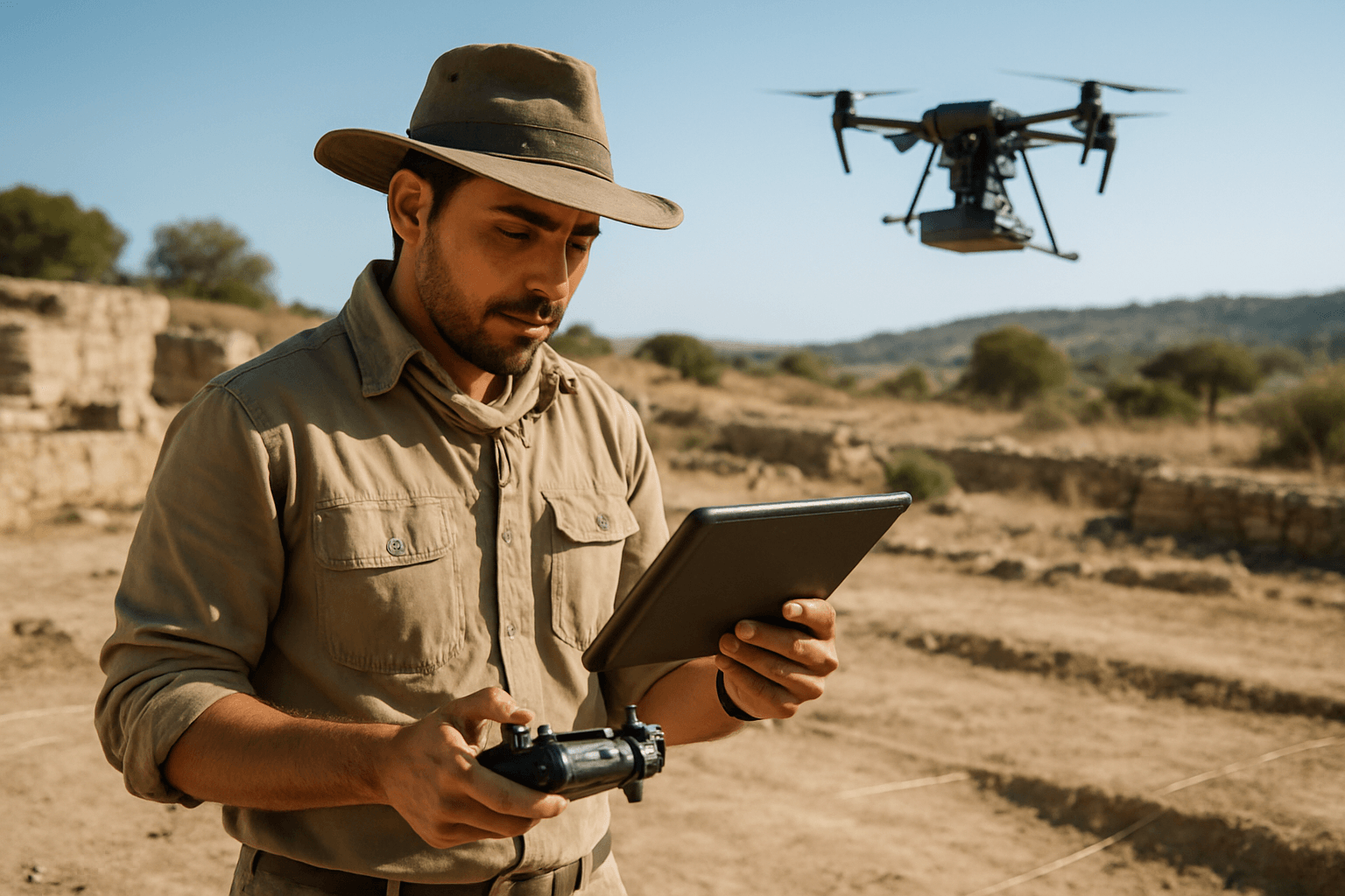
The Integration of Drones and GPR for Archaeological Mapping
Traditionally, GPR surveys were conducted manually with handheld or cart-mounted units, requiring researchers to walk systematically across survey areas. While effective, this method presents several drawbacks, including physical access limitations, time constraints for large areas, and potential interference with delicate surfaces.
The advent of unmanned aerial systems (UAS), or drones, has provided a viable and transformative alternative. By securely mounting GPR units onto drones, archaeologists can conduct surveys without direct ground contact, overcoming many of the limitations of traditional methods. Drones equipped with GPR systems can fly low and steady, maintaining a constant antenna height above the surface to ensure quality data collection. RTK (Real-Time Kinematic) technology is often integrated to provide precise georeferencing, mapping data to specific geographical coordinates.
Strategic Advantages of Drone-Based GPR in Archaeology
The combination of drones and GPR offers a multitude of benefits that are revolutionizing archaeological fieldwork:
Enhanced Efficiency and Speed
Drones can cover vast areas in a fraction of the time it would take traditional ground-based methods. This rapid data collection allows archaeologists to survey large landscapes quickly, identifying potential areas of interest before extensive fieldwork begins. A ground survey that might take weeks can be reduced to days with drone assistance.
Accessibility to Challenging Terrains
Archaeological sites are often located in remote, rugged, or dangerous environments, such as dense jungles, mountainous regions, or unstable terrain, making them difficult or impossible to access with traditional GPR carts. Mounting GPR systems on drones eliminates many terrain constraints, allowing surveys over rocky hillsides, dense vegetation, or even swampy ground without disturbing the site or endangering personnel.
Non-Invasive Survey and Site Preservation
One of the primary appeals of GPR, especially drone-based GPR, is its non-invasive nature. This allows researchers to peer beneath the surface without excavation, protecting valuable artifacts and preserving the archaeological record. It facilitates more ethical collaborations, particularly with community stakeholders who may oppose invasive excavations.
High-Resolution 3D Mapping
Drone-based GPR systems can generate detailed 3D subsurface models, revealing utilities, voids, geological features, and, critically, archaeological structures. This capability provides a comprehensive understanding of archaeological sites, both horizontally and vertically, allowing for the mapping of features over three meters deep with high resolution under optimal conditions.
Cost-Effectiveness
Compared to manned aircraft and satellite imaging, drones offer a more affordable solution for high-quality aerial data collection. Their operational flexibility means they can be deployed quickly and repeatedly without the significant logistical and financial overhead of helicopters or planes.
Challenges and Limitations
Despite its significant advantages, drone-based GPR for archaeological mapping is not without its challenges:
Signal Loss and Resolution
Decoupling the GPR antenna from the ground when mounted on a drone can lead to signal loss, particularly at the air-ground interface. This can result in a less pronounced difference between archaeological structures and the surrounding soil, making fainter remains harder to detect with a lower degree of resolution compared to ground-based GPR.
Environmental Factors
The effectiveness of GPR is influenced by factors such as soil composition, moisture content, and conductivity. Very dry soil is often mandatory for successful drone-based GPR surveys, as excessive moisture can cause significant signal loss. Dense vegetation can also introduce signal noise and air-wave reflections, complicating data interpretation.
Data Interpretation Complexity
GPR data requires careful analysis and interpretation, demanding expertise in both engineering and archaeology. Advanced software and machine learning algorithms are becoming crucial for identifying patterns and anomalies in the vast datasets generated.
Operational Constraints
Factors like battery life, payload capacity, and signal interference in dense environments can pose limitations. Legal restrictions and cultural or privacy concerns in certain regions may also complicate drone deployment.
Real-World Applications and Future Outlook
Drone-based GPR is proving to be a valuable tool in diverse archaeological contexts. Case studies have demonstrated its effectiveness in locating significant archaeological structures, even in areas with dense vegetation and challenging terrain, such as the Mimbres Culture Heritage Site in New Mexico where it helped distinguish human-made structures from natural subsurface variations. Another study at the Hulata solar panel construction site in Israel validated the adaptability of drone-based GPR in challenging clayey soils, successfully uncovering scattered artifacts. Researchers have also used drone-based GPR to identify a WWII hiding place in the Netherlands, showcasing its applicability for small-scale historic structures in complex soils.
The future of drone-based GPR in archaeology is bright, with ongoing advancements aiming to further enhance its capabilities. This includes the development of autonomous drones with advanced algorithms for flight planning and real-time data analysis, potentially integrating AI for automated image classification and predictive mapping. Miniaturization of new sensor types will further expand the range of data collectible from the air, allowing archaeologists to detect even more subtle clues beneath the surface. The ability to fuse data from various sources, including GPR, LiDAR, and historical records, will provide an even richer understanding of archaeological contexts.
Ultimately, drone-based GPR is not just a technological enhancement; it’s a paradigm shift. It promises to make archaeological exploration more inclusive, efficient, and less invasive, allowing us to uncover the secrets of the past while preserving them for future generations.


