Archaeology, often romanticized as a pursuit of dusty relics and intrepid explorers, is undergoing a profound technological transformation. Traditional fieldwork, while invaluable, is often labor-intensive, time-consuming, and geographically constrained. Imagine trying to map an ancient city hidden beneath a dense rainforest canopy or meticulously document a sprawling complex across rugged, inaccessible terrain. These challenges, which once severely limited the scope and efficiency of archaeological research, are now being overcome by the innovative application of Unmanned Aerial Systems (UAS), more commonly known as drones.
Drones have emerged as indispensable tools, bridging the gap between satellite imagery and ground-based surveys by offering unparalleled perspectives and data collection capabilities. They provide archaeologists with efficient, cost-effective, and non-invasive methods to survey, document, and ultimately preserve cultural heritage sites for future generations.
The Strategic Advantages of Drone Technology in Archaeology
The integration of drones into archaeological practice brings a multitude of benefits, enhancing every stage of a project from initial prospection to detailed documentation and long-term monitoring.
Enhanced Efficiency and Speed in Data Collection
One of the most significant advantages of using drones is the dramatic increase in efficiency and speed of data collection. Drones can cover vast areas in a fraction of the time it would take traditional ground-based methods, allowing archaeologists to survey large landscapes quickly and identify potential areas of interest before extensive fieldwork begins. A ground survey that might take weeks can potentially be reduced to days with drone assistance.
Accessibility to Challenging Terrains
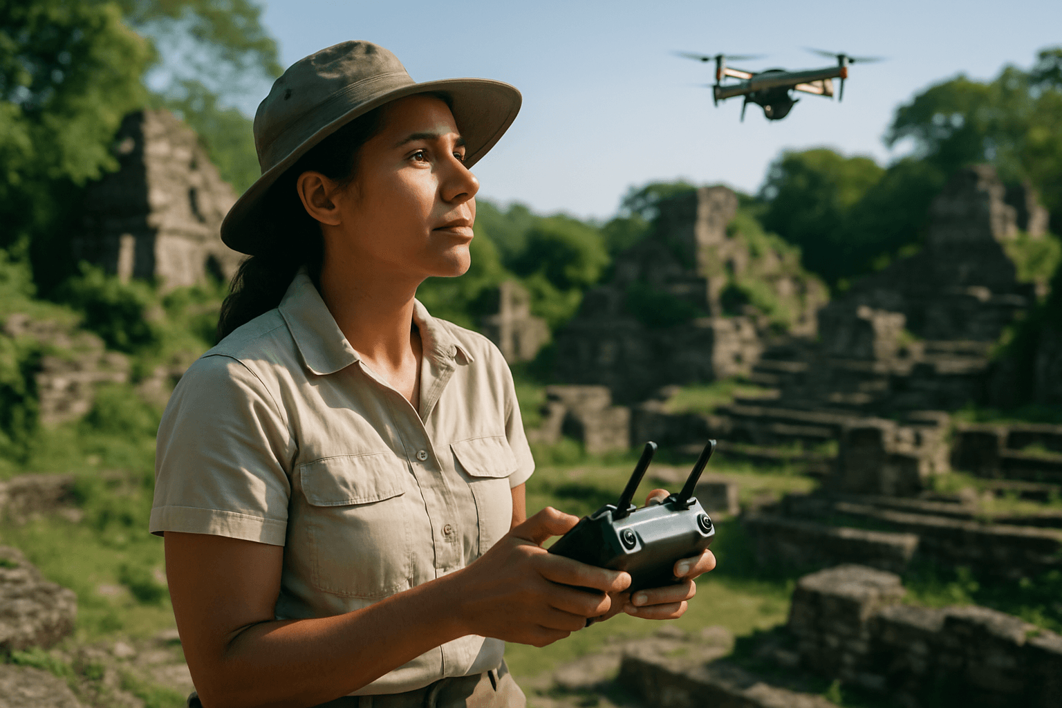
Archaeological sites are often located in remote, rugged, or dangerous environments, such as dense jungles, mountainous regions, or unstable terrains. Drones can navigate these difficult areas with ease, capturing critical data without risking human safety or disturbing fragile sites. This capability has led to the discovery of previously unknown sites hidden beneath thick vegetation, like ancient Mayan cities in Central America.
Non-Invasive Survey Methods and Site Preservation
Traditional excavation is inherently destructive. Drones, however, offer a non-invasive approach to archaeological investigation. By collecting data from above, they minimize the need for physical disturbance of the site, thus preserving the integrity of artifacts and structures. This non-destructive methodology is crucial for conserving delicate archaeological contexts and ensuring they remain undisturbed for future study.
Cost-Effectiveness
Compared to traditional aerial photography using manned aircraft or extensive ground surveys requiring large teams, drones provide a more affordable solution for high-quality data collection. This cost-effectiveness allows researchers to undertake more projects and monitor sites more frequently.
Key Drone Technologies and Sensors for Archaeological Mapping
Drones can be equipped with a variety of advanced sensors, each offering unique capabilities for archaeological mapping and discovery.
High-Resolution RGB Photography and Photogrammetry
Standard RGB (Red, Green, Blue) cameras on drones capture high-resolution aerial images. These images are then processed using photogrammetry software, which stitches together multiple overlapping photographs to create detailed 2D orthomosaic maps and intricate 3D models. These models provide comprehensive visual depictions of sites, aiding in planning excavations, documenting new discoveries, and tracking changes over time. Photogrammetry can achieve pebble-sized resolution and detailed 3D models for landscapes and structures.
LiDAR (Light Detection and Ranging)
LiDAR is a revolutionary remote sensing technology that uses laser pulses to measure distances to the ground, creating highly detailed 3D maps of the terrain. Its “X-ray vision” capability is particularly effective in penetrating dense vegetation, allowing archaeologists to “see through” forest canopies and reveal hidden structures and ancient landscapes beneath. This has been instrumental in uncovering sprawling pre-Columbian settlements and features like burial mounds and ancient roadways that would otherwise remain hidden.
Multispectral and Thermal Imaging
Beyond visible light, drones can carry multispectral and thermal sensors. Multispectral cameras capture data across specific wavelength bands, revealing subtle differences in vegetation health, soil composition, and moisture levels that can indicate buried archaeological features like cropmarks or soil marks. Thermal infrared photography can detect subtle temperature variations on the surface, which might reveal subsurface features such as buried walls or roads that retain heat differently from the surrounding soil.
Applications of Drones in Archaeological Mapping
The versatility of drones has expanded their utility across numerous archaeological applications:
- Archaeological Exploration and Prospection: Drones rapidly survey large areas to identify potential archaeological sites or features that are difficult to spot from the ground. They can significantly reduce the time spent in the reconnaissance stage of a project.
- Site Documentation and Mapping: Drones create highly accurate orthomosaic maps, Digital Elevation Models (DEMs), and 3D models of excavation sites and cultural landscapes. These detailed records are crucial for understanding spatial relationships and documenting findings.
- Monitoring and Preservation: Regular drone flights enable archaeologists to monitor sites over time, detecting changes caused by natural erosion, vegetation growth, human encroachment (e.g., looting or urban development), or the effectiveness of conservation efforts.
- Digital Reconstruction: High-quality 3D models generated from drone data facilitate virtual reconstructions of ancient sites and structures, offering new avenues for research, education, and public engagement.
- Assisting in Excavation Planning: Detailed maps and models help archaeologists plan future digs more efficiently, strategically placing trenches and managing logistical aspects of fieldwork.
Challenges and Considerations for Drone Integration
Despite the immense benefits, the adoption of drones in archaeology is not without its challenges:
- Regulations and Airspace: Operating drones requires adherence to evolving national and local aviation laws, including altitude restrictions, no-fly zones, and pilot certifications. Navigating these regulations can be complex, especially for international projects.
- Technical Expertise: While user-friendly drones are available, effective archaeological mapping often requires specialized knowledge in drone operation, data acquisition protocols, and sophisticated photogrammetry and GIS software processing.
- Data Volume and Processing: Drones collect vast amounts of high-resolution data, requiring significant computational power for processing, storage, and analysis.
- Sensor Limitations: While LiDAR is powerful, very dense vegetation can still obstruct laser beams from reaching the bare earth, and no single sensor provides all the answers. Thermal imaging effectiveness can depend on diurnal cycles and weather conditions.
- Ethical and Privacy Concerns: The increasing use of aerial imaging raises questions about privacy, particularly when sites are near private land or inhabited areas.
The Future of Drones in Archaeology
The role of drones in archaeology is continuously expanding. Future advancements are expected to bring even more sophisticated capabilities:
- Advanced Sensors: Miniaturization of new sensor types, such as ground-penetrating radar (GPR) and hyperspectral cameras, will further expand the range of data collectable from the air, allowing archaeologists to detect mineral traces, organic residues, and other subtle clues.
- Increased Automation and AI: Artificial intelligence and machine learning will likely become more integrated with drone technology, enabling automated image classification, predictive mapping of likely dig sites, and instant 3D rendering. AI can assist in automatically identifying patterns or anomalies in vast datasets, accelerating the pace of discovery.
- Longer Flight Times and Greater Payloads: Improvements in battery and motor technologies will extend flight durations, allowing for the mapping of even larger areas in a single mission.
- Real-time Data Processing and Visualization: The ability to process data in near real-time will provide archaeologists with immediate insights, enabling more adaptive and responsive fieldwork strategies.
Conclusion
Drones have undeniably ushered in a new era for archaeological site mapping and exploration. By offering unprecedented efficiency, access to challenging terrains, non-invasive data collection, and cost-effectiveness, they have transformed how we uncover, document, and preserve the physical remnants of past civilizations. From revealing hidden cities beneath dense jungles to meticulously monitoring the subtle changes at fragile heritage sites, drones are proving to be invaluable tools, profoundly impacting the depth and breadth of knowledge we can acquire about our shared human history. As technology continues to evolve, the synergy between drones and archaeology will only grow, promising even more extraordinary discoveries and a richer understanding of the ancient world.


