Our coastlines are dynamic interfaces, constantly shaped by powerful natural forces like waves, tides, and storms, exacerbated by the accelerating impacts of climate change, including rising sea levels. These changes manifest as both erosion (the wearing away of land) and accretion (the buildup of land), profoundly affecting ecosystems, infrastructure, and human communities worldwide. Accurately monitoring these processes is paramount for effective coastal management and adaptation strategies. In this critical endeavor, unmanned aerial vehicles (UAVs), commonly known as drones, have emerged as transformative tools, offering unprecedented precision, efficiency, and accessibility in tracking coastal change.
Understanding Coastal Erosion and Accretion
Coastal erosion is the process by which coastal land is lost due to the removal of sediment by water and wind, often leading to cliff retreats, beach narrowing, and habitat loss. Conversely, coastal accretion involves the deposition of sediment, leading to the expansion of landforms such as beaches, dunes, and deltas. Both processes are natural but are increasingly influenced by anthropogenic factors like dam construction, dredging, and climate change, which intensifies storm frequency and sea-level rise. The loss of coastal resources can have serious consequences for tourism, recreation, economic development, and public safety, threatening protective barriers like dunes and seawalls.
The Rise of Drones in Coastal Monitoring
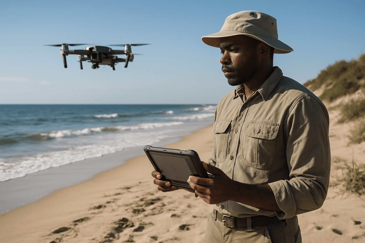
The use of UAVs for monitoring coastline changes has increased exponentially in recent years, becoming more frequent, practical, and effective for both academic research and administrative activities. Drones excel where traditional methods fall short, providing a versatile and cost-effective solution for observing these dynamic environments.
Traditional Methods vs. Drone Technology
Historically, coastal monitoring relied on labor-intensive ground-based surveys, such as peg-lines, total stations, and GPS/GNSS surveys, which provided 2D data and were time-consuming for large areas. While airborne LiDAR and satellite imagery offered broader coverage, they often came with high costs, limited resolution, or operational constraints like cloud cover.
Drones overcome many of these limitations, providing several key advantages for coastal research:
- Superior Spatial Resolution: Drones can capture details at the centimeter scale, far surpassing satellite imagery.
- Rapid Response Time: They can be deployed quickly after extreme events like storms to document immediate changes, which is crucial for disaster relief applications like FEMA.
- Controlled Timing: Researchers can schedule surveys precisely when needed, independent of satellite passes, allowing for optimal conditions such as specific tidal stages or lighting.
- Cost-Effectiveness and Efficiency: Drones are significantly more affordable than traditional aerial surveys or expensive satellite imagery, making frequent monitoring more feasible. They can cover large areas quickly, reducing personnel needs and survey time.
- Safety and Accessibility: Drones can safely and efficiently survey remote, hazardous, or inaccessible coastal areas, including dense vegetation, cliffs, and wetlands, where ground surveys would be difficult or dangerous.
- High-Resolution Data: They provide high-resolution images and videos, enabling detailed visual assessment and documentation of physical changes.
How Drones Monitor Coastal Changes: Key Technologies and Techniques
Drones can be equipped with a variety of sensors that aid in coastal erosion and accretion research, providing rich datasets for analysis.
Photogrammetry and Structure-from-Motion (SfM)
Photogrammetry, particularly using the Structure-from-Motion (SfM) technique, is a cornerstone of drone-based coastal monitoring. Drones capture a large number of overlapping aerial images from different angles. Specialized software then processes these images to create highly detailed 3D models, orthomosaics (georeferenced photographic maps), Digital Surface Models (DSMs), and Digital Terrain Models (DTMs).
- Creating 3D Models: SfM allows for point cloud data with centimeter-level precision, which is then used to reconstruct the 3D surface of the beach or coastline.
- Monitoring Morphological Changes: By comparing DSMs and DTMs collected at different times, researchers can quantify changes in beach elevation, dune loss, sediment accumulation, and overall volume changes, helping to identify long-term trends and patterns in erosion and accretion.
- Limitations: While effective, image-based photogrammetry can yield less accurate results in areas with low texture or dense vegetation, as it struggles to penetrate the canopy to capture ground points.
LiDAR (Light Detection and Ranging)
LiDAR is another powerful remote sensing technology integral to drone-based coastal mapping. It works by firing laser pulses and measuring the time it takes for them to return from surfaces, generating highly accurate 3D maps and precise elevation data.
- Penetrating Vegetation: A significant advantage of drone-mounted LiDAR is its ability to penetrate dense vegetation, capturing ground points below the canopy to create accurate Digital Elevation Models (DEMs). This is crucial for areas with coastal marshes or dune vegetation.
- High-Resolution Elevation Data: LiDAR delivers precise elevation data that is essential for understanding coastal topography, identifying areas at risk of erosion or flooding, and analyzing sediment transport dynamics.
- Bathymetric LiDAR: Specialized bathymetric LiDAR can even map underwater topography, providing insights into submerged coastal degradation.
Hyperspectral and Multispectral Imaging
Beyond visible light, drones can carry advanced sensors to analyze coastal environments in more detail.
- Multispectral Imagery (MSI) Sensors: These capture data across specific wavelength bands, including visible, red-edge, and near-infrared (NIR). Different vegetation types and health statuses reflect light differently across these bands, allowing for the calculation of vegetation indices like the Normalized Difference Vegetation Index (NDVI) to assess plant vigor and biomass. This is useful for monitoring coastal vegetation health, which plays a role in sediment stabilization.
- Hyperspectral Imagery (HSI) Sensors: Offering even greater spectral detail than multispectral sensors, hyperspectral cameras capture hundreds of narrow, contiguous spectral bands. This enables in-depth spectral examination of scene features, helping to differentiate materials with slightly different chemical compositions, detect biological processes, assess water quality (e.g., turbidity), and identify specific species or sediment types. Hyperspectral data can even be used to map sediment transportation by analyzing sand classes.
GPS/RTK Integration
To ensure the highest accuracy, drones are often integrated with GPS and Real-Time Kinematic (RTK) systems. RTK corrections, often streamed from networks, provide precise georeferencing to the images and data collected, achieving centimeter-level accuracy for 3D point clouds and models. This precision is critical for comparing data from repeated surveys and accurately mapping changes over time.
Benefits of Drone-Based Coastal Monitoring
The integration of drones into coastal monitoring programs offers a multitude of benefits, enhancing both the quality and efficiency of data collection.
Enhanced Spatial and Temporal Resolution
Drones provide unprecedented spatial resolution, capturing details at the centimeter scale that satellites cannot match. Their rapid deployment capabilities allow for more frequent surveys, providing high temporal resolution data that can capture rapid coastal changes, such as those caused by storms. This allows coastal managers to track changes over time, identify high-risk areas, and develop more informed strategies.
Cost-Effectiveness and Efficiency
Compared to traditional methods that are often labor-intensive and costly, drones offer a more economical and efficient solution. The equipment itself can be relatively low-cost, and the ability to cover large areas quickly reduces operational expenses and personnel requirements.
Safety and Accessibility
Drones eliminate the need for human surveyors to access dangerous or inaccessible coastal areas, such as steep cliffs, active erosion zones, or protected habitats. This significantly improves safety for researchers and minimizes disturbance to fragile ecosystems.
Data Accuracy and Precision
When combined with technologies like RTK-GPS and sophisticated processing software, drones can produce highly accurate and precise 3D topographic data, digital elevation models, and orthophotos. This quantitative data is crucial for scientifically robust analysis of coastal erosion and accretion.
Challenges and Limitations
Despite their advantages, drones in coastal monitoring face certain challenges:
Regulatory Hurdles and Airspace Restrictions
Navigating airspace regulations and obtaining necessary permits for drone operations can be complex and vary by region.
Weather Dependency
Drones are sensitive to adverse weather conditions such as strong winds, heavy rain, or fog, which can limit flight operations and data quality. Optimal conditions are required for consistent data acquisition, particularly for photogrammetry where lighting differences can affect image processing.
Data Processing Demands
The sheer volume of high-resolution data collected by drones requires significant computational power, specialized software, and expertise for processing, analysis, and storage.
Sensor Limitations
Battery life can limit the coverage area for a single drone flight, although advancements are continually improving this. Certain sensors also have limitations; for instance, photogrammetry struggles with vegetation penetration, while LiDAR, though superior in this aspect, is generally more expensive.
Case Studies and Real-World Applications
Drones are already being utilized in diverse coastal monitoring projects. For example, in Salem, Massachusetts, drone technology was used to monitor the erosion and accretion of a newly constructed living shoreline, accurately estimating fill amounts and tracking changes over time. Similarly, in the Spanish Mediterranean coast, UAVs have been used to research the dynamic evolution of coastal areas, detecting annual erosion and providing crucial data for decision-making and coastal management.
The Future of Drone Technology in Coastal Management
The future of drone technology in coastal management is bright, with ongoing advancements promising even greater capabilities.
AI and Machine Learning Integration
As more data is captured, artificial intelligence (AI) and machine learning (ML) are becoming essential for automated data processing, analysis, and the identification of subtle changes and trends in coastal morphology. This can help extract actionable insights more efficiently.
Advanced Sensor Development
Continuous advancements in sensor technology will likely lead to more compact, powerful, and versatile payloads, including improved hyperspectral sensors, miniature LiDAR units, and combined systems that offer even richer datasets.
Swarm Robotics and Autonomous Missions
The development of swarm robotics and increasingly autonomous “drone in a box” solutions could enable continuous, long-range monitoring over vast coastal areas without constant human intervention.
Conclusion
Drones are rapidly becoming indispensable tools for monitoring coastal erosion and accretion. Their ability to deliver high-resolution, accurate, and timely data at a relatively low cost is transforming how we understand, predict, and manage our dynamic coastlines. By providing critical insights into coastal changes, drones empower scientists, coastal managers, and communities to make informed decisions, develop effective adaptation strategies, and build resilience against the intensifying impacts of climate change and natural hazards, ultimately safeguarding these vital environments for future generations.


