Beneath the seemingly stable landscapes of the Arctic and high-latitude regions lies permafrost, ground that has remained frozen for at least two consecutive years. This vast, frozen reservoir of soil, rock, and ice covers approximately 24% of the Northern Hemisphere and plays a critical role in global climate regulation. However, as global temperatures rise, this ancient ice is thawing at an unprecedented rate, releasing potent greenhouse gases like methane and carbon dioxide, destabilizing landscapes, and threatening crucial infrastructure. Traditional methods for studying these remote and rapidly changing environments are often costly, dangerous, and limited in their scope and resolution. Enter the age of unmanned aerial vehicles (UAVs), or drones, which are transforming permafrost research by offering unparalleled flexibility, high-resolution data, and access to previously inaccessible areas.
Understanding Permafrost and Its Critical Changes
Permafrost contains a mixture of organic material, plants, and dead animals, some frozen since the last ice age, approximately 11,000 years ago. When permafrost thaws, this organic matter decomposes, emitting significant quantities of greenhouse gases, primarily methane (CH₄) and carbon dioxide (CO₂). Methane is particularly concerning, being 25 times more potent than CO₂ over a 100-year period, contributing to a dangerous positive feedback loop that further accelerates global warming.
Beyond climate feedbacks, permafrost thaw has profound local impacts. As ice-rich permafrost melts, the ground can lose its structural integrity, turning into a muddy slurry that can no longer support the weight of overlying soil, vegetation, or human constructions. This leads to ground subsidence, erosion, and the formation of thermokarst features such as thaw slumps, which can severely damage roads, buildings, pipelines, and other vital infrastructure. Some communities in Alaska, for example, have already been forced to relocate due to permafrost thaw and related coastal erosion. Accurate and timely monitoring of these changes is essential for understanding their mechanisms, predicting future impacts, and developing adaptation strategies.
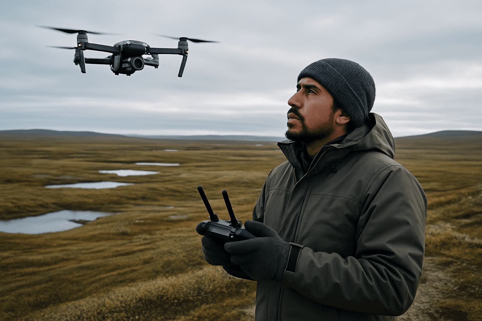
The Power of Drones in Permafrost Research
Remote sensing has always been crucial for studying the cryosphere due to its vast, often remote, and difficult-to-reach nature. While satellites offer broad-scale views, their spatial and temporal resolution can be limiting, especially for detecting small-scale, rapid changes or operating under frequent cloud cover. Conventional airborne surveys are effective but often prohibitively expensive. Unmanned Aerial Vehicles (UAVs), or drones, have emerged as a “bridging remote sensing platform,” filling the gap between localized in-situ measurements and coarser satellite data.
Drones provide several transformative benefits:
- High Spatial Resolution: They can capture data at centimeter-level resolution, allowing for detailed mapping of small-scale features and changes.
- Temporal Flexibility: Drones can be deployed frequently and on demand, enabling repeated surveys to track changes over short periods (e.g., daily, weekly, or seasonally).
- Accessibility and Safety: They can reach remote, rugged, or dangerous terrains, reducing the risks associated with manual fieldwork, such as navigating unstable ground or crevasse zones.
- Cost-Effectiveness: Compared to traditional airborne surveys, drones, especially off-the-shelf models, offer a significantly more affordable option for data collection, making high-resolution monitoring more accessible.
- Adaptability: Drones can carry a diverse range of lightweight sensors tailored to specific research needs.
Key Drone-Borne Sensors for Permafrost Studies
The versatility of drones is amplified by the array of specialized sensors they can carry. These payloads allow researchers to collect diverse data types crucial for understanding permafrost dynamics:
LiDAR (Light Detection and Ranging)
LiDAR systems emit laser pulses and measure the time it takes for them to reflect back, creating highly accurate 3D point clouds of the terrain.
- Application: Essential for measuring ground elevation changes, subsidence rates, and mapping thermokarst features with centimeter-level precision. LiDAR can also penetrate foliage to generate bare-earth digital elevation models (DEMs), which are crucial for analyzing changes in ground topography. Studies have used LiDAR data to measure snow depths and monitor the surface cover of agricultural fields in permafrost regions.
Photogrammetric RGB Cameras
Standard high-resolution RGB (Red, Green, Blue) cameras capture visible light imagery.
- Application: Used for creating detailed orthomosaics (georeferenced image maps) and 3D digital surface models (DSMs) through Structure-from-Motion (SfM) photogrammetry. These are vital for visual interpretation of landscape changes, mapping vegetation shifts, monitoring coastal erosion, and assessing infrastructure stability. They can detect rapid ground surface changes, such as retrogressive thaw slumps, often quantifying displacements at the sub-meter or centimeter scale.
Multispectral and Hyperspectral Sensors
These sensors capture light across multiple discrete spectral bands (multispectral) or a continuous spectrum of bands (hyperspectral), including visible, near-infrared, and thermal infrared light.
- Application: Used to analyze vegetation health and composition, differentiate between various land cover types, and track changes in surface water. For example, multispectral imagery can map and track crop health and investigate if permafrost thaw negatively impacts crops. Hyperspectral sensors offer more detailed spectral information, allowing for the detection of minute differences in spectral signatures, which can be invaluable for ecological studies.
Thermal Infrared Sensors
Thermal sensors measure the surface temperature of land and objects.
- Application: Crucial for identifying variations in surface temperature that can indicate underlying permafrost thaw, water bodies, or areas with differing soil moisture content. They help in mapping thaw slumps and other thermokarst features.
Atmospheric Sensors (e.g., Methane Detectors)
Specialized payloads can include quantum cascade laser (QCL) spectrometers or other gas detectors.
- Application: Designed to detect and quantify greenhouse gas emissions, particularly methane, directly from thawing permafrost. Autonomous methane detection drones equipped with QCL spectrometers can map Arctic methane fluxes at centimeter resolution, identifying previously undetected micro-seeps. This helps scientists understand carbon cycling and identify “hotspots” of methane release, which can be linked to accelerated erosion.
Ground Penetrating Radar (GPR)
Drone-mounted GPR systems use radar waves to map subsurface conditions without direct ground contact.
- Application: Enables researchers to find the top of the permafrost table, identify the presence and depth of ground ice, and measure the thickness of ice or snow layers. GPR surveys can be conducted safely and efficiently over hazardous terrain like glaciers or unstable permafrost, providing georeferenced radargrams with centimeter-level altimetry.
Specific Drone Applications in Permafrost Environments
The diverse sensor capabilities of drones enable a wide range of specific applications in permafrost research:
Mapping Ground Deformation and Subsidence
Permafrost thaw often leads to ground subsidence, where the land surface sinks due to the melting of ice within the soil. Drones equipped with LiDAR and photogrammetric cameras are highly effective at creating detailed 3D models that allow for the precise measurement of these changes over time. Repeated drone surveys can quantify even subtle elevation changes, providing critical data for assessing terrain stability and the integrity of infrastructure built on permafrost. Studies have shown that consumer-grade drones can successfully detect and quantify short-term, sub-meter ground surface changes attributed to permafrost thaw.
Monitoring Coastal Erosion and Thaw Slumps
Arctic coastlines are particularly vulnerable to erosion, which is often accelerated by permafrost thaw. Drones provide a flexible tool for monitoring these rapidly changing coastal environments. They can capture high-resolution imagery at frequent intervals (e.g., daily or weekly), allowing researchers to observe intra-seasonal erosion dynamics that might be missed by less frequent satellite or manual surveys. This high-frequency data helps in understanding the episodic nature of shoreline change and the role of events like storms. Drones are also used to monitor retrogressive thaw slumps, which are landslide-like features caused by the melting of ground ice, by quantifying changes in sediment volume and deriving land surface displacements.
Detecting Methane Emissions
The release of methane from thawing permafrost is a significant climate feedback. Drones carrying specialized methane sensors can “sniff” out these emissions, identifying hotspots and quantifying methane flux with high spatial and temporal resolution. This technology allows for the detection of previously unobserved micro-seeps and provides a much finer resolution than satellite data for tracking these powerful greenhouse gas releases. By mapping methane distribution, scientists can better understand carbon cycling and even predict areas of accelerated coastal bluff slumping and erosion.
Assessing Vegetation Changes and Ecosystem Impacts
Changes in permafrost environments often lead to shifts in vegetation patterns, such as increased shrub growth or changes in crop health. Multispectral and hyperspectral drone imagery provides valuable data for monitoring these ecological transformations. By analyzing spectral signatures, researchers can track vegetation health, identify stress, and map changes in plant communities, providing insights into how ecosystems are responding to permafrost thaw.
Subsurface Imaging with Ground Penetrating Radar
While drones are primarily used for surface observations, drone-mounted GPR extends their capabilities to the subsurface. This allows for mapping the depth of the active layer (the surface layer that thaws and refreezes annually), identifying ice-rich permafrost, and detecting ground ice. Such data is crucial for understanding the subsurface conditions that drive permafrost degradation and for validating remote sensing interpretations.
Advantages of Drone Technology for Permafrost Monitoring
The benefits of utilizing drones in permafrost research are multifaceted and profound:
- Unprecedented Spatial and Temporal Resolution: Drones bridge the critical measurement gap between sparse ground observations and coarser satellite imagery, offering centimeter-scale detail and the ability to conduct repeated surveys at user-defined frequencies. This allows for the capture of rapid, small-scale changes that are often missed by other methods.
- Enhanced Safety and Accessibility: The Arctic’s harsh and remote conditions, often characterized by rugged terrain and unstable ground, pose significant risks to researchers. Drones can safely access dangerous or logistically challenging areas, reducing fieldwork hazards and enabling monitoring in regions previously deemed inaccessible.
- Cost-Effectiveness and Flexibility: Compared to traditional manned aircraft or large research expeditions, drone operations can be significantly more affordable. Off-the-shelf drones, combined with open-source software, offer low-cost solutions for high-resolution mapping, making permafrost monitoring more accessible to a broader range of researchers and local stakeholders.
- Comprehensive Data Collection: The ability to integrate various sensors (LiDAR, RGB, multispectral, thermal, GPR, methane detectors) onto a single drone platform allows for a holistic approach to data collection, providing a more complete picture of permafrost changes and their impacts.
- Support for Infrastructure Management: By providing high-resolution data on ground deformation, erosion, and thaw slumps, drones directly support the monitoring and management of critical infrastructure in Arctic regions, helping to identify hazards at an early stage and mitigate risks.
Challenges and Considerations for Drone Operations in the Arctic
Despite their numerous advantages, operating drones in permafrost environments, particularly in the Arctic, presents unique challenges:
- Extreme Environmental Conditions: The Arctic is characterized by extremely low temperatures, high winds, icing, and limited visibility (e.g., ice fog, whiteout conditions). These conditions can severely impact drone battery life, affecting flight endurance (e.g., a battery lasting only three minutes at -43°C), and can cause malfunctions or crashes due to icing on propellers and wings.
- Logistical Hurdles: Remoteness often means limited access to charging infrastructure, spare parts, and reliable communication networks. Icy or remote runways can also pose problems for drone deployment.
- Navigation and Communication: Satellite coverage can be limited at high northern latitudes, which is critical for transmitting flight instructions and data. Magnetic interference in polar regions can also affect navigation systems. AI-driven obstacle avoidance and triple-redundant GNSS/INS navigation systems are being developed to address these issues.
- Data Processing and Storage: The sheer volume of high-resolution data collected by drones requires significant processing power and storage capabilities. Developing efficient workflows for denoising, aligning, and analyzing large point cloud datasets is crucial.
- Regulatory Frameworks: Drone operations are subject to national and international aviation regulations, which can be complex and restrictive, particularly for scientific missions in sensitive Arctic areas.
- Spatial Referencing Accuracy: Achieving reliable spatial referencing for multi-temporal analysis can be challenging in tundra landscapes due to unstable ground and a lack of permanent spatial reference points. While advanced RTK (Real-Time Kinematic) drones or differential GPS (dGPS) can improve accuracy, some studies demonstrate successful change detection with simpler, low-cost setups.
The Future of Drone Applications in Permafrost Research
The role of drones in permafrost research is continuously evolving, driven by rapid advancements in robotics, sensor technology, and data processing. Future developments will likely focus on:
- Increased Autonomy and Resilience: Developing drones specifically designed for extreme Arctic conditions, featuring enhanced battery performance, anti-icing systems, and advanced AI for autonomous navigation and data acquisition in challenging weather.
- Miniaturization and Integration of Advanced Sensors: Further miniaturization of high-fidelity sensors, including next-generation hyperspectral imagers, more compact LiDAR units, and multi-sensor fusion platforms, will allow for even more comprehensive data collection on smaller, more agile drones.
- AI and Machine Learning for Data Analysis: Artificial intelligence and machine learning will play an increasingly vital role in processing vast datasets, detecting subtle changes, identifying anomalies, and even predicting permafrost degradation patterns. Real-time plume detection and source localization for methane emissions are already being achieved with AI processing pipelines.
- Citizen Science and Community Engagement: The accessibility of low-cost, easy-to-operate drones holds immense potential for citizen science initiatives, empowering local communities and indigenous populations to monitor changes in their own environments and contribute valuable data to scientific understanding. Projects like “UndercoverEisAgenten” already involve students in steering drones and collecting data on permafrost polygons.
- Improved Data Sharing and Collaboration: Facilitating open data sharing and collaborative research will be crucial for maximizing the societal benefit of permafrost monitoring data and accelerating adaptation efforts.
Conclusion
Drones have unequivocally become indispensable tools in the scientific endeavor to understand and monitor changes in permafrost environments. By providing unparalleled resolution, flexibility, and safety, these unmanned aerial vehicles are unlocking new frontiers in Arctic research. From precisely mapping ground subsidence and coastal erosion to detecting potent methane emissions and assessing ecosystem shifts, drones offer a comprehensive and dynamic approach to studying this critical component of Earth’s climate system. While operational challenges in the harsh Arctic remain, ongoing technological advancements promise even more resilient and intelligent drone systems, cementing their role as vital agents in our quest to comprehend and respond to a rapidly thawing world.


