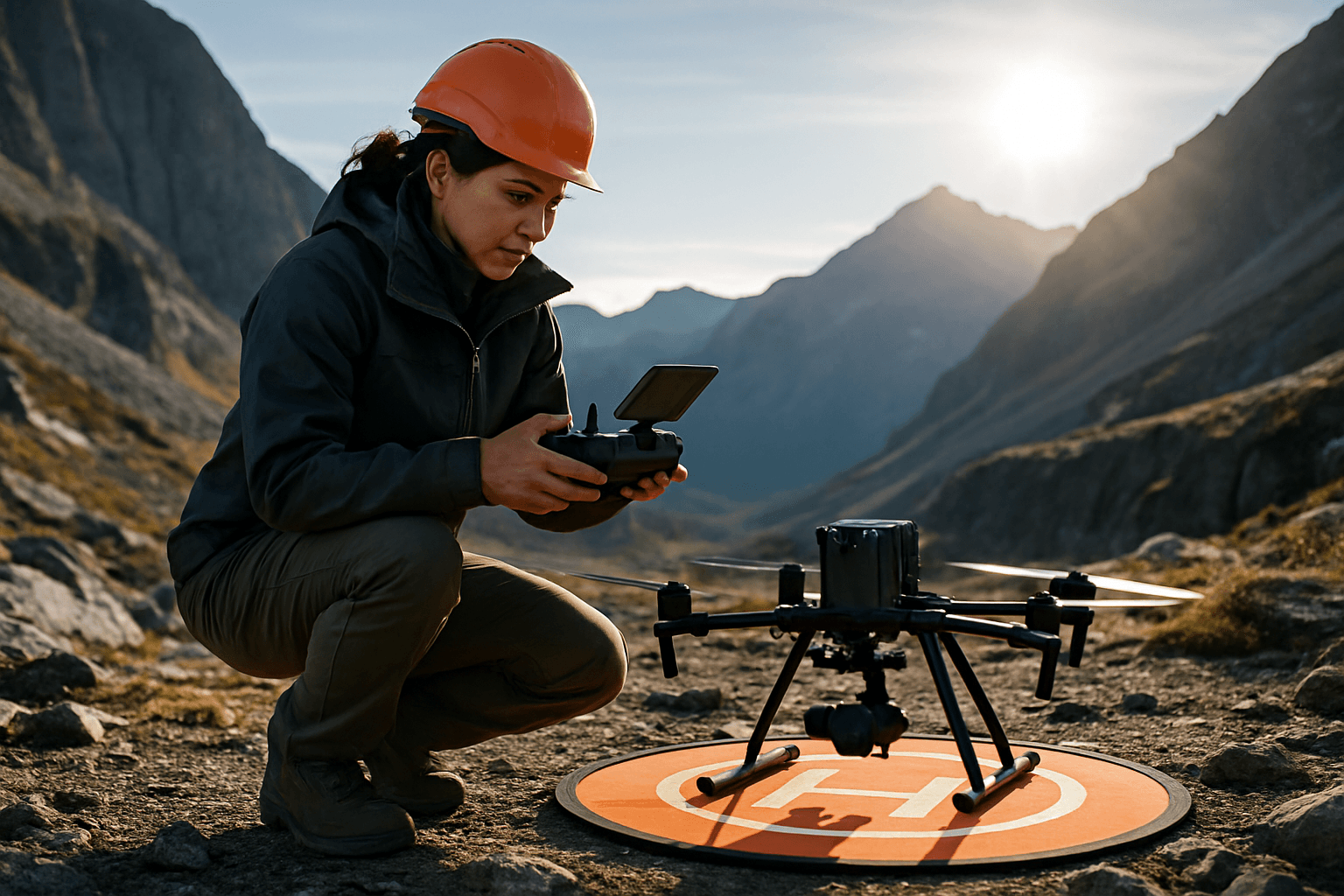
Drone technology has revolutionized surveying and mapping, offering unprecedented efficiency and detail, even in the most challenging landscapes. Mountainous terrain, with its dramatic elevation changes, unpredictable weather, and remote accessibility, presents unique hurdles that demand specialized knowledge and meticulous planning. Mastering drone surveying in these environments requires a comprehensive understanding of the operational complexities and the implementation of best practices to ensure both data accuracy and flight safety.
This guide delves into the essential considerations for successful drone surveying in mountainous regions, from pre-flight preparation and equipment selection to in-flight execution and data processing.
The Unique Challenges of Mountainous Drone Surveying
Operating Unmanned Aerial Systems (UAS) in mountains differs significantly from standard operations on flat ground. Several critical factors can degrade drone performance and increase operational risk.
Atmospheric and Weather Dynamics
Mountain weather is notoriously unstable and fast-changing, heavily influenced by topography. Key phenomena include:
- Reduced Air Density: At higher altitudes, air pressure drops, making it harder for drone propellers to generate the necessary lift. This forces the drone to work harder, consuming battery power more rapidly and potentially affecting stability.
- Orographic Winds and Turbulence: Wind impacting ridges and peaks creates strong, unpredictable turbulence. Anabatic (daytime uphill) and catabatic (nighttime downhill) winds, along with powerful leeward downdrafts and violent “crease rotors” behind ridges, pose significant risks to drone stability and control.
- Rapid Weather Changes: Sudden shifts in weather, including unexpected clouds, fog, or precipitation, can lead to rapid visibility loss, posing a serious danger, especially in narrow valleys. Colder temperatures at higher altitudes can also negatively impact battery performance.
Signal Interference and Line-of-Sight Limitations
The rugged topography of mountains can significantly interfere with drone communication and GPS signals:
- Radio Signal Bounce and Blockage: Mountains can block or bounce radio waves, causing complete signal loss if the drone flies behind a ridge. Dense vegetation can also interfere with signals, limiting reliable flight range.
- GPS Accuracy: While RTK and PPK systems enhance precision, complex terrain can still affect the quality of GNSS-assisted photogrammetry, impacting mapping accuracy.
Navigation and Terrain Complexity
Navigating drones in complex mountainous terrain requires advanced situational awareness:
- High Topographic Variability: Maintaining a consistent altitude relative to the ground (AGL) is crucial for uniform image resolution, but the varied elevations make this challenging without specialized features. Flying into ravines or valleys can lead to unexpected drone responses if not carefully managed.
- Obstacles and Wildlife: Trees, rock formations, and unpredictable wildlife (such as eagles or raptors) pose collision risks. Additionally, national parks, wilderness areas, and specific local ordinances may restrict drone operations to protect wildlife habitats or ensure public safety.
Essential Pre-Flight Planning for Mountainous Environments
Thorough planning is paramount for mitigating the inherent risks of mountain drone surveying.
Detailed Site and Weather Assessment
- Topographic Analysis: Utilize topographic maps and Digital Elevation Models (DEMs) to understand the terrain, including elevation changes, slopes, and potential obstacles. Identify suitable take-off/landing zones and potential emergency landing sites.
- Weather Monitoring: Constantly monitor local mountain weather forecasts, preparing for rapid changes in wind speed, temperature, and visibility. Define clear abort mission conditions based on weather parameters.
- Airspace Review: Check for any restricted airspace, temporary flight restrictions (TFRs), or local regulations concerning drone operations, especially near wilderness areas or protected habitats.
Strategic Flight Path Design
- Terrain-Following Flight: This is highly recommended for mountainous areas to maintain a consistent distance between the UAV and the ground, ensuring uniform Ground Sampling Distance (GSD) and minimizing out-of-focus issues. Many advanced drones and flight planning software offer this capability. If terrain-following is not available, divide the flight area based on altitude and adjust the operator’s position to maintain consistent flight height relative to the ground.
- Overlap Settings: Ensure sufficient image overlap (e.g., 75/75 frontal and side overlap) to facilitate accurate 3D model reconstruction, especially in areas with significant elevation differences.
- Altitude Management: Understand that the 400 ft Above Ground Level (AGL) rule applies to the terrain directly beneath the drone, not just the take-off point. Plan flight paths that respect this, potentially segmenting flights from different take-off points to cover varied elevations while staying compliant.
- Redundant Flight Paths: Plan alternative routes and escape paths in case of unexpected conditions or signal loss. Consider the impact of signal interference by limiting flights behind mountains or dense vegetation.
Selecting the Right Equipment for High-Altitude Surveying
Specialized drone hardware and software are crucial for reliable performance in demanding mountain environments.
Robust Drone Platforms
- High Service Ceiling: Choose drones with a high “Maximum Service Ceiling,” indicating the maximum recommended launch elevation. DJI drones, for example, typically have service ceilings of 4,000 to 6,000 meters (13,123 to 19,685 feet).
- VTOL Capabilities: Vertical Take-Off and Landing (VTOL) drones are advantageous in mountainous regions as they don’t require large, flat spaces for launching and landing, offering flexibility in confined areas.
- Endurance and Battery Life: Reduced air density at altitude increases battery consumption. Carry extra batteries and monitor levels closely, as cold temperatures further deplete them. Drones with longer flight times are beneficial for covering larger areas.
- Advanced Stabilization: Drones with advanced stabilization systems are essential to counteract strong winds and maintain image sharpness.
Precision Sensors and GPS Technology
- RTK/PPK GNSS Systems: Drones equipped with Real-Time Kinematic (RTK) or Post-Processed Kinematic (PPK) Global Navigation Satellite System (GNSS) modules are vital for achieving centimeter-level accuracy in geospatial data, minimizing the need for numerous ground control points (GCPs).
- LiDAR Payloads: For areas with dense vegetation, LiDAR sensors are highly effective as their laser pulses can penetrate foliage to map the bare ground surface, providing accurate 3D models where photogrammetry might struggle.
- High-Resolution Cameras: RGB cameras for photogrammetry should have high resolution (e.g., 42MP DSLR cameras) to capture detailed imagery, with sensor quality, altitude, and weather all affecting the final resolution.
Smart Flight Planning Software
- Terrain Following Integration: Use software with terrain-following features that integrate with preloaded 3D terrain data (DEMs or custom DSMs) to automatically adjust flight height and ensure uniform GSD.
- Mission Checklists and Planning Tools: Utilize software for precise mission planning, including defining objectives, conducting site surveys, and designing efficient flight paths with appropriate altitude, speed, and overlap. Some platforms can process aerial survey data online and generate 3D models and flight routes for efficient operation, such as DJI SmartFarm for agricultural applications.
Operational Best Practices
On-Site Preparations
- Equipment Checks: Before each flight, thoroughly inspect all drone components, including propellers, batteries, and the controller. Calibrate GPS and adjust drone settings to match high-altitude conditions.
- Ground Control Points (GCPs): While RTK/PPK reduce their number, strategically placed and precisely measured GCPs are still crucial for verifying accuracy, especially in complex terrain or when higher precision is required.
- Visual Line of Sight (VLOS): Always maintain VLOS with your drone. This is a critical regulatory requirement in many regions and helps in spotting potential obstacles and responding to unexpected events.
In-Flight Execution
- Gentle Maneuvers: Practice smooth navigation. Quick, sharp turns can destabilize drones, particularly in turbulent mountain winds.
- Battery Management: Monitor battery levels diligently and plan for early return-to-base if levels dip significantly due to cold temperatures or increased power consumption at altitude.
- Constant Situational Awareness: Be vigilant for environmental changes (wind gusts, sudden fog) and dynamic obstacles. If conditions deteriorate, temporarily land the drone in a safe spot. Watch out for birds of prey that might be curious or territorial.
Data Processing and Quality Control
The quality of the final output depends heavily on meticulous data processing.
- Photogrammetry Software: Utilize industry-standard photogrammetry software (e.g., Pix4D Mapper) to process the collected images into orthophotos, Digital Surface Models (DSMs), and 3D models.
- LiDAR Data Processing: For LiDAR data, specialized software is used to generate dense 3D point clouds, which can then be classified to extract terrain (Digital Terrain Models or DTMs) and create contour lines.
- Accuracy Assessment: Compare the generated outputs with independent checkpoints or existing high-accuracy data to verify the precision of the survey.
- Data Integration: Often, combining data from various sensors (RGB, thermal, LiDAR) and traditional survey methods can enhance the comprehensive understanding of the surveyed area.
Safety and Regulatory Compliance
Safety is paramount in mountain drone operations.
- Adhere to Regulations: Always comply with local, national, and international drone regulations, including altitude limits (e.g., 400 feet AGL), VLOS requirements, and restrictions near airports or controlled airspace.
- Respect Wildlife and Environment: Avoid disturbing wildlife, especially during breeding or migration seasons, and stay away from protected areas like official U.S. Wilderness Areas.
- Pilot Competence: Mountain flying demands advanced pilot skills, including energy management in thin air, reading local wind phenomena, and executing mountain-specific emergency procedures. Specialized mountain flight training is highly recommended for professionals.
By diligently applying these best practices, drone operators can unlock the full potential of UAS technology for accurate, efficient, and safe surveying and mapping in the world’s most breathtaking yet challenging mountainous terrains.


